Please Share Southeast Downloadable Routes!!

  • HTML tutorial

ClarkT

Rank IV
Launch Member

Enthusiast III

903
Asheville, NC, USA
First Name
Clark
Last Name
Glenn
Member #

0756

Brofessor, what a great idea to put routes in our region in one place. I have to admit I will be more of a user then a submitter since I’ve never recorded a route of mine once. I tend to just explore, poke around, and see where I ended up. But I love the idea of seeing routes to get an idea of target rich environments. [emoji106]


Sent from my iPhone using OB Talk
 
  • Like
Reactions: theBROFESSOR

tsteb112

Rank IV

Pathfinder I

1,212
Greenville
I like this idea as well. Do you know of any in NC? I haven’t really looked too hard but I know the trans American trail begins in the western part of the state and runs through Tennessee


Sent from my iPhone using Tapatalk
 
  • Like
Reactions: J100Roaming

theBROFESSOR

Rank VI
Launch Member

Influencer II

4,226
Conway, Arkansas
Member #

8306

I like this idea as well. Do you know of any in NC? I haven’t really looked too hard but I know the trans American trail begins in the western part of the state and runs through Tennessee


Sent from my iPhone using Tapatalk
This is the only one I have found for North Carolina.

https://www.overlandbound.com/forums/threads/outer-banks-south-core-island-north-carolina.10101/

There hasn't been many people post from North Carolina that I know of or have seen. Hopefully we will get more.
 

theBROFESSOR

Rank VI
Launch Member

Influencer II

4,226
Conway, Arkansas
Member #

8306

Brofessor, what a great idea to put routes in our region in one place. I have to admit I will be more of a user then a submitter since I’ve never recorded a route of mine once. I tend to just explore, poke around, and see where I ended up. But I love the idea of seeing routes to get an idea of target rich environments. [emoji106]


Sent from my iPhone using OB Talk
I was the same way until I discovered Gaia maps and then I really started to enjoy recording my route for future reference and use. I love marking trails that I need to come back and try out if I don't have the time at the moment. If I don't make a note on the trail file, my memory will fail me as always and I may never get the chance to go back and enjoy some of my discoveries. I can't rely on my memory. Ever. Thank God for Smart Phones. Lol.
 

theBROFESSOR

Rank VI
Launch Member

Influencer II

4,226
Conway, Arkansas
Member #

8306

quadabaum

Rank V
Launch Member

Traveler III

1,872
Georgia USA
Member #

11731

Great thread and thank you for being so active, this will come in handy for us later this year since I was thinking of exploring Arkansas some. Here is a link to the Ga Traverse page, this is what I used to route my way through the eastern section of the traverse over New Years.

GA Overland was an extremely helpful site for getting the information I needed for tackling my first multi day overland adventure this year. http://www.georgiaoverland.com/download.html
 

theBROFESSOR

Rank VI
Launch Member

Influencer II

4,226
Conway, Arkansas
Member #

8306

Great thread and thank you for being so active, this will come in handy for us later this year since I was thinking of exploring Arkansas some. Here is a link to the Ga Traverse page, this is what I used to route my way through the eastern section of the traverse over New Years.

GA Overland was an extremely helpful site for getting the information I needed for tackling my first multi day overland adventure this year. http://www.georgiaoverland.com/download.html
Awesome! Thank you! And when you come through or to Arkansas give me a shout. Would love to do some exploring with you!
 
  • Like
Reactions: quadabaum

Cully74

Rank V
Launch Member

Advocate III

1,836
Old Hickory, Nashville, Tennessee, USA
First Name
Drew
Last Name
Cullum
Member #

9821

These are from the Land Between the Lakes website...not routes I've done, but can be very useful. LBL basically has one road that runs up the middle, with roads branching off each side like a tree. This means most of the dirt roads you find out there don't loop around. You usually end up having to turn around and go back at some point, but there are still a lot of places to go. I'm sure a lot of the dirt roads are not even located in these files, but these files are more than enough to navigate around out there. Turkey Bay is actually a 4 x 4 area. Heard its cool but usually pretty crowded. We just stuck to the dirt roads off the service roads when we went.
 

Attachments

theBROFESSOR

Rank VI
Launch Member

Influencer II

4,226
Conway, Arkansas
Member #

8306

These are from the Land Between the Lakes website...not routes I've done, but can be very useful. LBL basically has one road that runs up the middle, with roads branching off each side like a tree. This means most of the dirt roads you find out there don't loop around. You usually end up having to turn around and go back at some point, but there are still a lot of places to go. I'm sure a lot of the dirt roads are not even located in these files, but these files are more than enough to navigate around out there. Turkey Bay is actually a 4 x 4 area. Heard its cool but usually pretty crowded. We just stuck to the dirt roads off the service roads when we went.
Awesome thank you! The wife and I will be traveling through there going to Louisville this July. She has a one week training and I will be doing some adventuring while she is in class. LBL is on our way...or will be lol.
 
  • Like
Reactions: Cully74

Cully74

Rank V
Launch Member

Advocate III

1,836
Old Hickory, Nashville, Tennessee, USA
First Name
Drew
Last Name
Cullum
Member #

9821

Awesome thank you! The wife and I will be traveling through there going to Louisville this July. She has a one week training and I will be doing some adventuring while she is in class. LBL is on our way...or will be lol.
I'm thinking most of these will be Service Roads, and then you'll find unmarked dirt roads off of them. Next time I go out there I'm recording everything I do.

Sent from my secret moon base...
 
  • Like
Reactions: theBROFESSOR

theBROFESSOR

Rank VI
Launch Member

Influencer II

4,226
Conway, Arkansas
Member #

8306

I'm thinking most of these will be Service Roads, and then you'll find unmarked dirt roads off of them. Next time I go out there I'm recording everything I do.

Sent from my secret moon base...
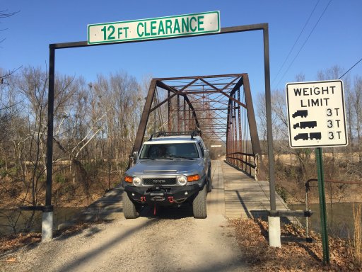
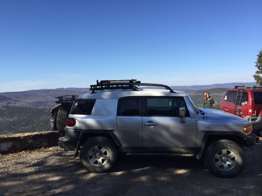
Screw the routes bro. You have an FJ Cruiser AND a secret moon base? You are now the coolest guy I know!
 

Cully74

Rank V
Launch Member

Advocate III

1,836
Old Hickory, Nashville, Tennessee, USA
First Name
Drew
Last Name
Cullum
Member #

9821

Haha. My auto phone signature. I'm kind of new to the off-roading thing. Been trying to figure out the best way to locate good routes. Starting to think the best way is to look in Google Earth and scan Nation Forrest and Parks for dirt roads. Haha.

Sent from my secret moon base...
 
Last edited:

erica stafford

Rank I
Launch Member

Member I

233
louisiana
First Name
Erica
Last Name
Stafford
Member #

26503

Anyone have some good routes for around the chatanooga up to knoxville and surrounding areas? We love secluded areas. Spot camp and creeks and waterfalls and rocks for the jeeps. Just any beautiful routes we could add to our adventure
 
  • Like
Reactions: Bozz and Nickzero

theBROFESSOR

Rank VI
Launch Member

Influencer II

4,226
Conway, Arkansas
Member #

8306

Anyone have some good routes for around the chatanooga up to knoxville and surrounding areas? We love secluded areas. Spot camp and creeks and waterfalls and rocks for the jeeps. Just any beautiful routes we could add to our adventure
I have a few that are just east of Chattanooga. Not sure if this link will work. I have them uploaded to my gaiagps.com account and it is public.

https://www.gaiagps.com/datasummary/routes/
 

Attachments

  • Like
Reactions: ZetRocks

Cully74

Rank V
Launch Member

Advocate III

1,836
Old Hickory, Nashville, Tennessee, USA
First Name
Drew
Last Name
Cullum
Member #

9821

I've seen some talk online about S. Tatum Creek Road in Bon Aqua, Tn. It's roughly 45 minutes southwest of Nashville. Sounds like its comparable to the Dirt Devil roads in these parts. If you live around Nashville, you know there are not many off road places to go. If your looking for something crazy this wont be it, but it does look like a good part of the day drive, and the aerial images from Google Earth look like there are more roads than just this one to explore. I traced a path along S. Tatum Road for easy navigation, since it jumps around a bit, and then I converted it to a gpx file. UPDATE...after further investigation I've realized this route is smack dab in the middle of the Dirt Devil area. Lol. So...yea this whole area is that...
 

Attachments

Last edited:
  • Like
Reactions: theBROFESSOR