US Northwest Pacific Crest Overland Route (PCOR) - Oregon Segment

  • HTML tutorial
U

UgotWheelz

Guest
The article referenced (and that I got the PCOR GPS route from) was written in 2018. This is what it said about the trail's difficulty:

"The vast majority of the Oregon portion of the PCOR is easy. However, long distances, muddy or snowy trails, and downed trees can cause challenges. Drivers should be sure to check road conditions before the trip and bring proper recovery gear and saws."

That's what I'm going by. By now I'm expecting the snow to be melted, and since it has been awfully dry lately, I'm expecting mud to be at a minimum. This should be a nice fairly easy scenic run. I'm bringing a chainsaw, tow straps, chain, shovel, axe, & two pairs of X-Bulls (generic MaxTrax).

So I figure 96% of this trail ("vast majority") could be easily done with something like my buddy's early 2000 era 2WD Toyota Tacoma Pre-Runner with 31" tires (which has decent clearance underneath). It is that potential 4% that'll getcha (you never know what's changed up ahead) and can ruin your day or make you have to turn-around. If my buddy had a Tru-Trac or locker in the back of his Pre-Runner, he'd be better equipped on this trip. If he needed some help through a muddy spot, I've got X-bulls, or I could give him a tug (hence the tow strap attachment points front & rear requirement). Too bad he's in Florida. If I had to choose between AWD (like my wife's Subaru Crosstrek) or 2WD truck and high clearance, I'd choose the 2WD high clearance vehicle every time (and strongly recommend putting some sort of traction device in the rear diff!).

You've gotta be careful though; some AWD vehicles are just cars that they've puffed-up a little bit, and aren't really SUVs. They're weak, and wouldn't stand up to the rigors of a difficult overlanding trip. Fortunately, most Overlanders have pretty stout vehicles they're using for travel - they've done their research.

Usually I'm taking my Jeep TJ overlanding. It has lockers front & rear, 4" lift, 33" tires, winch, armor, etc. (it's what I took on the WABDR). This time I'm taking my 96 Ram 1500 4x4 SWB single cab with 2" lift, 33" tires, Tru-Tracs front and rear, a tired 5.2 engine with 225,000 miles on it but runs good, and no winch. If I can pack the truck right, I'll leave the trailer at home.

Trails can be tight in the PNW. I'm taking a full-sized truck, but it is a single cab SWB. It has a cap on it, but it is no wider or taller than the truck cab. I'd be hesitant to bring a full-size truck with a large camper on it that's tall and wider than the truck bed.
Yes and Yes understood! You are correct about overgrowth, I know these roads, I have bikepacked many of them. For research I watched several Youtube videos of the entire Oregon section and reviewed the photos from Expedition portals trip and the Pacific CrestExpedition team that mappped it on a Youtube series. I followed the entire GPS route with Google satalite view this almost entirely follows WELL groomed forest service roads and hywys. Yes given the recent temps, time of year, and low snow fall this year I doubt that snow or mud will be an issue. The difficulty will come from more remote sections of Forest service road that haven't been cleared recently. These roads are kept groomed for forest fire fight equipment (allot of PFD and CCF in my family) but not every season. High clearance vehicles should not be necessary. So there should not be anything more than overgrown foliage and perhaps a downed tree, possible road washout from runoff. Watch the Pacific crest youtube videos where they tried to avoid allot of the paved hywy sections adding about 400 miles to the route they did it in stock Forester and a 2WD Ford Ranger. I suspect that most vehicles that are suitably prepared to handle gravel and forest service roads should have no issue, challenge only adds to the adventure. I would not attempt to do this route with less than 3 vehicles do the remote area of some of the track where a breakdown could be catastrophic, and self recovery challenging. I totally wish I could get away for this I would totally love to do this in a gravel racing spec compact car (thinking my RallyCross lifted Mazda Miata). You keep coming up with these great routes but not enough time to prep or plan for them I cant wait till I can plan ahead to do some of these routes keep the ideas coming for future routes. Have a great time and take pictures for us to all drool over.
 

armyRN

Rank V
Launch Member

Member III

1,683
Longview, WA
First Name
Paul
Last Name
Dickinson
Member #

22047

Ham/GMRS Callsign
KI7TSP
I think I watched that video a long time ago when I was originally looking at this route.

This PCOR trip is a consolation trip; hence the short notice. I was originally planning on leading an Old-School Vehicle run of the WABDR during this timeframe, and I put-out the Rally Point I think in April. Then COVID, then the NWOR got cancelled, and it just didn't take off. We were down to just me and one other person, and they were only going to be able to do the first day-or-two of the WABDR, so I cancelled it. When I mentioned I was going to do this Pacific Crest run instead since I had the time off, I was encouraged to put it up as a Rally Point in case anyone else was interested. So yes; totally short notice.

Here's one I'd like to do next summer (so start planning). I tried to get a group with the Northwest Overland Society group to go last year, but as what often happens, as you get closer to the departure date folks start dropping out (even folks I worked with that swore to me they were going). It is a run from WA all the way up to start of the Alaska Highway, then to Whitehorse, then to Dawson City and the start of the Dempster Highway to Tuktoyaktuk, and kayaking in the Arctic Ocean (kayaking optional of course). I'd like to try it again, but we need to see if Canada opens its border to travelers. Check out the write-up from the trip last year (and especially my trip report at the end) - my Jeep and trailer get around:


Arctic Trip.3.jpg
 
Last edited:
U

UgotWheelz

Guest
I think I watched that video a long time ago when I was originally looking at this route.

This PCOR trip is a consolation trip; hence the short notice. I was originally planning on leading an Old-School Vehicle run of the WABDR during this timeframe, and I put-out the Rally Point I think in April. Then COVID, then the NWOR got cancelled, and it just didn't take off. We were down to just me and one other person, and they were only going to be able to do the first day-or-two of the WABDR, so I cancelled it. When I mentioned I was going to do this Pacific Crest run instead since I had the time off, I was encouraged to put it up as a Rally Point in case anyone else was interested. So yes; totally short notice.

Here's one I'd like to do next summer (so start planning). I tried to get a group with the Northwest Overland Society group to go last year, but as what often happens, as you get closer to the departure date folks start dropping out (even folks I worked with that swore to me they were going). It is a run from WA all the way up to start of the Alaska Highway, then to Whitehorse, then to Dawson City and the start of the Dempster Highway to Tuktoyaktuk, and kayaking in the Arctic Ocean (kayaking optional of course). I'd like to try it again, but we need to see if Canada opens its border to travelers. Check out the write-up from the trip last year (and especially my trip report at the end) - my Jeep and trailer get around:


View attachment 168652
Allot of great things to see and do on the rout. I have allot of former customers in Alaska and a good buddy just moved back to AZ after being in Alaska for 10 years where he made allot of connections. I don't like the cold climates not really built for it but I am sure it would make for a greta adventure.
 

armyRN

Rank V
Launch Member

Member III

1,683
Longview, WA
First Name
Paul
Last Name
Dickinson
Member #

22047

Ham/GMRS Callsign
KI7TSP
What's today - Tuesday? We leave Sunday. So far nobody has signed-up for the trip, so I guess I should change "we" to "me".

Yesterday I got the GAIA app on my iPad, and got the trip loaded. So I'll have my phone on the dash mount for while I'm driving, and I'll have the iPad for if/when I need to see things in more detail or a larger view of the area.

I also mounted my X-Bulls and a shovel on the truck's topper (to keep space open in the truck bed).

Today's to-do list:

1. Get a fire extinguisher

2. Make sure the factory jack can lift the truck high enough to change a tire.

I'm thinking I should be able to pack the truck so I don't need the trailer. We'll see.
 
Last edited:
U

UgotWheelz

Guest
Hey Paul, sorry no takers have fun take lost of pictures.
 

armyRN

Rank V
Launch Member

Member III

1,683
Longview, WA
First Name
Paul
Last Name
Dickinson
Member #

22047

Ham/GMRS Callsign
KI7TSP
And that's ok; I won't have to worry about anyone else but me then on this trip.

Yes, my factory jack works with the lifted truck and larger tires all by itself. I've only used the jack once on the truck in all the 24 years I've had the truck. Nice to know it still works. I'll still bring the high-lift jack base with me just in case I need some extra footing. Plus it adds another 2.5 inches.

I also bought a 5lb fire extinguisher today from Home Depot. And the X-Bulls and a shovel are mounted on the roof. I'll be ready to leave come Sunday.Truck.1.jpgtruck jack.jpg
 
Last edited:

armyRN

Rank V
Launch Member

Member III

1,683
Longview, WA
First Name
Paul
Last Name
Dickinson
Member #

22047

Ham/GMRS Callsign
KI7TSP
Everyone should have a "Plan B" in case their overlanding vehicle breaks down in the middle of nowhere. Here's mine:

Minibike on truck.jpg

Just kidding. Technically and especially if you're by yourself, you should stay with your vehicle unless you know exactly where you are, and where you're going (and how far it is to get there). And don't overestimate your hiking abilities - especially in the heat.

This was taken recently when going to the beach.
 
  • Like
Reactions: M Rose

M Rose

Local Expert
Mod Team
Member

Advocate III

5,584
Northeast Oregon, United States
First Name
Michael
Last Name
Rose
Member #

20990

Ham/GMRS Callsign
W7FSB
Service Branch
US ARMY Retired
I’m sorry no one is interested in going... I would have gone on either trip had the motor not gone out in the Bronco...

I’m looking forward to your trip report when you return... go have fun good buddy. And be safe.
 
  • Like
Reactions: UgotWheelz
U

UgotWheelz

Guest
If I had a caregiver option for my parent with ALZ, I would milk the credit card for some new rolling stock and go. But I cant find anyone willing to take over caregiving for 1 day let alone 5 days. I look forward to the trip report as well.
 
  • Like
Reactions: M Rose

armyRN

Rank V
Launch Member

Member III

1,683
Longview, WA
First Name
Paul
Last Name
Dickinson
Member #

22047

Ham/GMRS Callsign
KI7TSP
I’m sorry no one is interested in going... I would have gone on either trip had the motor not gone out in the Bronco...

I’m looking forward to your trip report when you return... go have fun good buddy. And be safe.
Thanks. I'll try to do a decent trip report.
 
  • Like
Reactions: UgotWheelz

armyRN

Rank V
Launch Member

Member III

1,683
Longview, WA
First Name
Paul
Last Name
Dickinson
Member #

22047

Ham/GMRS Callsign
KI7TSP
If I had a caregiver option for my parent with ALZ, I would milk the credit card for some new rolling stock and go. But I cant find anyone willing to take over caregiving for 1 day let alone 5 days. I look forward to the trip report as well.
I work in a nursing home/rehab center. Alzheimer's sucks. Sorry to hear. My Dad has dementia, and my Mom and two sisters are taking care of him at home in Florida.

Yeah; need to plan some shorter trips. I'll help others plan trips, send me your ideas (but you have to sincerely plan on going on the trip if you're instigating it).
 
  • Like
Reactions: M Rose

Spud

Rank V
Launch Member

Off-Road Ranger I

2,365
St. Helens OR
First Name
Steven
Last Name
Ellett
Member #

3875

Ham/GMRS Callsign
W7LSX
Wish I could join, my work schedule has been changing faster than I can keep up with and my hours have been wild. Can't wait for this pandemic disaster to go away. Have a good trip!
 

armyRN

Rank V
Launch Member

Member III

1,683
Longview, WA
First Name
Paul
Last Name
Dickinson
Member #

22047

Ham/GMRS Callsign
KI7TSP
So today is FrIday, and I’m leaving Sunday morning. I’m tying up loose ends.

I did a trial fit of everything in the back of the truck today. Everything will fit, so I won’t be taking the trailer. I’ll take a picture of my set-up before I leave. On one side of the truckbed is the cot (with three 8-gallon action packers underneath with food and cooking gear minus stove) the chainsaw, and two 4-gallon milk crates (with stuff). On the other side of the truckbed is a 24 gallon Action packer with clothes and such, a 6-gallon milk crate, a 4-gallon milk crate, a cooler, and my air armor M240 air compressor. I’ll be bringing an extra 5 gallons of gas in one of the milk crates, and three gallon jugs of water (in addition to my multiple bottles of water). Fire extinguisher and axe are behind the seat; shovel is on the roof.

Also got my ARB folding chair, and my Slumberjack awning/trap thing. It should be a nice set-up. I’m looking forward to being able to just crawl in the back of the truck and go to sleep - no setting up tents or anything. Cooking will be done on the tailgate.

Also went to the grocery store to get the rest of my vittles (half of which I’ll bring home and save for my next trip). So tomorrow is pack non perishables, and get laundry caught-up. Then Sunday pack the cooler, clothes, tools, guns, electronics, and hit the road.

Sorry nobody else is going - it’ll be a nice trip. I haven’t heard any bad weather reports yet or the week.
 

armyRN

Rank V
Launch Member

Member III

1,683
Longview, WA
First Name
Paul
Last Name
Dickinson
Member #

22047

Ham/GMRS Callsign
KI7TSP
Ok... I'm 97% packed. All that's left is my toiletry bag, pillows, iPad and phone, and AR. Weather looks to be excellent for the first part at least. I'll get up, shower, have a big breakfast, toss those few things in the truck, and be on the way for my solo adventure.

I know I'm not reinventing the wheel here with my truck's camping setup (cot on one side with bins underneath, and stuff on the other side with a narrow isle in between), but this is my first time going overlanding with this setup. We'll see how I might change it once I'm done with this trip. I'm thinking of this as a trial run for longer trips up into Alaska and Canada.

I've got ratchet straps on each side to hopefully keep everything in place while bouncing along. Chainsaw and Slumberjack awning are under the head of the cot. I doubt I'll be using either of these, but am bringing just in case.
20200905_163129.jpg20200905_163129.jpg20200905_163129.jpg20200905_163035.jpg

I also use a 28 gallon action packer for my clothes bin (you can see it at the head of the cot by the cab). A Shockwave fits in 20200905_154232.jpgthere nicely too. Since I'm going solo, I plan on sleeping soundly, and feeling like I'm not at risk.20200905_163006.jpg20200905_163018.jpg
 
Last edited:

armyRN

Rank V
Launch Member

Member III

1,683
Longview, WA
First Name
Paul
Last Name
Dickinson
Member #

22047

Ham/GMRS Callsign
KI7TSP
Ok... trip report. But lets get a few things out of the way first.

1. I downloaded the route onto my phone which is using the GAIA (a GPS thingy) app. There is no way I or anyone could have followed this route without some sort of GPS device. I don't care if someone took your DELORME Atlas & Gazetteer and used a yellow highlighter and highlighted the exact route in the book for you. Trails are sometimes not labeled on the trail, or you might not know exactly where you are on the trail (or paved road) according to the book and you'll miss your turn-off. So a big thanks to the folks who wrote the original article and posted their route.

2. Even with the GPS and the blue line and arrow, I would still sometimes miss a turn-off. Sometimes the app would have plenty of "overlays" so roads were marked, and you could see your surroundings on the map (in this case, on my phone). Other times, all you've got is a blue line and an arrow. The arrow is you. If the arrow leaves the blue line, you've missed a turn somewhere, so you have to back-up and adjust course. Happened way more than once.

DSCN1432 (1).JPG

It becomes a big deal when you've only got the blue line (no overlays showing), and you have to detour for whatever reason (say a fire or something). If no overlays are present, and you don't know exactly where you are (happened quite a few times), it is hard to reroute yourself to get back on the trail. I started stopping every time I came to an intersection and marked where I was in the map book. Sometimes the trail wasn't marked, but I would still mark it in the book if I thought I was right (usually I was).

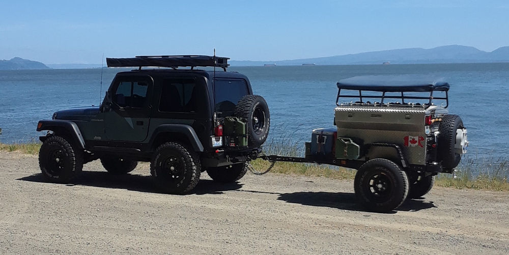
3. The PCOR is a mixture of pavement, maintained gravel roads, not so maintained gravel roads (brush is overgrown and touching both sides of your vehicle), and not maintained dirt roads (4WD might be necessary). And it switches back-and-forth. Early on I aired down to 20 PSI and just kept them there. The tires are "E" rated tires, so I figured even on pavement 20 PSI would be ok. I just didn't feel like always airing up-and-down every time I went on or off pavement.

Ok... let's get down to business.

Day One: Sunday morning. I left Longview on Sunday morning, and didn't hit Hood River till 1130, and started south on 35. I was admiring the scenery, and missed my first turn-off. So I had to turn around and get back on track. Pretty view of Mt Hood, paved road turns to gravel, and eventually you're back on pavement. Then I came to my first fire detour. So I had to figure out where I was exactly (it gets too easy to get lazy and just follow the arrow on the map, and you don't know where you are), and how to get back on the route. Which I did. Soon I was in the jungle; both sides of the truck getting hit with branches (the picture is not the worst of it).

DSCN1422.JPG

But it was fun. And I'm also thinking "I'm the only one out here in the middle of nowhere; if I get stuck or break down, I'm kinda screwed. Maybe doing this thing solo isn't the smartest thing I've done. But also not the dumbest thing either by a longshot, so I'll keep going". I spent my first night parked off the road in an area that had recently been logged (by Sisi Butte). But it was fine, and a beautiful sunny morning Monday morning.

Day Two: Monday morning. I got up, made a wonderful breakfast on the tailgate, and was back on the trail. Soon a forest ranger truck stopped me (extremely polite), and said there was a fire up ahead so I needed to go back the way I came. Fortunately I had crossed a paved road not too far back before shutting it down for the night, so I figured out where I was, where I thought I might be able to get back on the trail, and that's what I did. Eventually I ended up in Oak Ridge, where I filled up the tank, and ate dinner at this little tiny BBQ place. Huge portions of food for a very reasonable price.

DSCN1427 (1).JPG

South of Oak Ridge is Hills Creek Lake. I found a nice place to back the truck up by the lake before it got too dark. There were reports it was going to be windy that day/evening, and it was. But I slept well, and again woke up to a beautiful sunrise. Of course, you could smell the smoke from the fires. So far I had been staying one step ahead of the fires.

DSCN1429.JPG

DSCN1428.JPG

Day Three: Tuesday morning. I got up, made a wonderful breakfast, and started back on the trail. It was gravel around the lake, but it eventually became paved. As I'm driving down the paved road watching my phone to see when to turn off the pavement, a little blue Chevy is coming the other way. It stops, and a lady gets out of the car waving her arms wanting me to stop. So I did, and she asked if I had a chainsaw (which I did). Seems her little group were about 15 miles up the road, and with the windstorm that night a tree had fallen across the road and blocked them. So I went up and cut the tree for them, and then we all headed back, and I took my turn-off (which I had passed going on the way to the fallen tree). The chainsaw got a good bit of use that day. You could see there was a lot of tree debris in the road from the windstorm. And I guess it also helped the fires to move faster/farther. At one point I saw a bear cross the road, and then about 100 yards later a tree was down. That was probably the quickest I've ever cleared the road.

Up to this point, I was thinking any ol' vehicle could do this route. And then I was following the route (the arrow on the blue line) when suddenly I was off the route. Did they really want me to take that gnarly dirt road I just passed on the left? Yup. I thought "this is crazy", but when did that ever stop me. So I put it into 4WD high range first gear, and ambled through it. Totally an unmaintained road. Ups and downs; side to side. My truck made easy work of it because the trail was dry (and my truck is awesome), but if it had been wet or muddy it would have been more of a challenge. You would definitely need a high-clearance vehicle for this stretch (it went on for quite a while). And I had to pull the chainsaw out at least twice for fallen trees in order to keep going forward. So this was the 4% I was talking about earlier where 4WD and high clearance is needed.

So eventually it ended at pavement, and soon I found myself at the entrance to Crater Lake. It was later-mid afternoon, and I was thinking "Do I really want to do the Crater Lake thing, or just keep going?". And I thought "You're here, do this". So I went into the park, and drove around Crater Lake. Very pretty, but I think (in hindsight) I could have saved myself an hour and a half (or more) by just going to the first overlook, taken a picture, and then turned around and headed back. Oh well; I've done Crater Lake. You can't go down to the water, and some will argue with me, but once you've seen the lake, it pretty much looks the same from no matter where you look at it.

So as I was leaving Crater Lake heading north on the North Entrance Road, it was getting late. And I was getting low on gas (at about 1/3 of a tank, but I also had 5 gallons in a jug in the back of the truck), and I could also see smoke in the distance. So I went to Diamond Lake and got gas (17 gallons for my 26 gallon gas tank), and decided to stop for the night along Diamond Lake at the "Broken Arrow" campground. It was getting dark by now, so dinner consisted of a spaghetti with meat sauce MRE (actually pretty good) eaten via headlamp. I did my usual rearranging of gear (some stuff moves from the back of the truck to the cab) and bedded down for the night. Was thinking about what I was going to make for breakfast in the morning. I was a little concerned about the fires, but I figured if something were to happen, the campground host/hostess would come bang on my truck and tell me we had to evacuate.

So at 0030 they came and banged on my truck and told me I had to leave. Now. The fire was advancing on our position. So the chainsaw and AR got moved from the cab to the back of the truck, I put my crocs on (didn't take the time to put my shoes and socks on), and headed out. I could see the sky was red in the not-too-far-distance as I was leaving. When she told me we had to leave, I asked her what direction were they sending folks, and she said "Head to Bend". There were already people who had been north of Diamond Lake that had already evacuated. So I took 138 east to 97, and headed north on 97 towards Bend along with a bunch of other folks.

Not too long after getting on 97 northbound I came to a rest area, and pulled in to regroup. It was 0130, I'm wearing crocs, my tires are still at 20 PSI, and it is cold out. So I aired the tires back up to 32 PSI, put on real shoes and socks, put on my hoodie, and thought about my next move. The fire was heading south. The PCOR was wanting me to keep going south if I were to finish it. I could crash in the rest area parking lot, and see what tomorrow would bring. But I had a feeling a lot of the roads were going to be blocked or closed due to the fires if I went back, and I'd be having to do a lot of dodging and detours and bypassing to try and salvage what little I had left of the PCOR (which the last part is paved, but I didn't know how much if any gravel roads I had left before the final paved portion).

I had been dodging the fires since I started this trip, but they were catching up with me. Sadly, I figured it was time to go home. I got about 3/4 of the way through the state/PCOR Oregon Portion before having to turn back north and head home.

I stayed on 97 north till I got to 58, and took 58 west to Eugene and I-5, and then north on I-5 (bypassed Portland on 205) to Longview, WA (home). My phone kept sending me alerts about fires and park closers and such as I was on 58, and you could smell the smoke. I got home just after 0600 (Wednesday morning). Slept (I was out) from 0700 - 1130, then got up and started unpacking and cleaning gear, putting it out to dry, and washed the truck.

Today: Thursday. Finished putting away (now cleaned & dried) gear where it belongs. Other than mild superficial trail pinstriping, no vehicle damage. Ok; I lied. I did break a center cap on one of my wheels when I got too close to a tree I had cut that had fallen across the road (I was in a rush because of the bear sighting - and yes I had bear spray on me). But I had a spare at home, so we're good.

So I enjoyed the trip. It would have been more fun with other participants, but if you always wait for everything to be perfect you'll never go anywhere. But I wouldn't recommend doing this PCOR solo. If something - anything had happened (to me or the truck) that stopped forward progress, some of those roads I don't know when the last time someone had traveled them. I mean, you were usually in the middle of nowhere. And most of the time it seemed I didn't have cell coverage.

That's my adventure. You missed a good one. Please let me know if you have any questions.
 
Last edited:

armyRN

Rank V
Launch Member

Member III

1,683
Longview, WA
First Name
Paul
Last Name
Dickinson
Member #

22047

Ham/GMRS Callsign
KI7TSP
So I mentioned I had to cut down a tree across the road for a group of folks. Once I was done, I gave my "business" card to the group, and asked them to send me any pictures they took. I forgot to take pictures before I started cutting. A few days later they sent me some pictures. Anyways; here's what I did:

Chainsaw overlanding.3.jpgChainsaw overlanding.1.jpgChainsaw overlanding.2.jpg

Someone in the group had an axe, so they had started cutting some of the branches off before I got there. I finished the rest, and then went about cutting the tree itself. You can see the folks stuck behind the tree in picture #2. I think even more vehicles came as I was cutting the tree out of the way.

You can see my truck in the distance on picture #3.

The trees went way across the road (a big one, and a little one); you can see in picture #3 where I had cut it off at the far end (after cutting the smaller one), and am now working at the other end. If I were to do it over again, after I'd cut the big tree off at the far end, I would have made another cut between where I am pictured cutting the tree, and where I had cut the end off (so worked my way left-to-right making a total of three cuts and not just two). It worked out fine though.

I was glad I had my chainsaw with me - it got used quite a few times that day. Unless I'm having space issues (can't see it happening unless I'm going minimalist), it'll be coming with me on all my little adventures.