Traveler III
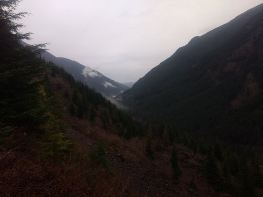
I've been itching to explore this valley just on the north side of the border with Cascades National Park. Previously, we had done some exploring here during our snow wheeling trip, and before that with my buddy's UTV, but we had turned back for various reasons.
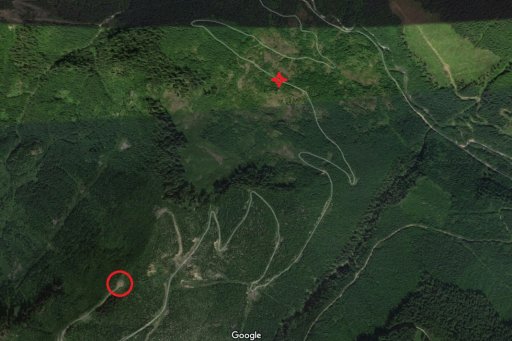
Originally, I was going to do this trip with a good friend of mine, but unfortunately he couldn't make it due to health reasons, so I was flying solo. I had done quite a bit of map recce with satellite photography, and it looked promising.
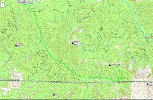
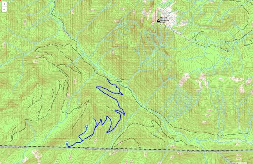
My plan was to follow this route down into the valley:
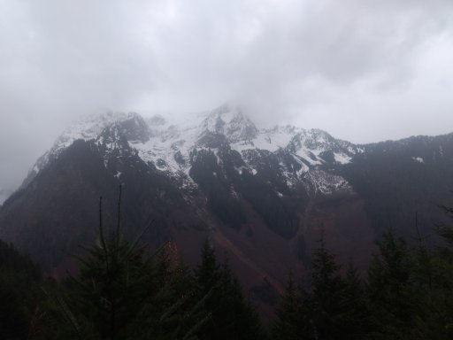
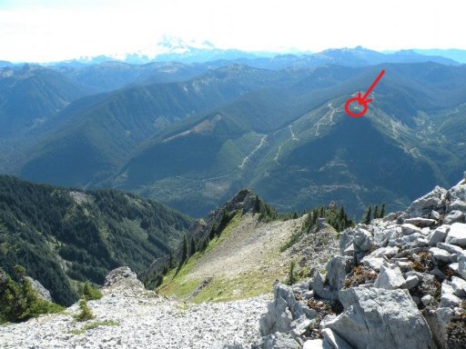
The first night I planned to drive the side track marked in blue to find an epic camp spot that appeared on sat photos, as well as in this photo taken from the peak of Mt. McGuire:
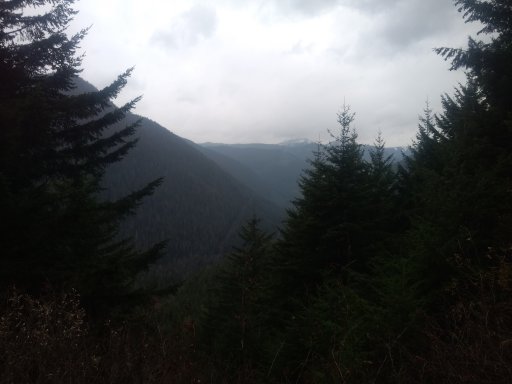
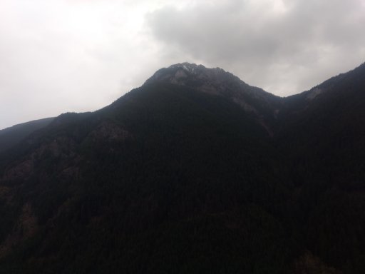
The following day, I would explore the roads at the end of the valley that appeared to switchback their way up to almost the top of the saddle between Spencer peak and Canadian Border peak. I was hoping to get up to the top of the road and then scramble the 300 or so meters to the saddle crest for epic views.
I got everything packed up and headed out much earlier than I expected, thanks to my kind wife cancelling a doctor's appointment of her own accord to let me go.
The weather was gorgeous and everything was going splendidly. However, in the immortal words of Robbie Burns, "The best laid plans o' mice and men gang aft aglee."
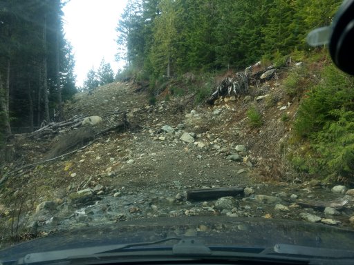
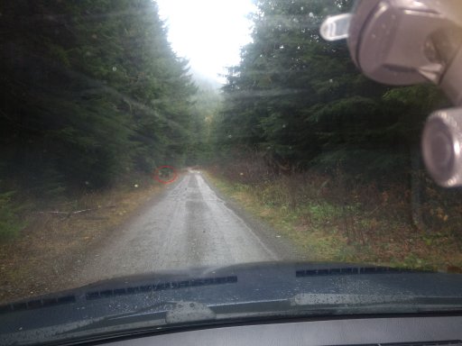
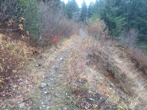
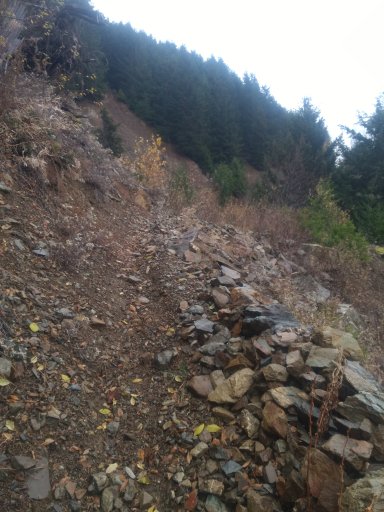
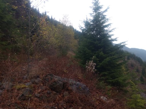
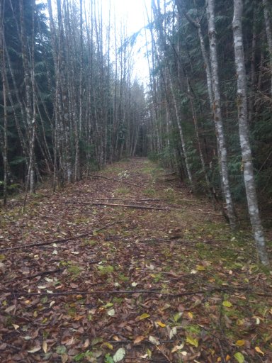
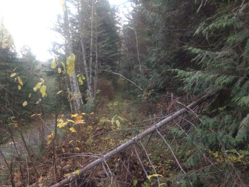
This was the start of the "road" up to my epic camp site:
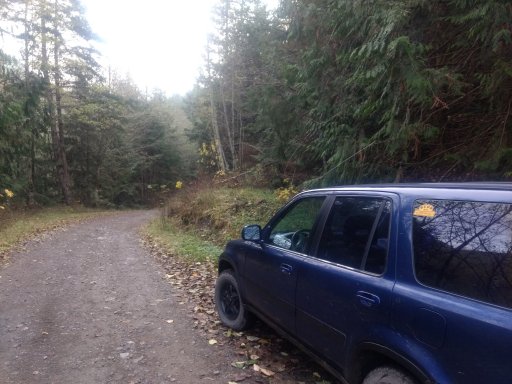
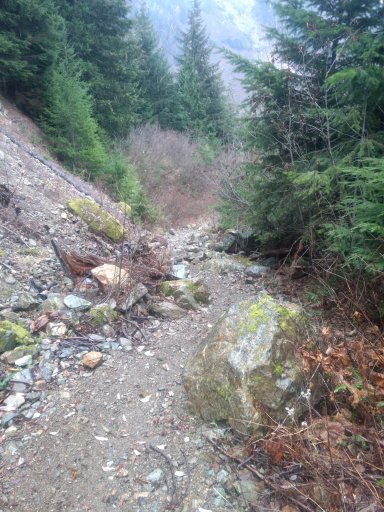
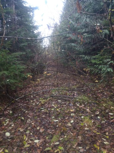
What road you say? Yes, that's what I said. This road:
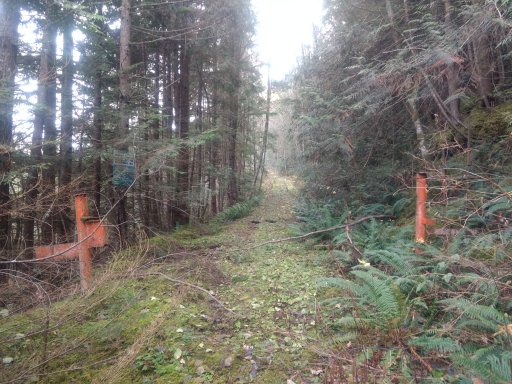
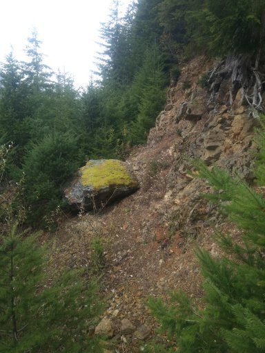
That sign you see peeking through the trees on the left explains that this road is deactivated as part of a forestry renewal project. It's been a very long time judging by what I saw later, but for the time being I knew I had to pick a new site. No matter, there was another mountain camp site that looked almost as promising on satellite only a little way down the road.
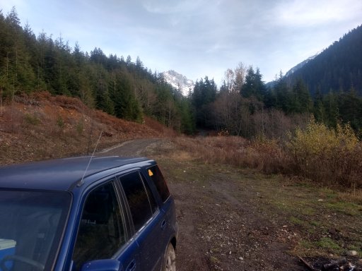
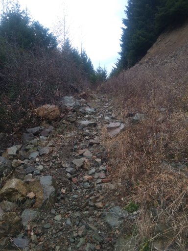
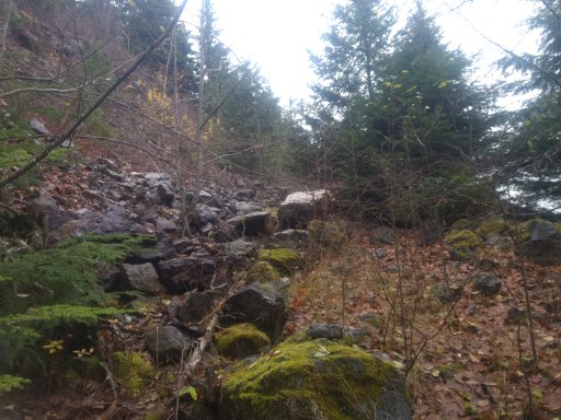
When I got to the road branch, it looked to be in far better condition, although several boulders had fallen over the road which I had to weave my way very carefully around, which made for some extremely sketch (and exciting) driving, especially without a spotter. It was going pretty well for about 3 or 400 meters until:
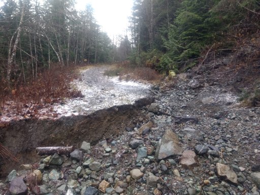
That wall of dirt goes about 8 to 10 feet down on the left. This photo is very deceiving; it makes it appear as though there's a fairly easy line on the right side, but it's actually extremely cambered and dodgy, and rolling down that massive washout was looking pretty likely. What you also can't see in this photo is the massive boulder right beside me with logs sticking over its edge. I decided discretion was the better part of valour here, especially since I was solo with nobody to spot me or help if I got myself in hot water. Back down past the boulders, thinking skinny thoughts, I drove on.
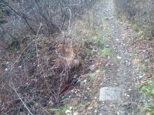
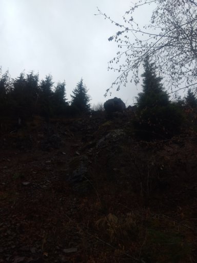
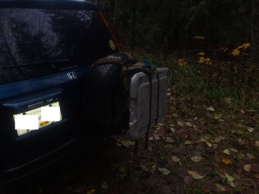
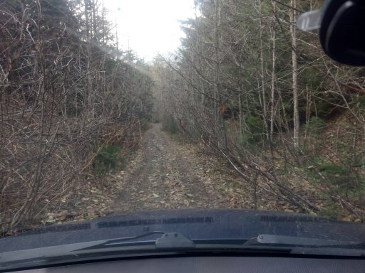
I ended up going all the way to the end of the road to just before the switchbacks started, and found myself in pin striping hell:
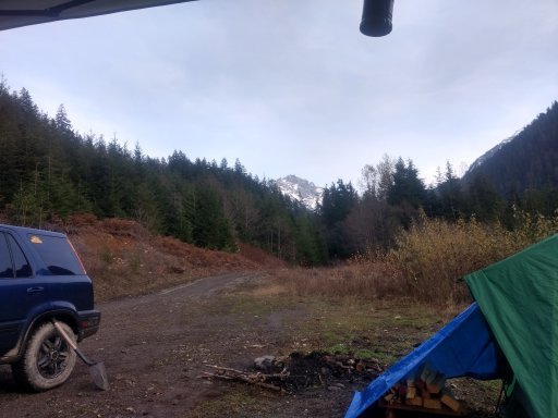
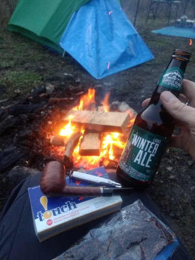
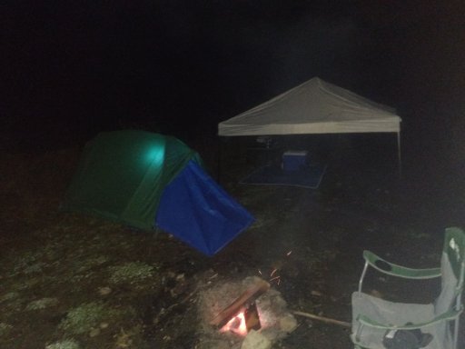
The road got dodgy and didn't show any signs of improving, so I turned around and headed back, finally settling on a decent campsite in a clearing in the road. More to follow soon!
Originally, I was going to do this trip with a good friend of mine, but unfortunately he couldn't make it due to health reasons, so I was flying solo. I had done quite a bit of map recce with satellite photography, and it looked promising.
My plan was to follow this route down into the valley:
The first night I planned to drive the side track marked in blue to find an epic camp spot that appeared on sat photos, as well as in this photo taken from the peak of Mt. McGuire:
The following day, I would explore the roads at the end of the valley that appeared to switchback their way up to almost the top of the saddle between Spencer peak and Canadian Border peak. I was hoping to get up to the top of the road and then scramble the 300 or so meters to the saddle crest for epic views.
I got everything packed up and headed out much earlier than I expected, thanks to my kind wife cancelling a doctor's appointment of her own accord to let me go.
The weather was gorgeous and everything was going splendidly. However, in the immortal words of Robbie Burns, "The best laid plans o' mice and men gang aft aglee."
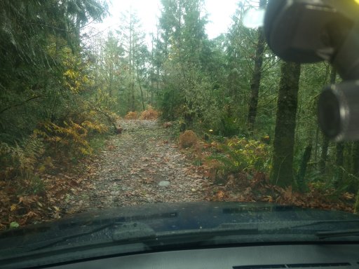
This was the start of the "road" up to my epic camp site:
What road you say? Yes, that's what I said. This road:
That sign you see peeking through the trees on the left explains that this road is deactivated as part of a forestry renewal project. It's been a very long time judging by what I saw later, but for the time being I knew I had to pick a new site. No matter, there was another mountain camp site that looked almost as promising on satellite only a little way down the road.
When I got to the road branch, it looked to be in far better condition, although several boulders had fallen over the road which I had to weave my way very carefully around, which made for some extremely sketch (and exciting) driving, especially without a spotter. It was going pretty well for about 3 or 400 meters until:
That wall of dirt goes about 8 to 10 feet down on the left. This photo is very deceiving; it makes it appear as though there's a fairly easy line on the right side, but it's actually extremely cambered and dodgy, and rolling down that massive washout was looking pretty likely. What you also can't see in this photo is the massive boulder right beside me with logs sticking over its edge. I decided discretion was the better part of valour here, especially since I was solo with nobody to spot me or help if I got myself in hot water. Back down past the boulders, thinking skinny thoughts, I drove on.
I ended up going all the way to the end of the road to just before the switchbacks started, and found myself in pin striping hell:
The road got dodgy and didn't show any signs of improving, so I turned around and headed back, finally settling on a decent campsite in a clearing in the road. More to follow soon!
Last edited: