
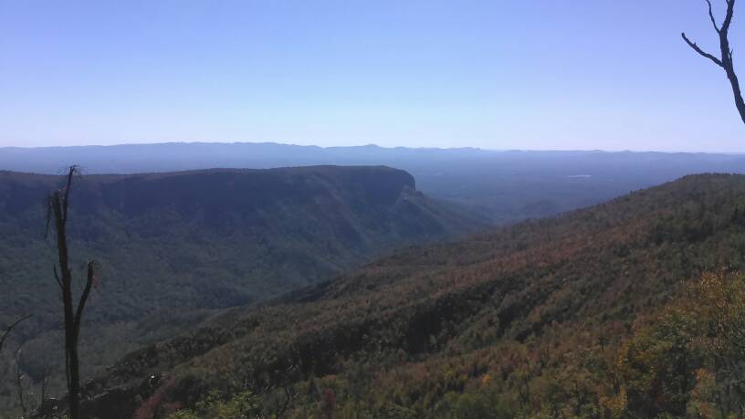
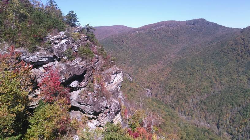
This is not a hard road to run in Western NC, but the views are awesome. Up is from NC 126 above Lake James, Down the road Starts in Linville Falls NC off highway 183. The road is an old state road from the 4o's. It is wide, gravel and dirt. It can be very rough with washboards and diagonal washouts, but a good front wheel drive can do it. You will work along the Linville River Gorge with good trail heads to lead you into the valley where the trout fishing is tremendous. Be ready for a hard hike both up and down. You will see Shortoff Mountain, Table Rock mountain, both very impressive rock formations. Stop at Wiseman's view near the top and get a view of the Gorge, and across to the famous Brown Mountains. Stay til dark and you may witness the mysterious Brown Mountain Lights. This road is a good afternoon drive.
Old Nc 105
- Thread starter Big E
- Start date
You are using an out of date browser. It may not display this or other websites correctly.
You should upgrade or use an alternative browser.
You should upgrade or use an alternative browser.


there are rough pull off sites along the road. you will be right along the road but its not that crowded. look at brown mountain beach road, craig creek road, or the roseboro road, these are on the other side of the gorge, one valley over. all easy drives with good fishing and camping spots along the way. mortimor national forest campground is closed but there are a few sites you can get into as well, enjoy.I've got a couple campsites waypointed in my GPS in that part of the woods. I'm shooting for a camping weekend with the family up that way around President's day.
National Geographic has a map series of the area, has all the fire roads that are open and places to visit. Mortimor, Edgemont have a ton of history. I will be in the outer banks around President's day, would not have minded taking folks out or sharing my map and ideas. Fish, hike, relax are the name of the game in this area.

Influencer II
This is exactly what I've been looking for today ironically. Thanks KS for the post from a fellow NC member!

If your in the area let me know. Love to help out finding you some fun things in this area.
I'm in NC. Just north of Greensboro. Been meaning to hit Richland road among others in the Western part of the state.
Sent from my XT1585 using OB Talk mobile app
Sent from my XT1585 using OB Talk mobile app

Traveler III
Try a Google of Richland road off-road. It's technically an actual county/state road but kinda unmaintained. But it's all private around it so do not leave the road.what and where is this richland rd?..we are going down to asheville in a month then hit all the national forests down there
Sent from my iPhone using OB Talk

Enthusiast III
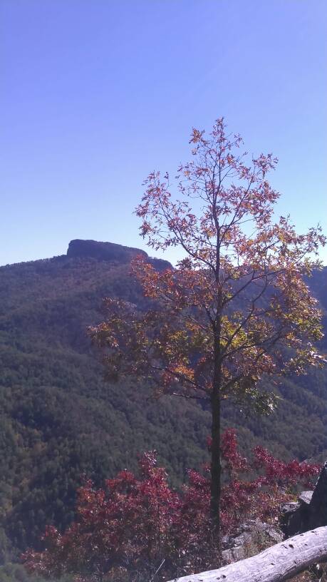
What is the name of the mountain with the big rock top? The one with the tree in the foreground.
Sent from my iPad using OB Talk
Table RockWhat is the name of the mountain with the big rock top? The one with the tree in the foreground.
Sent from my iPad using OB Talk
Enthusiast III
I think that is the same peak I could see from a place I visited years ago in Valle Crucis. Do you know if Table Rock can be summited by foot or 4Runner? Edit: Just found the hikewnc web page. I'll be hiking this soon.
Last edited:
