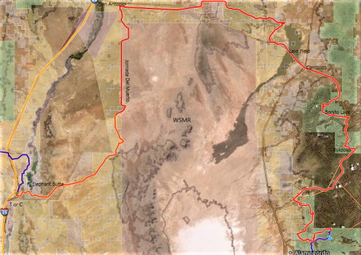
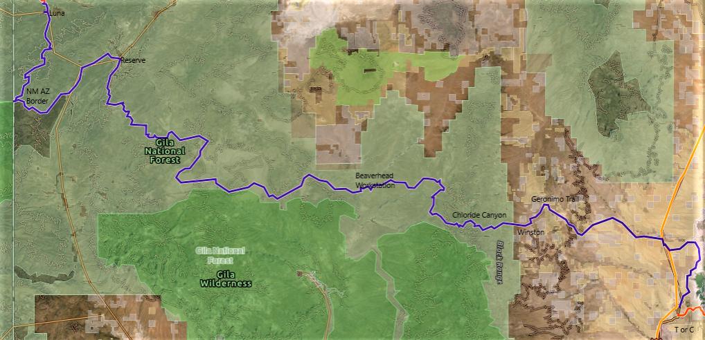
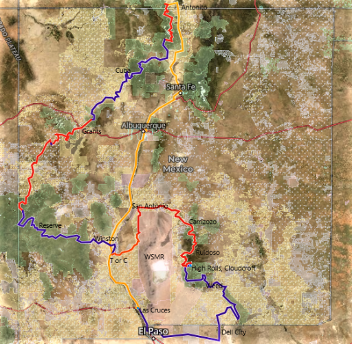
New Mexico Backcountry Discovery Route

  • HTML tutorial

velo47

Rank VII
Launch Member

Member III

6,184
Albuquerque, NM, USA
First Name
Matt
Last Name
Harland
Member #

21731

Ham/GMRS Callsign
W3TAX
The entire route:

NMBDR total route sat (2).png

Day 1

NMBDR Day 1 sat (2).jpg


I met up with Jimmy and Suzie from Prescott, AZ, and their pup, Luna, in Las Cruces. The plan was to motel it there that night (Monday), and then slab it to Dell City, TX in the morning to start the offroad route. When I got the motel, they were already there. Problem – a check engine light had come on in their van on the way to Cruces. Jim had a code reader, and it seemed to be a problem with the DEF system, but didn’t appear fatal. In fact, the light was intermittent, and so they decided to continue on, hoping they wouldn’t get the dreaded Sprinter “countdown.”

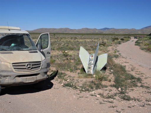
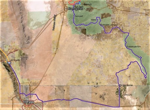
Tuesday morning we headed off to Dell City, and got there about 11 A.M., a little later than expected. Google Maps said it was about a two-hour drive, and it ended up being three-ish. Dell City is not exactly rich in colorful history. The town was founded in the late 1940s, when an aquifer was discovered underneath. This allowed for the cultivation of about 40,000 acres of previously desert land. Over the years, the population grew, peaking at almost 1,000, but only about 400 residents remain there today.

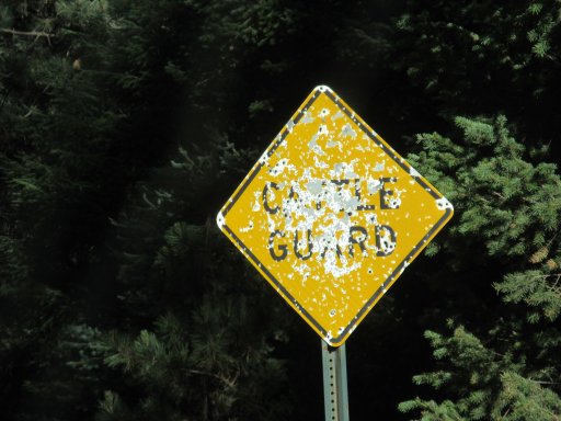
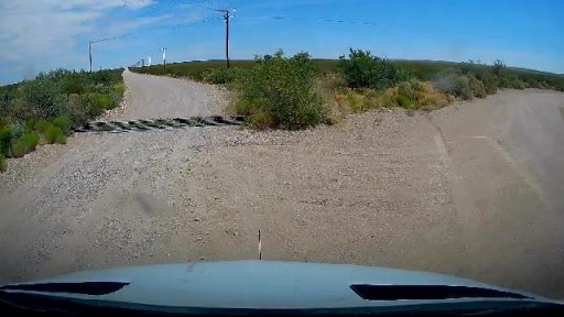
Fuel up, air down, and we’re off! A couple miles up the road, there’s a cattleguard and barb-wire fence. It’s the TX-NM border, no sign or anything, just a fence.

snapshot_001 border.jpg

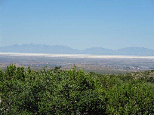
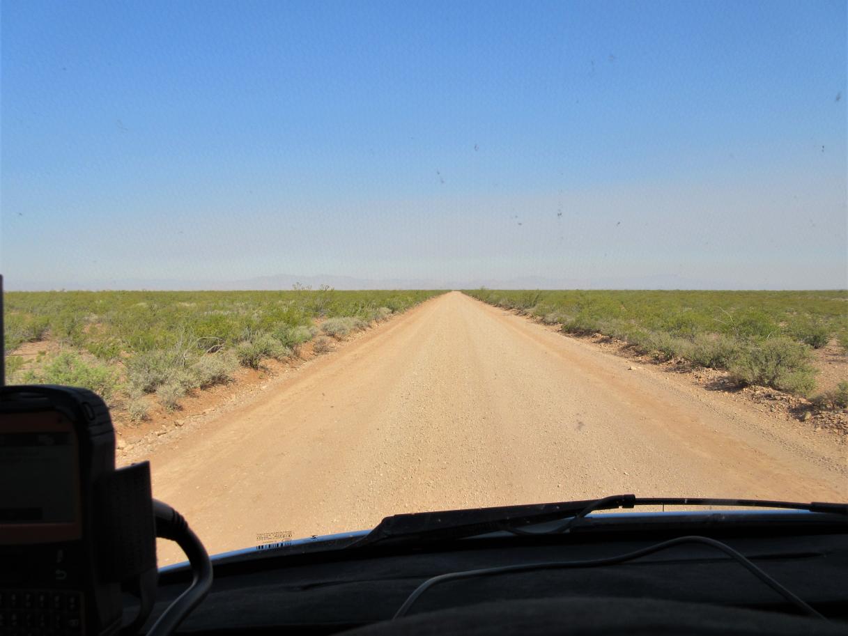
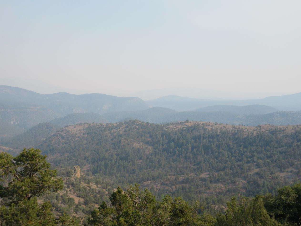
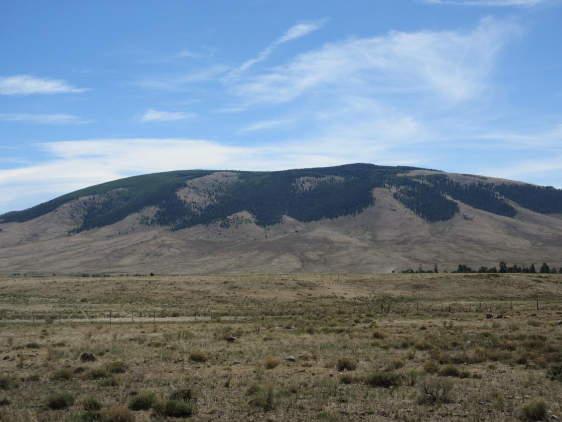
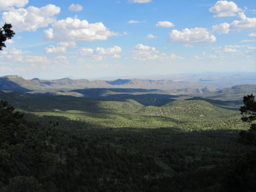
The first 130 miles is flattish desert with relatively good roads. Then the route enters the Lincoln National Forest and tips up to the Guadalupe Rim, a 1,500 to 2,000 foot high scarp with incredible views to the West. The rim is part of a giant Permian reef that was formed about 250 million years ago, buried in sediment, and later uplifted into what we now know as the Guadalupe Mountains.

20200616140807 Guadalupe 1.jpg

20200616140818 Guadalupe 3.JPG


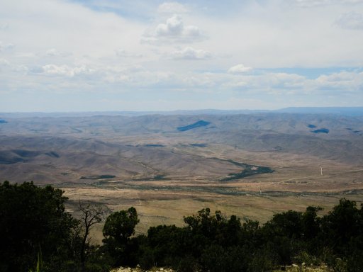
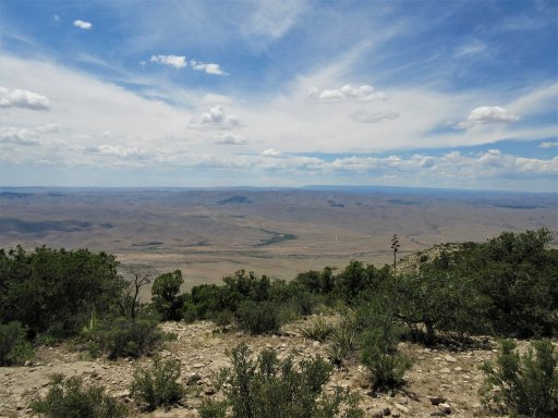
Guadalupe Mountains National Park, just south of the border, is home to the 4 highest peaks in Texas. The reef formation is the same one that contains Carlsbad Caverns National Park to the East as well. The road winds along the rim through the pinon-juniper scrub along the rim for several miles, before dropping back down into the desert.

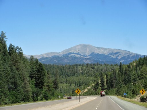
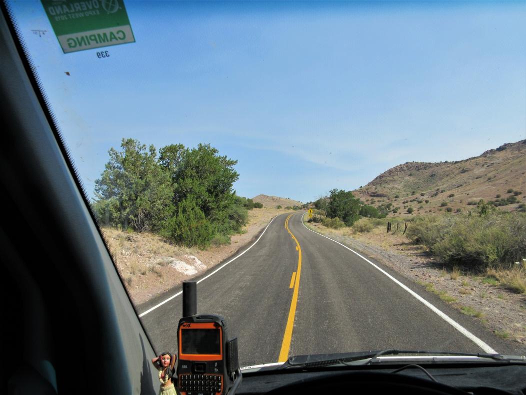
The desert section lasts not long, though, and soon we climb up into the Sacramento Mountains, first into P-J, and then into the pines. The route passes by the Bluewater Lookout, built in 1917, and quite possibly the oldest in the Lincoln NF.

Our next fuel stop was the Weed Store in Weed, NM in the Agua Chiquita Canyon. Weed was established in 1885, but there was trapping, ranching, and hunting activity in the area prior to that date. The town was named not because of the surrounding flora, but rather after a prominent merchant from White Oaks. Although W.H. Weed probably never visited the area, he set up a store at a crossroads there, and others settled around it. At one time, about 1,000 people called Weed home. Now the population is down to a mere 20.

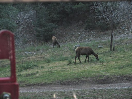
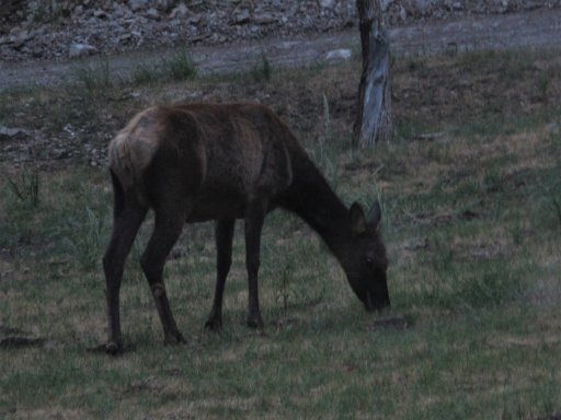
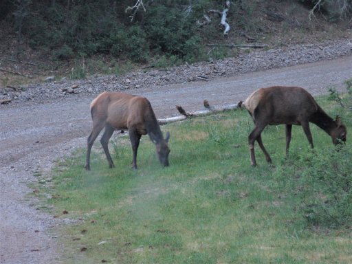
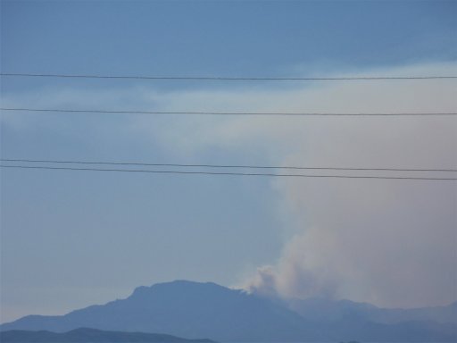
Winding our way up the small valleys past Weed in the late afternoon, we saw several elk, deer, and a coyote hunting some sort of small prey.

20200616164214 Sacramentos 1.JPG

20200616170346 Sacramentos 2.JPG


Then we were out into the P-J on West Side Road, high above Alamogordo on our way to High Rolls. On the peaks high above the road are the Sacramento Peak Solar Observatory and the Apache Point Stellar Observatory in Sunspot, NM. A side trip to Cloudcroft and Sunspot would be nice, but the timing wasn’t right for us.

20200616173243 Westside Rd.JPG


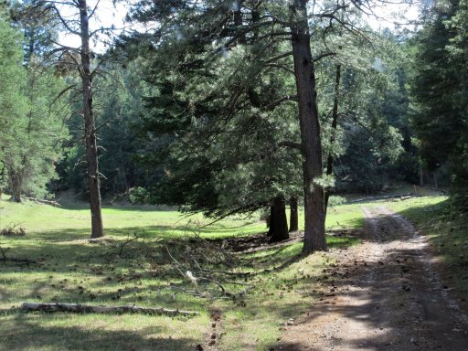
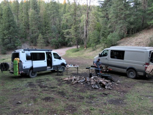
We continued on to High Rolls, founded in the 1880s and birthplace of Pulitzer Prize-winning wartime cartoonist Bill Mauldin. The first store, built in 1905, is still standing today. We decided we were not going to make it to Ruidoso before dark, and continued a few miles up into the NF and found a campsite for the night.

20200616200232 Day 1 camp.JPG

It was a long day. Total miles for the day, including the drive from Las Cruces to Dell City, was about 345 miles.
 

Attachments

Last edited:

Downs

Rank V
Launch Member

Member III

2,827
Hunt County Texas
First Name
Joshua
Last Name
Downs
Member #

20468

Ham/GMRS Callsign
KK6RBI / WQYH678
Service Branch
USMC 03-16, FIRE/EMS
Good deal, love it out there. When I went there was a lot of rain going on so we didn't make time as good as you guys did on day one lol. We started pretty early and didn't make it to Bluewater Lookout where we camped till after 5pm. Day 2 got us as far as just outside Cloudcroft.
 

velo47

Rank VII
Launch Member

Member III

6,184
Albuquerque, NM, USA
First Name
Matt
Last Name
Harland
Member #

21731

Ham/GMRS Callsign
W3TAX
Good deal, love it out there. When I went there was a lot of rain going on so we didn't make time as good as you guys did on day one lol. We started pretty early and didn't make it to Bluewater Lookout where we camped till after 5pm. Day 2 got us as far as just outside Cloudcroft.
We definitely lucked out weather-wise. All through the route there are large sections that, from the petrified ruts, look like they would be nearly (or actually) impassable in the mud. I was going to do the trip alone north to south last year, but after a week of rain every day, the roads were bad enough I aborted after only about 10 miles. This trip we only got a couple raindrops the last evening when we had already regained pavement.
 

velo47

Rank VII
Launch Member

Member III

6,184
Albuquerque, NM, USA
First Name
Matt
Last Name
Harland
Member #

21731

Ham/GMRS Callsign
W3TAX
Day 2

NMBDR Day 2 sat (2).png

This Wednesday morning I got up just before 6 A.M. and puttered around in the van, getting dressed and setting up my coffee. I looked out the driver’s side window and there are 2 cow elk grazing in our camp!

20200617061723 (2) elk 1.JPG

20200617061824 (2) elk 2.JPG

20200617062220 (2) elk 3.JPG

The traveling day began with some narrow rocky trails through the pine forest, and then a descent back into High Rolls.


Road signs here take a beating out here.

20200617081429 sign.JPG

The route continues to drop into the desert of the Tularosa Basin. That's White Sands National Park in the distance.

20200617095655 (2) white sands.JPG


There it turns onto the highway for what was expected to be a 40 mile run to the area around Ruidoso. We aired up and rolled up the highway. At Mescalero there was a large sign saying that all Mescalero Apache Tribal roads were closed. We stopped at the turn-off to assess, and by chance ran into a tribal official who confirmed that the Nation had experienced an outbreak and that we were not allowed on the off-road route to Ruidoso. We continued on pavement another 25 miles or so to Ruidoso, where we rejoined the route.

Ruidoso is at the foot of the 12,000 ft Sierra Blanca Peak. Native American ruins dating back to between 900 and 1400 AD have been found at the mountain. The Mescalero Apache consider the mountain to be the home of the mountain gods, their protectors.

20200617110055 (2) sierra blanca.JPG


The original name for the town was Rio Ruidoso, or “noisy river,” but the name was shortened sometime along the way. The current town dates back to about 1870, when the first building was erected. That building, Dowlin Mill, still stands today. In 1914, the first tourist cabins were built in Ruidoso. Others followed, and tourism took off with the building of the first ski-tow in 1938. The current ski area was opened in 1961. In 1963 it was purchased by the Mescalero Apaches. Ruidoso Downs is the home of the All-American Futurity, one leg of the Quarter Horse Triple Crown.

The route proceeds back onto to dirt outside Ruidoso, near Bonito Lake. The original dam was built by the railroad in 1907, and had a 132 mile wooden pipeline to provide water for steam locomotives at Pastura, NM. The current dam, built a little downstream, was completed in 1931. The lake was a source of drinking water for the city of Alamogordo, and a popular fishing and camping spot. In 2012, the Little Bear Fire and the subsequent monsoon rains filled the reservoir with mud and ash. It was drained and dredging and repairs began in 2015. The lake is still empty and work continues today.


From Bonito Lake we eventually dropped down to the desert floor and fueled up in Carrizozo, where I got my only Allsups burrito of the whole trip.

Carrizozo was established when the railroad put a station there in 1899. Carrizo is a grass which is excellent fodder for cattle. The extra “zo” denotes an abundance of such grass in the area. In 1909, it became the Lincoln County seat, sparking a legal battle that went all the way to the US Supreme Court. The town’s population peaked at around 2,000 by 1920. With the decline of the importance of the railroad, the population has halved since then.

About 35 miles west of Carrizozo on the current-day White Sands Missile Range is Trinity Site, where the first atomic bomb was detonated on July 16, 1945. Carrizozo was the first town downwind of the explosion and received some radioactive contamination from the blast. The blast vaporized the steel tower on which the bomb was mounted, melted the sand around the tower forming a mildly radioactive glass called Trinitite, and broke windows 120 miles away. The blast was felt over 150 miles away. The 51,500 acre Trinity site was declared a National Historic Landmark in 1975 and is open for visits only twice a year, in April and October.

The route heads west on the highway out of Carrizozo, across a lava flow known both as the Carrizozo Malpais and the Valley of Fire. Shortly thereafter, it turns north into the desert and then west, roughly paralleling the highway. Along this section, we met a couple ranchers traveling the opposite direction. They surveyed the vans and told us they see a lot of motorcycles on the route, but no rigs like those. But, they said, it looks like you’re well equipped, good luck to you and safe travels. Once back on the highway, we travelled west a little way towards San Antonio.

San Antonio can trace its history all the way back to 1629, but in recent times has been best known for being the home of great green chile cheeseburgers at the Owl Bar and the Buckhorn Tavern (now sadly closed). The Owl Bar was built by the Brunswick Balke Collender Company (you’ve probably used their bowling balls!). Prior to statehood, while New Mexico was still a territory, Conrad Hilton was born, the son of a merchant and hotelier in San Antonio. A.H. Hilton’s original mercantile burned down about 1930, but the wooden bar was saved and later installed in the Owl Bar, where it remains today.

We turned off the highway just short of San Antonio. Once the route heads south through the desert, it follows the fenceline along the western edge of the WSMR. The roads were pretty good through this section all the way to Elephant Butte Reservoir and the town of Truth or Consequences, our destination for the day.

Originally developed as a test site for the V-2 rocket, WSMR is the largest military installation in the US. It covers almost 3,200 square miles, and is contiguous with the 900 square mile McGregor Range Complex at Fort Bliss, TX, and Holloman Air Force Base near Alamogordo. In 1982, the Space Shuttle Columbia landed at WSMR. Twice over the years, rockets either launched at, or launched toward, WSMR have veered off-course and exploded in Mexico.

20200617165004 (2).JPG


Interestingly, on the road along the WSMR fence, my GPS acted very strangely, losing maps, turning off, and flip-flopping North and South. Other travelers of the BDR had mentioned this, but I didn’t believe it until I saw it for myself.

This area, from Socorro south to Las Cruces/El Paso, is known as the Jornada del Muerto, or “journey of the dead.” The name was given by Spanish conquistadores, denoting the especially hot and arid journey between the two cities. During the Pueblo Revolt of 1680, more than 2,000 Spanish, Isleta, and Socorro Pueblo residents were forced south out of Socorro. Fewer than 1,200 survived the journey to El Paso. Now, we cross that territory in just a few hours, even off-road.

We saw quite a few pronghorn, or “speed goats” in this area. In fact, the route traverses the eastern edge of the BLM Pronghorn Wilderness Study Area just south of highway between Carrizozo and San Antonio. Pronghorn are the fastest land animal in the Western Hemisphere and second in the world behind the cheetah. Unlike the cheetah, though, pronghorn can sustain high speeds over long stretches. They can reach speeds of upwards of 60 MPH in full sprint, and can sustain 35 MPH over 4 miles. They have a 320 degree field of vision and their vision is said to be equivalent to a human looking through 8-power binoculars. Because speed and vision are their main defenses against predators, they inhabit the wide open, and are seldom seen in more forested areas. Although they have horns, not antlers, they do shed regrow the outer sheath of the horns each year. They are not antelope, although they are often called such. They are most closely related to giraffes and okapi.

In the late afternoon, we rolled into T or C and all the State Park camping at Elephant Butte Reservoir was still closed, so we got a motel for the night. The dam at Elephant Butte was started in 1911 and finished in 1916. At the time, it was the largest irrigation enterprise in the US, and holds the largest body of water in the state of NM. T or C is a town of about 6,500 residents. Formerly known as Hot Springs, the first hot springs bath there was built in the late 1880s. By the 1930s, there were approximately 40 hot springs spas, with a population of only 3,000 residents. Currently, there are about 10 spas in operation. Hot Springs officially changed its name to Truth or Consequences in 1950, when it was announced that the popular radio show would host its 10th anniversary show from the first town to name itself after the show.

As we headed towards T or C, we could see the plume from one of the wildfires in the Gila National Forest. Hopefully the area to which we were traveling the next day would be unaffected.


20200617165305 (2) smoke.JPG

Total miles for day 2 was about 260. After traveling over 600 miles in 2 days, we spent the night only 75 miles north of our starting point in Las Cruces.
 

oneleglance

Rank V

Contributor II

1,453
Phoenix, AZ, USA
First Name
LANCE
Last Name
BLAIR
Ham/GMRS Callsign
KE7NKP
Great writeup and pics...
I had fun running part of the NMBDR and this makes me want to go back and do the entire thing again.
 
  • Like
Reactions: Downs

velo47

Rank VII
Launch Member

Member III

6,184
Albuquerque, NM, USA
First Name
Matt
Last Name
Harland
Member #

21731

Ham/GMRS Callsign
W3TAX
Day 3


Thursday we left T or C about 8 AM, headed north along Elephant Butte Reservoir, and then west across the flat desert towards Winston.


Soon enough it got a little hillier and less arid, and a portion travels over the Geronimo Trail National Scenic Byway. The byway starts in the south at San Lorenzo, NM, and the north end is at Beaverhead Workstation, with T or C in the middle. We would travel to Beaverhead today, but mostly not on the paved byway!


We inquired at the Winston General Store about the fires and were assured our route was safe. Winston was formed in 1881 by miners who found the nearby town of Chloride “too rowdy.” The town was originally named Fairview. Frank Winston, a businessman, moved to town in 1882. He was one of the good guys, and often extended credit to customers who were down on their luck. When he died in 1929, the town was renamed in his honor. Winston was a silver mining town, and like many others, was essentially shuttered by the silver panic of 1893. A handful of residents live there now and Frank Winston’s house and carriage house still stand, along with the 1890 schoolhouse and post office.

Off to the small town of Chloride, population 11. Chloride was founded in 1880, with the discovery of silver by Harry Pye. When times were rippin’, Chloride boasted 9 saloons, 2 hotels, a general store, butcher, dry goods store, candy store, pharmacy, Chinese Laundry, photographic studio, newspaper, and a school. Just as with Winston, the good times only lasted until 1893.

Here we entered the Gila National Forest. The Gila NF contains 3.3 million acres, and several designated Wilderness Areas, including the first in the nation, the Gila Wilderness. The Rocky Mountains southern terminus is in the Gila, as is the northern terminus of the Sierra Madres. The area also contains Chihuahuan and Sonoran deserts, contributing to its diverse flora and fauna.

In the highlands of the Gila, evidence has been found that Paleoindians at least passed through the area between 9,500 and 6,000 BC. Also found have been remains of the Cochise Culture (6,000 BC – 300 AD). The Mogollon, an offshoot of the Cochise, seem to be the first permanent settlers in the area, living in cliff dwellings and pit houses, and growing their own food. They appear to be the first to make clay pots, which reached its peak with the Mimbres people of the Mogollon culture. In the 1,200s the Mogollon disappeared, the reason for which is unknown. In the 1,500s and 1,600s the nomadic Apaches entered the area. They were hunter-gatherers who lived in tents and other temporary structures. In the 1,800s, the Spanish were mining copper in the area, and the natural resources were being heavily exploited. The area became part of the US in the mid-1,800s the Gadsden Purchase. In the late 1,800s the conservation movement was born, as some people realized that the plunder could not continue indefinitely. Aldo Leopold, among others, was instrumental in protecting the Gila Wilderness. In 1924, 755,000 acres of the Gila was finally set aside as the first designated wilderness area in the US.

As we entered the Gila, we also entered Chloride Canyon, a narrow, steep walled chasm cut by what appears now to be a small intermittent stream. The road twists and turns, crossing the stream reportedly over 100 times. I believe it. There is a pavement bypass here, but we had no problem getting the vans through, other than a multitude of new pinstripes.


Part way up the canyon is a spectacularly overhanging rock, and just past that are a group of petroglyphs painted in red on the canyon wall, and scratched into the soot on the underside of a nearby overhang.


We then climbed out of the canyon and into pine forest and meadows.


Throughout the area there are remnants of abandoned cabins and other buildings. Here we saw several elk and deer.


We went by the Forest Service’s Beaverhead Workstation and its associated dirt airstrip, then by Snow Lake, through the remnants of a big burn (the 2018 Buzzard fire, I think), and down into the town of Reserve around 5 PM.


Reserve is the county seat of Catron County with a population under 300. In the 1860s, Mexican-Americans established a string of villages along the San Francisco River, creatively named the Lower, Middle, and Upper San Francisco Plazas. When Anglo settlers arrived, they renamed Upper San Francisco Plaza as Milligan’s Plaza, later to become Reserve, NM.

Here, in 1884, Elfego Baca arrested a drunken cowboy named Charles McCarty, to the chagrin of McCarty’s compatriots. A shootout ensued in which one cowboy was killed. The Justice of the Peace ordered a nearby rancher to bring Baca in for questioning. A standoff ensued, and the rancher was killed. The cowboys retaliated, and allegedly fired over 4,000 shots into the house where Baca was holed up. Baca escaped unscathed, but he killed 4 cowboys and wounded another 8. Baca was tried on 2 counts of murder and was acquitted, even though now it appears he was never legally deputized. Later he became the Socorro County sheriff, and in 1888, a US Marshall. He then became a lawyer and politician both before and after New Mexico statehood in 1912.

In Reserve we would fuel up and split up, with Jim and Suzie going to Albuquerque to get the van looked by the dealer, and me continuing on the route. I continued on, turning just inside the AZ border, to the village of Luna (there is no gas in Luna any longer).


Luna is home to about 150 residents. The post office there was established in 1886. It was briefly a hideout for outlaws, but in 1883 was settled by Mormon ranchers. The town is named after Don Salomon Luna, who owned the lands prior to the settlement. Mormon Pioneer day is still celebrated in the town each year.

I camped for the night in the pines just north of Luna. This section of the trip was extraordinarily smoky due to the wildfires in SW NM and in AZ. Total mileage for the day was a wonderful 225, over 800 total, and we were still not halfway up the state!


Downs

Rank V
Launch Member

Member III

2,827
Hunt County Texas
First Name
Joshua
Last Name
Downs
Member #

20468

Ham/GMRS Callsign
KK6RBI / WQYH678
Service Branch
USMC 03-16, FIRE/EMS
Great writeup so far. You're making me want to get back out there and run more of it.
 
  • Like
Reactions: Shamu

velo47

Rank VII
Launch Member

Member III

6,184
Albuquerque, NM, USA
First Name
Matt
Last Name
Harland
Member #

21731

Ham/GMRS Callsign
W3TAX
Day 4


Friday began with a climb through the pines on Bill Knight Gap Road. This is the northern reaches of the Gila National Forest.


I saw quite a few elk and a few mule deer in the morning.


After passing through Bill Knight Gap and out of the Gila, the road leads into P-J scrub, then grasslands, and finally high desert.


Out in the sage, where I would expect to see mule deer or maybe even pronghorn, a lone cow elk crossed in front of me on the road.


This part of the day, the skies were still smoky, but it lessened as I moved north.

The route passes by the Zuni Salt Lake, if you’re not careful, you’ll miss it, as only a glimpse is visible from the road. Visitor access to the lake is not allowed.


Although not on the Zuni Pueblo reservration, which lies about 60 miles north, the lake is considered sacred ground by the Zunis, and has been under Zuni control since 1985. The lake itself is very shallow, no more than about 4 feet. In the summer, the water evaporates and leaves behind the salt flats where the harvesting of salt is possible.

The lake is the home of the Zuni Salt Mother, or Ma’l Okyattsik’i. Salt is important to the Pueblo people, both culinarily and ceremonially. Many, including the Zunis, Lagunas, Acomas, Hopis, and Taos have made annual pilgrimages for centuries to harvest salt from the lake. There is even evidence that the Chaco culture harvested salt at the lake. The lake and surrounding area has long been considered to be neutral zone, or sanctuary area, by the pueblos, and contains many burial sites and shrines.

For nine years, beginning in 1994, The Arizona-based Salt River Project, tried to build an 18,000 acre surface coal mine about 10 miles from the lake. It was proposed that 80 million tons of coal be extracted and railed to the Coronado Generating Station in Arizona. The mine would require large amounts of water from the aquifer, both for construction and operation. Native Americans, environmentalists, and ultimately the Federal Bureau of Indian Affairs opposed the mine.

In 2003, the Salt Lake and surrounding sanctuary area was listed on the National Trust for Historic Places Most Endangered Historic Sites list. Just a couple months later, SRP, in the face of this strong opposition on many fronts, relinquished its permits and coal leases for the mine.


The route continues through the high desert to the village of Fence Lake. About 40 people reside in Fence Lake, and the surrounding area is primarily ranchland. Fence Lake is so named because original settlers had to fence off a pond in the area to prevent animals from contaminating the water source. Don’t plan on fishing there, though, it seems the pond is long gone, but the name remains. There is a monument in the center of town to the pioneers and ranchers in the area.


North out of Fence Lake the route enters the Ramah Navajo Indian Reservation. The Ramah Reservation is not contiguous with the Navajo Nation, and covers about 230 square miles (less than 1% of the Navajo Nation) with has a population of a little over 2,000 residents. The Ramah have resided in the area since the 1500s, when they fought with the Zunis against the Spanish forces of Francisco Vasquez de Coronado. From the 1860s to the 1960s, the Ramah were independent of the Navajo Nation.

They still act somewhat autonomously of the Nation today, having their own police force, school system, etc. Although they had been there for centuries, the Ramah’s rights to the land they inhabit was not fully secured until the passage of Public Law 93-333 in 1979.

On the Ramah Reservation is the small village of Candy Kitchen, so named for the candy-making operation that was a front for a bootlegger rancher making ‘shine during prohibition. The kitchen ostensibly made pinon nut candy with all that sugar they were buying… Now, Candy Kitchen attracts all types, including retirees, artists, and off-grid fanatics. Many of the homes are not served by the electric utility, and the community is over 60 miles from the nearest supermarket. Since 2011, the Candy Kitchen Trading Post had been the center of the community. Unfortunately, it recently closed its doors.

I made a wrong turn and found this truck graveyard.


Across the road from the Trading Post is the Wild Spirit Wolf Sanctuary. Founded in 1991, the Sanctuary rescues wolves and wolf-dog hybrids. According to the Sanctuary’s director, Leyton Cougar, its mission is not rehabilitation and release or adoption, but rather providing a home for canids that cannot function either as wild or domestic. The Sanctuary is temporarily closed to visitors, but usually allows visitors and provides tours.

North of Candy Kitchen the route intersects with Ice Cave Road. Because the morning had been relatively good roads and fast travel, I decided to visit El Morro National Monument and El Malpais National Monument, both just a few miles from the intersection.

El Morro, to the west, really contains 2 separate attractions. First, and least known, are the unexcavated and partially excavated pueblos atop the rock promontory known as “Inscription Rock.” Atsinna, or A’ts’ina, the largest, was built about 1275 by Zuni ancestors. Made of flat sedimentary rock cemented together with clay and pebbles, it is about 200 by 300 feet, and housed between 1,000 and 1,500 people. Corn and other crops were grown in irrigated fields below the mesa, and the surplus was stored in well-sealed rooms in the pueblo. Cisterns at the pueblo collected rainwater. The oasis at the base of the mesa was also used, as evidenced by hand-and-toe steps on the cliff face from the oasis to the pueblo. The pueblo was multi-story and had at least 875 rooms surrounding an open courtyard. Only a very small portion has been excavated.

The second attraction is Inscription Rock.


Ancient indigenous people etched petroglyphs in the sandstone rock face eons ago.


When the Spanish came north into present-day New Mexico, the spring-fed oasis at the base of the cliff provided a reliable source of water in an otherwise dry landscape.


Soon, El Morro was a regular stop along the travel routes through the area. When they stopped, many travelers carved their names and dates of passage in the soft sandstone at the base of the cliff.


The earliest Spanish inscription is that of Don Juan de Oñate on his return from the Gulf of California on April 16, 1605. Oñate’s inscription is either over or under a Native American petroglyph. It’s unclear whether Oñate purposely overwrote the petroglyph as a sign of dominance, or the petroglyph was placed over his inscription as an act of rebellion.


After the Spanish, Anglo pioneers added their mark to the rock. El Morro was made a National Monument by Teddy Roosevelt in 1906, and in the same year US Federal law prohibited future carving at the site.


To the east of El Morro is El Malpais National Monument. It was so designated in 1987. El Malpais contains a large lava flow, lava tube cave systems, cinder cones, and other volcanic features. The lava flows are made of rugged pāhoehoe and ʻaʻā lava. Many of the tubes and cave are open to exploration only with a NPS caving pemit, but some, including the Big Tubes area, are open to the public. Entry into Big Tubes requires visitors to walk over a hydrogen peroxide mat to prevent the spread of certain fungi to the lava flow. Where the walking trails traverse the lava flows, rock cairns mark the way because it’s too difficult to carve trails into the lava.


Also in the area are the Ice Caves and Bandera Volcano. Located in a section of collapsed lava tube, the Ice Cave has been accumulating ice for several thousand years. The temperature in the cave remains below freezing year-round, allowing ice to remain through the summer. Not located on public land, this private venture is temporarily closed.

From Ice House Road, the route rises back into pine forest, onto a very narrow track, and then into Zuni Canyon and ultimately to the town of Grants, NM.


Grants was formed by the Grant brothers in the 1880s as a camp for building of the railroad through the area. Railroad logging fueled the growth of the town until the 1930s. Residents turned to farming, and the Grants-Milan area became the “carrot capital” of the US. Later, a Navajo shepherd discovered uranium in the area, starting a mining boom during the US building spree of nuclear weapons and power plants that lasted into the 1980s. Currently, the major industries are tourism and private prisons.

When I got to Grants, I had a message that Jim and Suzie were in town after heading to Albuquerque the evening before. We met back up and camped in the pines on the slopes of Mt. Taylor north of Grants.
 

velo47

Rank VII
Launch Member

Member III

6,184
Albuquerque, NM, USA
First Name
Matt
Last Name
Harland
Member #

21731

Ham/GMRS Callsign
W3TAX


On Saturday we broke camp, headed up through the pines along the flank of Mount Taylor in the Cibola National Forest.


The Cibola is a disjointed collection of National Forest lands that are spread across northern and central New Mexico, Oklahoma, and west Texas. The area we were in is the Mt. Taylor district, and is a relatively small chunk of the entire Cibola, which includes forest and grasslands of over 1.6 million acres.

Mt. Taylor, or Tsoodzif in Navajo, is a dormant stratovolcano. At just over 11,300 feet, it is the highest point in the Cibola National Forest and was named for President Zachary Taylor.

The mountain is considered sacred by the Hopi, Zuni, Laguna, Acoma and Navajo peoples. For the Navajo, the mountain is an integral part of their creation story. The Navajo believe that First Man created four mountains with the sacred soil from the Fourth World to mark the four cardinal directions (with Mount Taylor representing the south) and that the spirits of the Black God, Turquoise Boy and Turquoise Girl continue to reside in the mountain. For the four other tribes, Mt. Taylor is a place to connect to their ancestral past.

Soon we dropped off of Mt. Taylor and into the desert between Grants and Cuba. This area is a checkerboard of Navajo trust lands, BLM land, and private holdings. The desert landscape, as Jim said, looks just like you’re in a cowboy movie. It’s a beautiful stark landscape of mesas, draws, and interesting rock formations. We pass by the striking volcanic neck known as Cerro Alesna (the Spanish word for awl) and head towards Cabezon Peak.


A couple of mallards surprised me when they got up off this tank!


Cabezon Peak is a volcanic plug that is visible from miles around. It dominates the relatively low mesas and hills surrounding it on the north. Cabezon means “big head” in Spanish. The Navajo believe that it is the head of the giant Ye’i-tsoh, who was killed by the twin gods Nayenezgani and To’badzistsini. The lava flows to the south of Grants, which include El Malpais, are thought to be the congealed blood of Ye’i-tsoh.


As we head towards Cuba, the scenery is amazing and the travel is quick. In the rain, this section quickly becomes impassable. Between Reserve and Luna on day 3, I saw motorcycle tracks that seemed very new, but never caught up with any bikes. Here again, I saw motorcycle tracks over the truck tire tracks in the soft dirt. They appeared to be only a day or so old. There are also some older ones petrified into deep ruts from a couple bikes that struggled through here when the weather was not so good.

See this thread for an account about what this area is like in the mud!


We got to Cuba around noon, fueled up, and ate lunch at El Bruno’s. It was good.

Cuba (originally Nacimiento) was settled in 1736 by 4 men. 30 years later, the San Joaquin del Nacimiento land grant was formed, and more settlers moved in. The town was later abandoned due to heavy raiding pressure from the Comanches, Navajos, Utes, and Apaches. Slowly, as this pressure decreased, the grant area was repopulated by farmers and ranchers. In 1887, a post office was established, and the town was renamed Cuba, meaning water tank or trough. Cuba became an important stop along the travel routes north from Albuquerque and Bernalillo, as well as a trading center for the various Native American communities in the area.

We left Cuba and headed into the Jemez Mountains. The Jemez are in the Santa Fe National Forest, established in 1915 and covering over 1.5 million acres. The land was formerly designated as the Jemez National Forest to the west of Santa Fe, and the Pecos National Forest east of Santa Fe.

Being a Saturday, I expected the Jemez would be fairly busy. It is a popular day-trip and camping destination for people from Los Alamos, Espanola, Santa Fe, and even Albuquerque, especially in the summer. But it looked like the 4th of July weekend up there! Every campground was stuffed to the gunwales with trailers, campers, trucks, and ATVs. Any flat area where dispersed camping was allowed was crammed full as well.

We stopped at Teakettle Rock and decided to press on to the Tusas Mountains in hope of more peaceful camping. It would also shorten our trip the next day, allowing us to spend more time fishing at the Rio de los Pinos. Jim told me that New Mexicans sure seem to like camping…together.


Out of the Jemez to the north, we dropped into the desert around Abiquiu and Ghost Ranch – Georgia O’Keeffe country, with its striking banded mesas and cliffs. Then to Abiquiu Lake, and down the dam face to the Chama River tailwater. The dam was built in 1963, and was raised in 1986. It is managed by the Army Corps of Engineers. The tailwater was crowded and running pretty dirty, so we passed on fishing there and headed on towards Abiquiu.


Abiquiu (“choke cherry place”) was first settled in 1742 by several Tewa families and a catholic priest. In 1747, a Comanche raid forced the town to be abandoned. In 1754, a land grant was established and the area was resettled as a defensive outpost. The settlers were primarily of Native American descent, and were previously slaves, servants, and captives of the Spanish. Known as Genizaro, the land grant was their only way to become landowners. Abiquiu was the home of Georgia O’Keeffe from 1929 until 1984.

From Abuquiu, the route heads through El Rito (originally El Rito Colorado, or the red creek), one of the oldest Spanish Settlements in New Mexico.


From El Rito, we headed into the Tusas Mountains, expecting fewer campers. There were just a few less...


About 7 PM, we finally found a spot to camp, at about 9,600 feet at the top of a small pass.


Total mileage for the day was about 220, leaving us only about 100 miles to Antonito the next day.
 
Last edited:

Sparksalot

Rank VI
Launch Member

Influencer III

4,312
Bastrop County, TX, USA
First Name
Rex
Last Name
Drake
Member #

19540

Ham/GMRS Callsign
KI5GH
Service Branch
Air Force
Thanks for posting this. I did a bit of it over Memorial Day, but have been planning to visit more I. The future.
 

velo47

Rank VII
Launch Member

Member III

6,184
Albuquerque, NM, USA
First Name
Matt
Last Name
Harland
Member #

21731

Ham/GMRS Callsign
W3TAX
Day 6


Around Abiquiu, we had crossed into the Carson National Forest, encompassing about 1.5 million acres. The Carson was established in 1908 with the merger of the Taos National Forest and part of the Jemez National Forest. In 1982, the Pennzoil Corporation contributed 100,000 acres of the Valle Vidal to the Carson. We’ll be hunting elk there this November on a once in a lifetime draw!

We left our campsite on Sunday and continued north through the Tusas Mountains. We passed through the small village of Vallecitos, settled in 1824. In 1909, the village was granted Ejido (or communal) rights when Teddy Roosevelt created the Carson National Forest. In 1947, these rights were effectively reduced when grazing rights and allocations were reallocated in favor of large operators rather than local residents. The resulting lack of access to land and water for ranching operations killed the economy in Vallecitos, resulting in an exodus of residents. Only a few diehards remain today.


We traveled northward, and just after Cleveland Gulch, encountered the roughest section of road on the whole trip. A prophetic sign a mile or so earlier said “not suitable for passenger vehicles.” But, we had seen a few of those before, with no problem. Anyway, this rutted section only took about 15 minutes to negotiate, but if I had been alone, I would have found an easier bypass. Not dangerous, but a stuck would take a long time to get unstuck.


After the rutted section, the road opened up in to high plains, home to pronghorn rather than elk, and nice roads. Soon we skirted the Cruces Basin Wilderness, and crossed the Rio San Antonio, but it was too small to fish in that area. We continued on past San Antonio Mountain to the Rio de los Pinos. There were a fair number of campers here, just south of the Colorado border, but we found a few good runs and caught a couple trout each.


With rainclouds threatening for the first time on the trip, we left the Rio de los Pinos, crossed the narrow gauge tracks of the Cumbres & Toltec Scenic Railroad, and headed into Colorado.


The Cumbres & Toltec is a 64 mile rail route between Chama, NM and Antonito, CO. It was originally part of the Denver and Rio Grande Western Railroad, but the line has been owned by the states of Colorado and New Mexico since 1970. The track was laid in 1880, and the 3 ft narrow gauge was used instead of the 4’8 ½” standard gauge because it made tighter turns possible, a huge benefit in the high mountains. The line travels over the 10,000 ft Cumbres pass. Often, heavy snow would necessitate the use of rotary plows to clear the track, as winters may see up to 500 inches of snowfall on Cumbres Pass. In 1968, the working rail line was abandoned, and in 1971 the Scenic Railroad was formed. In 1973, the railroad was designated a National Historic Landmark.

Over the border, we found a campground along the Conejos River, and settled in for the evening. Just about 85 miles for the day, but a small section that was the most demanding of the trip.

The next morning, Jim and Suzie headed back to Albuquerque to get the DEF system on their van repaired (the parts had been ordered when they visited on Day 4). I stayed and fished the Conejos and caught one beautiful brown trout. A few casts later, I successfully turned 16 ft of leader and tippet into a rat’s nest about 2 ft long. I tried to untangle the mess, but decided to end my fishing with the memory of that big brown.

I packed up and headed into Antonito for fuel and to visit Cano’s Castle. Antonito, population under 800, was incorporated in 1889. The town is the northern terminus of the Cumbres & Toltec Railroad, and hosts many murals, most painted by Fred Haberlein. It is the home of the oldest church and congregation in Colorado, started in 1857.

Antonito is also home to Cano’s Castle, a collection of 5 structures, including 2 tall spires. The buildings are made or sheathed in scrap aluminum, hub caps tin cans, grills, and other shiny metal objects. Built by Dominic “Cano” Espinoza as a castle for God, the buildings are unoccupied (by people, at least) and Cano lived across the road in a small trailer. He purports that Jesus has been living there since 1987. Cano originally believed that Doomsday would arrive in 2000. It will happen, someday, according to him, in a rain of God-targeted meteorites that will kill two of every three people, and destroy all of the world's skyscrapers. All the skyscrapers including Cano's own Castle. It'll be sad to see the castle go, he has said, so everyone should visit it while they still can, and maybe get on the good side of someone who has the ear of God.


After checking out the castle, I headed down Highway 285 to Santa Fe and then Home to Albuquerque, and a soft bed and hot shower. Total mileage from door to door was just over 1,700 miles.
 
Last edited:

Brian Glendenning

Rank V
Launch Member

Enthusiast III

1,473
Socorro, NM
First Name
Brian
Last Name
Glendenning
Member #

22408

I've only done the section from Chloride to Reserve. Are the sections of low altitude travel short enough that you can always find a place that's cool for camping even in the summer? (Say above 7k').
 

velo47

Rank VII
Launch Member

Member III

6,184
Albuquerque, NM, USA
First Name
Matt
Last Name
Harland
Member #

21731

Ham/GMRS Callsign
W3TAX
Section 1 you have to get to about Weed, about 150 miles in to get out of the heat. On Section 2, your pretty much hot after you drop out of the mountains and into Carrizozo which is one reason we got a hotel in T or C. Not too hard to find cool spots on the other sections.