US West Mojave Road 12/22/18-12/25/18

  • HTML tutorial

moonpatrol

Rank IV
Launch Member

Enthusiast II

1,009
San Diego, CA, USA
First Name
Josh
Last Name
MMM
Ham/GMRS Callsign
K6EAT
Yep, rolling right through Xmas starting tomorrow morning and returning 12/25 evening. Longest trip I’ve done so far.

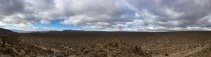
Planning on taking our time starting with the petroglyphs along 95, and doing whatever other hikes and detours possible along the way.

Will monitor 146.46 and possibly meet up with @Overland_Mike who is doing it as a single overnight. If anyone else is out there give me a holler on simplex KM6URN. Temps looking like low 60s high and sunny, but 40 or less at night, so avoiding higher elevations at night. Better than 110f highs though!

Nervous about the water crossing though for my stock xterra pro4x, so may bail out at zzyzx.
 
  • Like
Reactions: Andrew Lopez

moonpatrol

Rank IV
Launch Member

Enthusiast II

1,009
San Diego, CA, USA
First Name
Josh
Last Name
MMM
Ham/GMRS Callsign
K6EAT
Had an awesome trip and can't wait to go back.

Quick follow up with a few photos from this trip and some learnings. Keep in mind I'm a noob with most of my desert experience in backpacking:
  1. This road is freakin long. Started late at 95, bailed out at Little Cowhole just because we didn't have time! Total time spent on trail was 3 days, 3 nights instead of planned 4d/3n. Days are very short right now. Sunrise around 7:30 and completely dark just after 5p. Did only very minor side-trips and hikes. The first sections up the piute range were much slower than expected. Later portions were pretty washboardy. Do I just need to drive much faster?
  2. Sand was all pretty dry and firm and did not present any issues--great weather timing.
  3. Watson Wash did not seem passable (to this noob) without heavy modification and/or heavy experience. We looked at it for at least 20 minutes before bypassing. Photo included does not do it justice. The lower portions involved very deep holes (3-5') and seemed to require lateral approach angles.
  4. Weather conditions were calm, but I was a little surprised that even the "great" campsites are fairly exposed. My favorite was Mojave Camp.
  5. Mojave Road Guide is a unique and amazing thing!
  6. Stock Xterra can handle everything (with stock mud flaps intact), but this isn't a simple dirt road. Not sure why I expected it to be.
  7. Did not see mojave water crossing due to bailout at Little Cowhole. Was worried that my stock xterra could not handle it in any case. Soda lake would not have been an issue.
  8. Encountered only 2-3 other cars and never raised anyone on 2m (but only using an 8W HT)--except when visiting easily accessible Lava Tubes.
2018-MojaveRd-Patrol - 1 (3).jpg
2018-MojaveRd-Patrol - 1.jpg 2018-MojaveRd-Patrol - 2.jpg
2018-MojaveRd-Patrol - 4.jpg 2018-MojaveRd-Patrol - 5.jpg
2018-MojaveRd-Patrol - 6.jpg Watson Wash - pic does not at all do it justice. Biggest holes near bottom...


Photo
 

Attachments

  • Like
Reactions: Mojavewanderer

arbezee

Rank III
Launch Member

Enthusiast II

509
Hollister, CA
Member #

12506

That looked like it was an awesome trip. My brother and I are planning to the same thing this spring. The 2 places that worries me are Watson Wash and the water crossing. How far is the bypass around Watson Wash?
 

moonpatrol

Rank IV
Launch Member

Enthusiast II

1,009
San Diego, CA, USA
First Name
Josh
Last Name
MMM
Ham/GMRS Callsign
K6EAT
That's what really surprised me actually since I hadn't come across that info in my research: bypass is basically a road that goes right around it on power/waterline maintained graded roads--mayyybe an extra mile at most. In fact, probably most sections could be bypassed on such roads.

Sadly I don't know about Mojave river bypass--all info I found is there isn't really an easy bypass (except way back at 29mi pt or little cow, so this isn't super worth-it)
 
  • Like
Reactions: arbezee

mpienta

Rank I
Launch Member

Contributor I

233
Northern California
Member #

13376

Can any “experts” give advise on best method to traverse Watson Wash, pictured above. I’ll be on the Mojave Road next month. Thx, Michael
 

Enthusiast III

1,250
Phoenix, AZ
Can any “experts” give advise on best method to traverse Watson Wash, pictured above. I’ll be on the Mojave Road next month. Thx, Michael

Hardly and expert since I've only run it once. The bypass is Cedar Canyon Road. If approaching from the east, Cedar Canyon will merge from the south with the Mojave about a half mile prior to the short steep section descending into Watson Wash. Cedar Canyon Road then splits off to the north about a quarter mile prior to the bad (or good depending on your point of view) section of the Mojave. The east split coordinates are N35° 08.929' W115° 19.295'. Cedar loops north for about 1.5 miles before rejoining the Mojave briefly at N35° 09.361' W115° 19.780'. The two roads split again in less tan a half mile with the Mojave going south of Cedar Canyon Road for a few miles to Government Wells before they merge again.

Hope that helps.
 

mpienta

Rank I
Launch Member

Contributor I

233
Northern California
Member #

13376

Hardly and expert since I've only run it once. The bypass is Cedar Canyon Road. If approaching from the east, Cedar Canyon will merge from the south with the Mojave about a half mile prior to the short steep section descending into Watson Wash. Cedar Canyon Road then splits off to the north about a quarter mile prior to the bad (or good depending on your point of view) section of the Mojave. The east split coordinates are N35° 08.929' W115° 19.295'. Cedar loops north for about 1.5 miles before rejoining the Mojave briefly at N35° 09.361' W115° 19.780'. The two roads split again in less tan a half mile with the Mojave going south of Cedar Canyon Road for a few miles to Government Wells before they merge again.

Hope that helps.
Thx for the info. I’ll be in the trail Feb 6-10.
 

mpienta

Rank I
Launch Member

Contributor I

233
Northern California
Member #

13376

95DE204E-3D36-4244-A036-0BE57D2E276E.jpeg ED72F4B7-AE21-4664-9EAB-AA6F5B9AE2AC.jpeg 85A49425-1015-4BA3-B9E2-1DCAFBCBC4D8.jpeg Finished trip and trail is great. Did the trail in 3 days. Four days would be optimal if you want to spend some time hiking during the days.

Mojave River was about 18” higher than normal, due to recent rains, about 40”-48” deep in the middle. Cross the river “hugging” the left side.
I crossed the river in the middle and that was my demise. Water “flooded” into cabin and submerged ECU. No bueno!!

Water should be a lot lower in the Spring but may want to bypass Mojave River if it rains just prior to your trip.
 
Last edited:

McolbyB

Rank II
Launch Member

Contributor III

327
Phoenix, AZ, USA
Member #

15901

View attachment 85617 View attachment 85613 View attachment 85616 Finished trip and trail is great. Did the trail in 3 days. Four days would be optimal if you want to spend some time hiking during the days.

Mojave River was about 18” higher than normal, due to recent rains, about 40”-48” deep in the middle. Cross the river “hugging” the left side.
I crossed the river in the middle and that was my demise. Water “flooded” into cabin and submerged ECU. No bueno!!

Water should be a lot lower in the Spring but may want to bypass Mojave River if it rains just prior to your trip.
Sounds great. Looking forward to checking it out. I want to do a few side trails and check out the lava tubes. What all did you check out?