

Enthusiast I
Doing Mojave preserve looking for anyone wanting to tag along. Trail isn't technical, most can be done in 2wd. Leaving Thursdays night, November 1st, staying at the Avi resort and taking off Friday morning.
Weather this time of year is cold and windy.
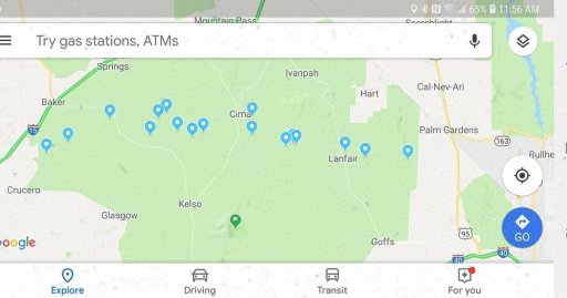
Coordinates to sites
Friday:
35.046167,-114.640333 Starting point from Ahi Macav Pkwy
35.114667,-114.984167 Fort Piute
35.119550,-115.115150 Abandoned School Bus and Car
35.135500,-115.177167 The Penny Can
35.153000,-115.327500 Rock Spring
35.155333,-115.336667 Bert Smith's Rock House
35.147167,-115.359167 Government Holes
35.175456,-115.463663 Thomas Place Corral on Death Valley Road (planned Day 1 camping spot)
Saturday:
35.221950,-115.462644 Death Valley Mine
35.181944,-115.613056 Mojave Camp (alternate Day 1 camping spot)
35.170000,-115.647000 Marl Springs
35.185333,-115.692833 Mojave Mailbox (and frog pond)
35.174677,-115.776461 Aiken Mine Road Corral (alternate Day 2 camping spot)
35.216381,-115.751322 Lava Tube
35.230233,-115.725783 Aiken Mine
35.216225,-115.900035 17-Mile Point (alternate Day 2 camping spot)
35.162778,-116.029444 Green Rock Mill Camp (planned Day 2 camping spot)
Sunday:
35.158000,-116.028667 Eastern edge of Soda Lake
35.130833,-116.095333 Travelers Monument
35.039091,-116.314367 Buried Boxcar 1 (these were hard to find)
35.037682,-116.316641 Buried Boxcar 2 (these were hard to find)
35.031108,-116.329946 Spooky Canyon
35.030862,-116.366385 Mojave River water crossing 1
35.037515,-116.380907 Mojave River water crossing 2
35.072450,-116.413550 Air up by the I-15 Freeway and Afton Road
Weather this time of year is cold and windy.
Coordinates to sites
Friday:
35.046167,-114.640333 Starting point from Ahi Macav Pkwy
35.114667,-114.984167 Fort Piute
35.119550,-115.115150 Abandoned School Bus and Car
35.135500,-115.177167 The Penny Can
35.153000,-115.327500 Rock Spring
35.155333,-115.336667 Bert Smith's Rock House
35.147167,-115.359167 Government Holes
35.175456,-115.463663 Thomas Place Corral on Death Valley Road (planned Day 1 camping spot)
Saturday:
35.221950,-115.462644 Death Valley Mine
35.181944,-115.613056 Mojave Camp (alternate Day 1 camping spot)
35.170000,-115.647000 Marl Springs
35.185333,-115.692833 Mojave Mailbox (and frog pond)
35.174677,-115.776461 Aiken Mine Road Corral (alternate Day 2 camping spot)
35.216381,-115.751322 Lava Tube
35.230233,-115.725783 Aiken Mine
35.216225,-115.900035 17-Mile Point (alternate Day 2 camping spot)
35.162778,-116.029444 Green Rock Mill Camp (planned Day 2 camping spot)
Sunday:
35.158000,-116.028667 Eastern edge of Soda Lake
35.130833,-116.095333 Travelers Monument
35.039091,-116.314367 Buried Boxcar 1 (these were hard to find)
35.037682,-116.316641 Buried Boxcar 2 (these were hard to find)
35.031108,-116.329946 Spooky Canyon
35.030862,-116.366385 Mojave River water crossing 1
35.037515,-116.380907 Mojave River water crossing 2
35.072450,-116.413550 Air up by the I-15 Freeway and Afton Road

