Hey all,
I'm creating this post to document my trip this past week that I took with some friends to explore Michigan's UP and hopefully plot a route for a trip later in September for the Back Yard Overland Tour. There are a ton of photos and videos so I'll try to break it down day by day to keep it a bit more concise.
The group:
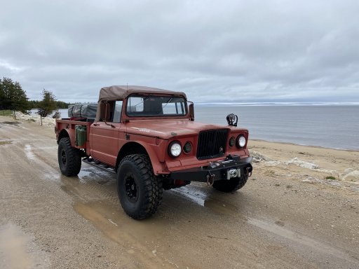
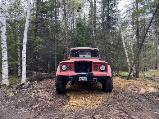
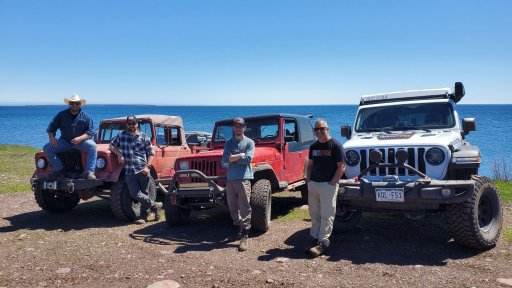
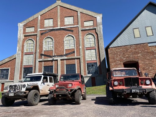
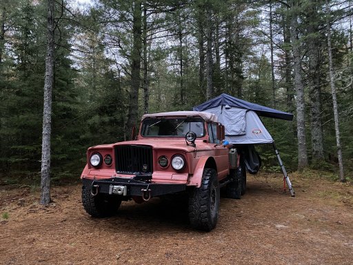
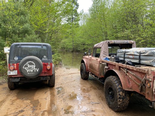
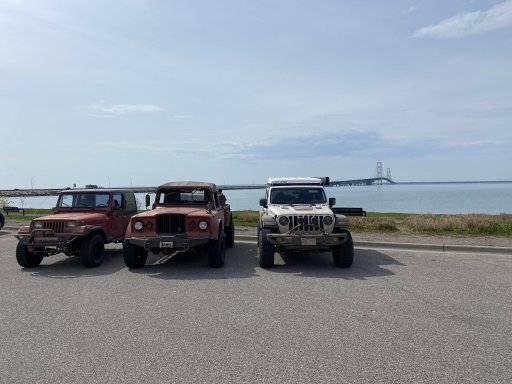
1967 Jeep M715 w/ V10 - myself and my codriver
1994 Jeep YJ w/ 4cyl Mercedes Supercharger - JeepSheepTV
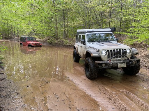
2022 Jeep JL Diesel - TrailsOffroad

Day 1 - halfway there
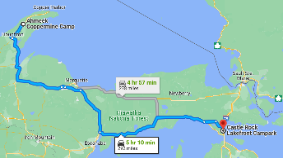
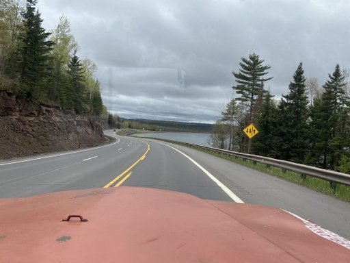
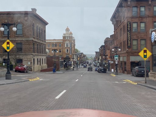
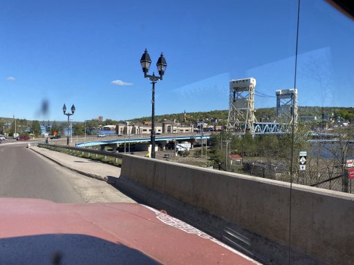
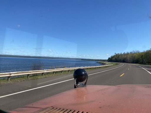
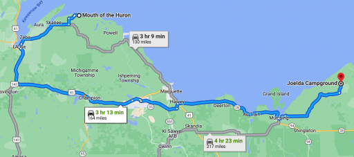
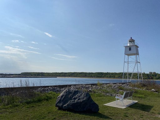
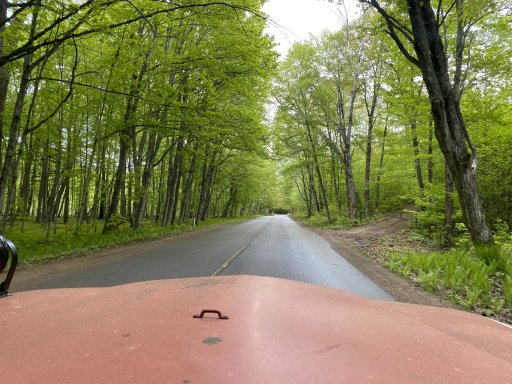
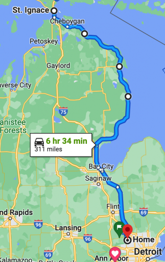
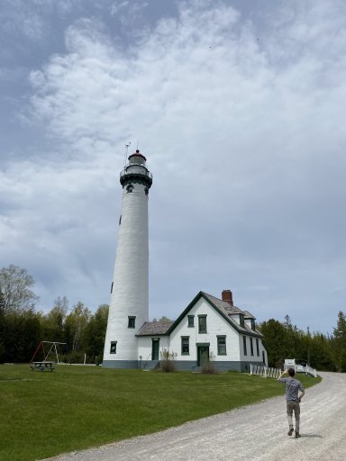
On the first day of my trip, myself and my codriver drove from our homes in the Northern Metro Detroit area to St. Ignace, MI the long way. The 715 is the most comfortable at 55mph for high speed and going over 60 it's just not happy. so we take the back roads, they're more scenic anyways. Total driving was going to be about 6hrs with no stops, so more like a full day with a hand full of stops and a later start.
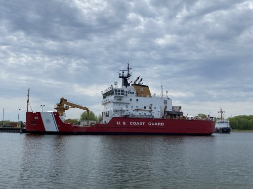
Our first stop after gathering supplies was Bay City. This was a half planned stop since we spotted the Vietnam Era Destroyer DD946 Edson! Since the M715 is also a Vietnam war era truck, we had to make the stop!
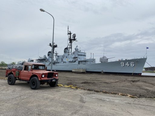
We were fortunate enough to talk with one of the sailors that served on this vessel when we stopped. He told us about the ground fire support missions that this ship participated in and informed us that we could stay the night on the ship if we wanted to! But he did warn us, that it is said to be haunted by an old caretaker who has been seen on the security cameras when know one was on board! I'll pass on that. haha. The most interesting thing that I thought about this ship was that it was in the Manhattan harbor during 9/11 and served as a temporary command post until better accommodations could be found for the FBI(?) I believe.
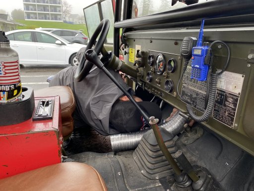
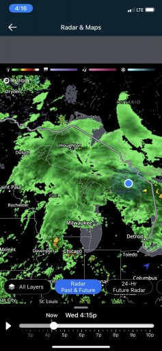
After we got lunch the weather unfortunately turned moist. This would be a common occurrence on this trip as it rained probably 40% of the time. This particular day, I think the UP got over 1" of rain! Making things more difficult for us is a less than watertight cab with water sneaking past the window seals and onto us. All this water eventually fogs up the windows and we have to wipe the moisture away with rags. My defroster was helping a little but was mostly effective on the passenger side. So we would travel with the defroster on and the driver's window open to pull the warm air across the windshield.
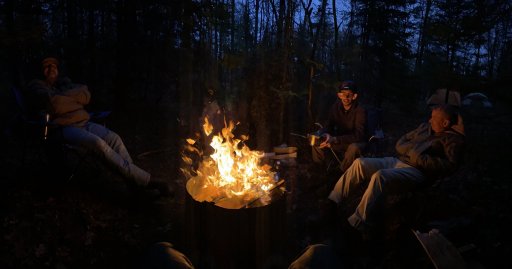
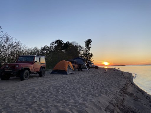
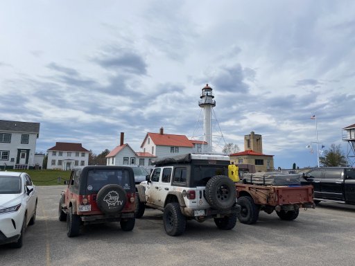
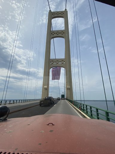
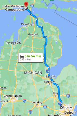
After many hours of driving in the rain, we made it across the Mighty Mac bridge and ventured onto our campsite for the evening. Just before we crossed the bridge, the storm started to grow in strength which made the crossing a bit nerve racking with low visibility, high winds, and slick surfaces.
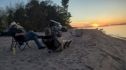
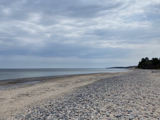
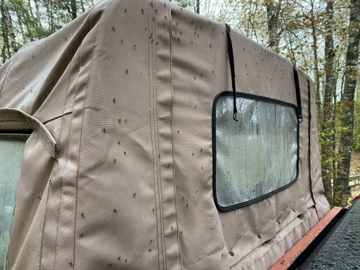
We got to camp at a National Park campground on the coast of Lake Michigan. This looked like a gorgeous spot when booking it online as it was right on the beach. As soon as we opened the doors of the cab, we were greeted by the largest swarm of mosquitoes / flies I've ever seen in my life! There were 100's of thousands of them! We put on bug spray and tried to look around a bit hoping it was a temporary setback. It was not. The bugs were flying in our faces and trying to bite me through my raincoat! As we went up to the beach the cloud of bugs only got thicker and as we crested a sand dune, we could see thousands of rain soaked mosquitoes in the dimples in the sand. This made the beach look black! I ran back to the truck after the encounter with a truly obscene amount of mosquitoes at the beach for the relative calm of the truck bound swarm. I can't imagine how much worse it would've been if it wasn't raining!
Back at the truck, we collected our thoughts and decided to brave a bold retreat a half hour back into town and rent a room for the night. I know what you're thinking, "those quitters! you should've toughed it out!". Well, at some point, it's just not worth it.
The rain would continue through the night until about 11:30am the next day.
I'm creating this post to document my trip this past week that I took with some friends to explore Michigan's UP and hopefully plot a route for a trip later in September for the Back Yard Overland Tour. There are a ton of photos and videos so I'll try to break it down day by day to keep it a bit more concise.
The group:
1967 Jeep M715 w/ V10 - myself and my codriver
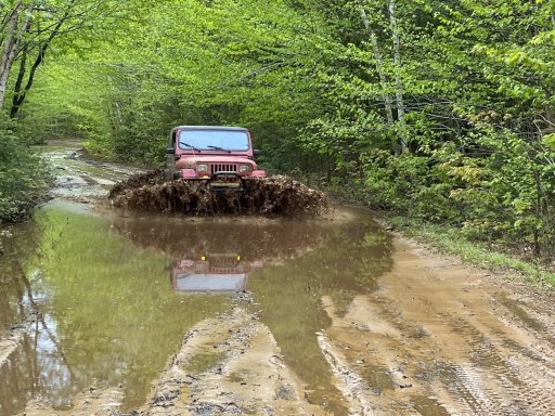
1994 Jeep YJ w/ 4cyl Mercedes Supercharger - JeepSheepTV
2022 Jeep JL Diesel - TrailsOffroad
Day 1 - halfway there
On the first day of my trip, myself and my codriver drove from our homes in the Northern Metro Detroit area to St. Ignace, MI the long way. The 715 is the most comfortable at 55mph for high speed and going over 60 it's just not happy. so we take the back roads, they're more scenic anyways. Total driving was going to be about 6hrs with no stops, so more like a full day with a hand full of stops and a later start.
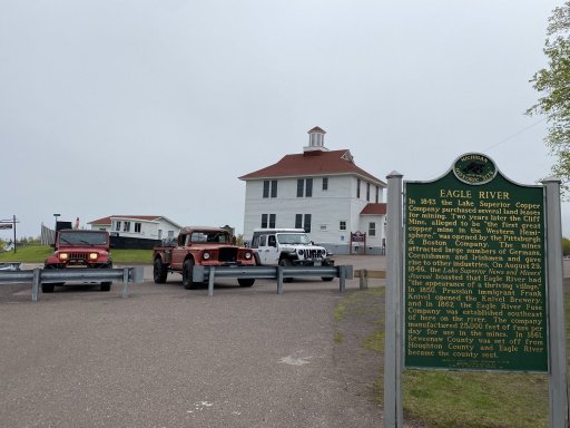
Our first stop after gathering supplies was Bay City. This was a half planned stop since we spotted the Vietnam Era Destroyer DD946 Edson! Since the M715 is also a Vietnam war era truck, we had to make the stop!
We were fortunate enough to talk with one of the sailors that served on this vessel when we stopped. He told us about the ground fire support missions that this ship participated in and informed us that we could stay the night on the ship if we wanted to! But he did warn us, that it is said to be haunted by an old caretaker who has been seen on the security cameras when know one was on board! I'll pass on that. haha. The most interesting thing that I thought about this ship was that it was in the Manhattan harbor during 9/11 and served as a temporary command post until better accommodations could be found for the FBI(?) I believe.
After we got lunch the weather unfortunately turned moist. This would be a common occurrence on this trip as it rained probably 40% of the time. This particular day, I think the UP got over 1" of rain! Making things more difficult for us is a less than watertight cab with water sneaking past the window seals and onto us. All this water eventually fogs up the windows and we have to wipe the moisture away with rags. My defroster was helping a little but was mostly effective on the passenger side. So we would travel with the defroster on and the driver's window open to pull the warm air across the windshield.
After many hours of driving in the rain, we made it across the Mighty Mac bridge and ventured onto our campsite for the evening. Just before we crossed the bridge, the storm started to grow in strength which made the crossing a bit nerve racking with low visibility, high winds, and slick surfaces.
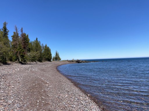
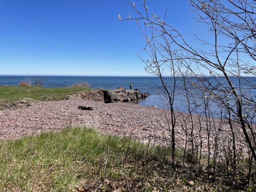
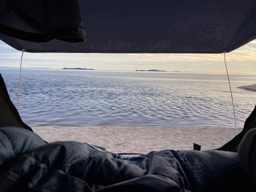
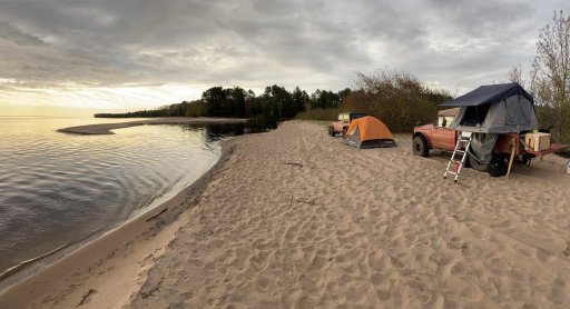
We got to camp at a National Park campground on the coast of Lake Michigan. This looked like a gorgeous spot when booking it online as it was right on the beach. As soon as we opened the doors of the cab, we were greeted by the largest swarm of mosquitoes / flies I've ever seen in my life! There were 100's of thousands of them! We put on bug spray and tried to look around a bit hoping it was a temporary setback. It was not. The bugs were flying in our faces and trying to bite me through my raincoat! As we went up to the beach the cloud of bugs only got thicker and as we crested a sand dune, we could see thousands of rain soaked mosquitoes in the dimples in the sand. This made the beach look black! I ran back to the truck after the encounter with a truly obscene amount of mosquitoes at the beach for the relative calm of the truck bound swarm. I can't imagine how much worse it would've been if it wasn't raining!
Back at the truck, we collected our thoughts and decided to brave a bold retreat a half hour back into town and rent a room for the night. I know what you're thinking, "those quitters! you should've toughed it out!". Well, at some point, it's just not worth it.
The rain would continue through the night until about 11:30am the next day.
Last edited: