

Pathfinder II
I'm not sure if "Communications" is the right place to put this...
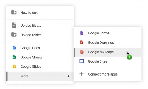
I recently found while starting to put all the planning together for next summers trip, that Google Drive allows you to put custom maps and the like in it.
You can import your GPX and KML files to get detailed routes in, but it also allows you to add your own way points, and collaborate with the other members of the expedition that may live... further away than allows for regular planning.
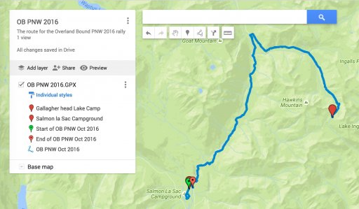
I threw this one together from the OB PNW Rally... https://drive.google.com/open?id=1k5C24d5dQGeVhvWGYIF83tZu6mk&usp=sharing
I'm a stickler for controlling access, and securing things, and between this new mapping that I found, and all the other document and file sharing that drive has, this makes it a pretty amazing planning tool.
It is worth noting, that unlike most of the Google Drive applications, this one cannot be used offline. So it will make for a great planning and collaboration tool, but not so much a field tool.
I recently found while starting to put all the planning together for next summers trip, that Google Drive allows you to put custom maps and the like in it.
You can import your GPX and KML files to get detailed routes in, but it also allows you to add your own way points, and collaborate with the other members of the expedition that may live... further away than allows for regular planning.
I threw this one together from the OB PNW Rally... https://drive.google.com/open?id=1k5C24d5dQGeVhvWGYIF83tZu6mk&usp=sharing
I'm a stickler for controlling access, and securing things, and between this new mapping that I found, and all the other document and file sharing that drive has, this makes it a pretty amazing planning tool.
It is worth noting, that unlike most of the Google Drive applications, this one cannot be used offline. So it will make for a great planning and collaboration tool, but not so much a field tool.

