

Hey everyone, new member to this site/overlanding, but pretty experienced in the outdoors (new to having a tough car). I like navigating by map and compass, or at the very least having one, and I'm looking for solid maps of Maine. The Delorme Maine Atlas and Gazetteer is no longer in production, and I was wondering if anyone had found a solid replacement for it? Thanks!
Map for Navigating Maine
- Thread starter stillmurphee
- Start date
-
Guest, we are migrating the site today. There may be interruption of service.
Would love to see what you come up with. Roadtripping out to downeast Maine in a few weeks and looking for some good trail time.

Advocate I
Delorme Map is still your best Bet. My best luck at least for Western Maine has been a combination of the Delorme, GAIA, and Google Maps.


Advocate III
.
@stillmurphee , You can still get the Delorme Maine Atlas & Gazetteer. I have a copy bought at the same source. This edition says DeLorme Publishing; 35th edition (December 13, 2018).
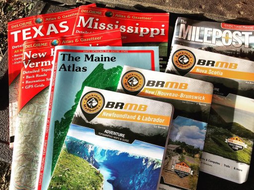
I first started using the Maine Atlas & Gazetteer from Delorme living in Maine in the late 1970's, when it was their first and only product. David Delorme went on to doing maps for upstate NY, too, and then more and more. I have their Atlas's for NH/VT, Mississippi, and Texas, as well. I wish I still had my old ones from the seventies. Would be fun to compare pages. Here's a cool wiki page on Delorme and how he transformed map availability.
You can also find and order the Delorme Atlas & Gazetteers online at Cabelas and at Garmin .
Here's a blog post about it:
I also used to get great topo maps from the trading posts up around Moosehead and sometimes at the AMC store on Mt Desert Island. Kept them rolled in a homemade quiver slung over crossways, for snowshoeing and hiking all up around Moosehead and down on Mt Desert.
I'm in Maine now exploring the coast and helping out family for the summer.
.
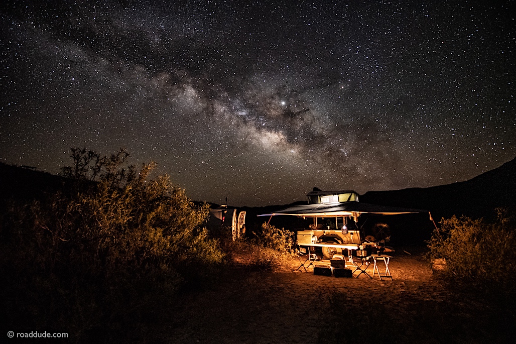
 roaddude.com
@stillmurphee , You can still get the Delorme Maine Atlas & Gazetteer. I have a copy bought at the same source. This edition says DeLorme Publishing; 35th edition (December 13, 2018).
I first started using the Maine Atlas & Gazetteer from Delorme living in Maine in the late 1970's, when it was their first and only product. David Delorme went on to doing maps for upstate NY, too, and then more and more. I have their Atlas's for NH/VT, Mississippi, and Texas, as well. I wish I still had my old ones from the seventies. Would be fun to compare pages. Here's a cool wiki page on Delorme and how he transformed map availability.
You can also find and order the Delorme Atlas & Gazetteers online at Cabelas and at Garmin .
Here's a blog post about it:
I also used to get great topo maps from the trading posts up around Moosehead and sometimes at the AMC store on Mt Desert Island. Kept them rolled in a homemade quiver slung over crossways, for snowshoeing and hiking all up around Moosehead and down on Mt Desert.
I'm in Maine now exploring the coast and helping out family for the summer.
.
Roaddude - On the Road In North America - ROADDUDE
Roaddude - Traveling Photographer/Writer/Artist On the Road In North America. Gear, reviews, people, places, and culture.
Last edited:

Not sure if the OP still needs this info or not. As others have said DeLorme's are still being produced. I think maybe the confusion is that they aren't updated every year so it may be a year or two (or more) between revisions. I find that for the NMW where I use them most the DeLorme's are generally accurate but the logging companies dont notify them when they improve a road so something that may appear to be an old logging road, may be a new logging road when you see it. But that type of difference in road conditions exists anywhere you roam. If you are in the NMW get to know how the blue Township & Range posts work- they aren't like an "Entering Town" sign so as you approach the (say) T6R12 sign, it means you are IN T6R12. If the other side (after you pass the post) says T6R13 it means you are now IN T6R13. That's an important distinction for using them. For years pre-GPS, that was the only way to know for sure where you were as so many little streams look the same. Of course names of streams and campsites help when you see them. But hey, that's part of the fun of being out there. (Sorry for a little drift here.....)

Pretty much everyone in Maine carries a hard copy of the Delorme maps for Maine in their vehicle. It's probably as good as you're going to get. Out west and up north it gets tricky. There are a lot of logging roads that get moved around depending on cut schedules. I would suggest that no matter where you go use a GPS with tracking so you can find your way back out if need be. One of my favorite parts of the state is out past Kokadjo up near Greenville. Beautiful country up there.

Member III
- 2,827
- First Name
- Kevin
- Last Name
- Trvlr
- Member #
-
20466
- Ham/GMRS Callsign
- KK7NAZ
- Service Branch
- MM1 US Navy
Complete with the largest rotating globe in the world....
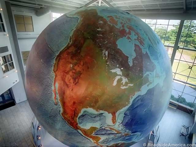
Eartha: World's Largest Rotating Globe, Yarmouth, Maine
An impressive, giant Earth globe that slowly rotates indoors, but you can see it from outside through a wall of windows, especially after dark.
www.roadsideamerica.com
Advocate III
You did know that Delorme is right on the south end of Freeport don't you? It's a nice big building I went in right after they moved in, at that time you could buy direct from them.
.Complete with the largest rotating globe in the world....
Eartha: World's Largest Rotating Globe, Yarmouth, Maine
An impressive, giant Earth globe that slowly rotates indoors, but you can see it from outside through a wall of windows, especially after dark.www.roadsideamerica.com
Yep! It's actually in Yarmouth, south of Freeport. Locals in some Maine small towns bristle when their town gets bunched in with the neighboring one.
Everyone around here feared Garmin would close up the building entirely when they bought DeLorme (which they did to own the InReach), but part of the deal DeLorme made is that Eartha would stay open and available to the public. They did close the map store in early 2016, unfortunately, which caused a big rush to go get remaining stock.
It had been the coolest place to go hang out and daydream while poring over detailed topos.
Here's an article in the Portland Press about the closing:

Fans mourn closing of DeLorme’s map store
But it's not the end of the world: The giant rotating and revolving globe will remain open to the public.
 www.pressherald.com
I might be heading up that way later today, matter of fact and might stop in.
.
Roaddude - On the Road In North America - ROADDUDE
Roaddude - Traveling Photographer/Writer/Artist On the Road In North America. Gear, reviews, people, places, and culture.
Last edited:
FYI for all here...just picked up a new Gazetteer...2019 version, they are still making them!
What's the copyright date? I always check that to see if its changed from prior versions.FYI for all here...just picked up a new Gazetteer...2019 version, they are still making them!
