Off-Road Ranger I
I hate leaving things unchecked.
Last year, @Captain Chaos scheduled a trip up the Huckleberry Jeep Trail in Ferry County, WA. A little over a week before the trip, wildfires closed the area. We'd have to stash it in our back pockets for another year, if it didn't get burned out.
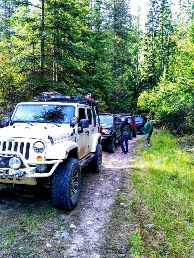
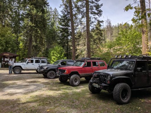
But with this forgiving year, @Paul Daniels @Chetta58 and @Aaron Niemi let me con them into checking out the trail.
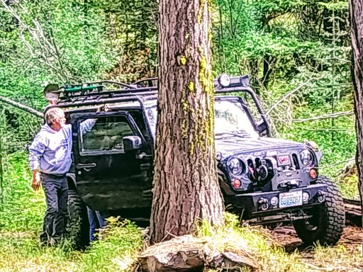
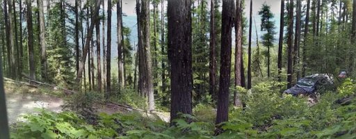
The seven mile trail winds up and over Huckleberry Mountain. From the east, it starts a light, curvy climb off Bangs Mtn Rd. through sections of sand, and a smooth rock embedded rutted Jeep width trail. Green brush lines the way. While not technical, I found 4Lo provided the optimum speed.
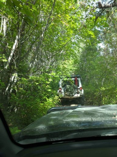
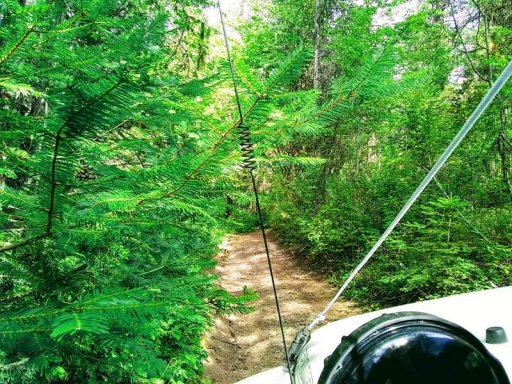
The trail narrows down to a double track, and the brush gets heavier, with less soft green fir and more dead undergrowth, lots of screeching across the top and sides of the vehicles. We could see someone came through and did a cursory clearing earlier this year, but held it tight for side x sides and atv's. I hadn't seen evidence of anyone recently running it, atv or Jeep.
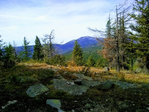
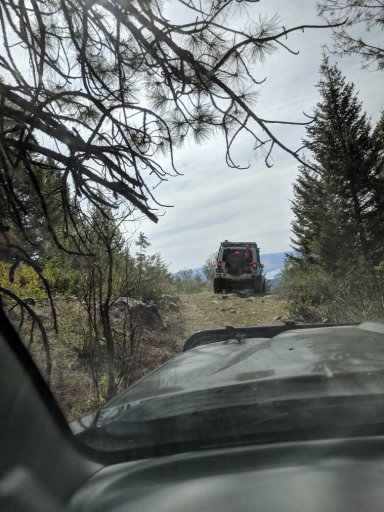
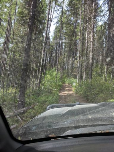
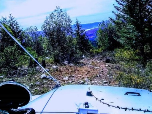
About 1/3 through the trail, we met 2 or 3 switch backs that required a few point turns and led us to the rocky summit, which provided limited views due to the overgrown brush. There are two dispersed camp spots that could hold around 5 rigs. After the summit, the trail goes from double track to a cow path, requiring another short hike to verify we were still on the right path. The descent to the west is much drier, and the rocks get sharper, with dead brush and limbs becoming quite intimate with your body panels. In some spots, the trail becomes a mere cowpath, literally, as we herded several forest cows down the trail. There were few opportunities for them to get off the path, so it took some horn honking for a few minutes to lead them down to a safe spot. Toeards the end, the path become a trail again, then evolves back into a forest road toward Burnaby Creek.
While I don't believe the trail is directional, I was relieved this is a rarely used trail. I found but a handful of spots that would allow opposing traffic to pass. Choosing to run the trail uphilll, from the east, the entrance isn't as easily located as the west entrance. Use gps tracks as a guide only, for we soon found they really didn't follow the trail. Whomever created the tracks roughly drew them along a map, for several places it deviates around mountain tops, etc. Fortunately, if you run the trail east to west, all other paths converged onto the Huckleberry proper.
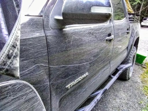
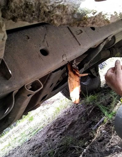
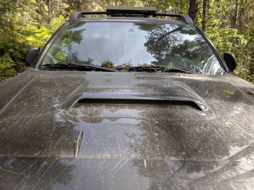
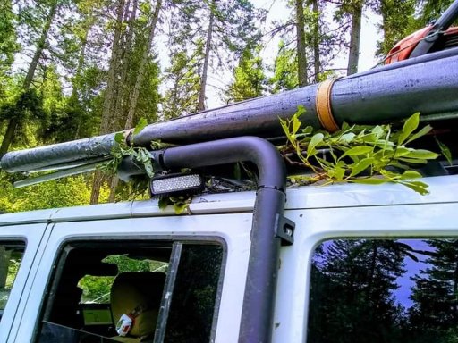
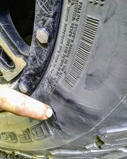
While this was a easy-light moderate trail, We did suffer some trail/ brush damage. All had expected pinstriping, some was a little more severe. All rigs had checked sidewalls, and Aaron had three of his new KO2 sidewalls slashed. I lost a light cover, which I should have removed, some scratches on my awning, and a repairable bent HAM radio antenna. Fortunately, Aaron's RTT cover did not get damaged, but a roof mounted version may. We were warned to bring saws by the local ATV club that maintains the trail, I would recommend loppers as well.
The Huckleberry Jeep trail is slowly becoming an ATV trail due to non-use. It would take a trail day with a couple of volunteers to clean up the trail.

Last year, @Captain Chaos scheduled a trip up the Huckleberry Jeep Trail in Ferry County, WA. A little over a week before the trip, wildfires closed the area. We'd have to stash it in our back pockets for another year, if it didn't get burned out.
But with this forgiving year, @Paul Daniels @Chetta58 and @Aaron Niemi let me con them into checking out the trail.
The seven mile trail winds up and over Huckleberry Mountain. From the east, it starts a light, curvy climb off Bangs Mtn Rd. through sections of sand, and a smooth rock embedded rutted Jeep width trail. Green brush lines the way. While not technical, I found 4Lo provided the optimum speed.
The trail narrows down to a double track, and the brush gets heavier, with less soft green fir and more dead undergrowth, lots of screeching across the top and sides of the vehicles. We could see someone came through and did a cursory clearing earlier this year, but held it tight for side x sides and atv's. I hadn't seen evidence of anyone recently running it, atv or Jeep.
About 1/3 through the trail, we met 2 or 3 switch backs that required a few point turns and led us to the rocky summit, which provided limited views due to the overgrown brush. There are two dispersed camp spots that could hold around 5 rigs. After the summit, the trail goes from double track to a cow path, requiring another short hike to verify we were still on the right path. The descent to the west is much drier, and the rocks get sharper, with dead brush and limbs becoming quite intimate with your body panels. In some spots, the trail becomes a mere cowpath, literally, as we herded several forest cows down the trail. There were few opportunities for them to get off the path, so it took some horn honking for a few minutes to lead them down to a safe spot. Toeards the end, the path become a trail again, then evolves back into a forest road toward Burnaby Creek.
While I don't believe the trail is directional, I was relieved this is a rarely used trail. I found but a handful of spots that would allow opposing traffic to pass. Choosing to run the trail uphilll, from the east, the entrance isn't as easily located as the west entrance. Use gps tracks as a guide only, for we soon found they really didn't follow the trail. Whomever created the tracks roughly drew them along a map, for several places it deviates around mountain tops, etc. Fortunately, if you run the trail east to west, all other paths converged onto the Huckleberry proper.
While this was a easy-light moderate trail, We did suffer some trail/ brush damage. All had expected pinstriping, some was a little more severe. All rigs had checked sidewalls, and Aaron had three of his new KO2 sidewalls slashed. I lost a light cover, which I should have removed, some scratches on my awning, and a repairable bent HAM radio antenna. Fortunately, Aaron's RTT cover did not get damaged, but a roof mounted version may. We were warned to bring saws by the local ATV club that maintains the trail, I would recommend loppers as well.
The Huckleberry Jeep trail is slowly becoming an ATV trail due to non-use. It would take a trail day with a couple of volunteers to clean up the trail.
Attachments
-
 94.3 KB Views: 3
 -
 55.7 KB Views: 3
 -
 91.7 KB Views: 3
 -
 107.8 KB Views: 3