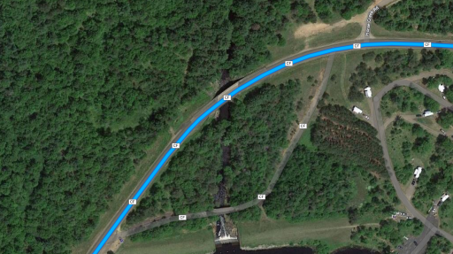
How do I know if a trail is legal for SUV or 4x4 vehicle? What sources should I be checking to make sure I'm on a legal overland trail? Thank you so much!
How to tell if it's a trail for SUV/4x4?
- Thread starter Charlielj
- Start date
-
Guest, we are migrating the site today. There may be interruption of service.
If you are going to us Google outside of very well traveled roads, I will absolutely guarantee that you will find yourself in a place you have no business. You will be "Google fornicated" I have no idea what the "CF" designation means and there is very little continuity in naming convention.
I would highly recommend On X or Gaia as a mapping utility they are both very inexpensive in the grand scheme of things..
I would highly recommend On X or Gaia as a mapping utility they are both very inexpensive in the grand scheme of things..

Member III
Another place to check is the National Forest Service site, while not a great tool for guidance it is good for checking road/trail restrictions. Some roads are open to everything year round while some stuff on the maps have width restrictions or high clearance warnings or seasonal closures. Most Forest ranger offices can get you paper maps too if that is something you are interested in. If I'm going somewhere new that I know nothing about I like to check multiple places to see if the road is really there and if it's open.
You know how we did it back before the internet....
Yep, just purchased Gaia and start learning how to use it now.If you are going to us Google outside of very well traveled roads, I will absolutely guarantee that you will find yourself in a place you have no business. You will be "Google fornicated" I have no idea what the "CF" designation means and there is very little continuity in naming convention.
I would highly recommend On X or Gaia as a mapping utility they are both very inexpensive in the grand scheme of things..

Influencer I
Well, just because a road is on private land does not mean it is not legal to travel. Many legal roads are on private land. Now camping is a different matter.The public lands overlay is great. Keeps you from wandering onto private property unknowingly.

Off-Road Ranger I
- 1,518
- First Name
- Javier
- Last Name
- Armendariz
- Member #
-
27524
- Ham/GMRS Callsign
- KC3VWL
As MrWilson pointed out, check multiple sources. And by that I mean Government sources. Just because an app has it listed does not mean it's even a legal trail. This has been an issue with a popular off-road mapping app (not OB1 or Gaia).

Advocate III
Sometimes you just have get out there and take a look. There have been many times that I have hit a locked gate that wasn't on the map, the "road" is a motorcycle track now and not an actual road, the road shows on the map but where I'm looking there is nothing but a drop-off or trees and bushes and it's totally overgrown and impassable.

Member III
I think I have ran into every scenario you mentioned at some point in time, never been a big deal just adds to the adventure when you have to find a new route. Now if you are dead set on making a through track somewhere and there is no other route it's a bummer. That's why I like to check multiple sources before I head into a new area and usually have an alternative route in mind if I'm trying to make a point A to point B drive. Gaia is my go to when trip planning but I generally fact check it to google earth/maps because I feel their Sat views are more up to date and better. I'm usually not looking for a road names or status of the road but to visually see if it's still there. Then if it looks to be more of a trail I check with the forest service site to see what if any restrictions it has.Sometimes you just have get out there and take a look. There have been many times that I have hit a locked gate that wasn't on the map, the "road" is a motorcycle track now and not an actual road, the road shows on the map but where I'm looking there is nothing but a drop-off or trees and bushes and it's totally overgrown and impassable.

Advocate I
If it is a local trail can always check the local town office and see if the road has a legal row.
Google while pretty good is not always updated. For example. There is a road that supposedly open that google will try and route you through that hasn't had a river crossing in 50 years. Trees a foot thick grow in the middle of the trail. I have tried editing it a few times with no luck.
Google while pretty good is not always updated. For example. There is a road that supposedly open that google will try and route you through that hasn't had a river crossing in 50 years. Trees a foot thick grow in the middle of the trail. I have tried editing it a few times with no luck.
Autism Family Travels
Rank IV

Enthusiast III
I've accidentally camped on hundreds of private lands. Be careful, and don't be a jerk about it.
In some states, land owners expect such, and can be welcoming. The TAT rolls through all kinds of private land.
If people would share routes more often, this could be more efficient.
In some states, land owners expect such, and can be welcoming. The TAT rolls through all kinds of private land.
If people would share routes more often, this could be more efficient.


