Enthusiast III
Enthusiast III

Influencer II
Enthusiast III
Enthusiast III
Let me know how this goes. I'm prob going to be out there around Thanksgiving weekend and was gonna spend a day or 2 working west to east. Pending weather and conditions I was looking to peel off and head south at Helen.I think I’m going to start at Helen Friday night and go west. If I’m on my own.
Enthusiast III
Enthusiast III
Looks there is multiple sites with drop box 6-12 dollars a night. I have some spots marked from Georgia over land that looks like good primitive spotsLet me know how this goes. I'm prob going to be out there around Thanksgiving weekend and was gonna spend a day or 2 working west to east. Pending weather and conditions I was looking to peel off and head south at Helen.
Out if curiosity. How does camping work out there? Pretty much off the trail and make camp where ever you want?
Thanks
Vandy
Enthusiast III
Enthusiast III
Enthusiast III
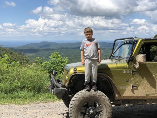
He was happier than he looks the sun was in his eyes lolWent from Trey Mountain Road to Dalton . Got a camp every night and wasn’t too crowded. Weather was great
Enthusiast III
Ive made several trips to do the traverse including a portion this week. Here is my take...Let me know how this goes. I'm prob going to be out there around Thanksgiving weekend and was gonna spend a day or 2 working west to east. Pending weather and conditions I was looking to peel off and head south at Helen.
Out if curiosity. How does camping work out there? Pretty much off the trail and make camp where ever you want?
Thanks
Vandy
Enthusiast III