

Hi, I am completely new to the world of handheld GPS devices. I am looking into the Garmin eTrex line of GPS devices. Let me first explain my goal. I have a private land where my family and I have made several trails, which are not mapped. I would like to use a GPS device to record my tracks in as much detail as possible (the terrain is quite difficult to navigate) as I travel along all of the trails that we have made. I would then like to export and compile them to create a complete map of our trails, including points of interest (waypoints), which I could then import back onto the GPS. Then a newcomer would be able to follow these trails with the GPS and always know where they are relative to all the trails and waypoints. Is this doable with the eTrex devices? Would the eTrex 10 be sufficient? What would be the best way to do this? Thank you!!
Garmin eTrex - Creating a trail map using track recordings
- Thread starter bruceharvey
- Start date

Advocate III
- 5,584
- First Name
- Michael
- Last Name
- Rose
- Member #
-
20990
- Ham/GMRS Callsign
- W7FSB
- Service Branch
- US ARMY Retired
You have to use Garmin mapping software, you can’t make your own maps. Just buy a Garmin GPS with the mapping already installed. Walk you land and you can make a track of your trails. Or load Gaia in your phone like MRose suggested. The 10 dosent have mapping capabilities.
Last edited:
Sinocai
Rank IV

Member III
Another option. Garmin has the garmin connect app. With any garmin GPS with Bluetooth. Or download able tracks. Once the track and way points are uploaded it will automatically lay it over the map. This way you are able to see it overplayed on a the satellite view as well.Hi, I am completely new to the world of handheld GPS devices. I am looking into the Garmin eTrex line of GPS devices. Let me first explain my goal. I have a private land where my family and I have made several trails, which are not mapped. I would like to use a GPS device to record my tracks in as much detail as possible (the terrain is quite difficult to navigate) as I travel along all of the trails that we have made. I would then like to export and compile them to create a complete map of our trails, including points of interest (waypoints), which I could then import back onto the GPS. Then a newcomer would be able to follow these trails with the GPS and always know where they are relative to all the trails and waypoints. Is this doable with the eTrex devices? Would the eTrex 10 be sufficient? What would be the best way to do this? Thank you!!

Gaia does the same thing, your phone or iPad has to have a gps in it. If not Garmin has the GLO ll that connects to your phone via Bluetooth. What “map” are you laying your track and waypoints on when you download? That is what is confusing. The 10 does not have mapping software, the 20 does. That is where you are going to see the big price jump from non-mapping to a mapping GPS. If your talking the maps on connect you could do it that way. I am not sure how detailed the maps are until they get to the point of having to pay for them. Their “base maps” have very little to no detail. That’s the “hook” to get you buy the detailed map software.Another option. Garmin has the garmin connect app. With any garmin GPS with Bluetooth. Or download able tracks. Once the track and way points are uploaded it will automatically lay it over the map. This way you are able to see it overplayed on a the satellite view as well.
Last edited:
Sinocai
Rank IV
Member III
Ya good point...totally agree with the base layer map...i believe garmin connect uses Google as their base map. Or something super similar. Gaia is ok as a start but like you said gotta pay to play. The basic membership is ok gives you the option to create tracks and waypoints. Import and export using GPX and KML files.Gaia does the same thing free, your phone or iPad has to have a gps in it. If not Garmin has the GLO ll that connects to your phone via Bluetooth. What “map” are you laying your track and waypoints on when you download? That is what is confusing. The 10 does not have mapping software, the 20 does. That is where you are going to see the big price jump from non-mapping to a mapping GPS. If your talking the maps on connect you could do it that way. I am not sure how detailed the maps are until they get to the point of having to pay for them. Their “base maps” have very little to no detail. That’s the “hook” to get you buy the detailed map software.Another option. Garmin has the garmin connect app. With any garmin GPS with Bluetooth. Or download able tracks. Once the track and way points are uploaded it will automatically lay it over the map. This way you are able to see it overplayed on a the satellite view as well.
There is a lot with the basic membership, one is sat. and USFS and some really nice topos. I recently upgraded WOW! All sorts of maps. I have had Gamin handhelds for years. I used to sell them. I find myself using Gaia more and more when exploring. I’m sure screen size is one reason. I run an Airll with the Garmin GLOll. The amount of maps, US Coastal charts, topos, 1900 and 1930 topos USFS, even hydrography, probably around 20. The one thing I really like is when I’m taking pictures along the trail, when I save the route in different colors It lets me upload all the pix from my camera via Bluetooth and markers them on the map exactly where I took the pix! This saves me hours of figuring out where I took them, now I just click and done. When you bring up a waypoint it brings all the pix up of that location. I have the Garmin software topos for the East Coast US and the Rocky Mtns. Can’t go wrong with a Garmin. Bulletproof, mine even floats. If you have any questions about them give me a shout. Glad to help. I also used to do seminars on navigation so if you have questions with Lon’s and lats, marking/loading waypoints, routes, all that stuff let me know.Ya good point...totally agree with the base layer map...i believe garmin connect uses Google as their base map. Or something super similar. Gaia is ok as a start but like you said gotta pay to play. The basic membership is ok gives you the option to create tracks and waypoints. Import and export using GPX and KML files.
Sinocai
Rank IV
Member III
Thats awesome!!..thanks for the offer for nav...i won't need it(15 years in the army) but always good to know someone who's good at nav...its always one of those things that people kind of stuff off....till you need it....then they turn to the "nav guy" hahahThere is a lot with the basic membership, one is sat. and USFS and some really nice topos. I recently upgraded WOW! All sorts of maps. I have had Gamin handhelds for years. I used to sell them. I find myself using Gaia more and more when exploring. I’m sure screen size is one reason. I run an Airll with the Garmin GLOll. The amount of maps, US Coastal charts, topos, 1900 and 1930 topos USFS, even hydrography, probably around 20. The one thing I really like is when I’m taking pictures along the trail, when I save the route in different colors It lets me upload all the pix from my camera via Bluetooth and markers them on the map exactly where I took the pix! This saves me hours of figuring out where I took them, now I just click and done. When you bring up a waypoint it brings all the pix up of that location. I have the Garmin software topos for the East Coast US and the Rocky Mtns. Can’t go wrong with a Garmin. Bulletproof, mine even floats. If you have any questions about them give me a shout. Glad to help. I also used to do seminars on navigation so if you have questions with Lon’s and lats, marking/loading waypoints, routes, all that stuff let me know.Ya good point...totally agree with the base layer map...i believe garmin connect uses Google as their base map. Or something super similar. Gaia is ok as a start but like you said gotta pay to play. The basic membership is ok gives you the option to create tracks and waypoints. Import and export using GPX and KML files.

Enthusiast III
- 1,753
- First Name
- Steven
- Last Name
- McCullough
- Member #
-
15897
- Service Branch
- USCG Retired
Sounds like you have some experience with GPS units...I'm a/was a Coast Guard helicopter pilot so I have no issues understanding maps and charts and Lat/Long but when it comes to portables, I am a newbie. Looking to do the TAT this spring and debating on what to use for GPS. I haven't used GAIA on my phone yet, but plan to buy the tracks from Sam and I think his site says they are GPX (available via email or SD card). Can you load those to an iphone for use by GAIA? I was looking at the Garmin Overlander but also am looking at the Vanquisher Industrial Rugged 8" tablet. It operates on Windows 10 Pro and not sure if there are any mapping apps that can overlay GPX tracks on it. Thoughts?There is a lot with the basic membership, one is sat. and USFS and some really nice topos. I recently upgraded WOW! All sorts of maps. I have had Gamin handhelds for years. I used to sell them. I find myself using Gaia more and more when exploring. I’m sure screen size is one reason. I run an Airll with the Garmin GLOll. The amount of maps, US Coastal charts, topos, 1900 and 1930 topos USFS, even hydrography, probably around 20. The one thing I really like is when I’m taking pictures along the trail, when I save the route in different colors It lets me upload all the pix from my camera via Bluetooth and markers them on the map exactly where I took the pix! This saves me hours of figuring out where I took them, now I just click and done. When you bring up a waypoint it brings all the pix up of that location. I have the Garmin software topos for the East Coast US and the Rocky Mtns. Can’t go wrong with a Garmin. Bulletproof, mine even floats. If you have any questions about them give me a shout. Glad to help. I also used to do seminars on navigation so if you have questions with Lon’s and lats, marking/loading waypoints, routes, all that stuff let me know.
I would be looking at Gaia Premium the amount of mapping is fantastic. They just added two new maps in the last couple of weeks. Live thermal imaging of forest fires and Native American Territories which are really cool. You can choose what maps, charts, old topos from 1900 and 1930 you overlay on top of one another and what % so you can see the map underneath. Marking waypoints is a breeze. Just zoom into a spot tap on make waypoint and a little circle with a dot in the middle comes up, you move it over you spot. Boom. IMO I would be looking at a tablet mainly for screen size over a hand held. For now just get the basic Gaia and and you will be hooked, my Wife say she has turned into a Garage Widow with me researching all the time! One really cool feature is when I take pix along the routes that I save. It loads them on to your maps automatically which used to take me hours to do one by one now just a couple clicks which you can also export, or print. If the tablet dosent have a GPS in it I would recommend the Garmin GLO ll just turn it on it links to the pad via Bluetooth. It’s so small I put it in my shirt pocket when I take the iPad while exploring on foot. Garmin handheld you are basically going to have one set of topos, Gaia......around 50.Sounds like you have some experience with GPS units...I'm a/was a Coast Guard helicopter pilot so I have no issues understanding maps and charts and Lat/Long but when it comes to portables, I am a newbie. Looking to do the TAT this spring and debating on what to use for GPS. I haven't used GAIA on my phone yet, but plan to buy the tracks from Sam and I think his site says they are GPX (available via email or SD card). Can you load those to an iphone for use by GAIA? I was looking at the Garmin Overlander but also am looking at the Vanquisher Industrial Rugged 8" tablet. It operates on Windows 10 Pro and not sure if there are any mapping apps that can overlay GPX tracks on it. Thoughts?
Enthusiast III
- 1,753
- First Name
- Steven
- Last Name
- McCullough
- Member #
-
15897
- Service Branch
- USCG Retired
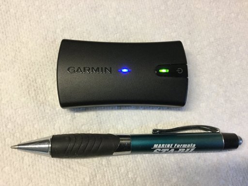
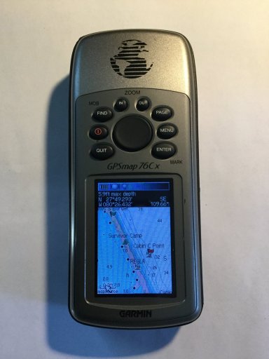
Will Gaia accept uploaded routes and tracks? If I buy the tracks from Sam (Home), I need something to load them on. I'm not sure if Gaia on an iphone (I have Apple Carplay so screen size isn't too much of an issue) will accept tracks (POI's) like a Garmin can. And for that matter, I don't know if a tablet will either. I want to try out Gaia, but up until now my overlanding (lack there of due to personal conflicts) didn't justify it.I would be looking at Gaia Premium the amount of mapping is fantastic. They just added two new maps in the last couple of weeks. Live thermal imaging of forest fires and Native American Territories which are really cool. You can choose what maps, charts, old topos from 1900 and 1930 you overlay on top of one another and what % so you can see the map underneath. Marking waypoints is a breeze. Just zoom into a spot tap on make waypoint and a little circle with a dot in the middle comes up, you move it over you spot. Boom. IMO I would be looking at a tablet mainly for screen size over a hand held. For now just get the basic Gaia and and you will be hooked, my Wife say she has turned into a Garage Widow with me researching all the time! One really cool feature is when I take pix along the routes that I save. It loads them on to your maps automatically which used to take me hours to do one by one now just a couple clicks which you can also export, or print. If the tablet dosent have a GPS in it I would recommend the Garmin GLO ll just turn it on it links to the pad via Bluetooth. It’s so small I put it in my shirt pocket when I take the iPad while exploring on foot. Garmin handheld you are basically going to have one set of topos, Gaia......around 50.View attachment 173807View attachment 173808

