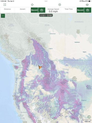
Just sharing a map layer on Gaia that shows you snow levels. There is also weather and fire layers as well. This spring the northwest and other areas have received way more snow than we usually do. It’s good to be prepared before you go.
Another helpful snow related layer to use with Gaia is the one for snowmobile trails, it shows what is groomed and closed to vehicles. Now that it's April they will stop grooming and those roads will open back up but it's useful during the winter months to see what you can access. I had a trip planned into an area that only had low/moderate snow so should have been accessible in the Jeep but when I looked closer with the Snowmobile Trail Layer on 75% of it was groomed trails, glad I checked before heading out.
Hi Guest, Become a Member to gain access to the Member Forums, Member Map, Member Calendar of Events, and Rally Point overland trip planner! Click this link Learn More for more information!
This site uses cookies to help personalise content, tailor your experience and to keep you logged in if you register.
By continuing to use this site, you are consenting to our use of cookies.