Forestry Trunk Road, Alberta

  • HTML tutorial

Pathfinder I

1,212
Canada
First Name
Craig
Last Name
PereferNotToSay
We will be driving from Texas up to Glacier NP last week of June and get into Canada on June 27th. We have 5 days to spend in the area and will be headed back south on July 2nd. I know I want to drive the FTR and wouldn't mind an mild/moderate trail ride for our 17 4Runner w/ a winch. My wife wants to check out Louise, Maligne, Johnston Canyon & Cave, Liard Hot Springs. Mostly looking for camping reservations since we are planning this trip so late.
5 days will be a pretty short timeline to go for the whole FTR route up to Liard -- did you mean the Miette hot springs near Jasper? For what it's worth, from the US Border to Liard is about a thousand miles, so you'd have a two thousand mile round trip which means, in 5 days, you'd have to drive about 8 to 10 hours per day at highway speeds to make that work. Doable on highway, hard to do if you are camping and off-roading.


For booking camp sights, if you are wanting to do the FTR, there are two options:

https://albertaparks.ca - This allows you to book campsites for all the provincial parks.

Foothills Recreation Management Association | West Fraser - These folks have camp sites run by the Fox Creek Development Corp. They are almost universally very nice, and fairly affordable.

On the other hand, the FTR is full of random pullouts and such so you'd probably have good luck finding a place to pull over and camp. We've been doing it for years without a problem.
 
  • Like
Reactions: ❤️Lovey❤️

TexasTJ

Rank I

Enthusiast I

5 days will be a pretty short timeline to go for the whole FTR route up to Liard -- did you mean the Miette hot springs near Jasper? For what it's worth, from the US Border to Liard is about a thousand miles, so you'd have a two thousand mile round trip which means, in 5 days, you'd have to drive about 8 to 10 hours per day at highway speeds to make that work. Doable on highway, hard to do if you are camping and off-roading.


For booking camp sights, if you are wanting to do the FTR, there are two options:

AlbertaParks.ca | Alberta Parks - This allows you to book campsites for all the provincial parks.

Foothills Recreation Management Association | West Fraser - These folks have camp sites run by the Fox Creek Development Corp. They are almost universally very nice, and fairly affordable.

On the other hand, the FTR is full of random pullouts and such so you'd probably have good luck finding a place to pull over and camp. We've been doing it for years without a problem.
Thanks for the input. I had it in my mind that Liard was much closer, it has been nixed. I should've mentioned that I just want to run part of the FTR, starting as close to the border as possible, and not much further north than Hinton, definitely not up to Grand Prairie. I wouldn't say offroading, but I'd like to get off of the paved high way. I may try to check out Waiparous Falls trail if time allows.
 
  • Like
Reactions: ChasingOurTrunks

Pathfinder I

1,212
Canada
First Name
Craig
Last Name
PereferNotToSay
Thanks for the input. I had it in my mind that Liard was much closer, it has been nixed. I should've mentioned that I just want to run part of the FTR, starting as close to the border as possible, and not much further north than Hinton, definitely not up to Grand Prairie. I wouldn't say offroading, but I'd like to get off of the paved high way. I may try to check out Waiparous Falls trail if time allows.
The maps make them look much closer than they are! It only tweaked for me because I remember enjoying Liard very much, but still having to spend many days cold and wet in the seat of my motorbike to get back home, and I'm in Edmonton so it's not even that far. The last few days of my trip, between Liard and home, just seemed like quite a slog.

Another option for Hot Springs is Radium, and the town is pretty quaint too. It's a nice route from Radium into Banff through Kootenay National Park -- all paved, but really nice and you can more easily do a loop that includes Banff/Lake Louise this way than you can with Liard.

Basically, there are two north-south routes and both are amazing depending on what you're looking for.

1) Icefields Parkway - this is an amazing route with only 3 "exits" to speak of -- one near Banff, one near Jasper, and in the middle at a place called Saskatchewan River Crossing. This is entirely paved but it is by far the most scenic highway in the world in my opinion, and really gets you through the heart of the Canadian Rockies. Here's that route:

Glacier National Park to Jasper


If you wanted to cut out of West Glacier and head north, you could hit up Radium on the way and it only adds an hour or so. Less prairies to drive through on this route too:

Glacier National Park to Jasper


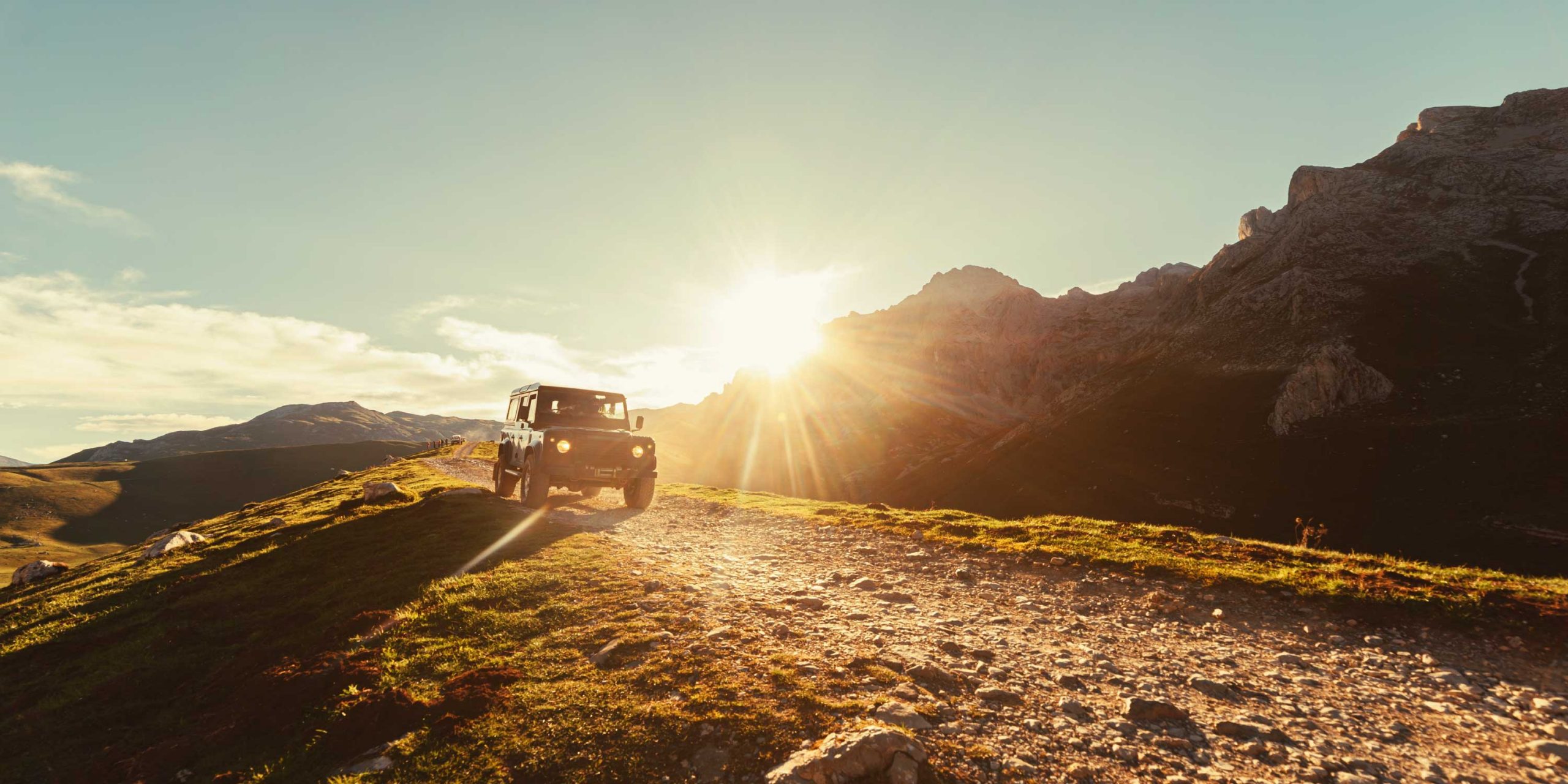
2) The other North/South route is the Trunk Road. It's all gravel and has cut-offs literally everywhere for camping and exploration. It's a logging road though and I generally advise getting a portable radio that allows you to tune into commercial bands (I think 130-144 MHz, but don't quote me on that) as many of the side roads are active logging roads. Trucks will call out their kilometre marker and "heavy" (coming out of the bush) or "light" (going into the bush). Generally you can't announce your location in the same way as these are commercial bands, but listening in can let you know when a few hundred tons of truck and logs are whipping towards you at 60 miles an hour on a dirt road! A cheap BoaFeng should do the job.

Google is being crappy about routing right now as some roads may be closed due to the spring thaw, but I imagine they'll open soon. If you look for Route 40 and 734, north of Cochrane, those two roads make up the bulk of the Trunk Road and you can navigate from the US Border all the way north to Grande Prairie if you need to.


If I only had 5 days, I would probably try to loop both the Parkway and the FTR in, heading through Radium & the Kootenays, and check out the Banff/Lake Louise area. After that I'd head up the Icefields to Sask River Crossing or to Jasper. At SRC, you can sneak out to the David Thompson Highway, Abraham Lake area which is a major wildlife corridor -- good chance to see bears and elk along there, and when we do the Icefields we often cut out around here to spend the night near Abraham Lake. Then I'd hop back on the Parkway to Jasper, then loop over to Hinton and take the Forestry Trunk Road south.

This way, you get to see the best of the Canadian Rockies, but if you are short on time or need to make miles, you can cut off the trunk road in a few places and hit pavement back to the border at high speed. By my count, depending on side trips this route is under 2000 kilometres from Northern Montana (Glacier Park area), which would mean to do it in 5 days you'd only have to average 350-400 kilometres per day. This is very doable in my mind but your preference may vary.

I would also double and triple check all these routes and distances, no guarantees stated or implied and all that stuff, but here's a rough guide of the route I'm talking about:

Trans-Canada Hwy to Jasper

Hopefully others will chip in suggestions on things to see and trails to run; I have less experience with specific routes and trails because I tend to be a "There's a road, let's follow it" on the FTR as opposed to planning/tracking where I've been.
 
  • Like
Reactions: Nicolas and TexasTJ

Pathfinder I

1,212
Canada
First Name
Craig
Last Name
PereferNotToSay
You are very welcome Tex! I hope you guys have a fantastic adventure in my adopted home province and if you have any other questions in the lead up or while you are on the road, feel free to drop us a line!

Safe travels and happy adventuring!
 

Etoimos

Rank V
Launch Member

Member III

2,779
Peyton, CO
First Name
Keith
Last Name
Upton
Member #

11810

I just recently became aware of the FTR while researching and planning for my trip from Colorado to Tuk next summer. Does anyone have some good suggestions for a campsite or two on the southern end near Coleman? I'll be travelling in either my Gladiator with my OGT trailer as picture below, or I'll be towing the same trailer with a new Power Wagon. My buddy will be tagging along as well in a four door Jeep Wrangler.


As for towing the trailer, I'm not concerned about any rough roads or terrain. It will go where ever the Jeep will go. What I am concerned about is switchbacks or tight turns in the trees where the overall turning radius would be an issue.

So if anyone know of some sites that would suite my needs, I'd appreciate some additional info on them. Feel free to PM/DM me if you to want to post your favorite places in a public place.

Thanks!
 

Pathfinder I

1,212
Canada
First Name
Craig
Last Name
PereferNotToSay
I just recently became aware of the FTR while researching and planning for my trip from Colorado to Tuk next summer. Does anyone have some good suggestions for a campsite or two on the southern end near Coleman? I'll be travelling in either my Gladiator with my OGT trailer as picture below, or I'll be towing the same trailer with a new Power Wagon. My buddy will be tagging along as well in a four door Jeep Wrangler.


As for towing the trailer, I'm not concerned about any rough roads or terrain. It will go where ever the Jeep will go. What I am concerned about is switchbacks or tight turns in the trees where the overall turning radius would be an issue.

So if anyone know of some sites that would suite my needs, I'd appreciate some additional info on them. Feel free to PM/DM me if you to want to post your favorite places in a public place.

Thanks!

As for the truck and trailer, the Forestry Trunk Road was built primarily for the forestry industry, so the roads are all built with logging trucks in mind. There are a few trails off the road that might give you a headache, but I'd wager that is less than 1% of the side roads off the FTR. Everything else is Forestry, or at the very least Oil and Gas, so the roads are for the most part designed to take 50' long trucks. Your jeep should have no problem on that stretch.

There are 4x4 trails along the route, like Ruby Falls or Waiparous, but those are specific trails that lead to vistas or neat overlooks -- of which there are many NOT on 4x4 trails -- and so I would say they are optional.

In terms of campsites at the south end near Coleman, you have a few options.

1) There is no shortage of wild camping along there. iOverlander has a ton of suggestions with user reviews and that is the easiest way to find a "discovered" wild campground, but that depends on your style. If you find it's late and you just need to pull over, I'd wager that you will be within 30 minutes of a great spot basically anywhere along the FTR in that part of the world. Here is a screen cap showing there's lots of spots in iOverlander, and I'd wager that the majority of the good spots are not in this app, so there's plenty around.

Screen Shot 2021-10-05 at 11.58.29 AM.png

2) Provincial Parks -- These are a great option and there are some that are technically provincial parks but run by private logging companies as part of their land use deal. They are cheap ($15/night) and typically have unlimited firewood. There are a bunch further north around Hinton, but the Alberta Parks site will have a ton of info in general.

3) National Parks. These are harder to get into, but one of the appealing parts of this part of the world are Alberta's legendary mountain towns like Banff or Jasper. If you want some civilization breaks into your trip, you'd be hard pressed to find places that have better examples of "civilization" than Banff or Jasper, and so staying at one of the campgrounds in or near the towns might be appealing to you as you can spend a night at a local brewery and not worry too much about having to still get into camp. Also, these towns are not far off the FTR so it doesn't force you into too much pavement travel if that's what you wish to avoid.
 

Etoimos

Rank V
Launch Member

Member III

2,779
Peyton, CO
First Name
Keith
Last Name
Upton
Member #

11810

As for the truck and trailer, the Forestry Trunk Road was built primarily for the forestry industry, so the roads are all built with logging trucks in mind. There are a few trails off the road that might give you a headache, but I'd wager that is less than 1% of the side roads off the FTR. Everything else is Forestry, or at the very least Oil and Gas, so the roads are for the most part designed to take 50' long trucks. Your jeep should have no problem on that stretch.

There are 4x4 trails along the route, like Ruby Falls or Waiparous, but those are specific trails that lead to vistas or neat overlooks -- of which there are many NOT on 4x4 trails -- and so I would say they are optional.

In terms of campsites at the south end near Coleman, you have a few options.

1) There is no shortage of wild camping along there. iOverlander has a ton of suggestions with user reviews and that is the easiest way to find a "discovered" wild campground, but that depends on your style. If you find it's late and you just need to pull over, I'd wager that you will be within 30 minutes of a great spot basically anywhere along the FTR in that part of the world. Here is a screen cap showing there's lots of spots in iOverlander, and I'd wager that the majority of the good spots are not in this app, so there's plenty around.

View attachment 211722

2) Provincial Parks -- These are a great option and there are some that are technically provincial parks but run by private logging companies as part of their land use deal. They are cheap ($15/night) and typically have unlimited firewood. There are a bunch further north around Hinton, but the Alberta Parks site will have a ton of info in general.

3) National Parks. These are harder to get into, but one of the appealing parts of this part of the world are Alberta's legendary mountain towns like Banff or Jasper. If you want some civilization breaks into your trip, you'd be hard pressed to find places that have better examples of "civilization" than Banff or Jasper, and so staying at one of the campgrounds in or near the towns might be appealing to you as you can spend a night at a local brewery and not worry too much about having to still get into camp. Also, these towns are not far off the FTR so it doesn't force you into too much pavement travel if that's what you wish to avoid.
Thanks for the detailed response Craig. I forget about iOverland. I tried it many years ago and found it lacking and never really went back to it. I'll check it out again now and see what I can find.

One of my main goals is to avoid civilization and pavement as much as possible. That said, we are going to have to do some of both during our 30 day trip.
 
  • Like
Reactions: ChasingOurTrunks

Pathfinder I

1,212
Canada
First Name
Craig
Last Name
PereferNotToSay
Thanks for the detailed response Craig. I forget about iOverland. I tried it many years ago and found it lacking and never really went back to it. I'll check it out again now and see what I can find.

One of my main goals is to avoid civilization and pavement as much as possible. That said, we are going to have to do some of both during our 30 day trip.
You are very welcome. The success of iOverlander is also it's greatest weakness; with more users, the "good" spots are more likely to be busy, but there is also likely to be more "good" spots recorded.

You won't have too much trouble avoiding civilization along the trunk road that's for sure! Pretty much as soon as you cross the border to Canada you have options of being pretty remote. I would also recommend picking up a copy of the BackRoads MacBook series; I believe there is also a layer that features their data for Gaia GPS subscribers but the area you are allowed to use offline is limited. I use Gaia, but I also have the paper books:


As you plan your trip, or after you embark, if you need anything local don't hesitate to ask!
 

Etoimos

Rank V
Launch Member

Member III

2,779
Peyton, CO
First Name
Keith
Last Name
Upton
Member #

11810

You are very welcome. The success of iOverlander is also it's greatest weakness; with more users, the "good" spots are more likely to be busy, but there is also likely to be more "good" spots recorded.

You won't have too much trouble avoiding civilization along the trunk road that's for sure! Pretty much as soon as you cross the border to Canada you have options of being pretty remote. I would also recommend picking up a copy of the BackRoads MacBook series; I believe there is also a layer that features their data for Gaia GPS subscribers but the area you are allowed to use offline is limited. I use Gaia, but I also have the paper books:

I'm a Gaia user as well, but I'll definitely checkout the Backroad Mapbooks. Thanks for the tip on those.


As you plan your trip, or after you embark, if you need anything local don't hesitate to ask!
Thank you very much for this kind offer. It is always nice to have someone local to reach out to if things go sideways on a trip. Depending on my final dates and route locations, perhaps we can just meet up to explore for a day or two together.
 
  • Like
Reactions: ChasingOurTrunks

Pathfinder I

1,212
Canada
First Name
Craig
Last Name
PereferNotToSay
Thank you very much for this kind offer. It is always nice to have someone local to reach out to if things go sideways on a trip. Depending on my final dates and route locations, perhaps we can just meet up to explore for a day or two together.
I'm always up for an adventure! For sure reach out and have a safe trip!!
 
  • Like
Reactions: Etoimos

Etoimos

Rank V
Launch Member

Member III

2,779
Peyton, CO
First Name
Keith
Last Name
Upton
Member #

11810

Our dates for this trip are finally set, May 28 though June 26. According to the research I've done, the FTR (also known as Highway 40) will be closed for the majority of our trip (Dec to mid-June). The FTR could be an option on the return trip, but that would depend on how much time we have left. So now I'm looking for an alternate route that will not be closed in early June.