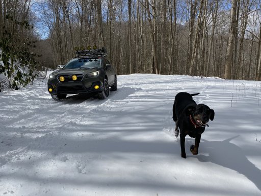
Edgemont, Mortimer, Wilson's Creek. Western NC.

  • HTML tutorial

Apdski

Rank V
Launch Member

Influencer II

1,691
Raleigh, NC, USA
First Name
Andrew
Last Name
D
Member #

12158

If it is that's awesome! Trying to find the thread on here where some members said it was closed permanently now. I'd love to try it.
Its a trail on my bucket list so I hope its not closed. Probably wont be able to make it out this spring however.
 

Sasquatch SC

Rank VI
Launch Member

Member III

3,782
Jefferson County, Colorado, United States
First Name
Trey
Last Name
Hayes
Member #

17253

Its a trail on my bucket list so I hope its not closed. Probably wont be able to make it out this spring however.
It's not permanently closed. According to a forestry service guy I talked to last week while I was up there riding some other stuff in the area, it was a seasonal closure for maintenance - which it desperately needed. It was fine when I rode it in March other than some trash people had thrown out and a few spots where people had gone off-trail or who were either ignorant to or simply disregarded the concept of "tread lightly." When I hit it again in late summer, we literally filled a trash bag with all kinds of trash. Everything from beer cans to exhaust tips. There were also some serious erosion damage at the second creek crossing, the long mud line, and the final climb before getting to the top. A trail gets over-ridden and it's bound to happen, so I would say the closing for maintenance is definitely justified in this case.

I hit some of these specific, popular trails to see what the hype is about, but my general overlanding philosophy is to pick a general area and then just start exploring. I just wander around taking whatever track I can find that isn't gated or has a trespassing sign. That is why my rig is named the Appalachia Wander Wagon. Because it is a wagon. And I wander around. Mostly in Appalachia. I spent the past two weekends exploring that area and I haven't even scratched the surface on what there is out there to explore. I did however find, and map, a track that is every bit as fun and as challenging as Hurricane Creek and the trailheads are only about a ½ mile from each other. Hurricane Creek goes to the east of I-40, this one goes to the west and is accessed by taking Exit 7 - Harmon's Den. I'm not sure if it has an "official" name because the most fun part was only noted with a FS number. It passes by Buzzard Roost (which is one hell of a view).

I haven't added this to the downloadable forum yet because I was hoping to visit it again to get a cleaner track recording. Here is the rough version. I did this two weekends ago on 2/22.
After you get off Exit 7 head west, towards the river. That will be FS 288. This will take you past Buzzard Roost which is not clearly marked on the route or on my map (rough draft - sorry), but if you keep a sharp eye out you can see where some people have spray painted the trees on the right side. After a while you will get to a junction where there are three different options. On my track you can see that I took two of them. FS 3537 is also called Tower Trail. I took it hoping it was a fire tower, but it was just a giant comms array on a summit. It had some easy but cool climbs, but it is only an out and back. After I got back to where I started from the Tower, I had the option to continue south on FS 288 or I could head west on FS 289. The westward route dropped down onto a rougher looking track with a lot of big stones all over the place. It looked more difficult and fun, so that is the route I took and I do not regret it. It was an awesome track! It got a little rowdy and was completely worth it. When I get a chance, I hope to get out there again to not only clean up my track recording - but I found out that after you go across the creek crossing at the bottom, if you take a left turn (instead of the right turn I took) it will take you down Mount Sterling Road aka the Old Cataloochee Turnpike which looks pretty cool.

Last weekend, 2/29, I rode some of the backways from Harmon's Den to Max Patch. I'm not sure if that part was all hard pack gravel or not because there was like 1'+ of snow on the ground.
IMG_1345.jpg After we got to Max Patch we went back east on the main route, Max Patch Rd. However, I found another rowdy track on our way back to the interstate because we were planning on grabbing a campsite at Harmon's Den. The road is called Shelton Laurel Road or FS 3567. It is only 3.9 miles long but if you're looking for something fun it is worth it. I knew was going to be worth it after we passed an XJ with a 6" lift and then a TJ with a windshield logo proclaiming it to be a "Mud Addict". The guy in the TJ actually stopped to talk and told me I might get stuck. I guess because I was driving a Subaru that doesn't have a traditional low-range or lockers... he obviously underestimated my dedication. It was definitely really, really muddy with some deep mud holes and some tricky technical sections. It was fun.

If you have a Gaia account, I'm pretty sure you can view my general account with most of the Appalachia Wander Wagon Adventures from the past year. Happy trails!
 

Roost OR

Rank I

Off-Road Ranger I

146
Charlotte, NC, USA
First Name
Ean
Last Name
Bass
Ham/GMRS Callsign
-
It's not permanently closed. According to a forestry service guy I talked to last week while I was up there riding some other stuff in the area, it was a seasonal closure for maintenance - which it desperately needed. It was fine when I rode it in March other than some trash people had thrown out and a few spots where people had gone off-trail or who were either ignorant to or simply disregarded the concept of "tread lightly." When I hit it again in late summer, we literally filled a trash bag with all kinds of trash. Everything from beer cans to exhaust tips. There were also some serious erosion damage at the second creek crossing, the long mud line, and the final climb before getting to the top. A trail gets over-ridden and it's bound to happen, so I would say the closing for maintenance is definitely justified in this case.

I hit some of these specific, popular trails to see what the hype is about, but my general overlanding philosophy is to pick a general area and then just start exploring. I just wander around taking whatever track I can find that isn't gated or has a trespassing sign. That is why my rig is named the Appalachia Wander Wagon. Because it is a wagon. And I wander around. Mostly in Appalachia. I spent the past two weekends exploring that area and I haven't even scratched the surface on what there is out there to explore. I did however find, and map, a track that is every bit as fun and as challenging as Hurricane Creek and the trailheads are only about a ½ mile from each other. Hurricane Creek goes to the east of I-40, this one goes to the west and is accessed by taking Exit 7 - Harmon's Den. I'm not sure if it has an "official" name because the most fun part was only noted with a FS number. It passes by Buzzard Roost (which is one hell of a view).

I haven't added this to the downloadable forum yet because I was hoping to visit it again to get a cleaner track recording. Here is the rough version. I did this two weekends ago on 2/22.
After you get off Exit 7 head west, towards the river. That will be FS 288. This will take you past Buzzard Roost which is not clearly marked on the route or on my map (rough draft - sorry), but if you keep a sharp eye out you can see where some people have spray painted the trees on the right side. After a while you will get to a junction where there are three different options. On my track you can see that I took two of them. FS 3537 is also called Tower Trail. I took it hoping it was a fire tower, but it was just a giant comms array on a summit. It had some easy but cool climbs, but it is only an out and back. After I got back to where I started from the Tower, I had the option to continue south on FS 288 or I could head west on FS 289. The westward route dropped down onto a rougher looking track with a lot of big stones all over the place. It looked more difficult and fun, so that is the route I took and I do not regret it. It was an awesome track! It got a little rowdy and was completely worth it. When I get a chance, I hope to get out there again to not only clean up my track recording - but I found out that after you go across the creek crossing at the bottom, if you take a left turn (instead of the right turn I took) it will take you down Mount Sterling Road aka the Old Cataloochee Turnpike which looks pretty cool.

Last weekend, 2/29, I rode some of the backways from Harmon's Den to Max Patch. I'm not sure if that part was all hard pack gravel or not because there was like 1'+ of snow on the ground.
View attachment 142934 After we got to Max Patch we went back east on the main route, Max Patch Rd. However, I found another rowdy track on our way back to the interstate because we were planning on grabbing a campsite at Harmon's Den. The road is called Shelton Laurel Road or FS 3567. It is only 3.9 miles long but if you're looking for something fun it is worth it. I knew was going to be worth it after we passed an XJ with a 6" lift and then a TJ with a windshield logo proclaiming it to be a "Mud Addict". The guy in the TJ actually stopped to talk and told me I might get stuck. I guess because I was driving a Subaru that doesn't have a traditional low-range or lockers... he obviously underestimated my dedication. It was definitely really, really muddy with some deep mud holes and some tricky technical sections. It was fun.

If you have a Gaia account, I'm pretty sure you can view my general account with most of the Appalachia Wander Wagon Adventures from the past year. Happy trails!
Dude... thanks for the info! We are going up to this area this weekend and will try out these trails. I’ll get back next week on if Hurricane Creek is closed. We will definitely try Buzzard Roost, but I saw somewhere that a portion of the road to the West of the lookout (Cove Creek I believe) was closed due to maintenance. Did you happen to come across any closed sections up there?
 

Sasquatch SC

Rank VI
Launch Member

Member III

3,782
Jefferson County, Colorado, United States
First Name
Trey
Last Name
Hayes
Member #

17253

Dude... thanks for the info! We are going up to this area this weekend and will try out these trails. I’ll get back next week on if Hurricane Creek is closed. We will definitely try Buzzard Roost, but I saw somewhere that a portion of the road to the West of the lookout (Cove Creek I believe) was closed due to maintenance. Did you happen to come across any closed sections up there?
Nope. I didn't really encounter ANY gates up there. That's why I spent two weekends back-to-back up there. I can't wait for DST so I'll be able to get more exploring done. There are still a TON of routes in that immediate area that I haven't gotten to. I've been all over the entire Grandfather Ranger District of Pisgah (I really only record the unpaved routes that are worthy of interest) and I've seen just about all there is to be seen. So now I'm moving onto this whole Cataloochee area.
 

Roost OR

Rank I

Off-Road Ranger I

146
Charlotte, NC, USA
First Name
Ean
Last Name
Bass
Ham/GMRS Callsign
-
Nice! I’ll let you know what we are up to. I’ve scoured a few routes south of that area off of the Blue Ridge Parkway. If I can figure out how to post a route, I’ll share it, but it’s completely untested so it may be closed for all I know.

GPX viewer
 

Attachments

Roost OR

Rank I

Off-Road Ranger I

146
Charlotte, NC, USA
First Name
Ean
Last Name
Bass
Ham/GMRS Callsign
-
Nice! I’ll let you know what we are up to. I’ve scoured a few routes south of that area off of the Blue Ridge Parkway. If I can figure out how to post a route, I’ll share it, but it’s completely untested so it may be closed for all I know.

GPX viewer
Scouted*
I don't think that is correct; let me try again.
Route off of I-40 through Cherokee
How's that?
 

Sasquatch SC

Rank VI
Launch Member

Member III

3,782
Jefferson County, Colorado, United States
First Name
Trey
Last Name
Hayes
Member #

17253

Scouted*
I don't think that is correct; let me try again.
Route off of I-40 through Cherokee
How's that?
I dunno man... I overlayed that on a satellite view. It looks like 90% of that is pavement, and what does look like gravel does have some houses/structures along it on the southwestern side of that is on Cherokee Nation land. But it is worth checking out. I don't really plan routes for most of my trips, so I'm not great at that kind of planning unless I already know the roads. I just pick an area and see what I can find where I'm not intruding on anything or anyone. Give it a shot, I could be completely wrong.
 

Roost OR

Rank I

Off-Road Ranger I

146
Charlotte, NC, USA
First Name
Ean
Last Name
Bass
Ham/GMRS Callsign
-
Yea, the parents want to see the area as well, not just the trails so got to conclude a little for them to allow me to make the routes. We'll give it a try and I'll update you on the dirt sections.
 
  • Like
Reactions: Sasquatch SC