Edgemont, Mortimer, Wilson's Creek. Western NC.

  • HTML tutorial

EP34FR

Rank I

Traveler I

Anyone have GPS or other location data for any/all of the campsites along the forestry roads in the area?

Been wanting to do a trip here for a while, but it’s a 5 hour drive for me. I’d kinda like to do a little research, see the site locations and have a plan of some potential sites in place before I head out.
 

NCtoAKtoNC

Rank 0

Contributor I

60
Raleigh, NC, USA
First Name
Matt
Last Name
Baugnon
Doing one of these this weekend. Going to talk to the folks at Betsey's Ole Country Store to check on road conditions before I pick a route. (It's been raining almost every day this week.) Will post pictures of the road when I finish.
 

NCtoAKtoNC

Rank 0

Contributor I

60
Raleigh, NC, USA
First Name
Matt
Last Name
Baugnon
Anyone have GPS or other location data for any/all of the campsites along the forestry roads in the area?

Been wanting to do a trip here for a while, but it’s a 5 hour drive for me. I’d kinda like to do a little research, see the site locations and have a plan of some potential sites in place before I head out.
I'll mark them as I drive as the purpose of our drive this weekend is to find camping spots.
 
  • Like
Reactions: EP34FR

Big E

Rank VI
Launch Member

Member III

3,384
Morganton, NC
Member #

3420

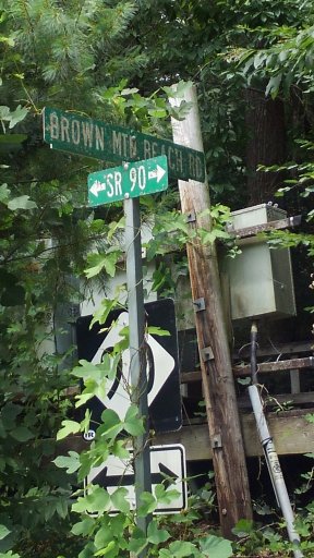
More to add to this area. When you are on Brown Mountain Beach road, (dirt) you will cross a bridge with a road turning left on the North end. This road Sr 1336 is marked Craig Creek road. This road will take you out to NC 181 just north of mile marker 17. There are places to camp along the way on this road.

When you get to 181, just south of mm17 is fire road 228. This is a several miles long dead end into the Steel Creek area. There is numerous camping, fishing, swimming spots on this road. It is gated and may be locked at times during the year.

Enjoy.
 

Big E

Rank VI
Launch Member

Member III

3,384
Morganton, NC
Member #

3420

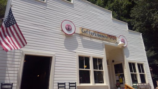
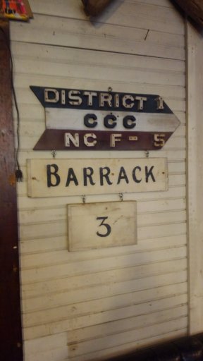
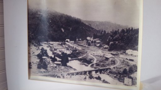
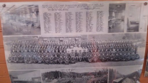
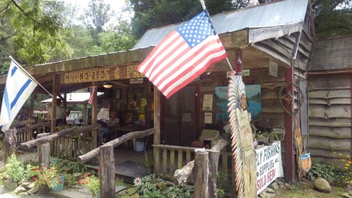
The old general store in Edgemont has been reopened as a museum, guide to the area center, and snack stand. Go visit and support the effort if your in the area. KIMG2873.JPGKIMG2872.JPGKIMG2870.JPGKIMG2869.JPGKIMG2867.JPGKIMG2871.JPG
 

Sasquatch SC

Rank VI
Launch Member

Member III

3,782
Jefferson County, Colorado, United States
First Name
Trey
Last Name
Hayes
Member #

17253

Does anyone have a coordinates for the campsites and roads> I'm headed up this coming weekend
Here are some in the area that I mapped recently.

Pineola Road (FS 464) - there are some campsites at the top. Primitive and away from everything. The road itself is hard pack gravel and easy. Campsites are marked on the map.

Old House Gap Road (FS 192) - I didn't mark any campsites on this road - I was too busy trying to keep the trail from destroying my rig. It isn't a trail I would take lightly, without a spotter, and without being prepared to take some punishment. Other than adding some more dents to my skid plates and some skuffs to the bottom of the bumpers, this trail also sheared off one of my front end links.

Maple Sally Road (FS 1357) also known as Maple Grove Church Road - this is a beautiful area with some amazing overlooks. There was a tree down on the trail and this was one of the few times I went out exploring without my chainsaw. Before I got to the blockage, I did find one really nice campsite. It is marked on the map.

All of these tracks are less than 60 days old. I don't find it necessary to track the main routes like Brown Mountain Beach Road or Route 90 because they are super well marked & heavily traveled. All the other runs I attempted in the area were either seasonally closed or closed due to storm damage. I will be back to do some more exploring. I didn't name my rig the Appalachia Wander Wagon for nothing. "And into the forest I go, to lose my mind and find my soul." - John Muir
 

TheOverlandingGoat

Rank IV
Launch Member

Enthusiast III

1,183
Greensboro, NC
Member #

5605

Planning a trip up this way, is there dispersed camping along the creek on Beach Mountain Rd? I’d like to find a place close to the water to enjoy for a weekend.
 

Sasquatch SC

Rank VI
Launch Member

Member III

3,782
Jefferson County, Colorado, United States
First Name
Trey
Last Name
Hayes
Member #

17253

Planning a trip up this way, is there dispersed camping along the creek on Beach Mountain Rd? I’d like to find a place close to the water to enjoy for a weekend.
No, there is absolutely no camping whatsoever allowed on the creek itself. I’ve heard of people trying to low-key car camp (sleeping in the back) and they will write you a fat ticket. You can pay-camp at Mortimer or there are some great dispersed spots on top of Pineola, but it’s a good couple of miles up the mountain.
 
  • Like
Reactions: TerryD

bhayes423

Rank II

Enthusiast III

473
Knoxville
First Name
Blake
Last Name
Hayes
Here are some in the area that I mapped recently.

Old House Gap Road (FS 192) - I didn't mark any campsites on this road - I was too busy trying to keep the trail from destroying my rig. It isn't a trail I would take lightly, without a spotter, and without being prepared to take some punishment. Other than adding some more dents to my skid plates and some skuffs to the bottom of the bumpers, this trail also sheared off one of my front end links.
Would a stock Tacoma TRD OR have any issues on this road? Planning on a trip through this area in 2 weeks before finishing in Asheville and I'll be the only rig.
 

Sasquatch SC

Rank VI
Launch Member

Member III

3,782
Jefferson County, Colorado, United States
First Name
Trey
Last Name
Hayes
Member #

17253

Would a stock Tacoma TRD OR have any issues on this road? Planning on a trip through this area in 2 weeks before finishing in Asheville and I'll be the only rig.
Depends on the weather. It was a mess recently and was getting over-ridden while wet. The trail is known for some off-camber action which can be made worse with wash-outs. I've done this a few times in my Subie. I've even done it once with a buddy in a stock height Outback following, but we were going downhill and that was during July when it was super dry. If you are going to be a solo rig, you will probably want a spotter and some recovery gear just in case you get caught in a rut. You could always get another rig to ride the trail with you especially since you have 2 weeks before you plan on getting there. There are a lot of people on here that are always down to hit some trails.
 

bhayes423

Rank II

Enthusiast III

473
Knoxville
First Name
Blake
Last Name
Hayes
Depends on the weather. It was a mess recently and was getting over-ridden while wet. The trail is known for some off-camber action which can be made worse with wash-outs. I've done this a few times in my Subie. I've even done it once with a buddy in a stock height Outback following, but we were going downhill and that was during July when it was super dry. If you are going to be a solo rig, you will probably want a spotter and some recovery gear just in case you get caught in a rut. You could always get another rig to ride the trail with you especially since you have 2 weeks before you plan on getting there. There are a lot of people on here that are always down to hit some trails.
Thanks for the info!

I'm watching the weather but have the week of March 16th off and want to explore NC some and get some drinks in Asheville.
 
  • Like
Reactions: Sasquatch SC

greatgibbs10

Rank III
Launch Member

Enthusiast I

874
WNC
First Name
Melissa
Last Name
Gibson
Member #

22320

I heard it's shut down for good now.
Actually, Hurricane Creek is open. It wasn't a part of the seasonal road closures in the Pisgah NF, but it's a muddy mess thanks to all of the rain this winter.
 

bhayes423

Rank II

Enthusiast III

473
Knoxville
First Name
Blake
Last Name
Hayes
Actually, Hurricane Creek is open. It wasn't a part of the seasonal road closures in the Pisgah NF, but it's a muddy mess thanks to all of the rain this winter.
If it is that's awesome! Trying to find the thread on here where some members said it was closed permanently now. I'd love to try it.