Edgemont, Mortimer, Wilson's Creek. Western NC.
- Thread starter Big E
- Start date
You are using an out of date browser. It may not display this or other websites correctly.
You should upgrade or use an alternative browser.
You should upgrade or use an alternative browser.


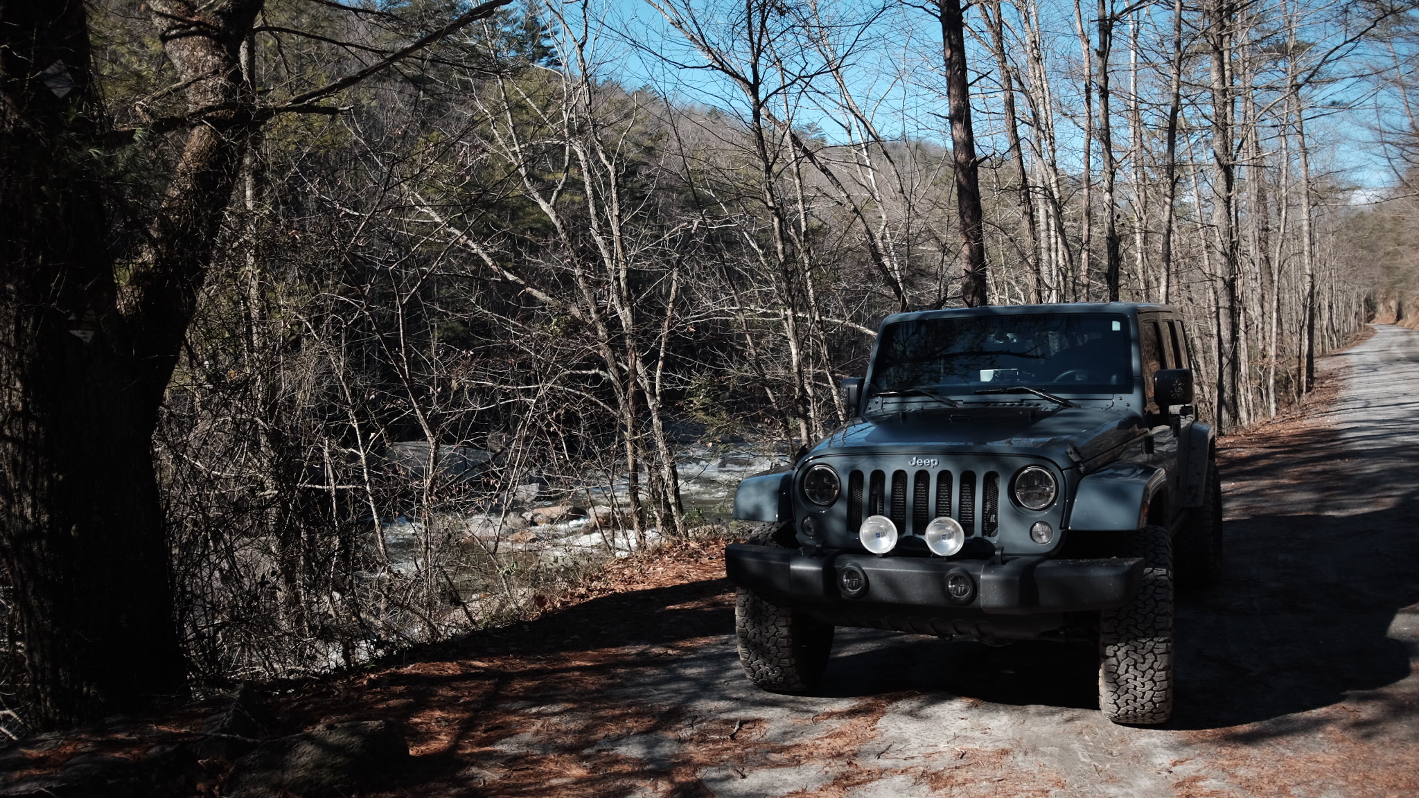
Damn I'm going to check out more of this the next time I head out that wayI recently posted a favorite road of mine, Old NC 105. I want to add another area very close to this first road in Western NC that I find a great place to wheel. The area is known as Wilson's Creek locally, historically its the Globe Valley. The main town in the area is Edgemont, and when I say town its a loose term. These mountain hold a few such communities and its a beautiful area. From Morganton NC take highway 181 north. Just past mile marker 12 you will have a right hand turn onto Brown Mountain Beach Road (1335). When this road crosses the county line it becomes Adako Road(1337), and just past that you will turn left onto Brown Mountain Beach road(1328). ( its a bit confusing with the repeated name) This road stays paved for about a mile then turns gravel, dirt, mud depending on the season. This road will take you 8 miles along Wilson's Creek. The road can be busy in summer, especially on weekends. The entire road is a great place for swimming, biking, white water rafting, fishing, and hiking.
I recommend if you go, stop at the Visitor's Center along the road. It has a bunch of photos and history of the Mortimer community which a ghost town along the road. As you head north from the center you will see the remains of an old cotton mill, bridge piers, and a flag pole marking the location of the old town that was wiped out in 1940 in a flood. Continue north and the road will T with state route 90 (dirt road). Stop at Betsy's old country store at the T for snacks and a nice visit. At this T turn left. You will see the remains of the old CCC camp and the current location of the Forest Service camp ground, a great place to camp. If you stay or explore the area there is the old Mortimor cemetery behind the work building and old walls and steps from the old camp. Continue on the road to the community of Edgemont. I am going to add two roads out of the valley your in that will take you up the mountains and up to the Blue Ridge.
Route 1
Just before you reach Edgemont you will see a left turn onto Fireroad 464, the Jonas Ridge Road. Its a long ride up the mountain, when you reach the top turn left on a paved road onto state road 1441 and this will take you to the community of Jonas Ridge on highway 181. As a side trip, as you approach the end of the road you will see a road to the left(going up) fire road 58 (its a long dead end) that will take you to the community of Kawana.
Route 2
When you reach Edgemont you will see a left turn onto Fireroad 981 Roseborough Road. This road will take you up the mountain to the town of Roseborough and will continue up to the Linville NC. You will meet up with the Blue Ridge Parkway before you get to town. Cross the parkway and continue into Linville. You will find yourself at a four way light with US 221 NC 181 and NC 105.
If you hit the parkway and want to take it instead turn right you will go several miles and reach the Linn Cove Viaduct and some wonderful views of the valley you just came up from.
alternate route
If you continue straight into Edgemont you will climb up the mountain on state road 1420, which will cross into state road 1514 which will climb up into the town of Gragg, be carefull when you reach this area, 1514 will take you up to US 221 below Grandfather Moutain, state road 1515 will take you farther up US 221. But, 1516 will drop you back down the mountain back onto NC 90 through the town of Globe, and that a route and posting for another day.
Cell phones do not work well in this area, usually only on ridge tops and spotty at best. Fill up with gas and have a full tank before you go into the area, there is no fuel in the valley itself. Morganton, Pineola, Linville, and Jonas Ridge will have fuel and food. There are trail heads for hiking , pull offs for primitive camping, and little creeks for pictures and dips in cooling water. National Geographic map 779 Linville Gorge and Mount Mitchell is a good road map to take with you. Enjoy the area, its beautiful.
Sent from my HTC6535LVW using OB Talk mobile app
Let me know when you make it here.Damn I'm going to check out more of this the next time I head out that way
Sent from my HTC6535LVW using OB Talk mobile app
Sent from my E6810 using OB Talk mobile app

I've got a few visuals to add to this post. Just recently began exploring it more extensively.
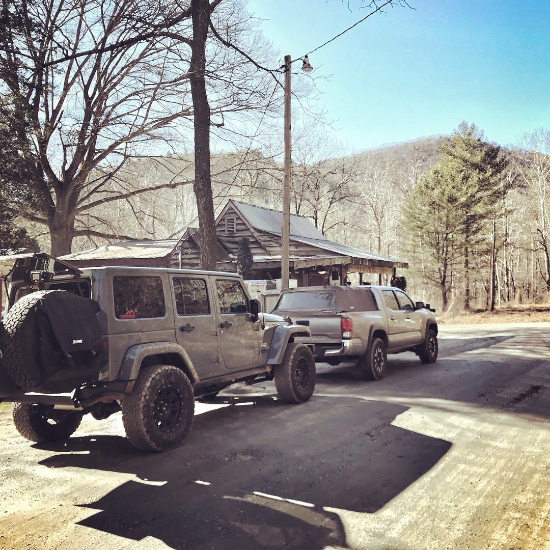
Betsy's (stop for a hotdog)

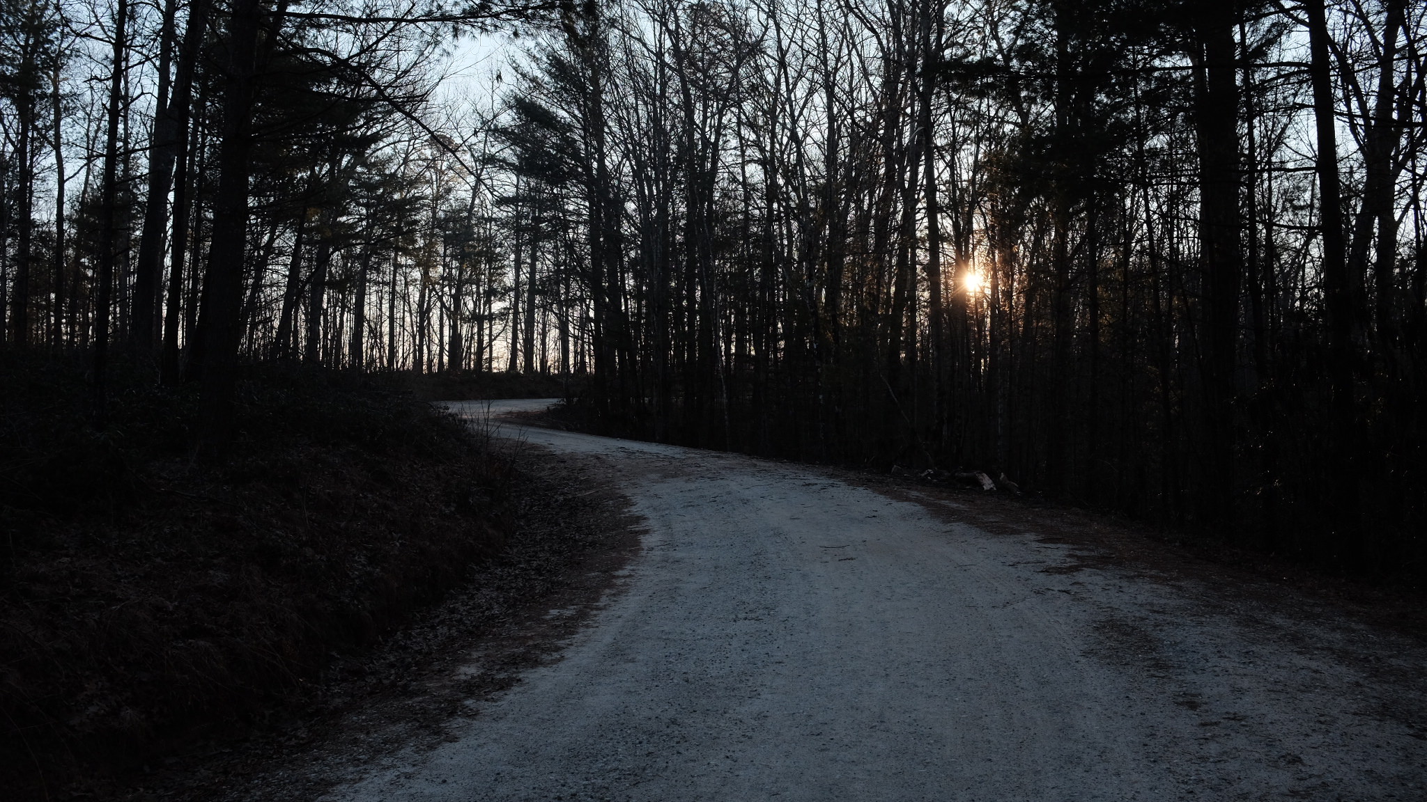
Roseboro Rd. nearing sunset
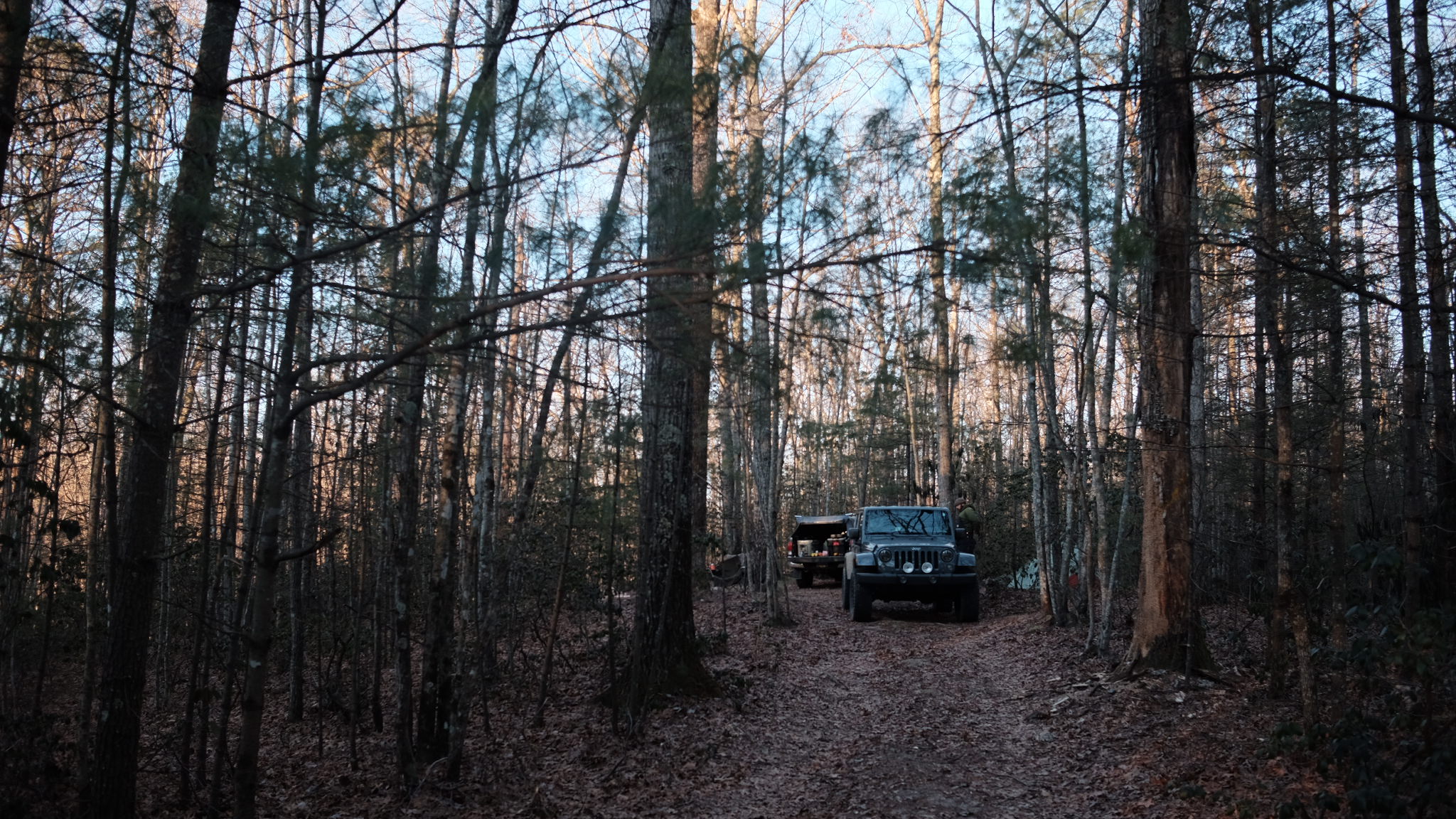
One of a couple dispersed campsites along Roseboro Rd.
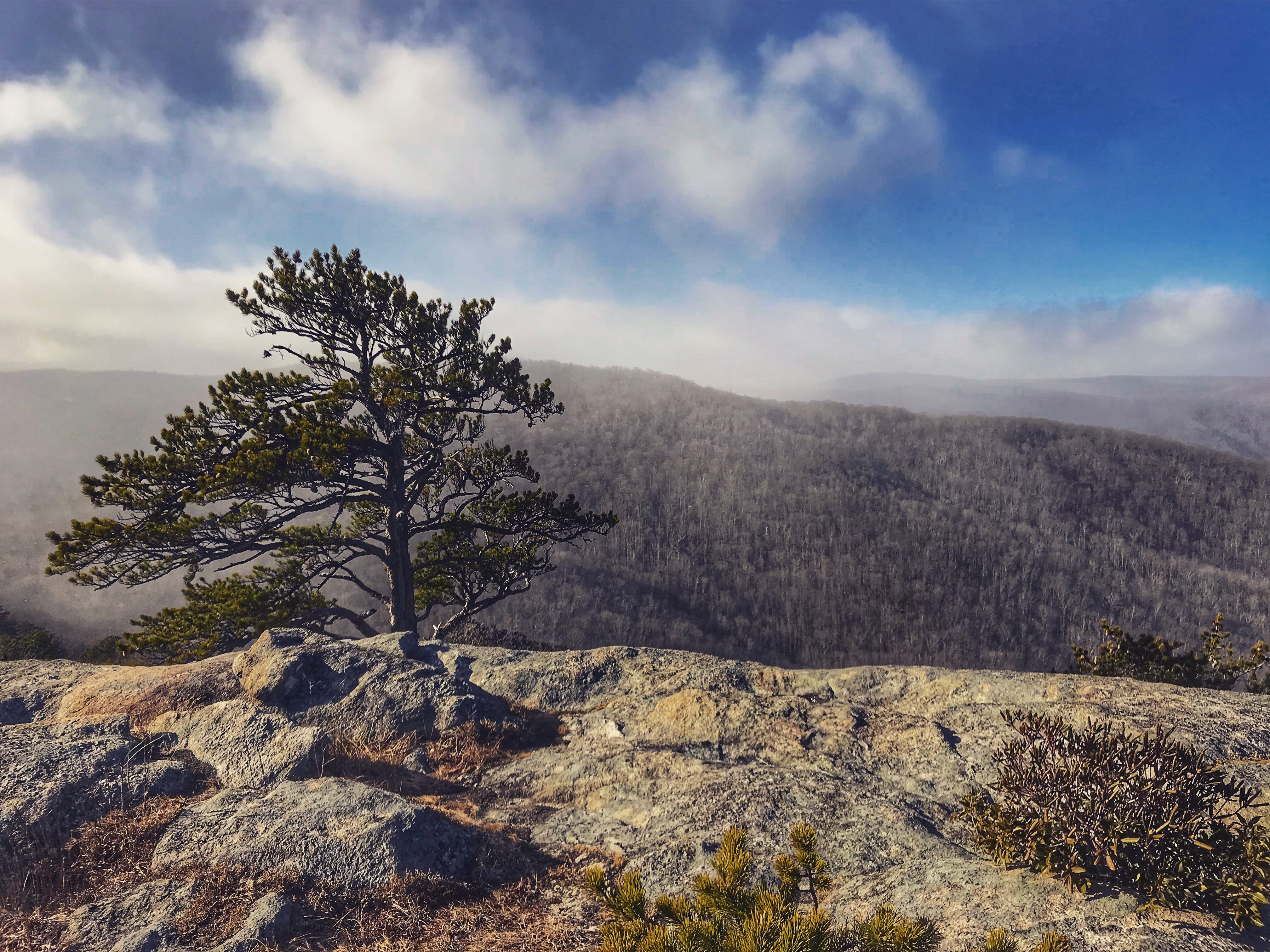
A short hike along Pineola Rd. will get you to this view.
Brown Mtn. Rd. alongside the creek.
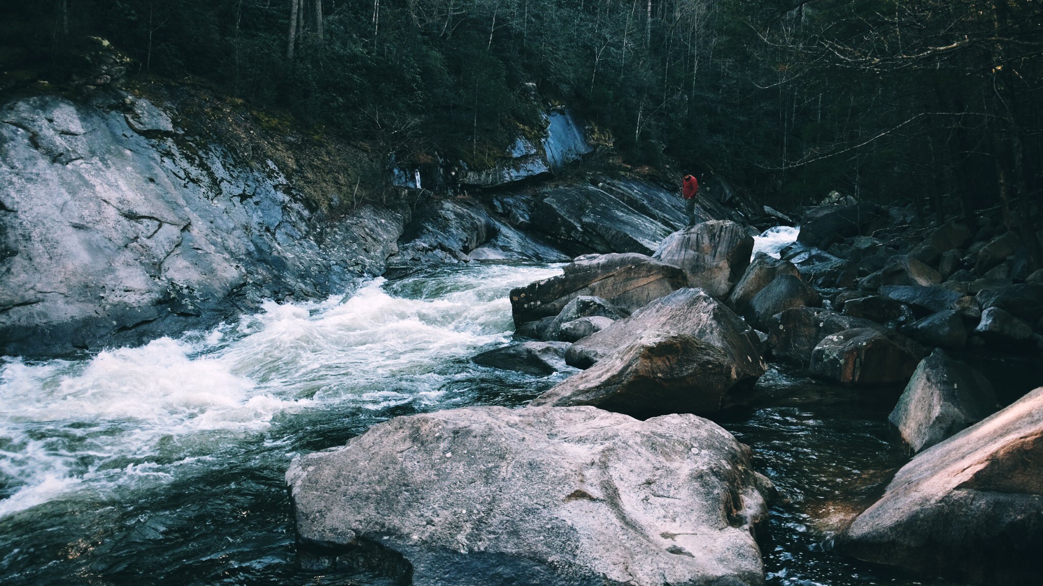
Creek view.
Betsy's (stop for a hotdog)
Roseboro Rd. nearing sunset
One of a couple dispersed campsites along Roseboro Rd.
A short hike along Pineola Rd. will get you to this view.
Brown Mtn. Rd. alongside the creek.
Creek view.

Member III

Definitely adding this one to the list as well! Planning to hit Old 105 tomorrow! Thanks for posting all of this!

Advocate III

I am planning to go out for 3 weeks ish starting third week end of September Va. Nc. Tn. Wv. Ending up in New York for the Overland East Meet Up Oct. 5th.
Plan on enjoying these roads.
Thanks for All the great info
Plan on enjoying these roads.
Thanks for All the great info
How are the campsites in this area? Being a National Forest, I rekon you can set up camp anywhere; but, for the spots that are already established, are they spaced far apart so that you don't have neighbors?
yes you will not have neighborsHow are the campsites in this area? Being a National Forest, I rekon you can set up camp anywhere; but, for the spots that are already established, are they spaced far apart so that you don't have neighbors?
Any suggestions for trails welcome.I am planning to go out for 3 weeks ish starting third week end of September Va. Nc. Tn. Wv. Ending up in New York for the Overland East Meet Up Oct. 5th.
Plan on enjoying these roads.
Thanks for All the great info
Or meet up for a run or coffee.
Most of my time will be in NC.
Thanks,
Ed
Member III
Any one have this mapped out on GPS yet? My brother just took me to Wilsons at the 1st of the month for some trout fishing, I had never been before to either! Had a blast and want to explore more.
If no one has one that is cool I will just have to do it one my own!
Thanks for the detailed information.
If no one has one that is cool I will just have to do it one my own!
Thanks for the detailed information.
These are fire roads. Most GPS should show them as they are used by the folks living along them. Nat Geo has a good map of the area also.Any one have this mapped out on GPS yet? My brother just took me to Wilsons at the 1st of the month for some trout fishing, I had never been before to either! Had a blast and want to explore more.
If no one has one that is cool I will just have to do it one my own!
Thanks for the detailed information.
Member III
Planning to head up to Wilson’s Creek area for some mild exploration this weekend. Will be my son’s (20) first trip since finishing up his 4Runner.
We're y'all heading up 181 Saturday morning? I got in the middle of 4 Toyotas rigged up heading out of Morganton.Planning to head up to Wilson’s Creek area for some mild exploration this weekend. Will be my son’s (20) first trip since finishing up his 4Runner.
That was likely us. We had 3 4th gen 4Runners and my 5th gen.We're y'all heading up 181 Saturday morning? I got in the middle of 4 Toyotas rigged up heading out of Morganton.
Yep. I got in the middle of the group when it closed to 1 lane. White Tacoma. Hope y'all had a good time.That was likely us. We had 3 4th gen 4Runners and my 5th gen.
