US Northwest Eastern Washington/Northern Idaho June Trip; WABDR sections 2&4

  • HTML tutorial

Ebbs

Rank VI
Member

Influencer III

4,518
Spokane, WA, USA
First Name
Brandon
Last Name
Eberhardt
Member #

20143

Ham/GMRS Callsign
KE0JBH
Service Branch
Air Force 02-18
OnX has updated their "recent imagery" as of May 13th and Snow levels look promising for June 7-9th BDR trip. I think we'll still have snow to get through but who knows what 3 weeks will do. Section 3 I think will need to be bi-passed, and I have a tentative route in mind starting at Bethal Ridge (section 2, and 4 (bypass 3)) should be some awesome views.

Snow Levels from this weekend (on/off section 5 of the BDR) were close to 6000'. We had one tree to clear (a second that really we could have gotten around, but figured we'd just do a bit of trail maintenance). I will be bringing my Chainsaw, and think we should have at least one more. WABDR is notorious for downed trees, though I'm not sure if it's specific sections that are bad.

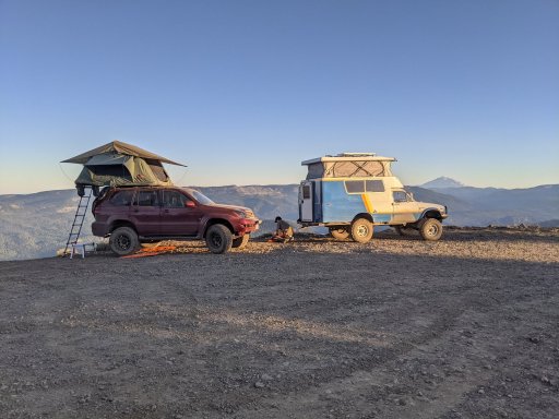
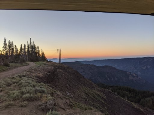
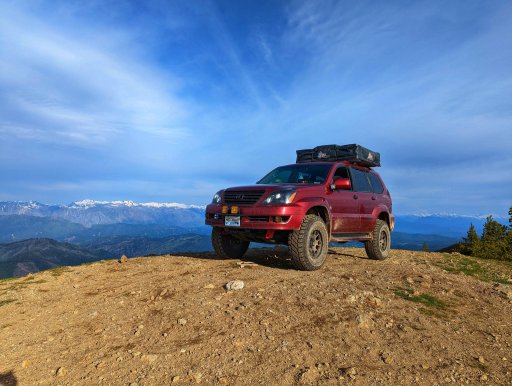
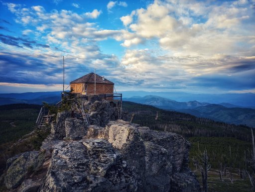
Here are a couple shots from the areas we'll see.
These are from July 2021
Bethel Ridge
DSC03057.JPG
Bethel Ridge
PXL_20210706_032037911.jpg
Bethel Ridge
PXL_20210706_121228015.jpg

Backside of Bethel Ridge
PXL_20210706_160749461.jpg
and June 2022
Chumstick Peak
PXL_20220615_142329839-01.jpg
Chumstick Peak
PXL_20220615_142533596.PANO-01.jpg
Sugarloaf Fire Lookout
PXL_20220616_123838392-02 (002).jpg
Lake Chelan
PXL_20220614_214020676-01.jpeg
 

MrWilsonWJ

Rank V
Launch Member

Member III

1,691
Kennewick, WA
First Name
Dustin
Last Name
Wilson
Member #

23384

I'm bummed I can't make this trip since I've been wanting to hit more of the WABDR, but I'll be at a concert in the area of where section 2 dumps out on the HWY 410 so it's a fair trade. It should be a fun trip across Bethel ridge, this time of year you'll probably hit a good deal of mud and maybe still some snow drifts in the trees. I do have a couple recommendations for section 2. Assuming you're coming up 1500/Bethel ridge road from HWY 12, before turning onto 1500-324 continue up the road a little and turn off on Cash Prairie/199. At a little over 1/2 mile in there is a nice little view point for some pictures if you have time and not far out of the way, it's easy to miss since there isn't much of a turn out but I can send GPS coordinates if you want. My other suggestion is to turn off on Grouse Heaven road to bypass the last of R-1000 unless you are dead set on running the exact WABDR route. It takes you to the same place but is about 2 miles shorter and you avoid a few mile of softball size cobble. I don't think you really miss out on anything special going that way and it's pretty decent gravel roads so you'll be able to cruise a bit faster.

Where are you guys planning to camp on night one?
 

Ebbs

Rank VI
Member

Influencer III

4,518
Spokane, WA, USA
First Name
Brandon
Last Name
Eberhardt
Member #

20143

Ham/GMRS Callsign
KE0JBH
Service Branch
Air Force 02-18
I'm bummed I can't make this trip since I've been wanting to hit more of the WABDR, but I'll be at a concert in the area of where section 2 dumps out on the HWY 410 so it's a fair trade. It should be a fun trip across Bethel ridge, this time of year you'll probably hit a good deal of mud and maybe still some snow drifts in the trees. I do have a couple recommendations for section 2. Assuming you're coming up 1500/Bethel ridge road from HWY 12, before turning onto 1500-324 continue up the road a little and turn off on Cash Prairie/199. At a little over 1/2 mile in there is a nice little view point for some pictures if you have time and not far out of the way, it's easy to miss since there isn't much of a turn out but I can send GPS coordinates if you want. My other suggestion is to turn off on Grouse Heaven road to bypass the last of R-1000 unless you are dead set on running the exact WABDR route. It takes you to the same place but is about 2 miles shorter and you avoid a few mile of softball size cobble. I don't think you really miss out on anything special going that way and it's pretty decent gravel roads so you'll be able to cruise a bit faster.

Where are you guys planning to camp on night one?
Yes please send me any waypoints and recommendations.

that by pass is that bypassing Baby Head Hill?

I'm planning on camping right on the ridge, either at that first wide area, or up and around so we're on the ridge but facing west (for sunset) I remember there being several areas up there we could camp at.
 

MrWilsonWJ

Rank V
Launch Member

Member III

1,691
Kennewick, WA
First Name
Dustin
Last Name
Wilson
Member #

23384

Baby head hill would be after you cross HWY 410 and are heading up to Cleman mountain, I do know of bypasses for that if it's the spot I'm thinking of. But the bypass I was referring to would be a little over 8.5 miles into Bethel ridge at 46.75346, -120.99198. It's called Grouse haven road and links back up with Malloy Canyon road at 46.79750, -120.93448. Gaia doesn't show it to be a through road, OnX does and it is. It's roughly 2 miles shorter and the road is a lot better if you want to make up some time/save some time for later in the day. I do remember there being some decent places you could camp off of it but I've never marked them so I don't have any coordinates on those.

It sounds like you know where most of the open spots to camp are on Bethel ridge. For those it's really how far you want to go, what's open and if there is enough room for your group as there is about 5-10 decent ones along the main trail. Other camp options would be if you wanted to run out SE on the ridge on the 4W672/4W652 trail. There is a few places you could camp out there one is at the shack that's a ways out there 46.69605, -121.04985. Only problem with there is if you get some weather it's pretty open out on that ridge. Also it's more of a 4X4 trail, most of it is pretty easy but there is some rocky hills and a couple tight spots. Another option to camp is down at Bear Lake, if you go around to the SW side there is a cool spot that is a little above the lake and a lot nicer then the main area everyone goes to. It's about 5.5 miles off of the Bethel Ridge trail on Oak Creek road. There is a short and fast way down from the ridge to the lake (4W671 Bethel-Lynn Lake Tie) but I do not recommend it if you have full size rigs, trailers or mostly stock vehicles. It's steep, loose and tight, we went down it once and there was a couple spots the rear end of the Jeep tried to pass the front. There are a few other camp sites I frequent up there but they would be a bit more out of your way if you don't plan to complete Bethel ridge before setting up camp. If you're ever back in the area I can PM you the coordinates for a killer spot me and my friends usually go to a couple times a year for base camp wheeling trips.

As for POI's the spot I mentioned off of 199/Cash Prairie Rd is a good view point 46.71217, -121.13827. It's not far out of the way before you would head up onto Bethel Ridge and if you have time the drive out that road to the Cash Prairie trailhead is worth it for some pictures, the views are pretty awesome. Another place would come shortly after crossing HWY 410 and heading up FSR 1711, the road at the top is Cleman Mountain Ridge road, the WABDR maps have you turning off onto Jones road which is shortly after the towers up there. But Cleman Mountain Ridge Rd road goes about another 5 miles along the ridge and has some good views down into the Naches valley. It would be an out and back detour so kind of dependent on your timeline if you really want to go out there. Really there is tons of awesome trails and view points up there but those are a couple I could think of that wouldn't take you too far off your route.
 
  • Like
Reactions: Ebbs

Ebbs

Rank VI
Member

Influencer III

4,518
Spokane, WA, USA
First Name
Brandon
Last Name
Eberhardt
Member #

20143

Ham/GMRS Callsign
KE0JBH
Service Branch
Air Force 02-18
Baby head hill would be after you cross HWY 410 and are heading up to Cleman mountain, I do know of bypasses for that if it's the spot I'm thinking of. But the bypass I was referring to would be a little over 8.5 miles into Bethel ridge at 46.75346, -120.99198. It's called Grouse haven road and links back up with Malloy Canyon road at 46.79750, -120.93448. Gaia doesn't show it to be a through road, OnX does and it is. It's roughly 2 miles shorter and the road is a lot better if you want to make up some time/save some time for later in the day. I do remember there being some decent places you could camp off of it but I've never marked them so I don't have any coordinates on those.

It sounds like you know where most of the open spots to camp are on Bethel ridge. For those it's really how far you want to go, what's open and if there is enough room for your group as there is about 5-10 decent ones along the main trail. Other camp options would be if you wanted to run out SE on the ridge on the 4W672/4W652 trail. There is a few places you could camp out there one is at the shack that's a ways out there 46.69605, -121.04985. Only problem with there is if you get some weather it's pretty open out on that ridge. Also it's more of a 4X4 trail, most of it is pretty easy but there is some rocky hills and a couple tight spots. Another option to camp is down at Bear Lake, if you go around to the SW side there is a cool spot that is a little above the lake and a lot nicer then the main area everyone goes to. It's about 5.5 miles off of the Bethel Ridge trail on Oak Creek road. There is a short and fast way down from the ridge to the lake (4W671 Bethel-Lynn Lake Tie) but I do not recommend it if you have full size rigs, trailers or mostly stock vehicles. It's steep, loose and tight, we went down it once and there was a couple spots the rear end of the Jeep tried to pass the front. There are a few other camp sites I frequent up there but they would be a bit more out of your way if you don't plan to complete Bethel ridge before setting up camp. If you're ever back in the area I can PM you the coordinates for a killer spot me and my friends usually go to a couple times a year for base camp wheeling trips.

As for POI's the spot I mentioned off of 199/Cash Prairie Rd is a good view point 46.71217, -121.13827. It's not far out of the way before you would head up onto Bethel Ridge and if you have time the drive out that road to the Cash Prairie trailhead is worth it for some pictures, the views are pretty awesome. Another place would come shortly after crossing HWY 410 and heading up FSR 1711, the road at the top is Cleman Mountain Ridge road, the WABDR maps have you turning off onto Jones road which is shortly after the towers up there. But Cleman Mountain Ridge Rd road goes about another 5 miles along the ridge and has some good views down into the Naches valley. It would be an out and back detour so kind of dependent on your timeline if you really want to go out there. Really there is tons of awesome trails and view points up there but those are a couple I could think of that wouldn't take you too far off your route.
That's awesome and some great info. I'll definitely be looking at my route and seeing what I can incorporate. shouldn't be super tight on time, but as I'm sure you know, time tables can quickly get out of whack with a group. let alone any recoveries or breakdowns.

THANK YOU!
 
  • Like
Reactions: PapaDave

Ebbs

Rank VI
Member

Influencer III

4,518
Spokane, WA, USA
First Name
Brandon
Last Name
Eberhardt
Member #

20143

Ham/GMRS Callsign
KE0JBH
Service Branch
Air Force 02-18
I plan on uploading the route this weekend. I've added a couple of the waypoints @MrWilsonWJ suggested (Seriously, thanks!) and we'll start the PM thread.
At this point, is everyone planning on leaving at 1230 Friday? it's 4hrs from our meeting point (Pilot Travel Center off 90, 10506 W Aero Rd, Spokane, WA 99224)
For anyone wanting to leave Friday evening after work, it's definitely doable, it's pretty much all interstate to Yakama, then highway to Bethel Ridge Road, the road up to bethel ridge is pretty good, and wouldn't be super difficult to find our camp, I think I had cell signal, but I also have a satellite communicator so can send GPS coordinates for anyone arriving late.

If anyone would like to just meet up Saturday morning that is fine, we can coordinate, just know it's hard to be super accurate with rally point times due to terrain, conditions, ect. but I'll do my best. I can create a route and designate a rally point (there are several spots where we cross pavement, as well as a dip into Ellensburg for gas before heading up to Cashmere) Just know most if not all of the technical off-roading is before Ellensburg, most on Bethel Ridge, straight out of our first nights camp.
 
  • Like
Reactions: PapaDave

Ebbs

Rank VI
Member

Influencer III

4,518
Spokane, WA, USA
First Name
Brandon
Last Name
Eberhardt
Member #

20143

Ham/GMRS Callsign
KE0JBH
Service Branch
Air Force 02-18
Won't make this one due to wife's travel schedule. Will See you all in July!

That's too bad, but yeah July should be a good one, I'm excited as I didn't get to run that trip last year.