

Member III
Over 10,000 years ago, Lake Lahontan was North America’s largest ice-age lake with an area stretching 8500 square miles from northwest Nevada and northeast California to southern Oregon. Depths of the lake were estimated at 500 to 900 feet.
The only remnants of the Lahontan ice-age Lake are Pyramid and Walker Lakes and a vast expanse of the Black Rock Desert, including Soldier Meadows and the trails through the surrounding mountains and canyons. The remote and rough environment whets the HappyOurOverlanding gangs appetites for the history and pre-history of the area and the desire to follow a portion of the old Applegate Trail for the next 5 days.
For the modern-day art folk, you may recognize this area as the place where the yearly Burning Man festival is held. In September Burning Man takes over a portion of the lower playa and erects a temporary city aptly named Black Rock City.
Making our way to Applegate Trail
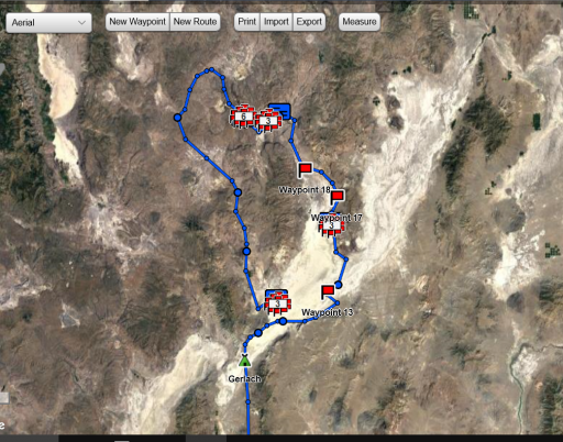
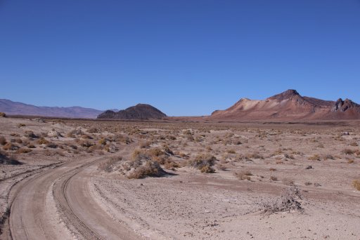
After about three hours of driving on smooth asphalt from our home base with stops for dog walks, snacks and topping off our tanks in Gerlach NV, we entered the west end of the Playa just below where Burning man is held. Our goal that day was to zoom across the playa to the east side and headed for Black Rock, an Iconic outcrop near the middle of the playa, with a few stops on the way and meet up with the Applegate Trail.
We pushed on across the playa, kicking up dust and turning our vehicles into the color of cement-white. We zigged and we zagged over the sand and eventually picked up the designated route to our first destination and requisite stop at Black Rock Springs for a picture.
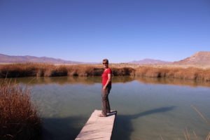
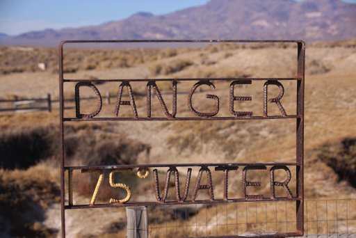
Even though this is a rather warm spring, it doesn’t compare to our next stop. So, from here we connected to the Applegate Trail and headed to Double Hot springs.
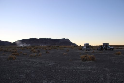
We decided to camp on the high side of Double Hot Springs which made a great backdrop for out campsite.
Signposts Along the Trail
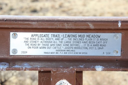
At this and many other stops along the way, Trails West, Inc. has placed markers (placards mounted to what look to be cut railroad tracks) that give insight to the places emigrant travelers came through along with quotes from their written history.
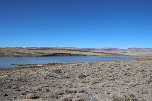
Continuing down the trail, we came to our first river crossing—or should I say, a very muddy, rutted, boggy river crossing which wanted to push the vehicles into the tall Rushes on the sides. Once this obstacle was overcome, we stop at Mud Lake.
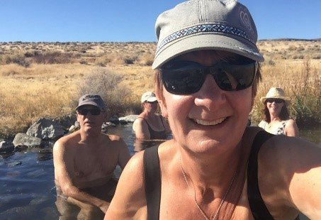
From here we drove to the high side of the lake and found a campsite to stay two nights in Soldiers Meadow. There are certain areas that BLM has set up as designated campsites so folks don’t disturb the surrounding environment. Soldiers Meadow is one of those areas. The benefit of this campsite is the access to several warm spring pools in which you can soak your tired bones and muscles after being jostled around on the trail.
After two days of scrumptious meals, soaking in a hot-spring pool, a hot shower, and two nights of Coyotes singing, we headed off—skirting Mud Meadow, and into Fly Canyon.
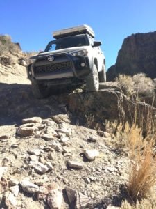
From a couple of rut filled river crossings to climbing over, around, and down some butt puckering terrain, everything along the trail was fairly straight forward. Well– until I started driving the incorrect line down a rock step. Leave it to the ‘Newby’ overlander to miss the mark.
Thank goodness for Spotters
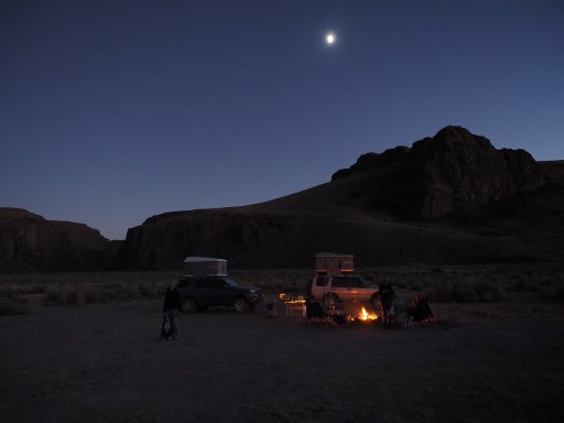
Once we were out of the canyon, we found a campsite about 100 yards from a steep grade with worn ruts made by the wagons that came this way. We decided to name the site ‘Wagon Rut Campsite.’ The site had a spectacular view of the surrounding mountains and the trail from where we came.
Once on the other side of the hill, it was into the tall shrubs and through a narrow canyon to follow a meandering trail to the next water crossing. But first we had to herd some free ranging cows and calves. It’s astonishing to see these large beasts staring at you eye-to-eye through the window as we calmly passed to ensure we didn’t scare them. Sure glad they didn’t decide to come up for a visit –though they did deposit ‘pies’ along the trail that we had to maneuver around when possible.
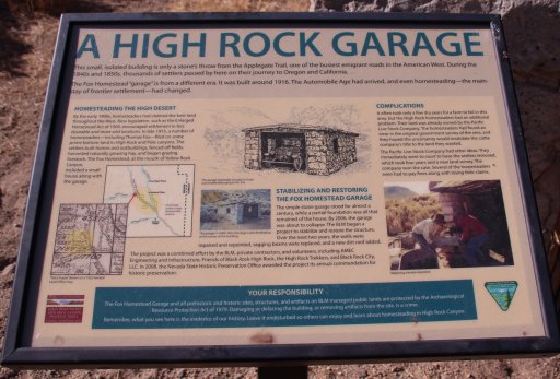
Further down the trail we continued to East Fork High Rock Canyon wilderness and pulled into the High Rock Canyon Garage. Not that we were in need of any service since this garage has been abandoned for quite a while.
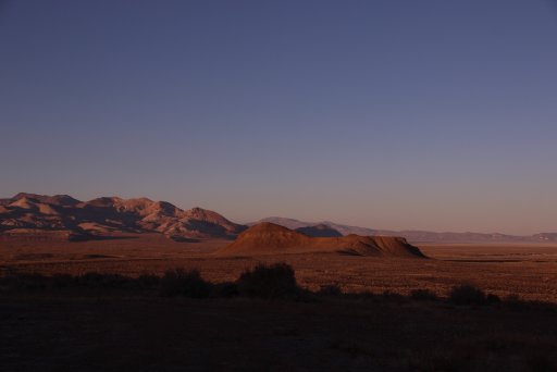
Well five days of 4-wheeling fun was coming to an end along with our water and gas supply. We decided to spend our last night overlooking the Playa within a few miles of Gerlach where we could fuel up again.
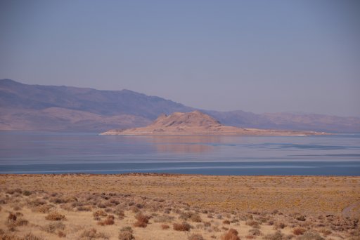
On our drive back home, we stopped at one of the two lakes left over from the Ancient Ice Age Lake—Pyramid Lake, and captured our final shots of our Happy Our Overlanding adventure.
The only remnants of the Lahontan ice-age Lake are Pyramid and Walker Lakes and a vast expanse of the Black Rock Desert, including Soldier Meadows and the trails through the surrounding mountains and canyons. The remote and rough environment whets the HappyOurOverlanding gangs appetites for the history and pre-history of the area and the desire to follow a portion of the old Applegate Trail for the next 5 days.
For the modern-day art folk, you may recognize this area as the place where the yearly Burning Man festival is held. In September Burning Man takes over a portion of the lower playa and erects a temporary city aptly named Black Rock City.
Making our way to Applegate Trail
After about three hours of driving on smooth asphalt from our home base with stops for dog walks, snacks and topping off our tanks in Gerlach NV, we entered the west end of the Playa just below where Burning man is held. Our goal that day was to zoom across the playa to the east side and headed for Black Rock, an Iconic outcrop near the middle of the playa, with a few stops on the way and meet up with the Applegate Trail.
We pushed on across the playa, kicking up dust and turning our vehicles into the color of cement-white. We zigged and we zagged over the sand and eventually picked up the designated route to our first destination and requisite stop at Black Rock Springs for a picture.
Even though this is a rather warm spring, it doesn’t compare to our next stop. So, from here we connected to the Applegate Trail and headed to Double Hot springs.
We decided to camp on the high side of Double Hot Springs which made a great backdrop for out campsite.
Signposts Along the Trail
At this and many other stops along the way, Trails West, Inc. has placed markers (placards mounted to what look to be cut railroad tracks) that give insight to the places emigrant travelers came through along with quotes from their written history.
Continuing down the trail, we came to our first river crossing—or should I say, a very muddy, rutted, boggy river crossing which wanted to push the vehicles into the tall Rushes on the sides. Once this obstacle was overcome, we stop at Mud Lake.
From here we drove to the high side of the lake and found a campsite to stay two nights in Soldiers Meadow. There are certain areas that BLM has set up as designated campsites so folks don’t disturb the surrounding environment. Soldiers Meadow is one of those areas. The benefit of this campsite is the access to several warm spring pools in which you can soak your tired bones and muscles after being jostled around on the trail.
After two days of scrumptious meals, soaking in a hot-spring pool, a hot shower, and two nights of Coyotes singing, we headed off—skirting Mud Meadow, and into Fly Canyon.
From a couple of rut filled river crossings to climbing over, around, and down some butt puckering terrain, everything along the trail was fairly straight forward. Well– until I started driving the incorrect line down a rock step. Leave it to the ‘Newby’ overlander to miss the mark.
Thank goodness for Spotters
Once we were out of the canyon, we found a campsite about 100 yards from a steep grade with worn ruts made by the wagons that came this way. We decided to name the site ‘Wagon Rut Campsite.’ The site had a spectacular view of the surrounding mountains and the trail from where we came.
Once on the other side of the hill, it was into the tall shrubs and through a narrow canyon to follow a meandering trail to the next water crossing. But first we had to herd some free ranging cows and calves. It’s astonishing to see these large beasts staring at you eye-to-eye through the window as we calmly passed to ensure we didn’t scare them. Sure glad they didn’t decide to come up for a visit –though they did deposit ‘pies’ along the trail that we had to maneuver around when possible.
Further down the trail we continued to East Fork High Rock Canyon wilderness and pulled into the High Rock Canyon Garage. Not that we were in need of any service since this garage has been abandoned for quite a while.
Well five days of 4-wheeling fun was coming to an end along with our water and gas supply. We decided to spend our last night overlooking the Playa within a few miles of Gerlach where we could fuel up again.
On our drive back home, we stopped at one of the two lakes left over from the Ancient Ice Age Lake—Pyramid Lake, and captured our final shots of our Happy Our Overlanding adventure.


