Member III
Hello Northern Neighbors,
I'm planning a month long trip from the US (entering Canada from Montana) all the way up to Tuktoyaktuk in the NWT. I have been trying to find some information on dispersed camping in Canada, but there does not seem to be much info out there on it. Everything seems to be geared towards camping in campgrounds, or backcountry backpack camping. Is dispersed camping a thing up there or is everything in designated campsites?
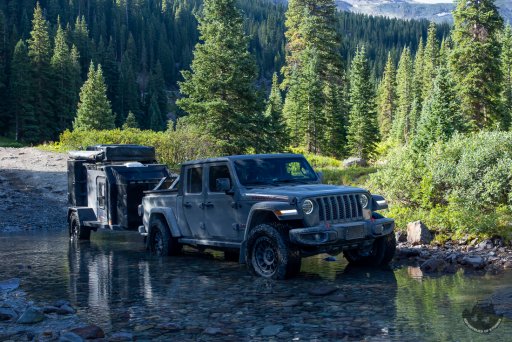
I have a tentative route mapped out, but would be fine with updating it for good dispersed camp sites. Below is a pic of my rig if that helps any and there will be one other Jeep travelling with me. Any info you guys can share would be really appreciated.
I'm planning a month long trip from the US (entering Canada from Montana) all the way up to Tuktoyaktuk in the NWT. I have been trying to find some information on dispersed camping in Canada, but there does not seem to be much info out there on it. Everything seems to be geared towards camping in campgrounds, or backcountry backpack camping. Is dispersed camping a thing up there or is everything in designated campsites?
I have a tentative route mapped out, but would be fine with updating it for good dispersed camp sites. Below is a pic of my rig if that helps any and there will be one other Jeep travelling with me. Any info you guys can share would be really appreciated.