Pathfinder I
Adapted from my post on our Colorado/Canyon forum. Shayn is an OB member I believe.
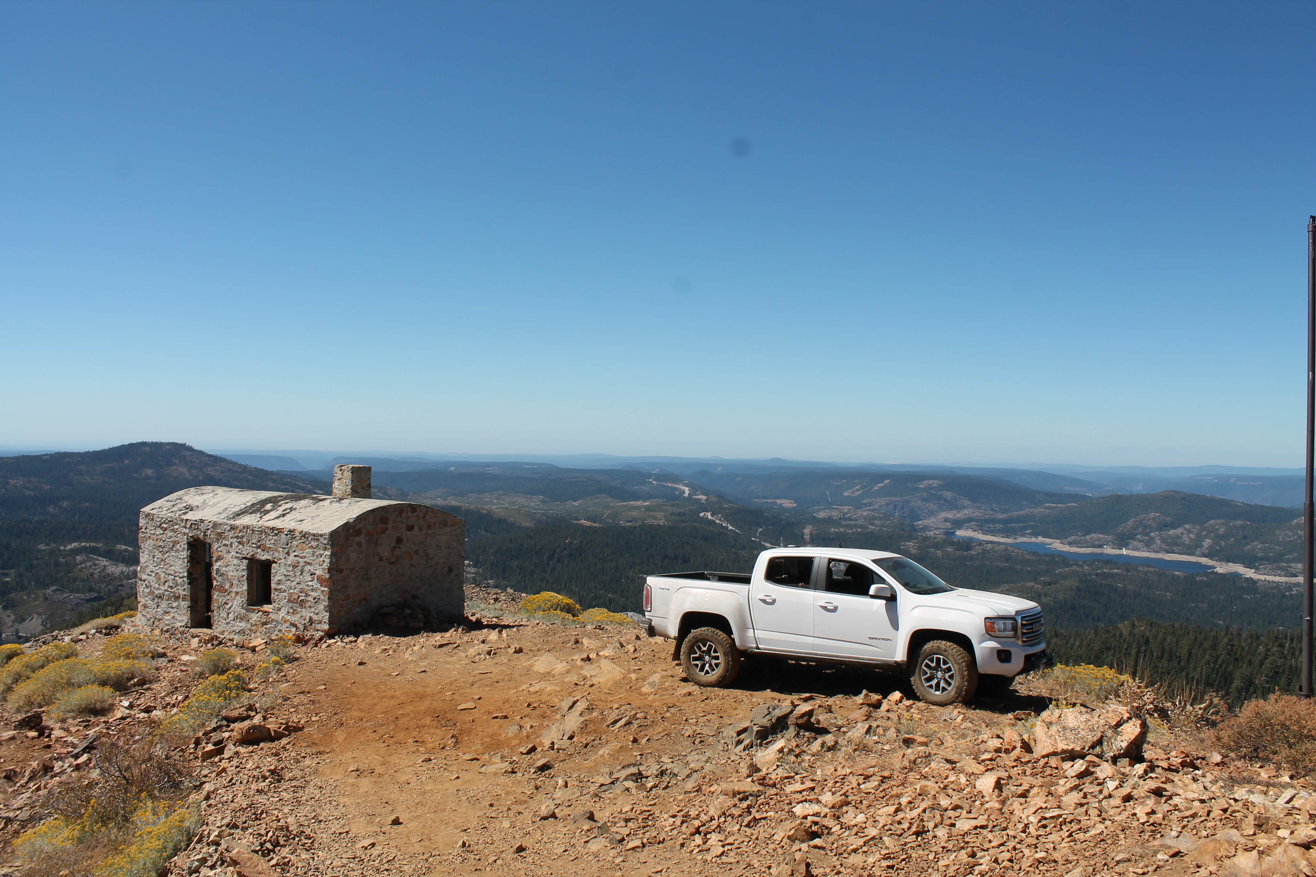
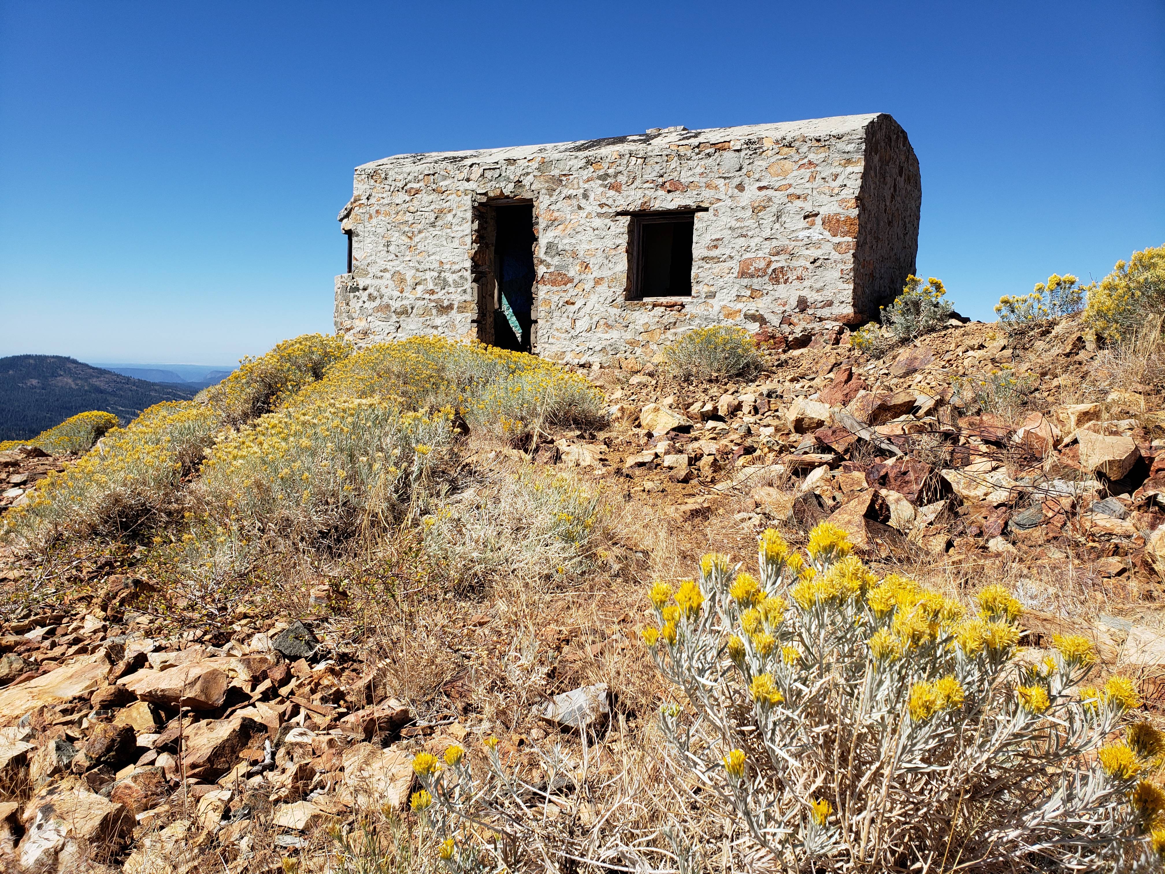
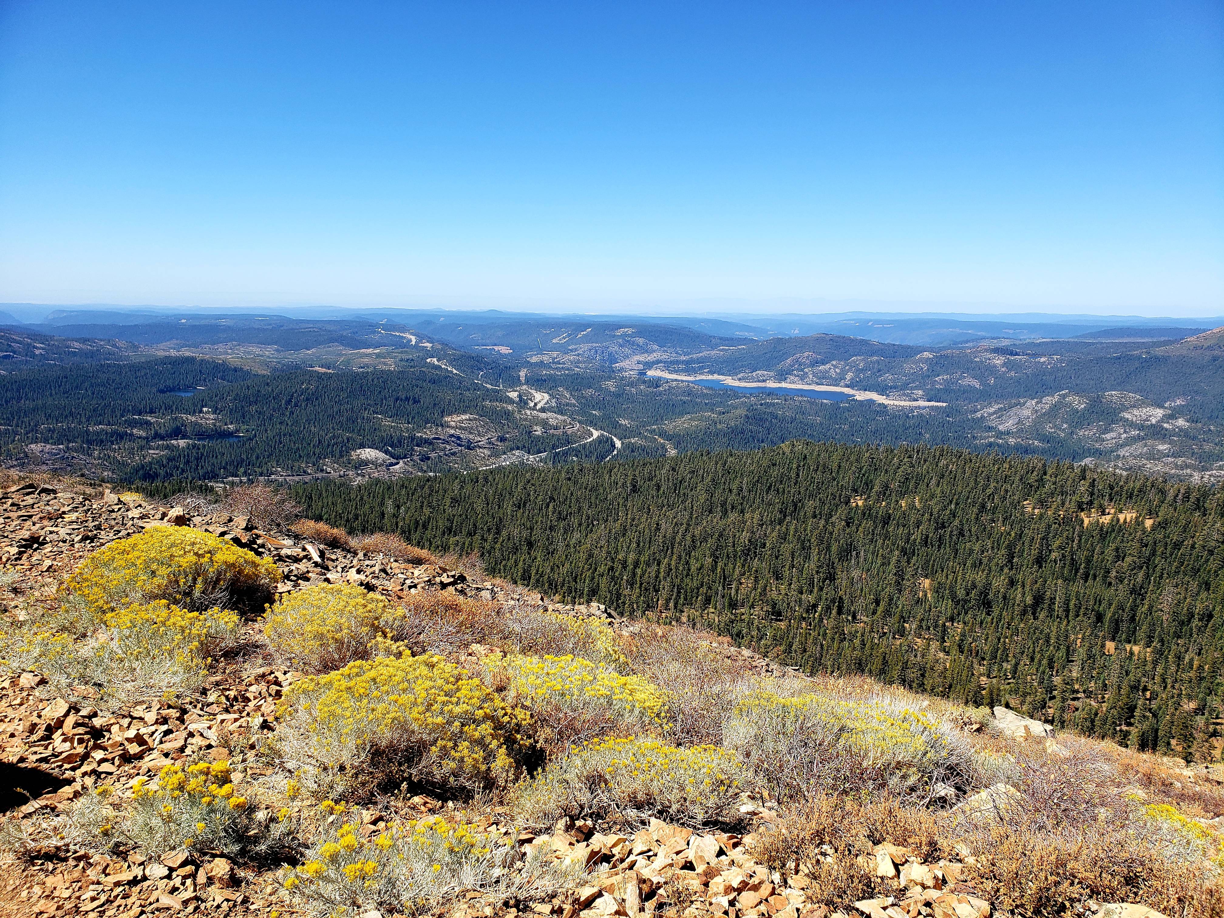
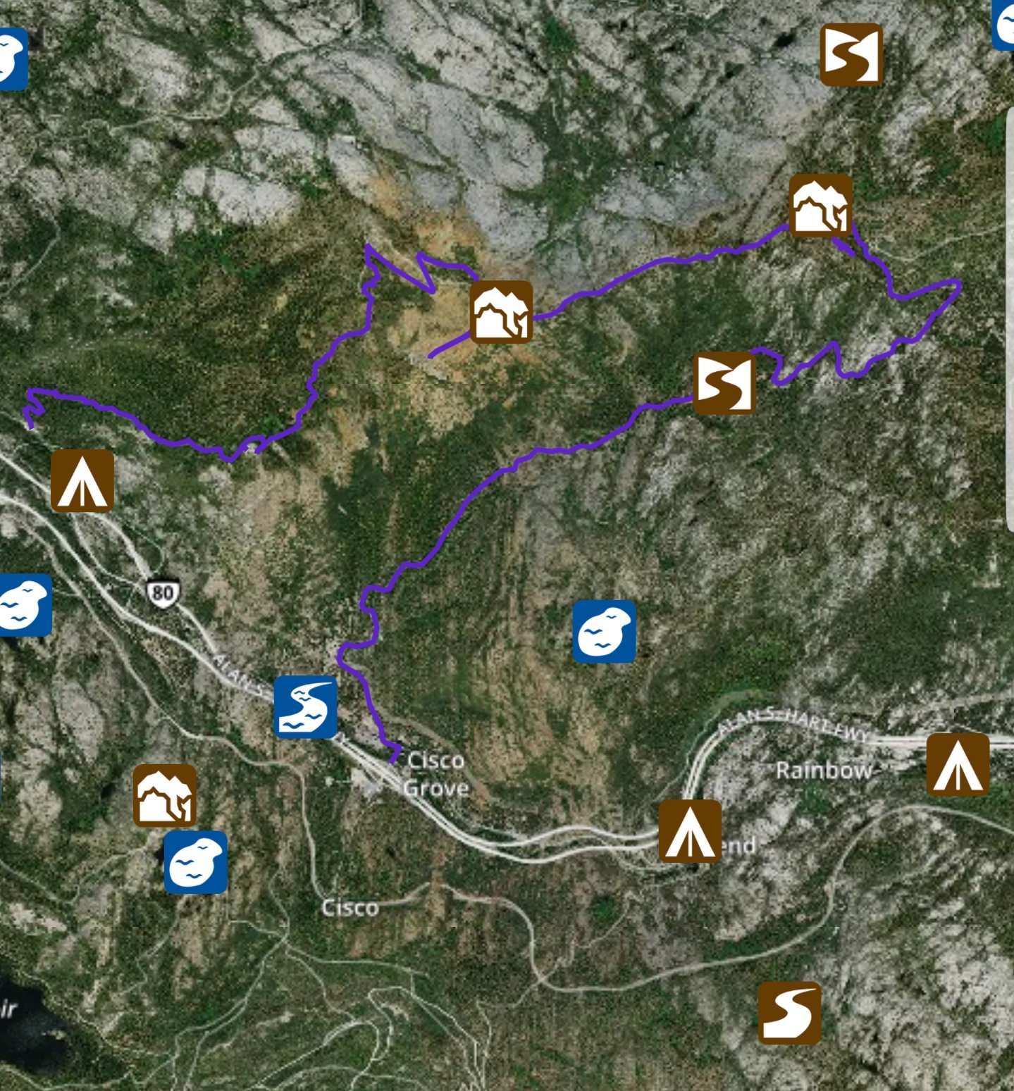
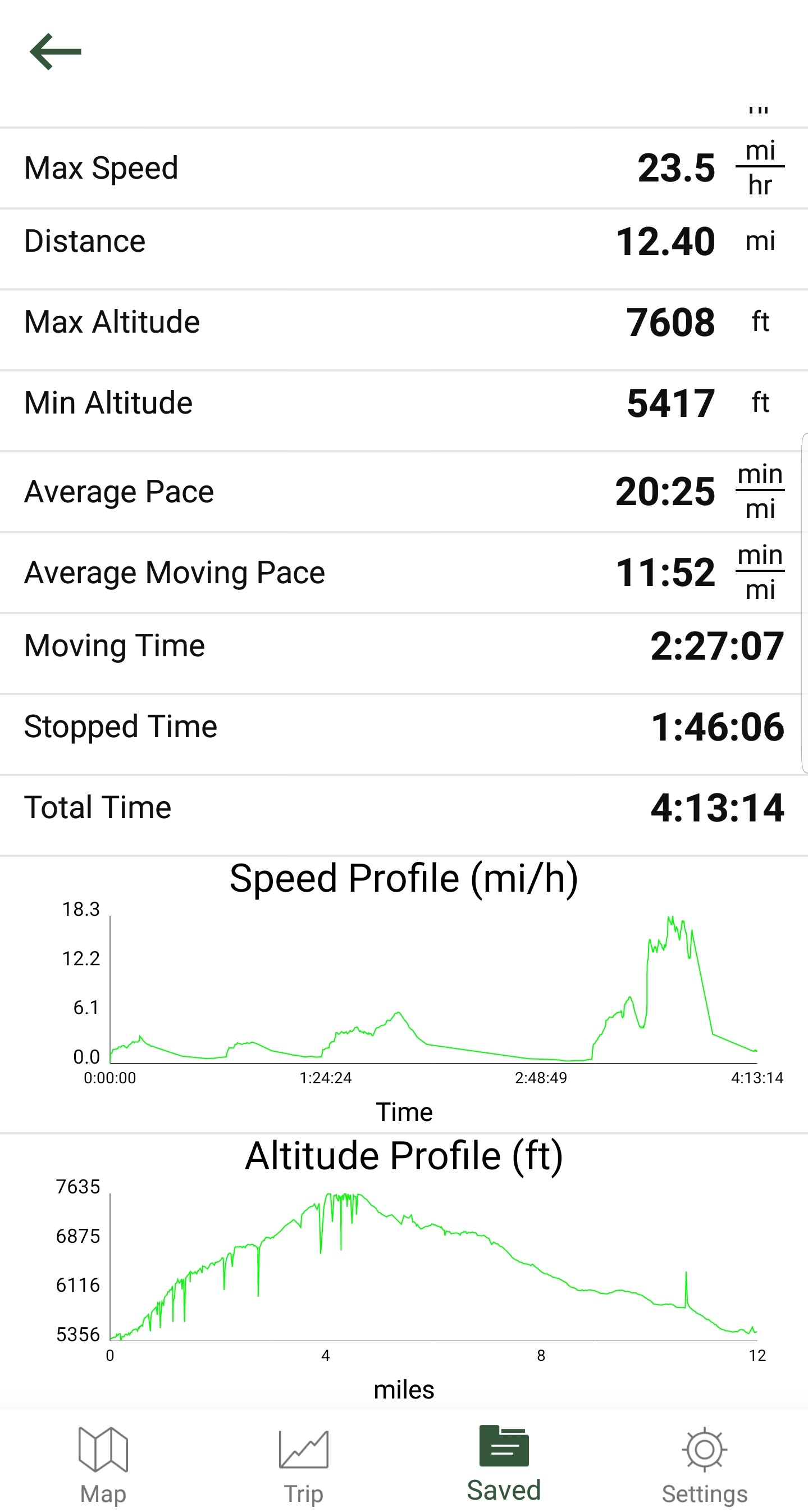
Shayn, his dad, Dean, and I hit up Signal Peak Trail today. GPX Track for GAIA or other GPS app. For those familiar with the trail, we ran it clockwise.
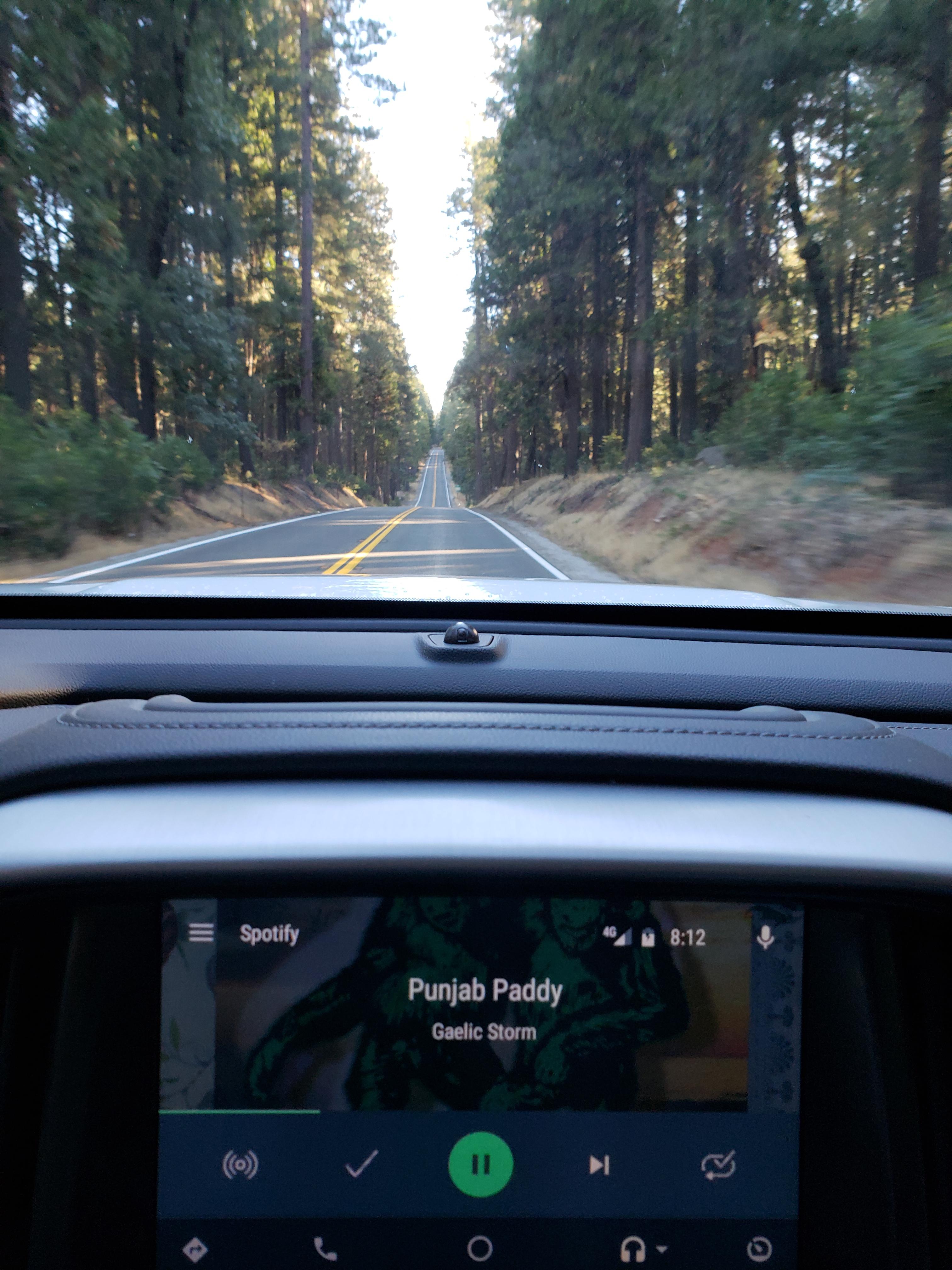
I was pretty beat after a whirlwind trip to Mammoth Lakes and not getting home until midnight last night. I didn't want to back out and look like a flake after previously saying I'd go so I unloaded the truck, washed the bugs off the windshield, threw some off-road gear in the back seat and off I went.
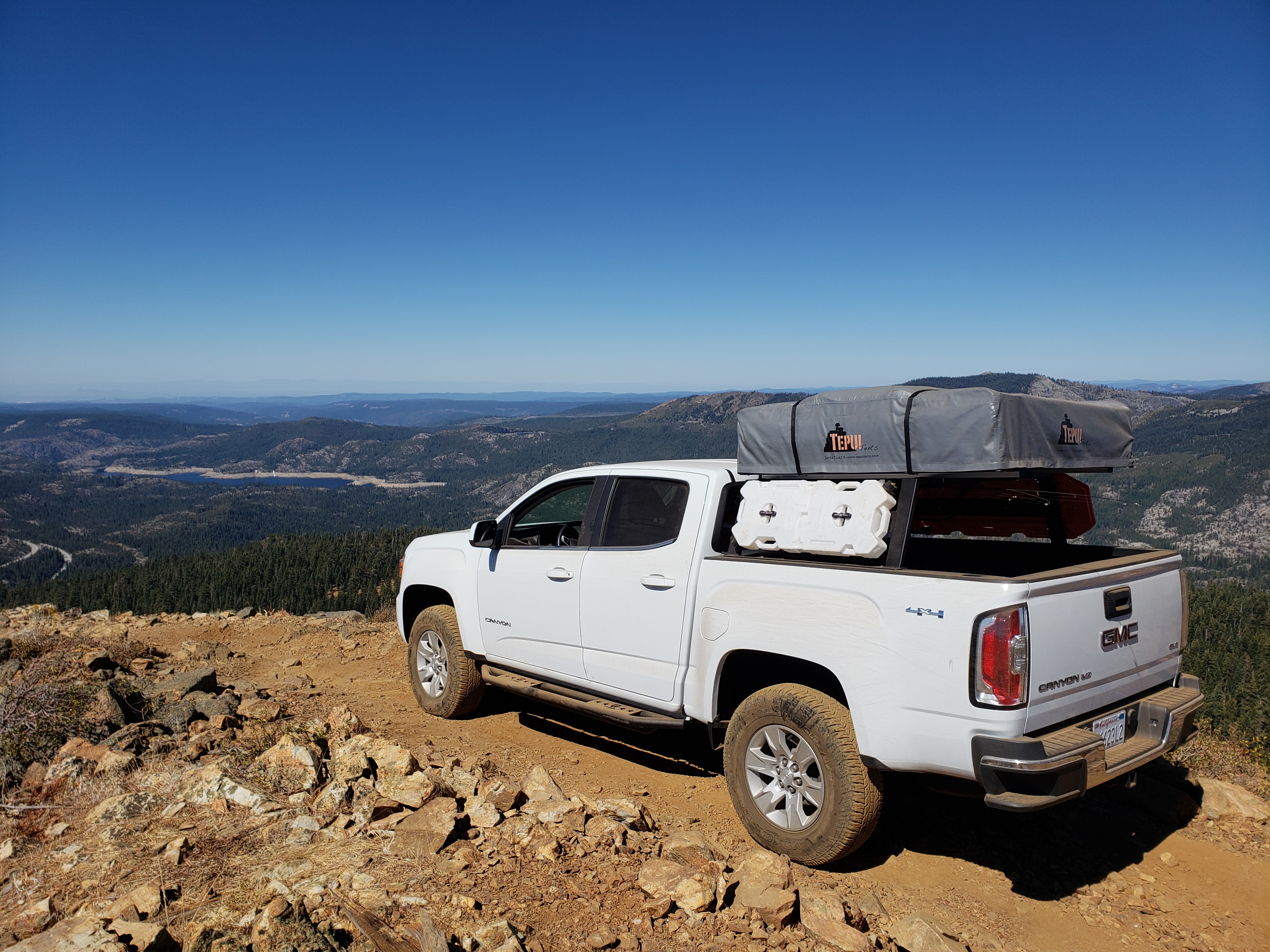
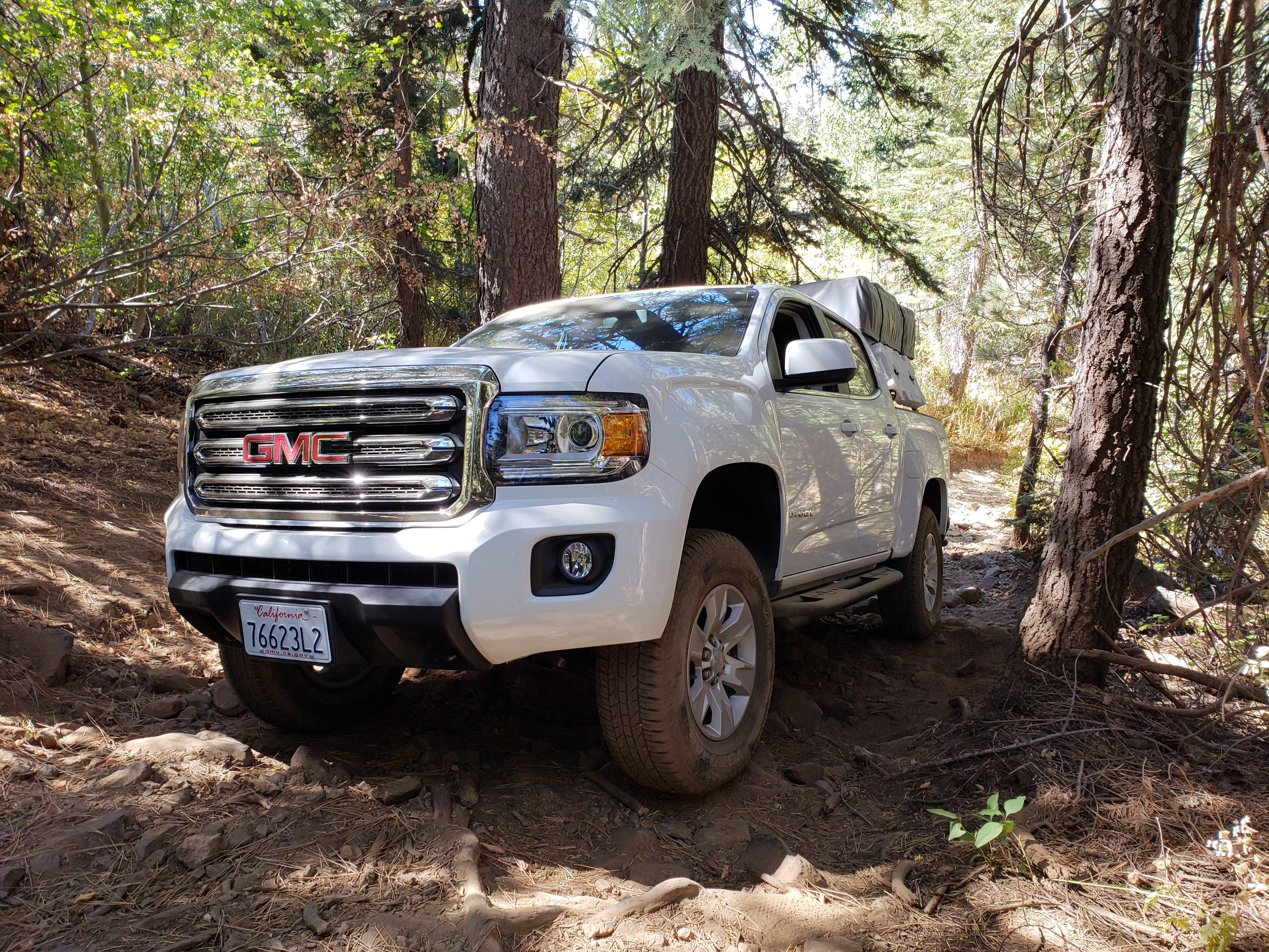
I met up with Shayn and Dean at the Eagle Lakes Road exit and we headed off to the trailhead where we proceeded to air down and talk mods for a bit. For some reason I thought his truck was a long bed.... Instead, he has a white short bed crew cab SLE Canyon model just like mine. He was smart and removed his rack and RTT before this trip.
So off we go looking like twins. lol I tagged my Tyger step bar (not a true slider) on the driver's side going over the very first obstacle and thought well, this is going to be fun, what am I going to break on this run?
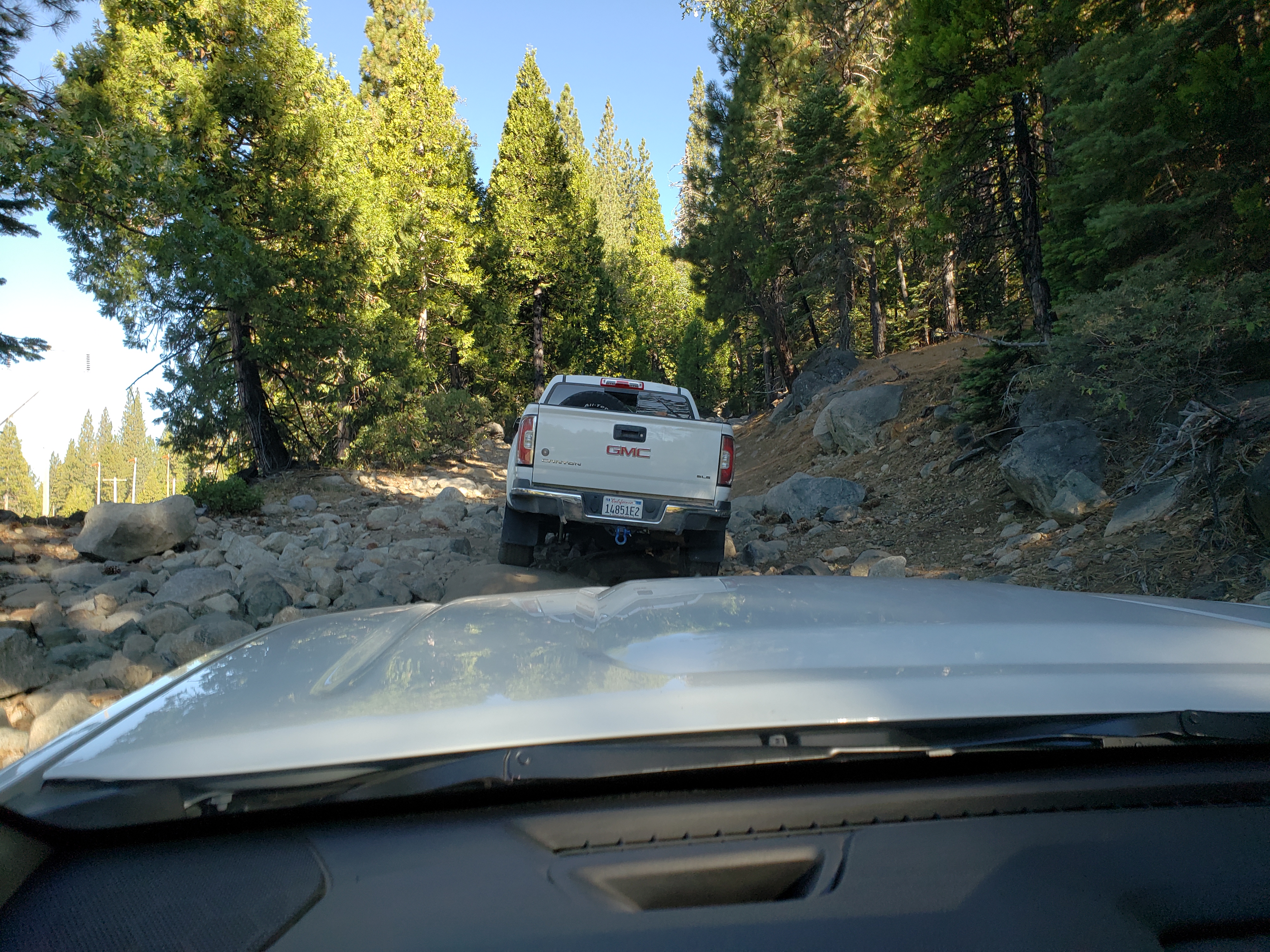
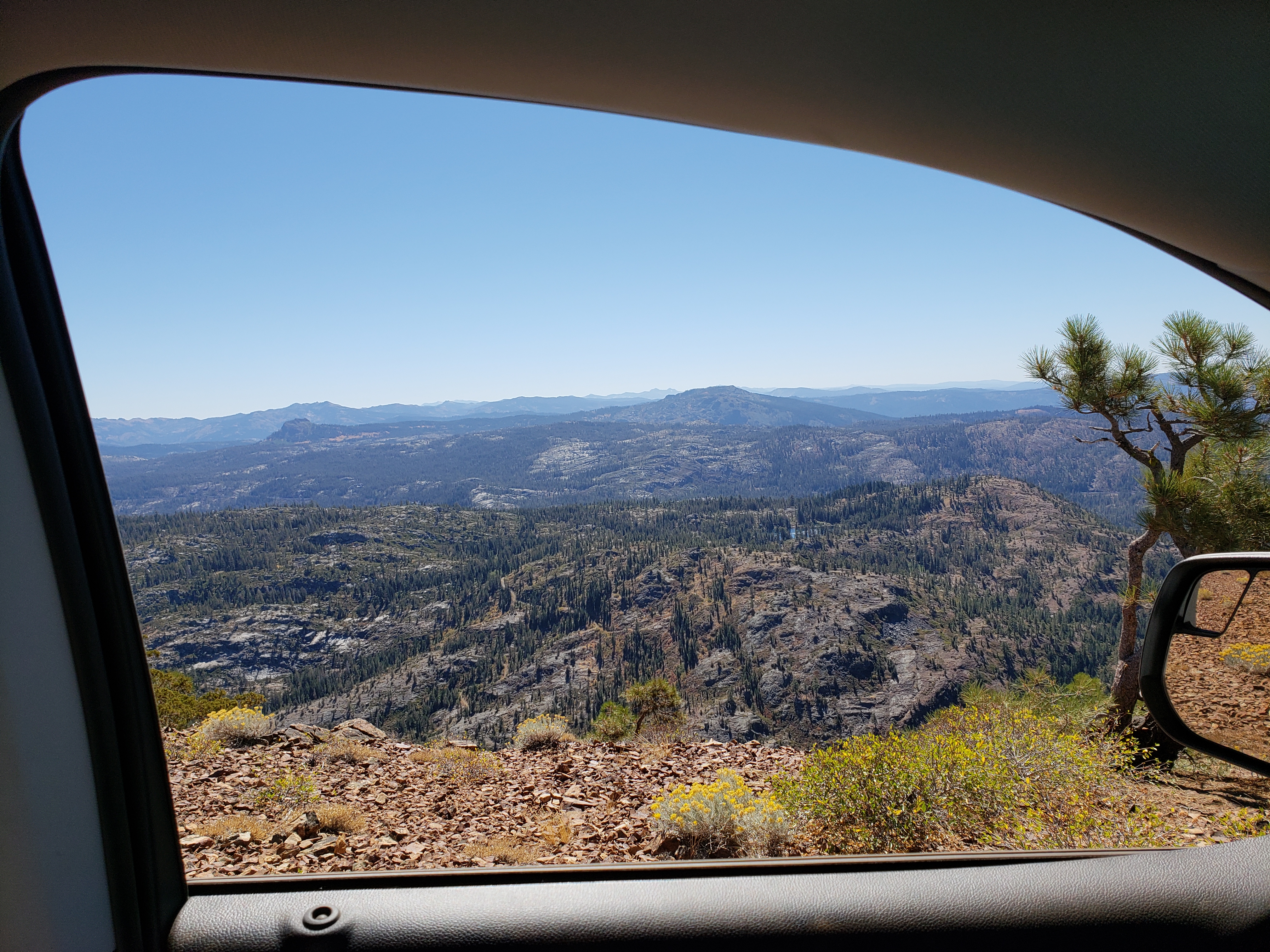
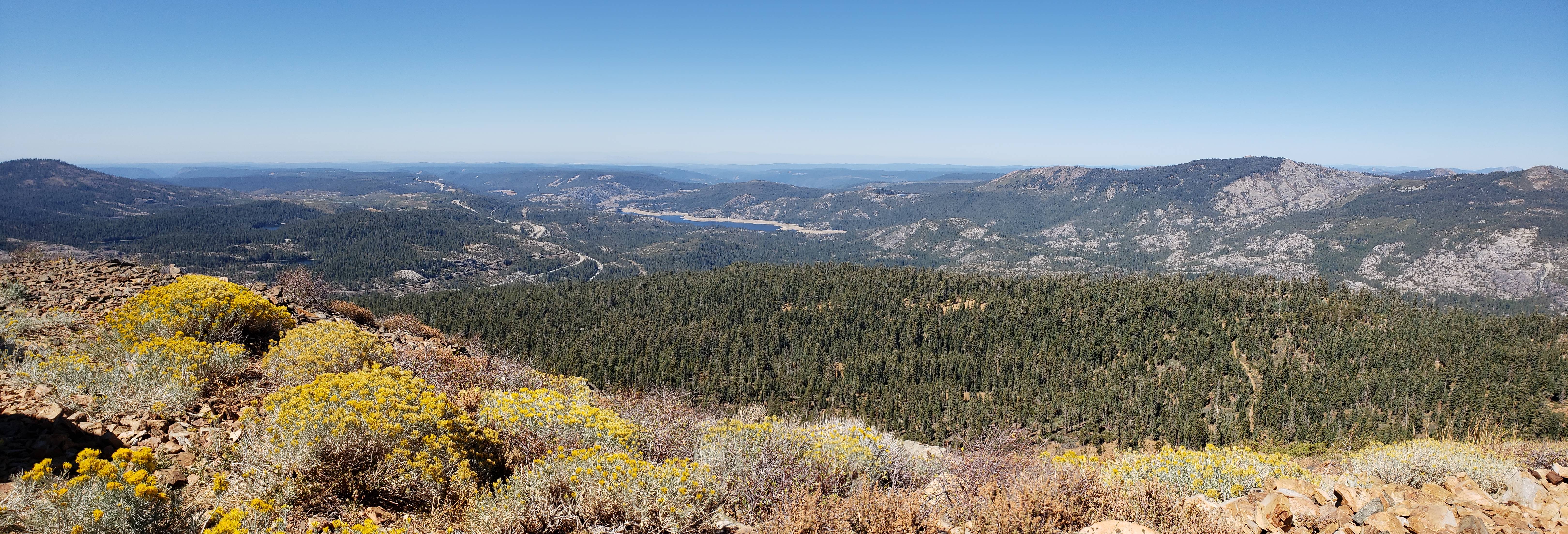
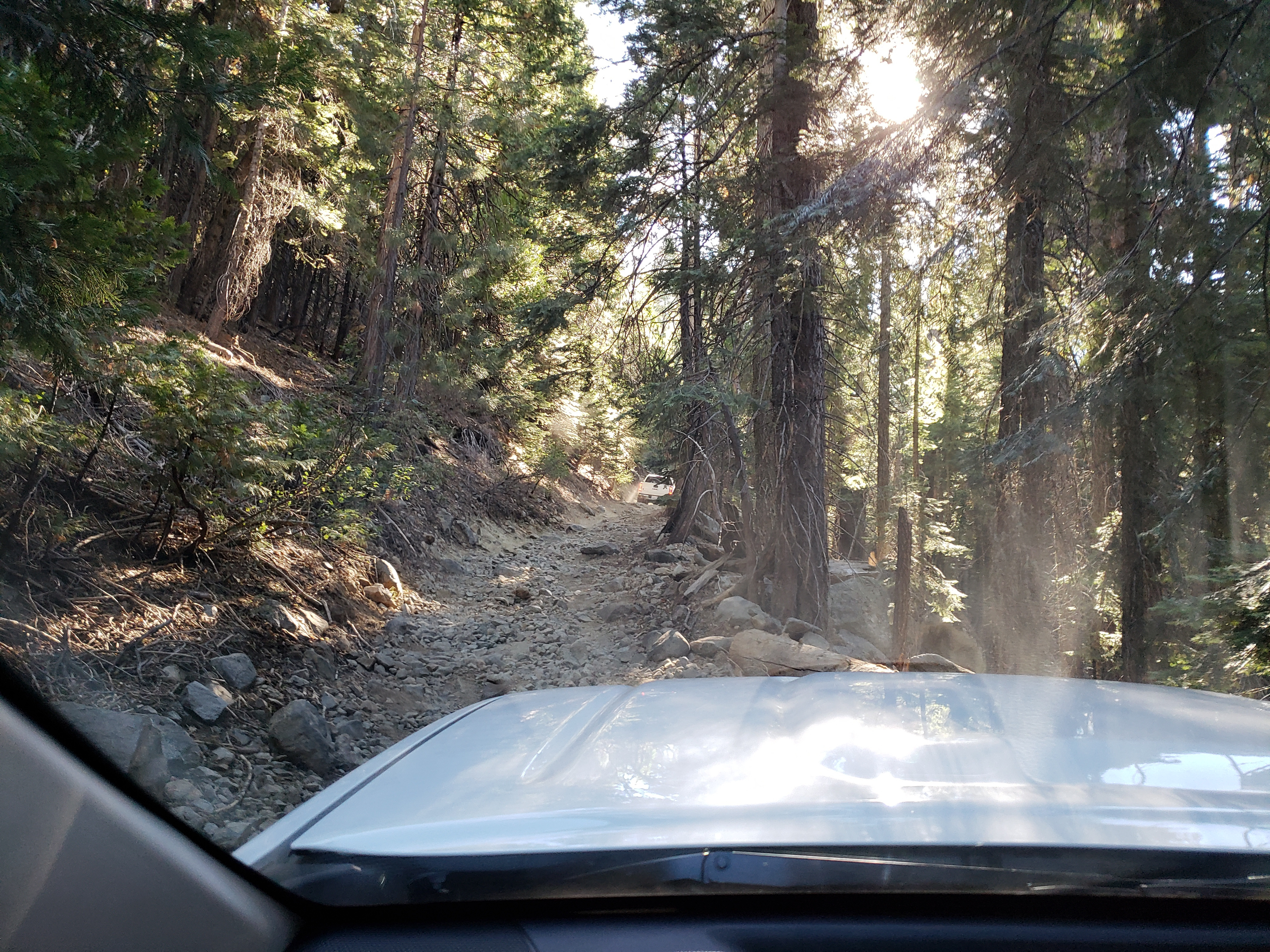
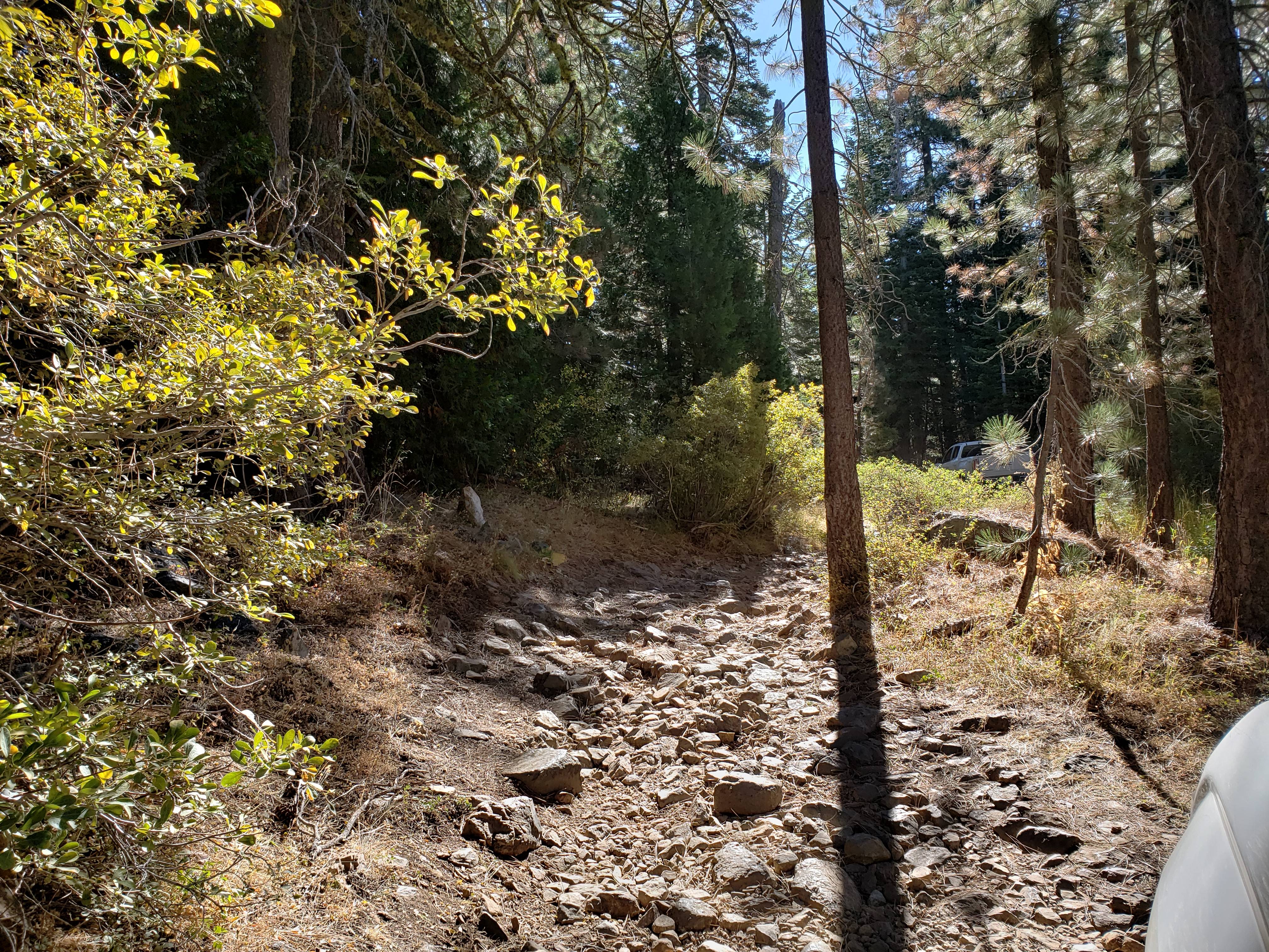
The first section was pretty mild. The trail was essentially rock cobbles for much of the way.
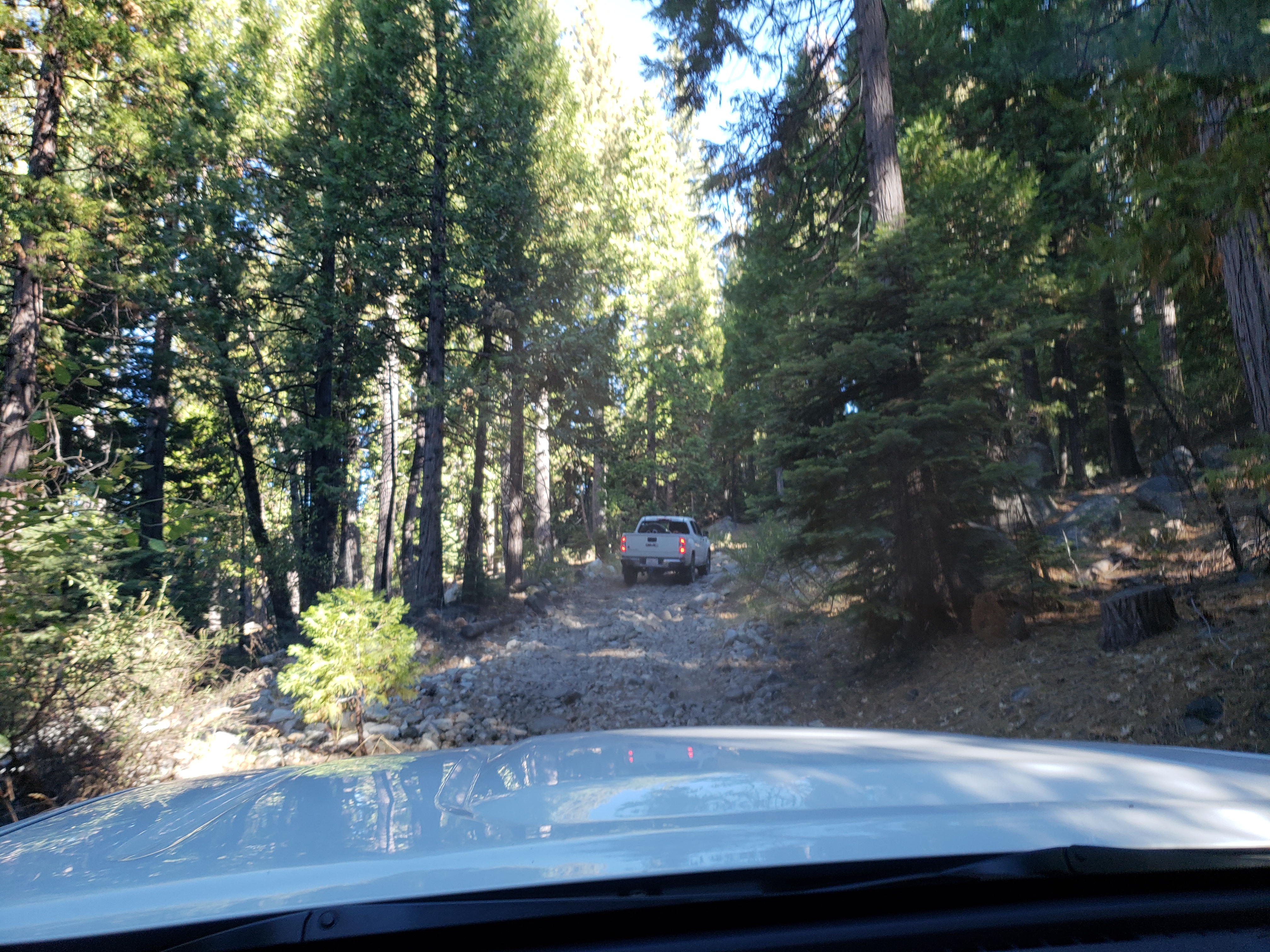
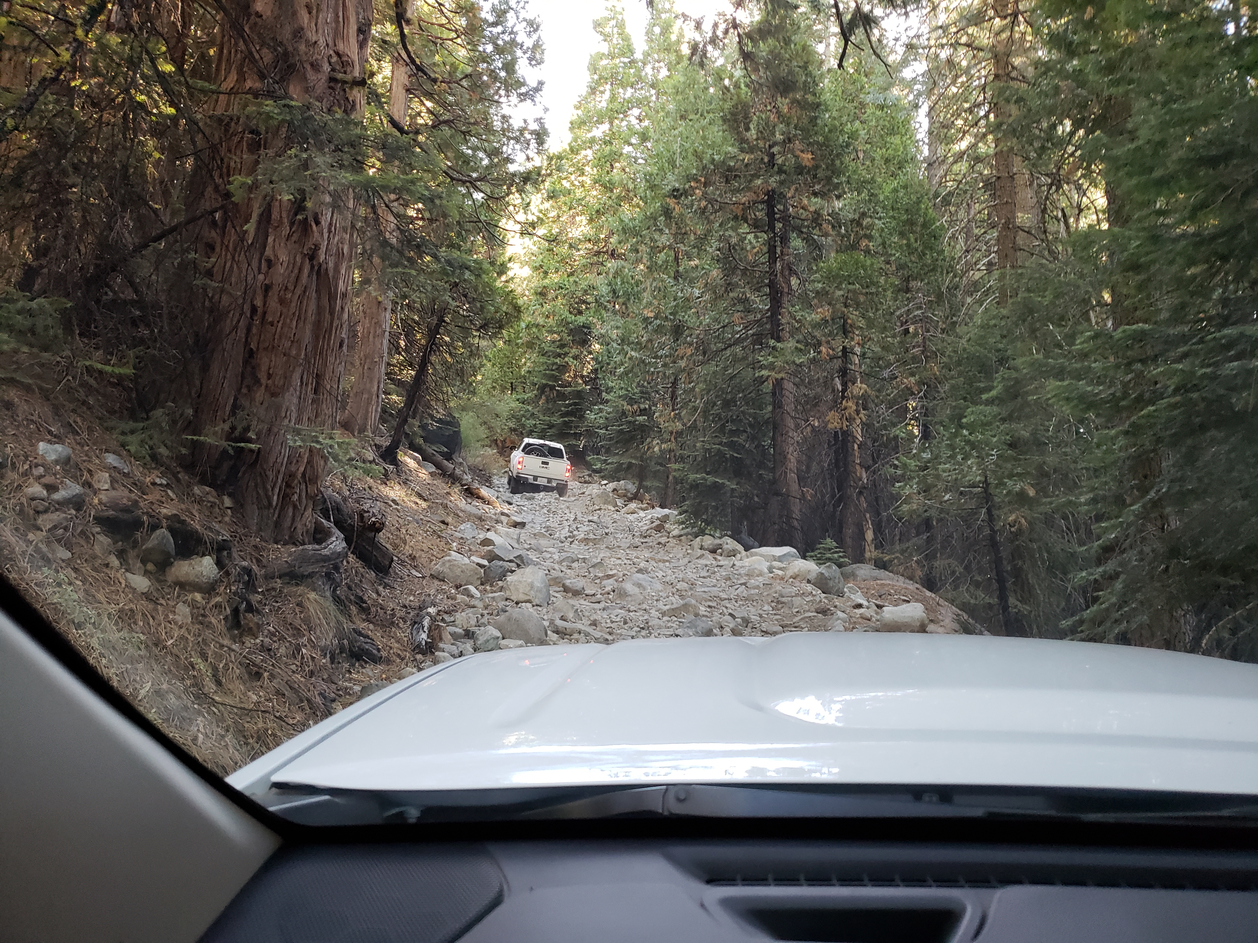
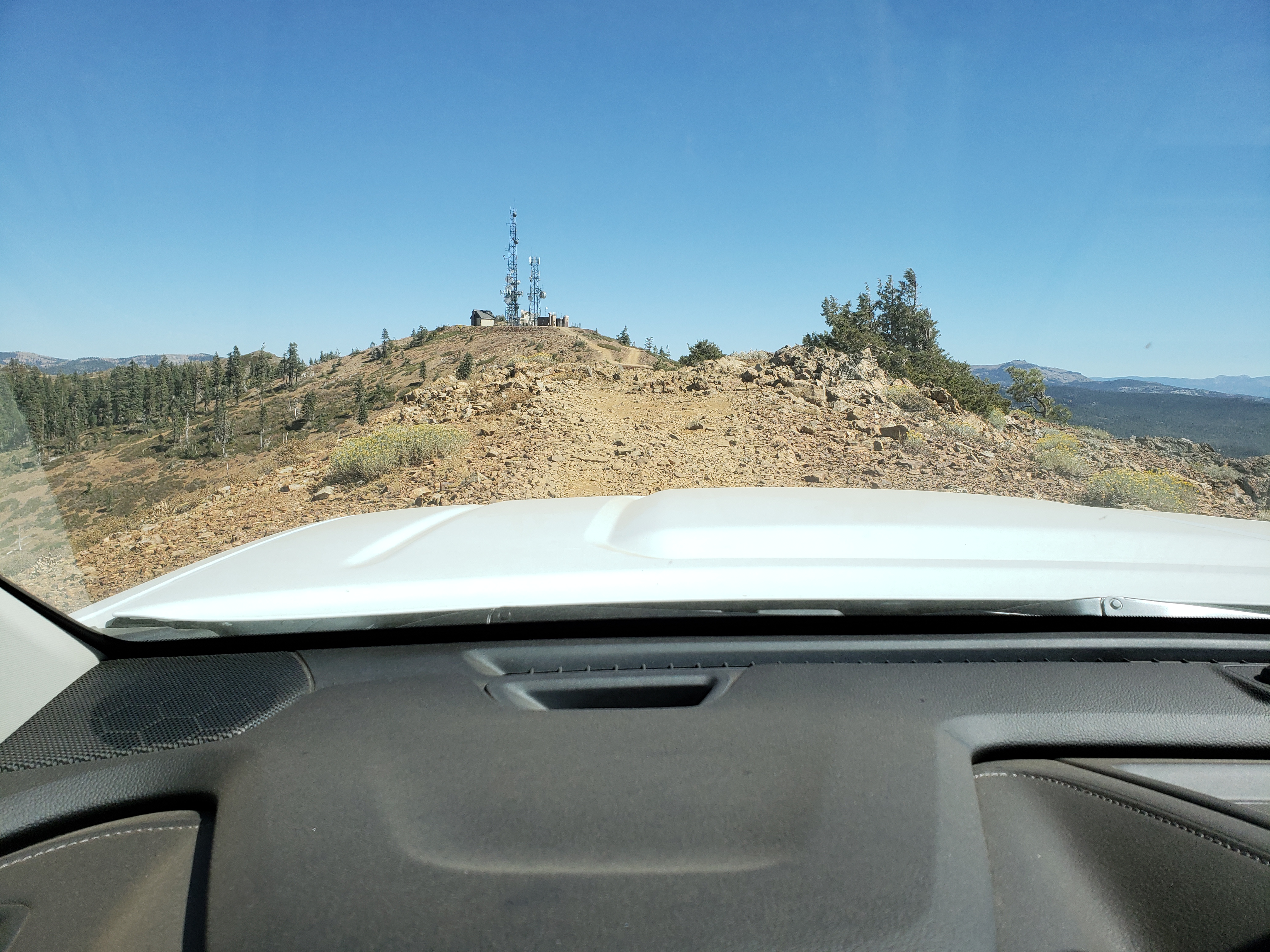
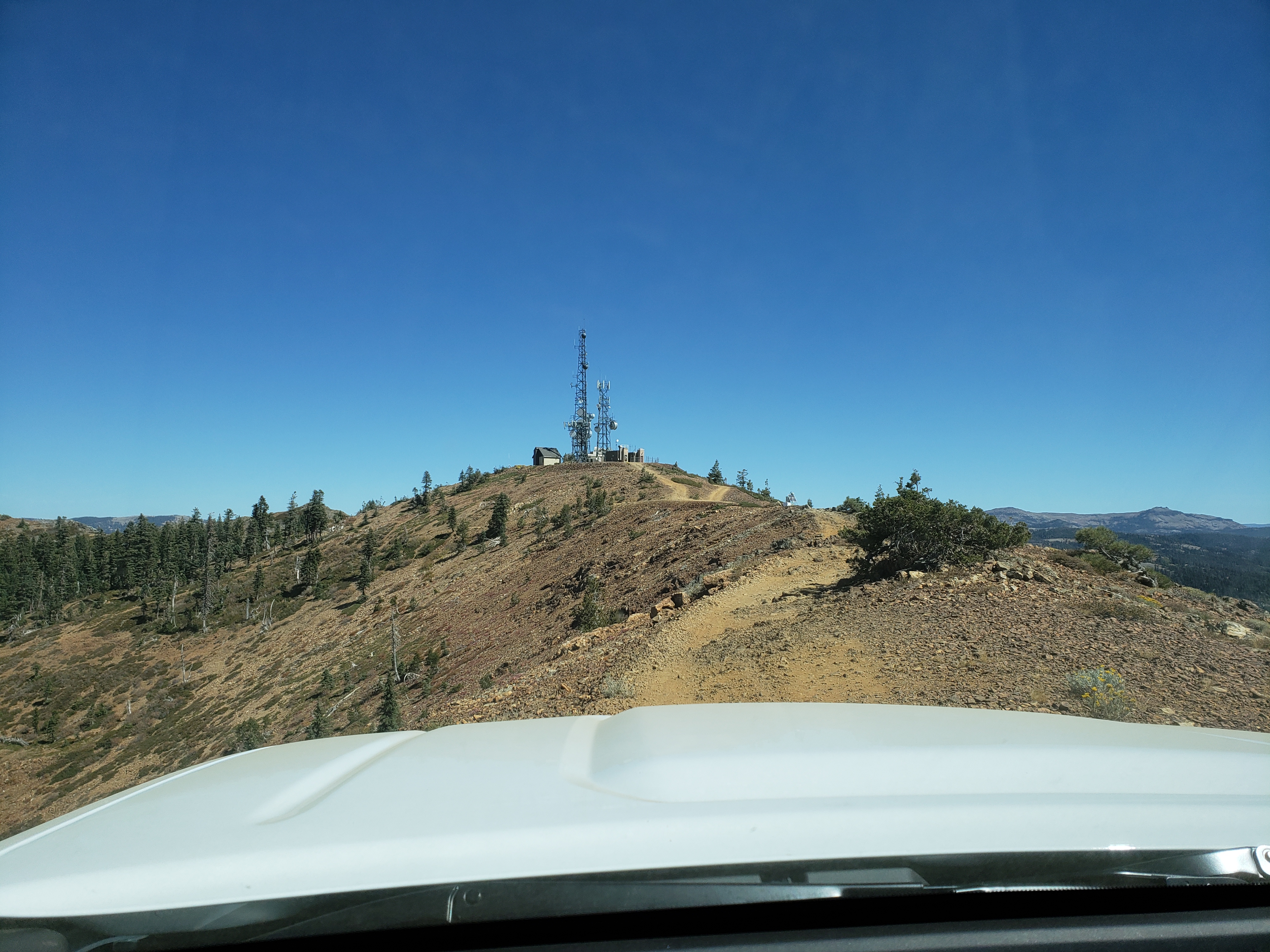
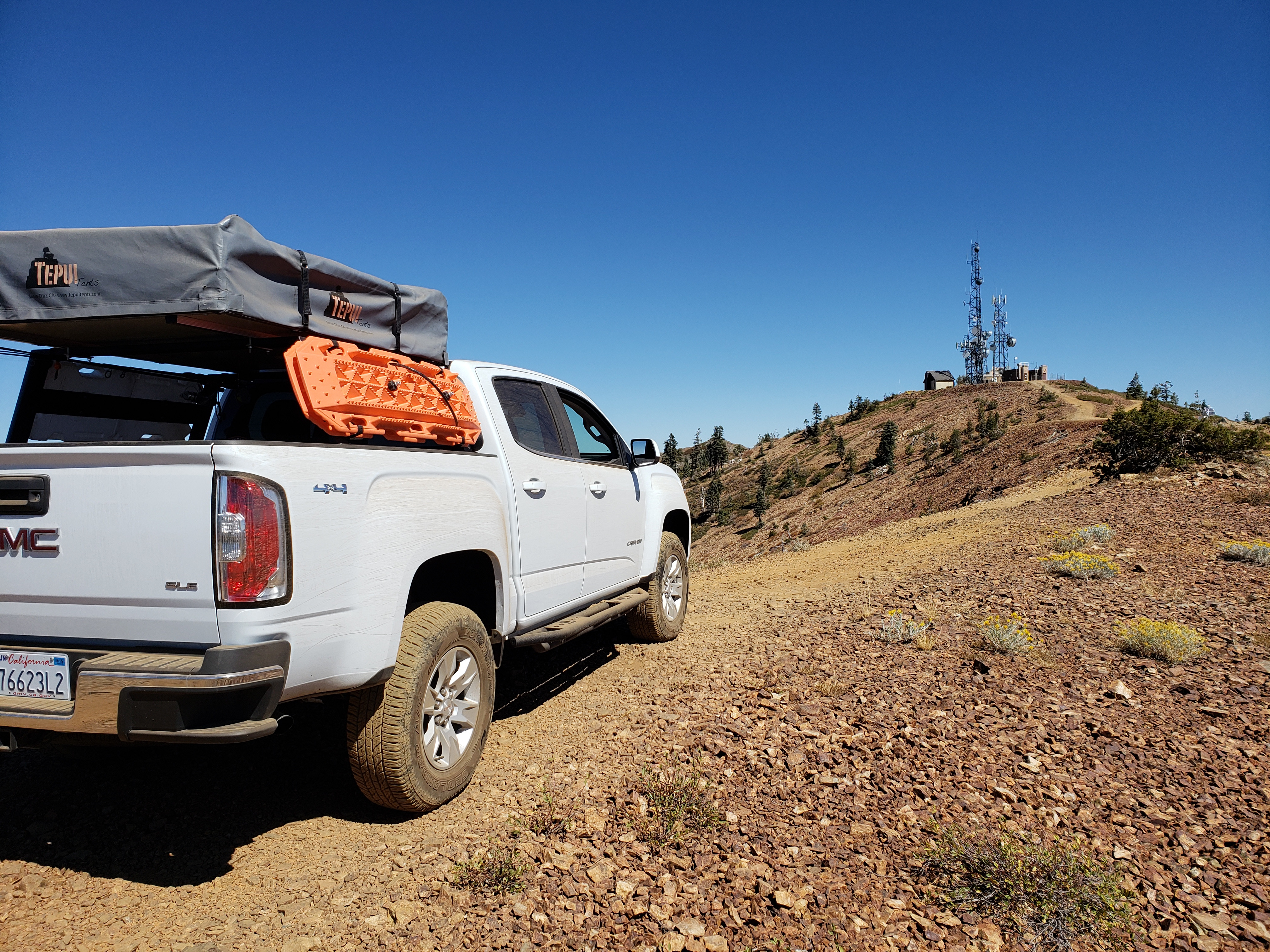
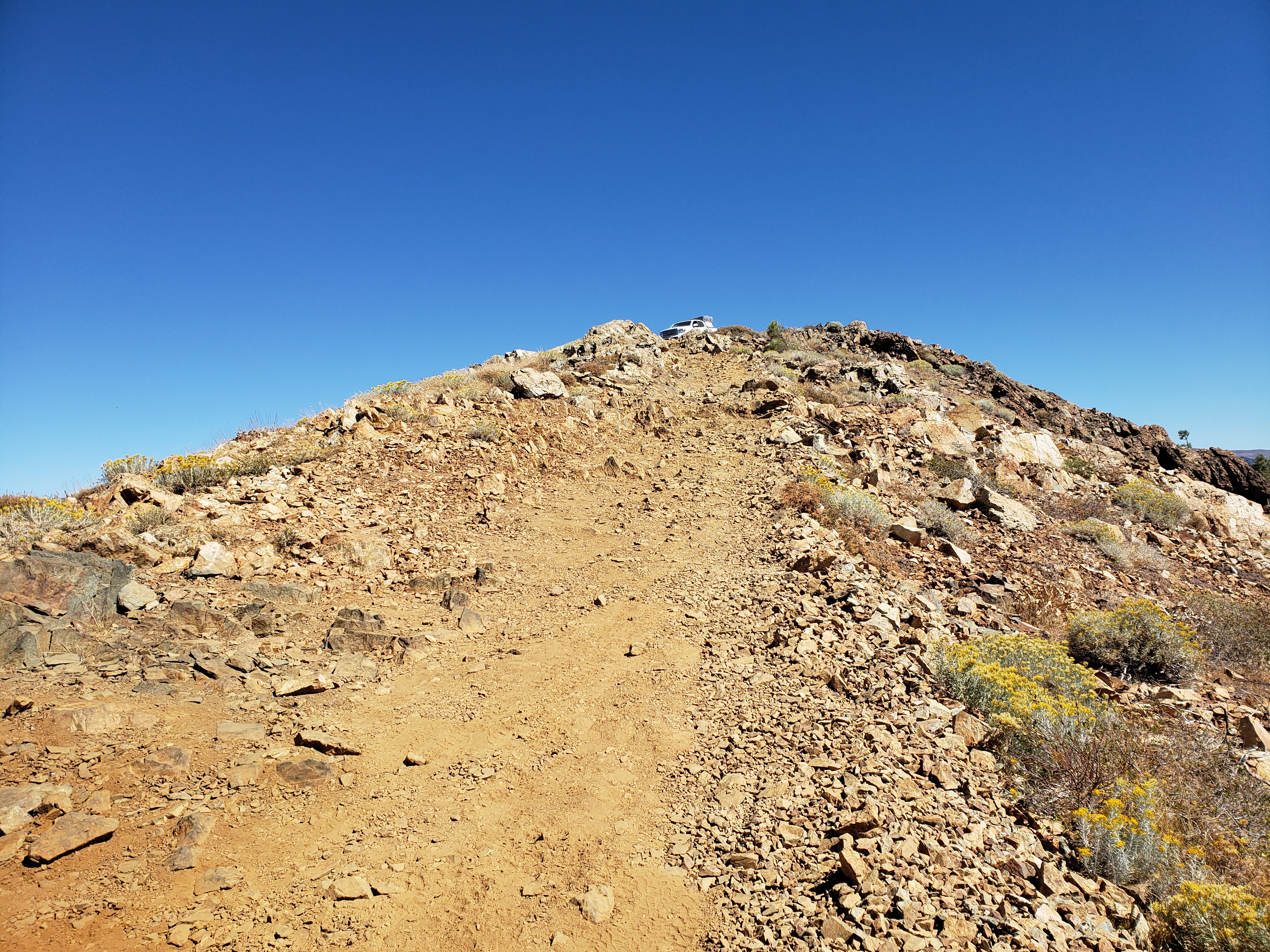
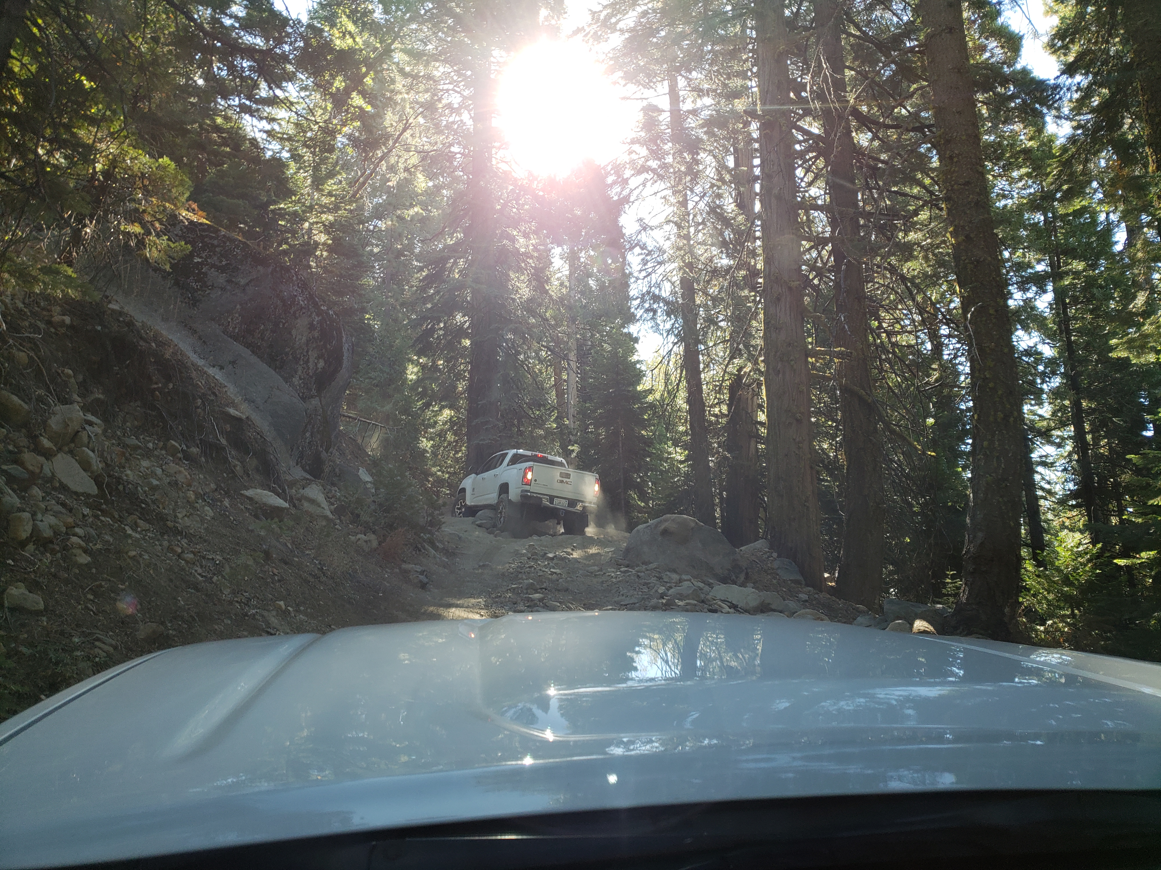
The trail started to get more narrow and steep.
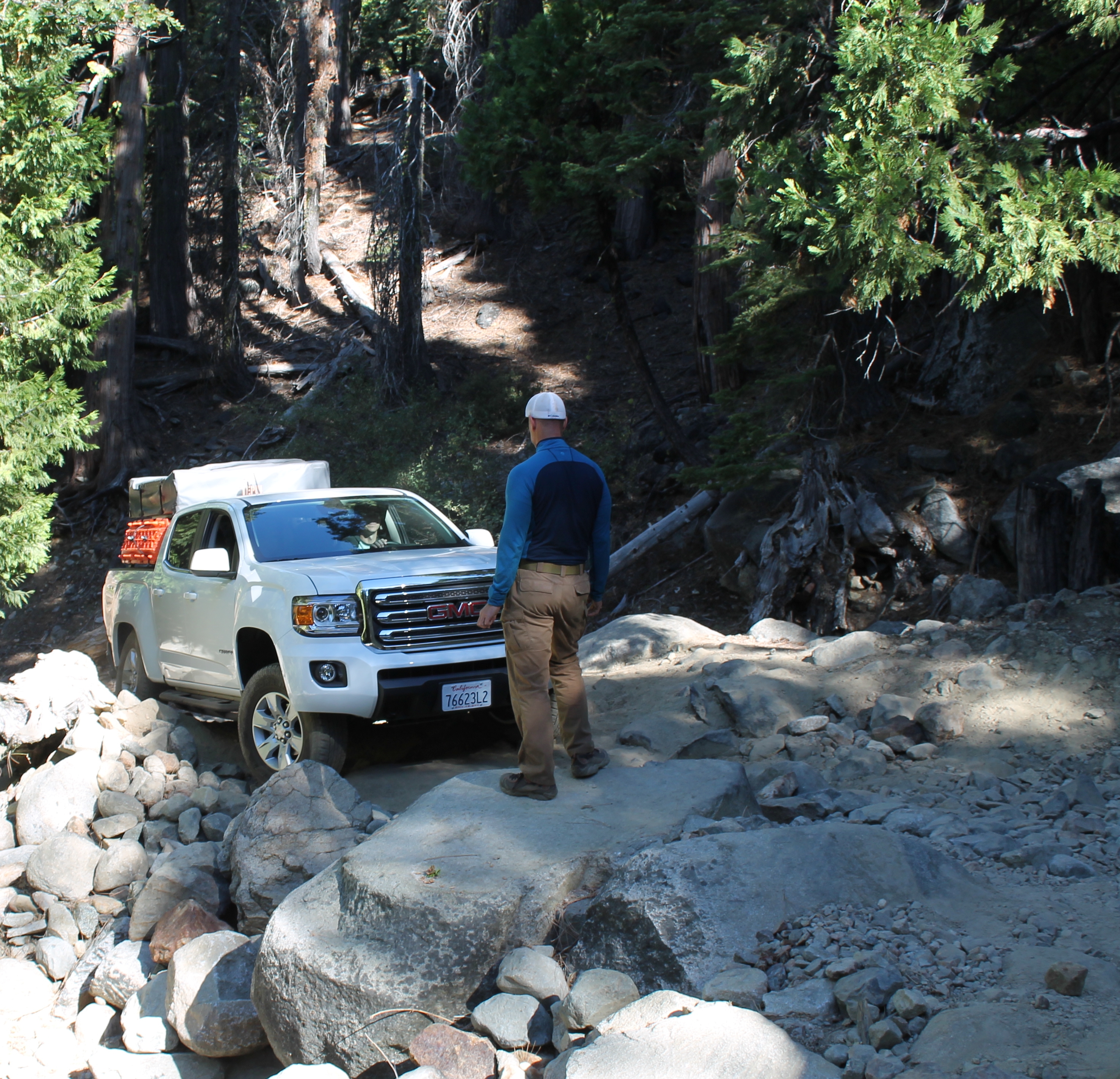
And then...... THE rocks
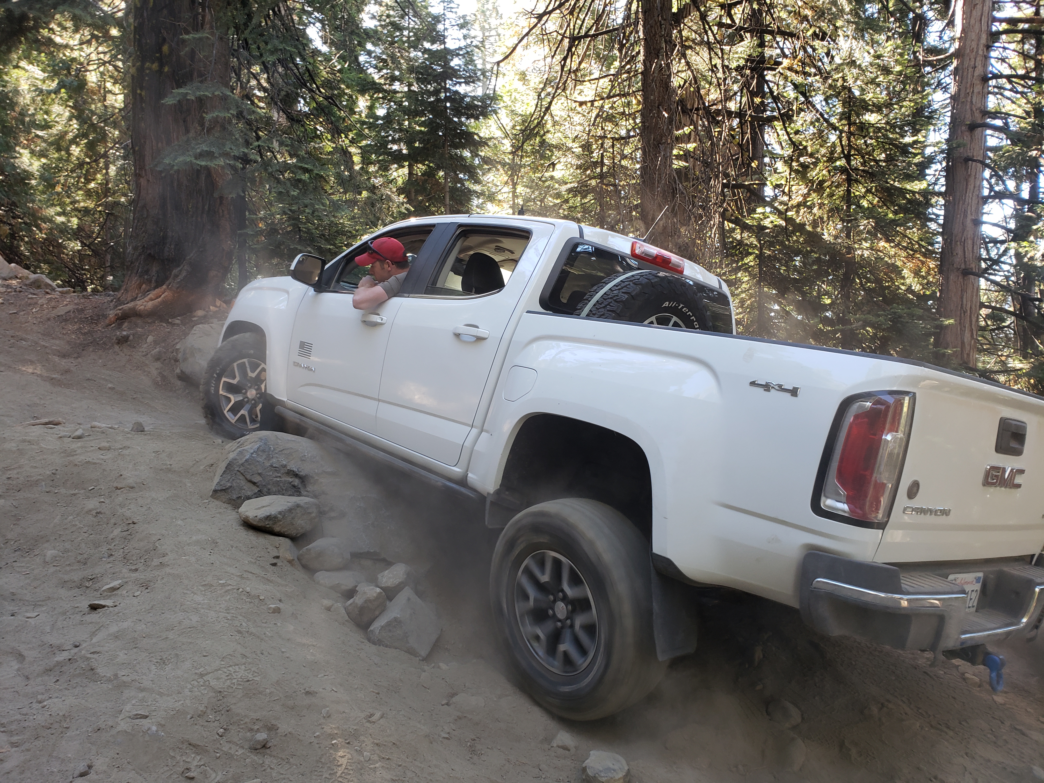
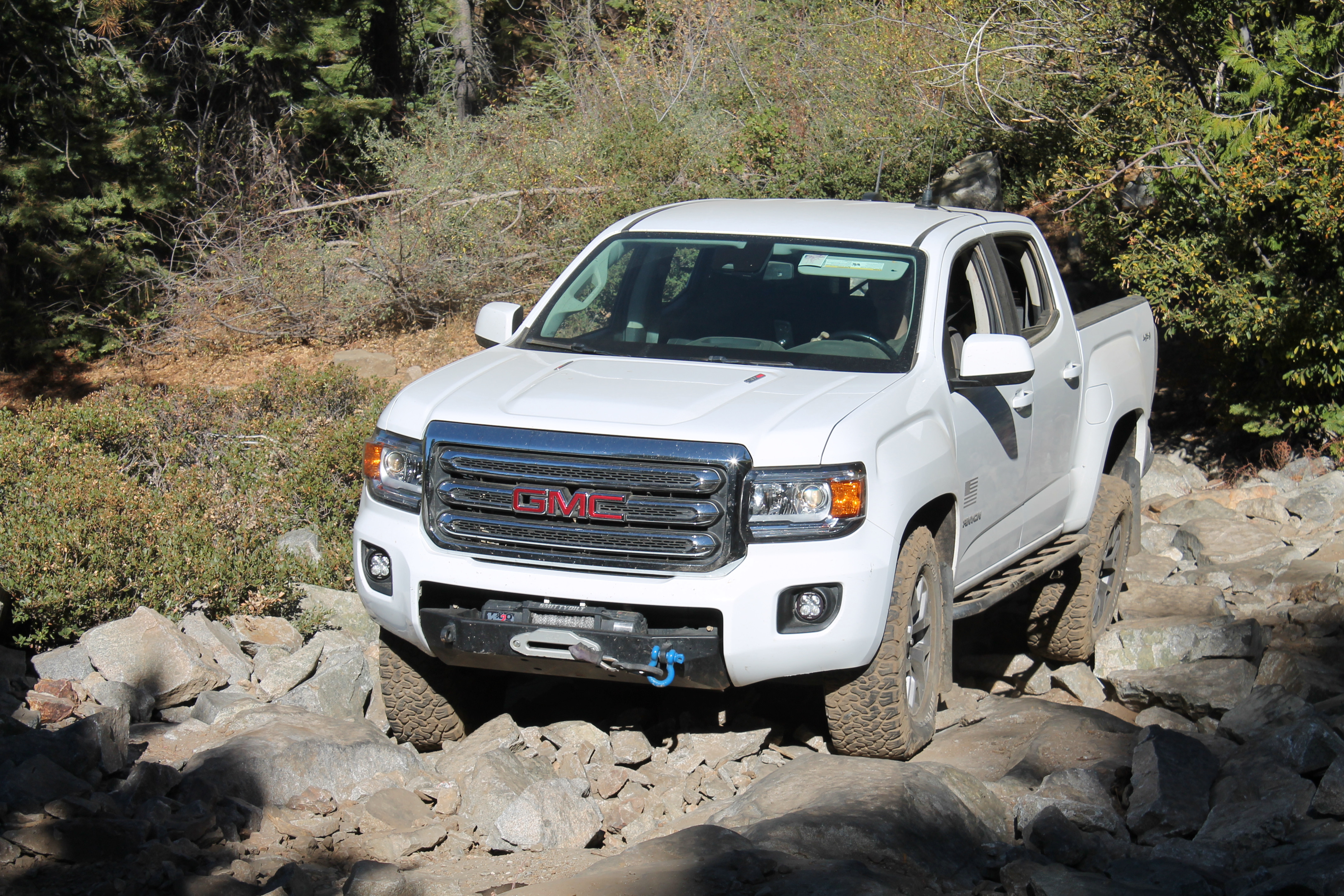
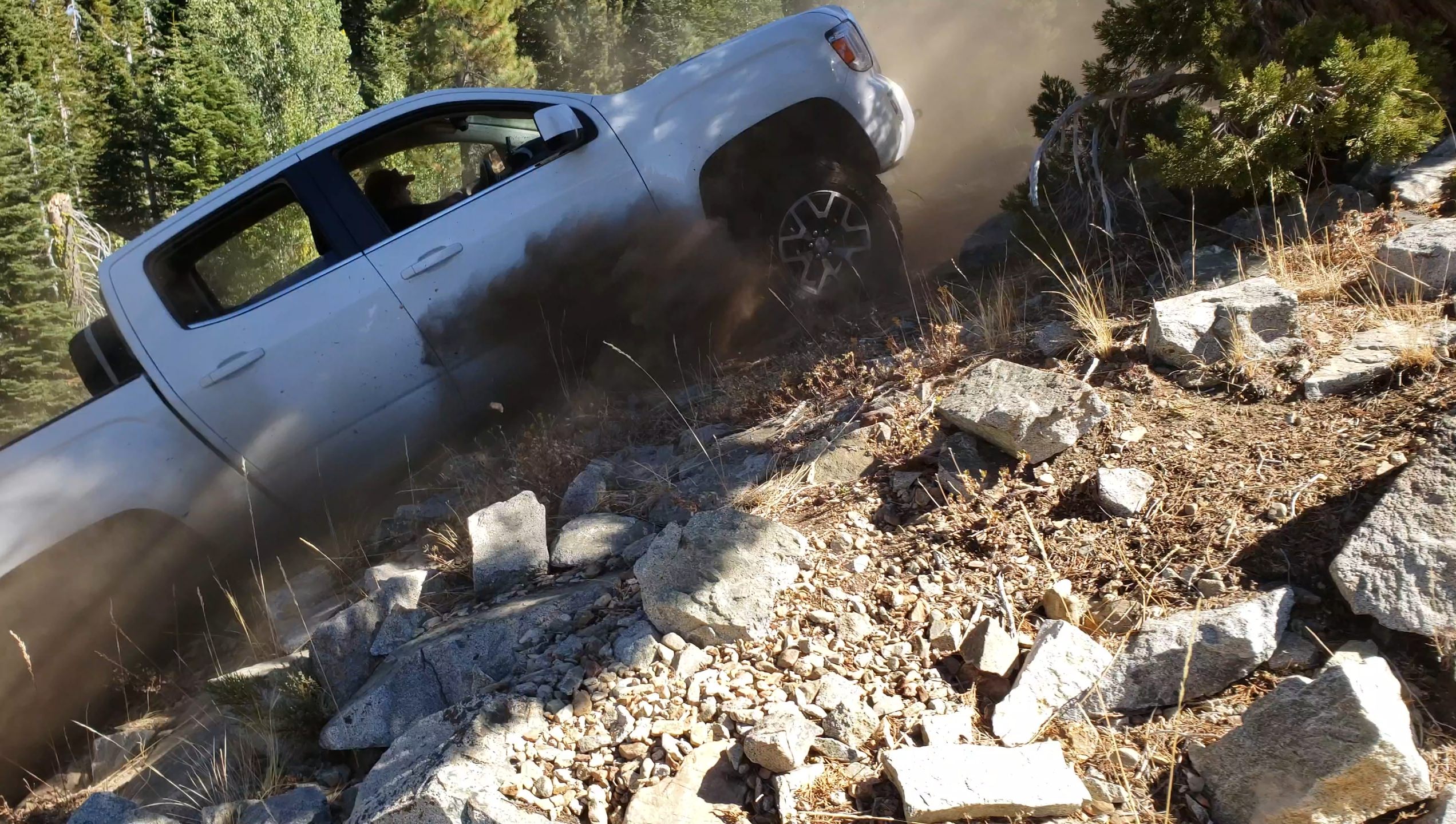
I saw these rocks on a couple of Youtube videos and their positioning and size makes them difficult to get around without damaging the vehicle or without a lot of armor. What you can't see in this photo is a big boulder on his passenger side which restricts your angle of attack. Dean jumped out and started moving some of the smaller rocks around for us then spotted for Shayn. With a couple of tries and a bit of sliding his Canyon made it through just fine. I'll tell ya, after seeing his truck slide around on this big rock I feared for the worst. With some great spotting I got up on the rock fairly quickly but getting over the rock without a front locker proved tough. I had to use some good old fashioned momentum to get over the top which isn't easy when starting off perched on the rock with an auto rear locker! I proceeded to slide towards the passenger side just enough to kiss the other boulder with my Tyger step bar. Lost some paint but no metal damage. #win
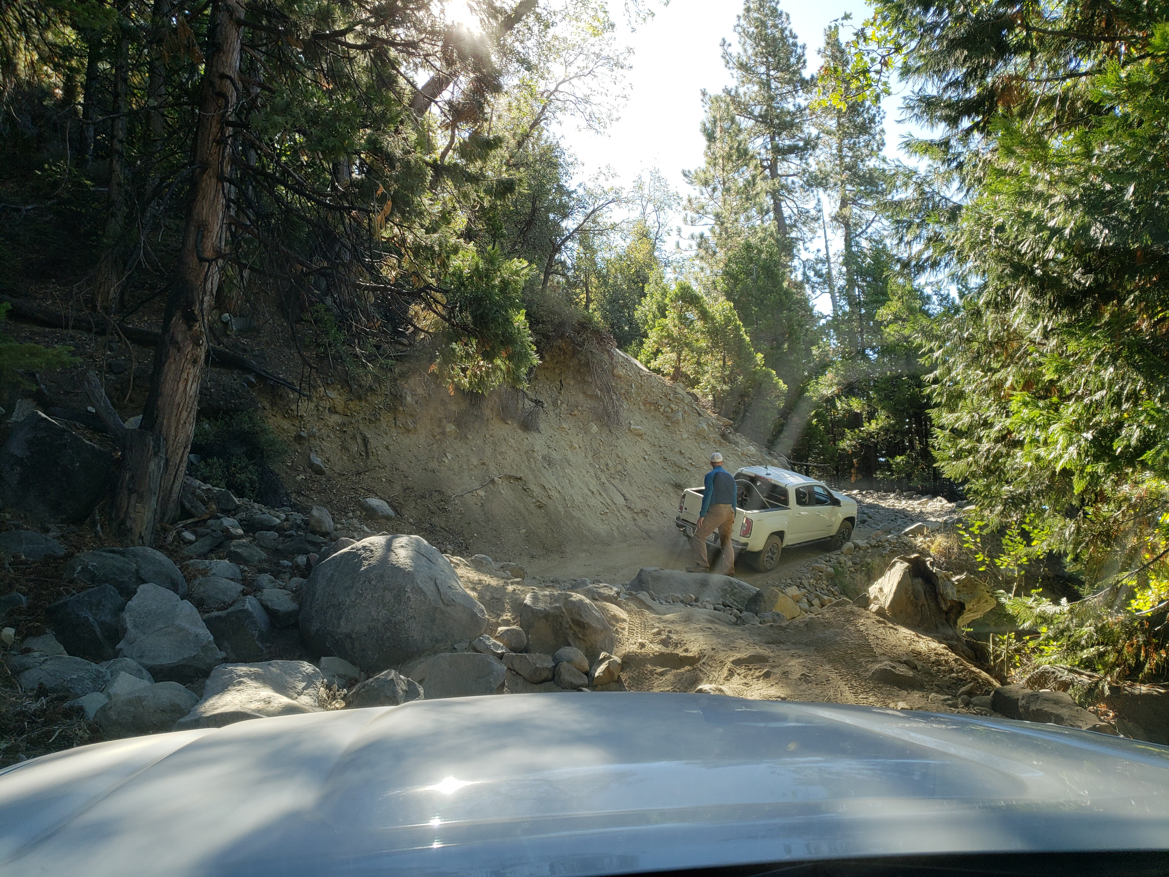
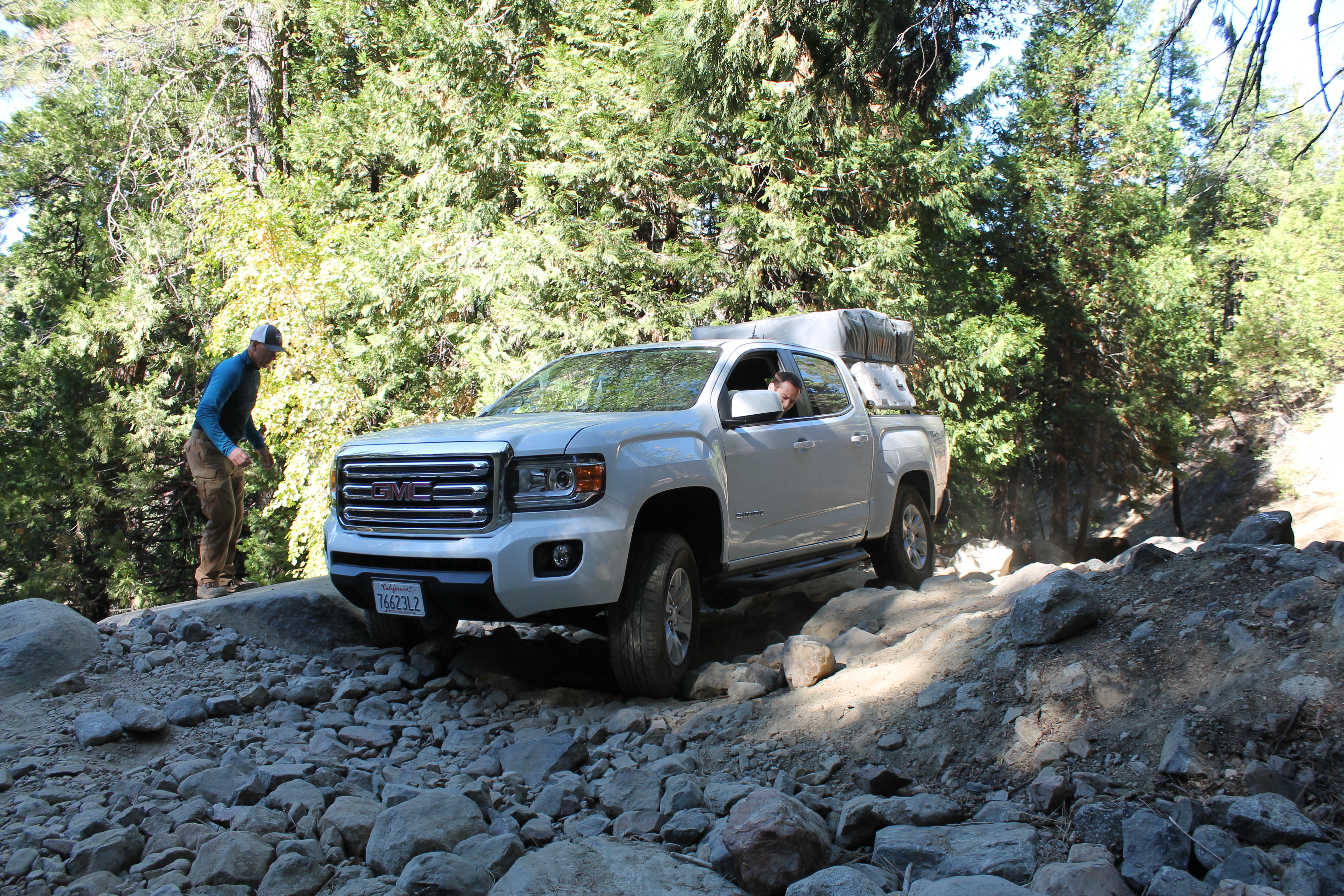
Then another "WTF am I supposed to do here" moment. I just watched Shayn go through but I was still at a loss. Dean got me through it without much trouble though. I did sit on the passenger side bar enough to cause the truck to rock up and down a bit at which point I fully expected the Tyger bar to break off but it didn't.
My turn
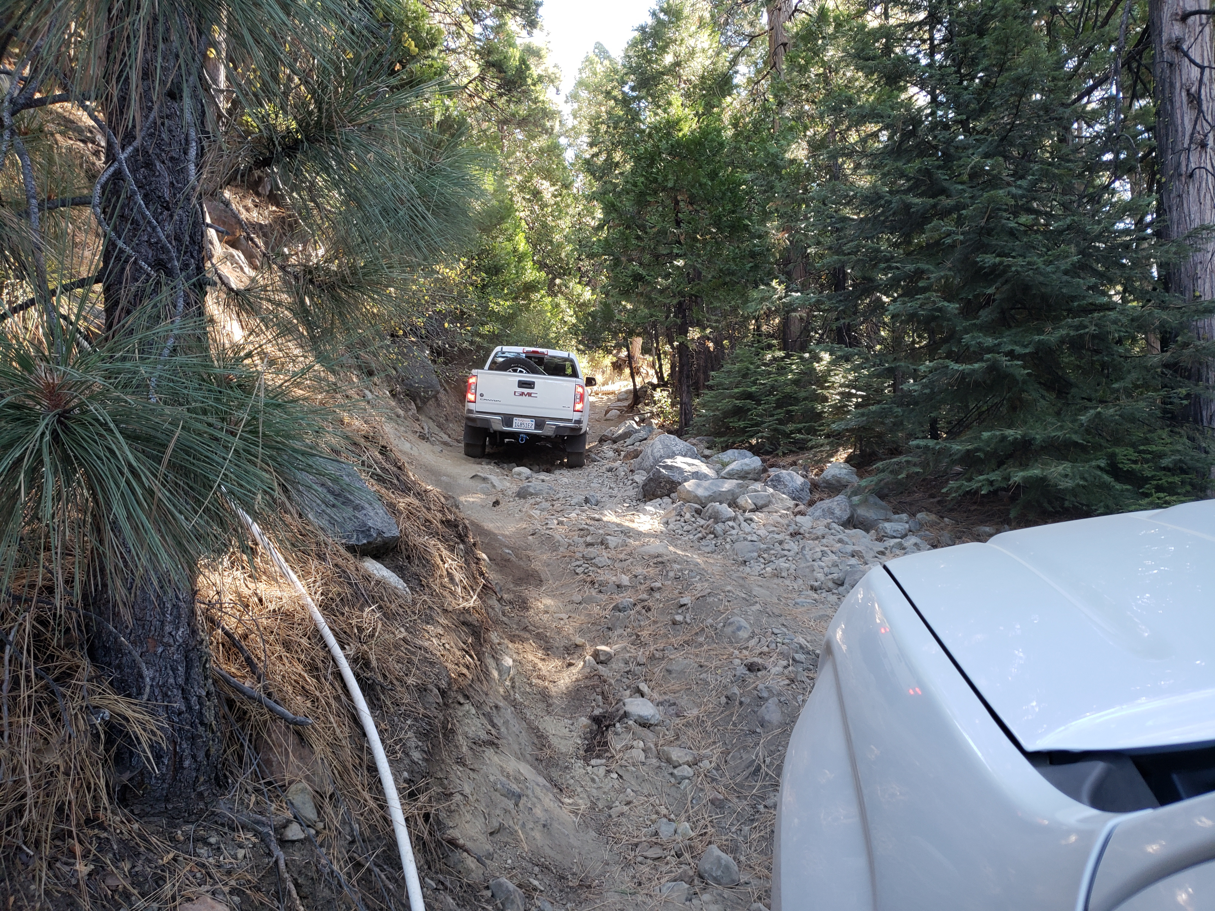
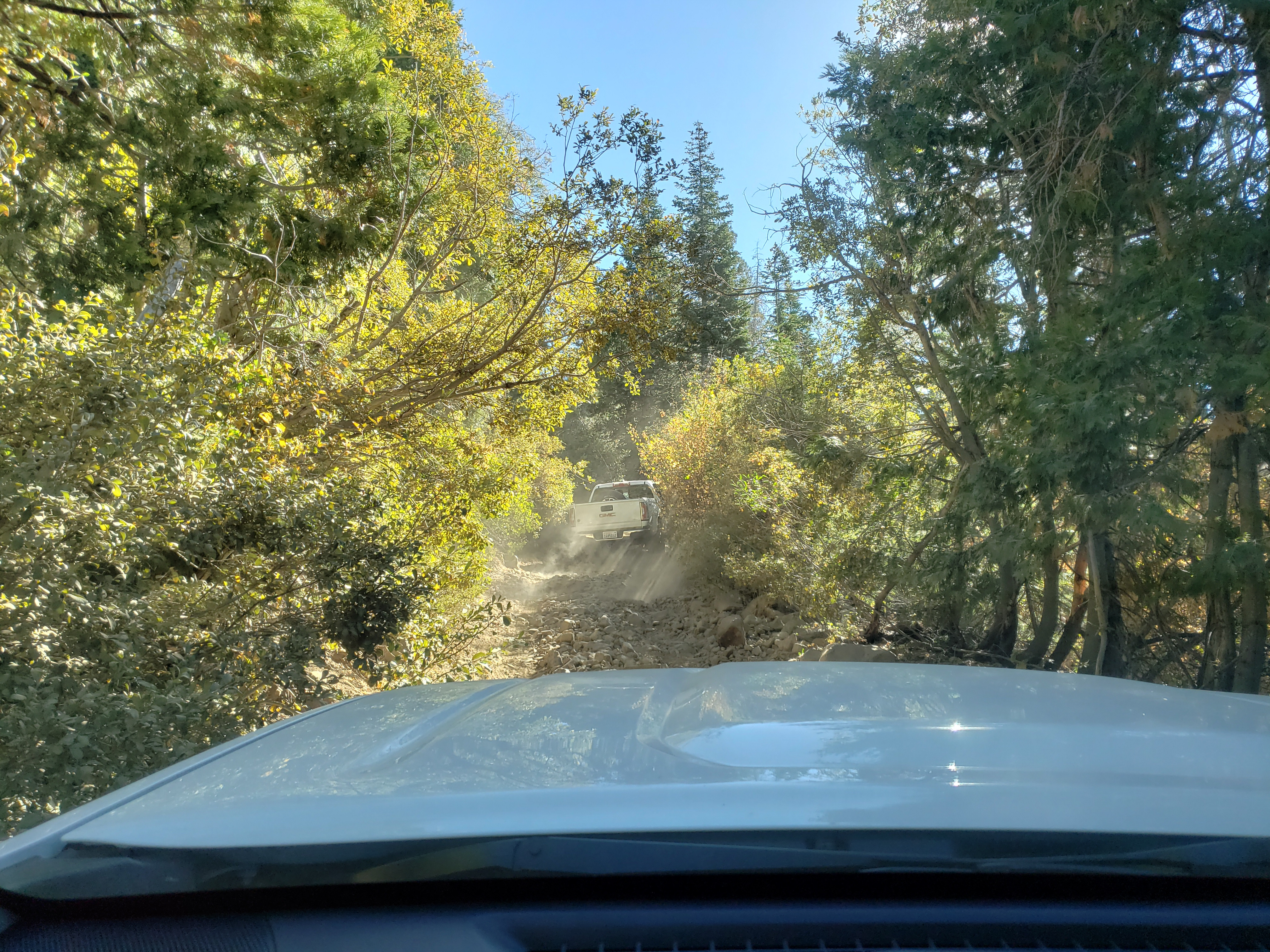
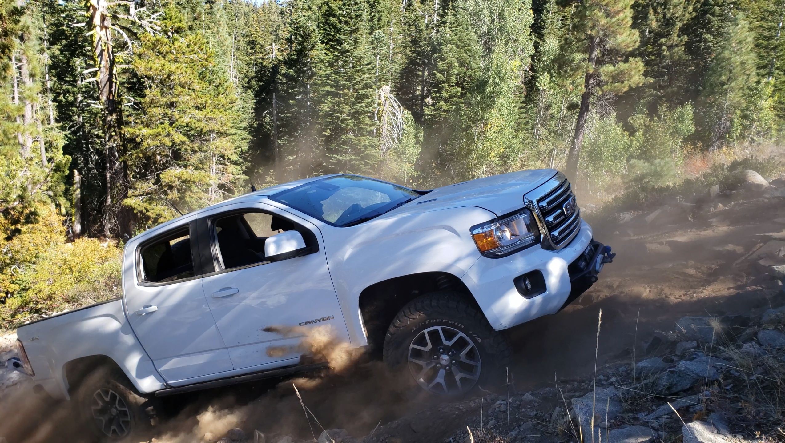
More tight trails and rocks then even tighter trails. Yikes! #firstpinstripes
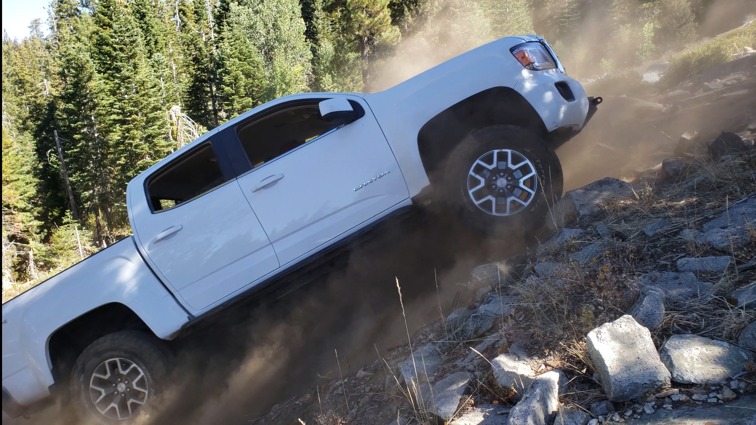
We came upon a really gnarly and really steep alternate trail that the big boys play on. It was waaaay out of my league with very little to no armor but Shayn was up the the task. He has true rock sliders and full steel skids protecting the undercarriage. It's way steeper in person. Dean and I honestly didn't think he'd make it up but.....
I took the main trail and planned to meet up with them a little further up where the trails meet. I smashed my passenger side Tyger step bar again and once I got past the root/rock/hole I had to get out and make sure the step was still attached. Yup! soldier on.
Shayn, his dad, Dean, and I hit up Signal Peak Trail today. GPX Track for GAIA or other GPS app. For those familiar with the trail, we ran it clockwise.
I was pretty beat after a whirlwind trip to Mammoth Lakes and not getting home until midnight last night. I didn't want to back out and look like a flake after previously saying I'd go so I unloaded the truck, washed the bugs off the windshield, threw some off-road gear in the back seat and off I went.
I met up with Shayn and Dean at the Eagle Lakes Road exit and we headed off to the trailhead where we proceeded to air down and talk mods for a bit. For some reason I thought his truck was a long bed.... Instead, he has a white short bed crew cab SLE Canyon model just like mine. He was smart and removed his rack and RTT before this trip.
So off we go looking like twins. lol I tagged my Tyger step bar (not a true slider) on the driver's side going over the very first obstacle and thought well, this is going to be fun, what am I going to break on this run?
The first section was pretty mild. The trail was essentially rock cobbles for much of the way.
The trail started to get more narrow and steep.
And then...... THE rocks
I saw these rocks on a couple of Youtube videos and their positioning and size makes them difficult to get around without damaging the vehicle or without a lot of armor. What you can't see in this photo is a big boulder on his passenger side which restricts your angle of attack. Dean jumped out and started moving some of the smaller rocks around for us then spotted for Shayn. With a couple of tries and a bit of sliding his Canyon made it through just fine. I'll tell ya, after seeing his truck slide around on this big rock I feared for the worst. With some great spotting I got up on the rock fairly quickly but getting over the rock without a front locker proved tough. I had to use some good old fashioned momentum to get over the top which isn't easy when starting off perched on the rock with an auto rear locker! I proceeded to slide towards the passenger side just enough to kiss the other boulder with my Tyger step bar. Lost some paint but no metal damage. #win
Then another "WTF am I supposed to do here" moment. I just watched Shayn go through but I was still at a loss. Dean got me through it without much trouble though. I did sit on the passenger side bar enough to cause the truck to rock up and down a bit at which point I fully expected the Tyger bar to break off but it didn't.
My turn
More tight trails and rocks then even tighter trails. Yikes! #firstpinstripes
We came upon a really gnarly and really steep alternate trail that the big boys play on. It was waaaay out of my league with very little to no armor but Shayn was up the the task. He has true rock sliders and full steel skids protecting the undercarriage. It's way steeper in person. Dean and I honestly didn't think he'd make it up but.....
I took the main trail and planned to meet up with them a little further up where the trails meet. I smashed my passenger side Tyger step bar again and once I got past the root/rock/hole I had to get out and make sure the step was still attached. Yup! soldier on.
Last edited: