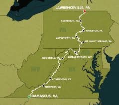
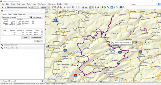
So I decided to get out to Loyalsock. It is a 2 hour highway drive. But who wants to drive the highway.
So, starting in Rothrock going through Bald Eagle up through Pine Creek and then over to Loyalsock and across is about a 14 hour dirt road extravaganza.
So that is too much for a day trip. But I have it routed...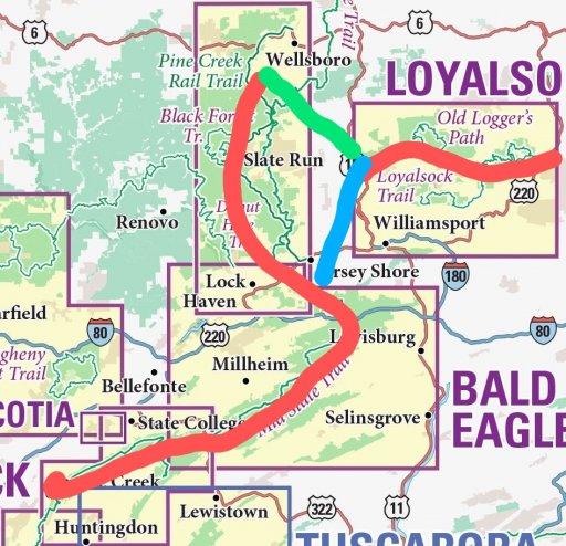
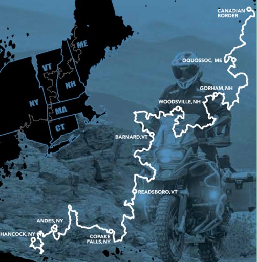
The RED line is the sections I have routed to be inclusive to dirt.
The green is just a direct route for the long trip...and blue is just a direct route for the scouting trip. I still need to route this area for off pavement...another GAP in the maps.
Using the blue route it is only 7ish hours to the Loyalsock set in. And then about 3 hours to drive across the Loyalsock map. Giving me enough to time to...ugh...drive the highway home.
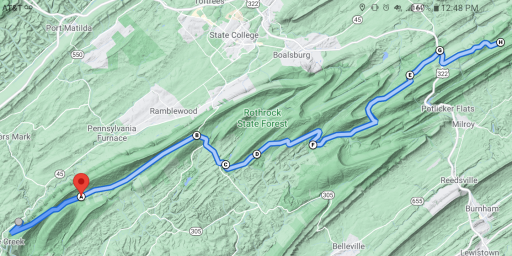
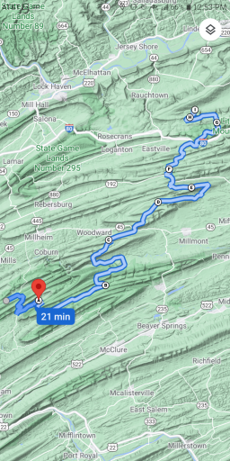
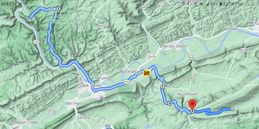
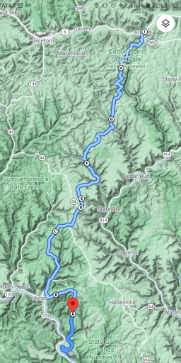
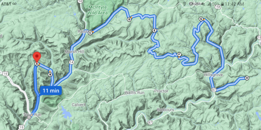
I again plotted the route on google maps. I have been trying to find a way to match up the routes...but it seems to be something you need to use a computer for and a bunch of cutting and pasting.
I will share the routes with more posts in this thread...the blue and green are still a work in progress.
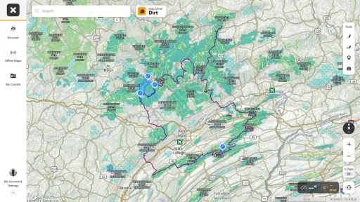
The full route is 343 miles...guessing about almost 290 miles is off pavement.
And the scout route is 232 miles with probably 190 miles off pavement.
Think that makes for a pretty good overlanding route...even by Western standards.
So, starting in Rothrock going through Bald Eagle up through Pine Creek and then over to Loyalsock and across is about a 14 hour dirt road extravaganza.
So that is too much for a day trip. But I have it routed...
The RED line is the sections I have routed to be inclusive to dirt.
The green is just a direct route for the long trip...and blue is just a direct route for the scouting trip. I still need to route this area for off pavement...another GAP in the maps.
Using the blue route it is only 7ish hours to the Loyalsock set in. And then about 3 hours to drive across the Loyalsock map. Giving me enough to time to...ugh...drive the highway home.
I again plotted the route on google maps. I have been trying to find a way to match up the routes...but it seems to be something you need to use a computer for and a bunch of cutting and pasting.
I will share the routes with more posts in this thread...the blue and green are still a work in progress.
The full route is 343 miles...guessing about almost 290 miles is off pavement.
And the scout route is 232 miles with probably 190 miles off pavement.
Think that makes for a pretty good overlanding route...even by Western standards.