Ok so I ran the trip with two exceptions. I didnt take forest service roads from the end of chloride to Cibola NF where Mount Withington is, and I didnt camp on Lookout Mountain, I camped at its base where I could see the fire lookout. Due to sleeping wrong on the ground, I didnt need to sleep in a tent for a second night. After i exited chloride onto highway 59 I followed it to 52 where I turned north. Which, much to my surprise, highway 52 turns to dirt after the first hill as you go north from the intersection of highway 59. And after you turn onto 549, its closer to a 4x4 trail than a road, a nice surprise. I was expecting a 2 lane highway due to it being former highway 52.
Im typing this as my phone uploads the pictures to my computer for easier uploading. So I'll try and copy four wheeler to my best ability.
To get to Chloride, you must first go through Winston NM. I highly recommend carrying a paper map, or an offline version on your devices as all cell sercives vanish about half way between Winston and Truth or Consequences. But once in Chloride, follow the main street all the way to the end where the road dead ends. When you can go no further, hang a left and follow the tracks. For the first 1.2 miles, youre on private property.
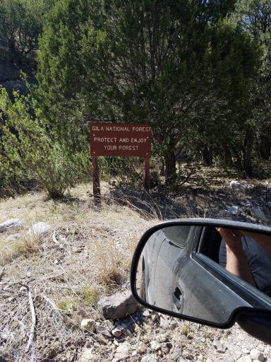
You cross through this creek a lot. So many times that I lost count. The cattle guard that marks the beginning of Gila National Forest, is enough of a grade that I began to spin and had to put it in 4HI. I kept it in 4Hi just for giggles honestly, but there were a couple places I shifted into 4LO for, the control, and the ability to crawl.
Theres a few rock gardens, switchback climbs, quite a few of the trail runs next to a steep cliffs, and a few mud puddles. But all in all, an enjoyable drive that any vehicle with 4wd and id say 8 inches of ground clearance could do.
The mudholes look as if they come and go. The deepest came just under the bottom of hub on my wheels (33 inch tires) and it was a muddy enough to where I had to gun it to clear the tires. But the majority were rock/solid bottoms.
Places to set up camp are easy to identify. Theyre the grassy bits in a trail full of rocks. Most of which already have fire rings made of stones found nearby. Spots become more available as you cross the continental divide.
The places I kicked it down into 4LO are the switchbacks. I enjoy having the control 4LO gives my truck along these obstacles.
Onto Mount Withington and 549:
As I previously stated NM52 is dirt, but the turn off for 549 is well marked and its more of a two track dirt road. You run along this unassuming track until you make one little climb, and then it drops. The forest service even felt the need to put a steep narrow road sign for it. It is narrow too. I felt like hugging the cliff face next to my door rather than flirt with the other side, but maybe thats just me.
You almost drive through the forest, which is a beautiful drive, before you get to the turn off for Mount Withington. Theres still snow in some places along the trail for Withington, going up they gave me no trouble. Coming down, it got sketchy. Making my rear end kick out toward the drop off in one spot. Although the snow and one or two small trees were over the trails in places, the view at the top was worth it.
Pictures in next post.
My wife are in from Dallas and staying in Truth or Consequences. Is it possible to do a day trip to Chloride Canyon?