Back Country Navigator.....yah or nay?

  • HTML tutorial

RCJEEP

Rank I
Launch Member

Traveler I

271
Salkum, WA
Member #

10552

I guess I'm still trying to figure out EXACTLY how this works. I wanted to track my route but couldn't quite do it. Maybe it is just a show and tell style with only adding waypoints? If anyone had any idea how this thing works let me know or maybe I should scrap it for Gaia GPS????20180330_160646.jpgIMG_20180330_161746_348.jpg

Sent from my SAMSUNG-SM-G891A using OB Talk mobile app
 

Ballbearing

Rank II
Launch Member

Enthusiast I

434
US
First Name
Jason
Last Name
Alberring
Member #

11593

Ham/GMRS Callsign
AC9YQ
Service Branch
US Army
I have been trying both Backcountry navigator and Gaia. In my limited use I don't see an advantage of one over the other. Granted, I don't have a lot of use on either. I think I may be able to answer your question though.

If you click on LOCATION (between PLACE and MAP LAYERS) there should be an option to record a track. At least there is on my app.

It seems that Gaia is better represented in these forums so I think I may start using it more.
 
S

SubeeBen

Guest
I have used ALOT of gps devices for hunting etc. & for overlanding/traveling on & off-road Gaia is the most easiest I have found . Just my 2 cents.✌
 
  • Like
Reactions: RCJEEP

Sandpoint Steve

US NorthWest Region Local Expert
Member
Member
Supporter

Pathfinder III

4,017
Sandpoint, Idaho
First Name
Steve
Last Name
Marchiando
Member #

11655

Ham/GMRS Callsign
KI7POE
I use a combination of BC nav, maps.me, copilot and a Garmin handheld. All do different things well. BC nav is nice to have for viewing topographic maps and Arial views. I run them in an Android indash unit. Following tracks works well, but recording is problematic. You have to remember to start the track again everytime we stop the rig and shut it down. The handheld units are great for this. They run for hours and anytime they are on they're recording your trip. So to sum up, I use the Android stuff to tell me where I'm going, and the handheld to tell me where I went.

Steve Marchiando
North Idaho
 
Last edited:
  • Like
Reactions: RCJEEP

RCJEEP

Rank I
Launch Member

Traveler I

271
Salkum, WA
Member #

10552

I have been trying both Backcountry navigator and Gaia. In my limited use I don't see an advantage of one over the other. Granted, I don't have a lot of use on either. I think I may be able to answer your question though.

If you click on LOCATION (between PLACE and MAP LAYERS) there should be an option to record a track. At least there is on my app.

It seems that Gaia is better represented in these forums so I think I may start using it more.
Thank you, I was able to record a track today. I'm not sure which is better or not still. I will play around with Gaia some more, I'm just having a hard time justifying the money they want on a yearly basis. Time will tell

Sent from my SAMSUNG-SM-G891A using OB Talk mobile app
 

RCJEEP

Rank I
Launch Member

Traveler I

271
Salkum, WA
Member #

10552

I use a combination of BC nav, maps.me, copilot and a Garmin handheld. All do different things well. BC nav is nice to have for viewing topographic maps and Arial views. However I run them in an Android indash unit. Following tracks works well, bit recording is problematic. You have to remember to start the track again everytive we stop the rig and shut it down. The handheld uniare great for this. They run for hours and anytime they are one they're recording your trip. So to sum up, I is the Android stuff to tell me when am and where I'm going, and the handheld to tell me where I went.

Steve Marchiando
North Idaho
Interesting, thank you

Sent from my SAMSUNG-SM-G891A using OB Talk mobile app
 

Quicksilver

Rank VI
Launch Member

Advocate III

3,127
Molalla, OR
Member #

5353

I've found Gaia a lot easier to use. I tried BCN first and was completely lost, if you'll pardon the pun. Couldn't figure out very much of it at all.
 

1Louder

Rank VI
Launch Member

Member II

4,187
AZ
First Name
Chris
Last Name
K
Member #

1437

Ham/GMRS Callsign
K1LDR
TI will play around with Gaia some more, I'm just having a hard time justifying the money they want on a yearly basis. Time will tell
The app is updated constantly. They have a team of developers vs 1 (BCN). Gaia and other developers have to pay licenses for most of the maps they offer. You have way more map options with Gaia than most other apps.

The good quality and current maps are not free for developers to use. The fees to the developers vary. Typically it is based on the amount of data downloaded each month by the users.

I am not saying that will or should make it worth it to you. I am just saying there is a reason for the fees besides a company wanting to make money. For me $2-3 a month to have good quality mapping. Forgo a Starbucks or other fast food visit and you can easily pay for quality software each month.

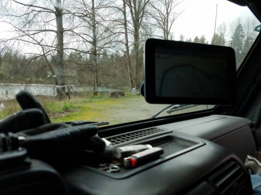
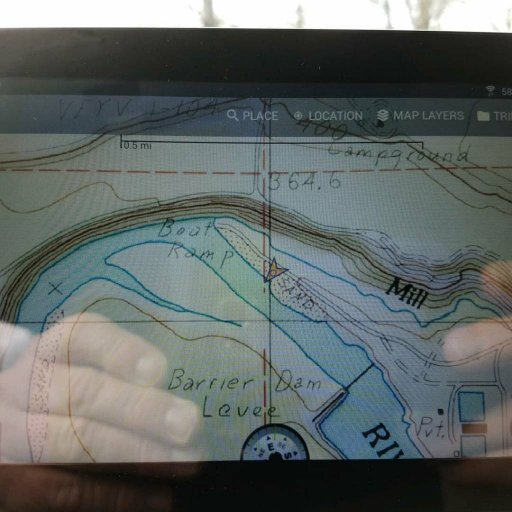
It really depends how far off the beaten path you go. Apps like Maps.me and Pocket Earth work well for roads and ok for well established dirt roads. After that you need something more robust. I do a lot of "jeep trails" as they are defined on maps and a lot of exploration. I need the best quality maps out there including current satellite to keep me out of trouble.

All of this has been discussed in other threads. So I will end it here. I have used the app for 5 years. Tried and paid for many other apps. I always go back to Gaia. I like the app so much that I went to work for them part time. While I no longer work for them I still believe it is the best app out there. Will I keep trying others? You bet.