Over the Thanksgiving holiday, my wife and I traveled down to New Mexico from our home in California to see my family and our other daughter. I'll try and spare the long winded-ness I'm known for and get to the pictures and descriptions... 'cause that is what we are all really here for, is it not?
The trip down to New Mexico is a familiar one to us. We travel the same basic path through Nevada and Arizona, mostly because it's largely empty and relatively speedy limits of travel means we make good time. The trip down there is a story in it's own right, owing to our over zealous adventure sense and hyper confidence in an under equipped vehicle. There is a multitude of cool things to see and do in the Nevada desert-scape off Hwy 95. You don't even need 4 wheel drive, but it helps. Our capable rover, dubbed ∩OV Firefly (that reads ∩northodox Overland Vehicle Firefly) is deceptively apt for adventure travel and we have done a few things in it. I'll leave those stories for another rainy day... or pandemic lockdown.
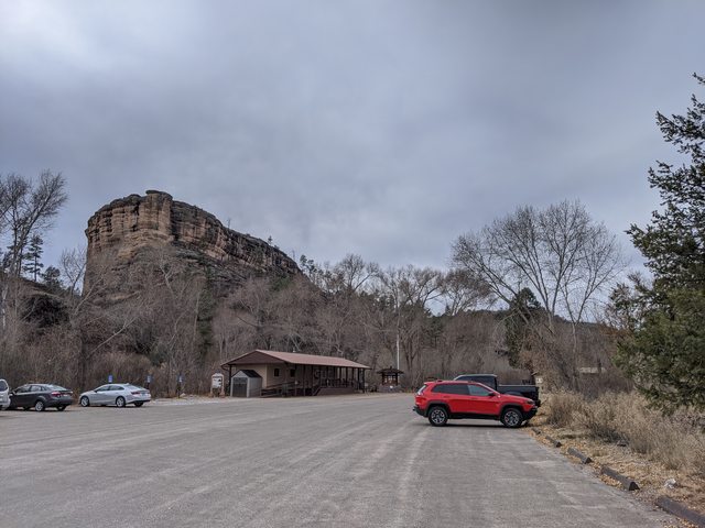
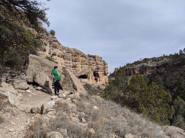
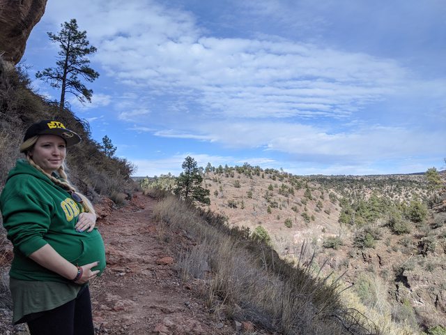
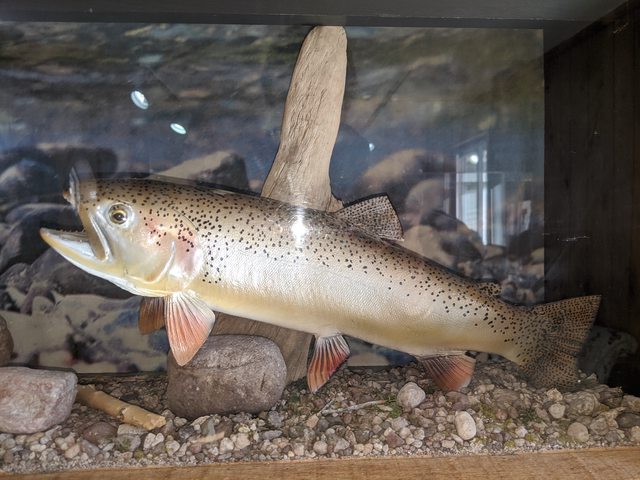
After we had suitable time to relax and enjoy a bit of family time with me mum the night before, we awoke on a chilly morning to gather the troops and visit one of the nations lesser visited monuments. I was comfortable and didn't really want to get out of bed. Neither did my stud, Artemis.

As a quick side note: One could make an adventure of the lesser visited national sites. There are some interesting prospects in some back water places.
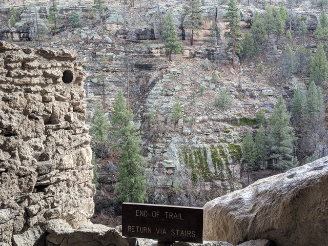
Taking Pinos Altos Rd out of Silver City, we drive through the familiar upper pine, fir and juniper dominated forests in these parts. We have some deciduous trees - cottonwoods, aspens and such, but this is evergreen country and we have a lot of them. The road passes through a very old and very small town of the same name and that, again, is a story for another day. This corner of the US is little traveled in comparison to the rest of the continent and a lot of history remains just below the surface. Every so often you can stumble across (or find easily if you know where to look) a well preserved piece of history. I invite you to find your own adventure.
The road continues on through the Gila National Forest and makes a turn towards Mimbres at Lake Roberts. From Mimbres, you can head east out the Black Range (oooh, more adventures) and hit I-25, or you can head back towards HWY 180 and into Silver City. As a kid, we used to make the loop in our cars. Sometimes as fast as possible, sometimes with less haste. There were bragging rights and times kept. A good deal of betting of all sorts of goods was done. Women were swooned, others scorned. Good times.

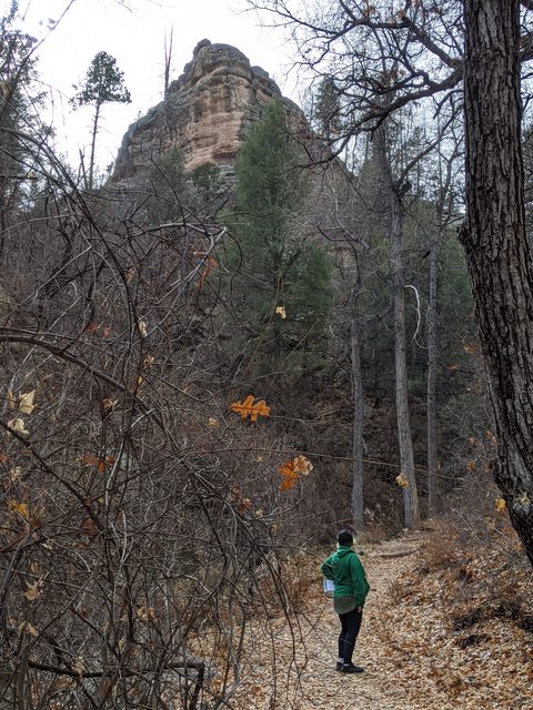
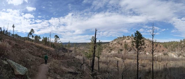
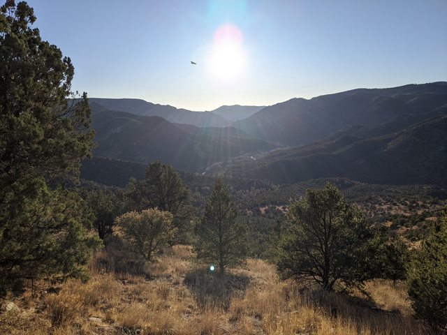
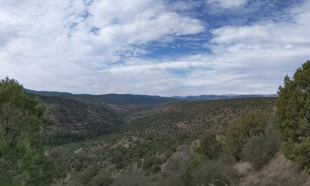
The views along this stretch of the highway are mostly canyon walls and pine forests, but at some points you get great glimpses of the watershed divide. You can stand at points and look left as one watershed drains to the Colorado River in Arizona and the other watershed drains into the Rio Grande, down Mexico way. A quick view back down towards the west and the Gila watershed (which is where I have a residence).
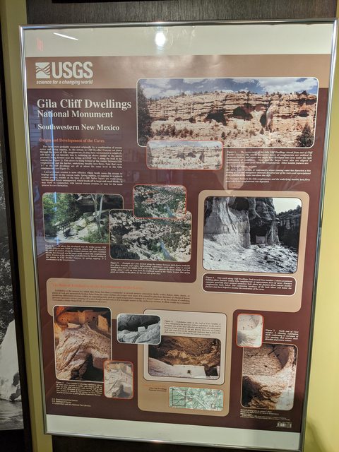
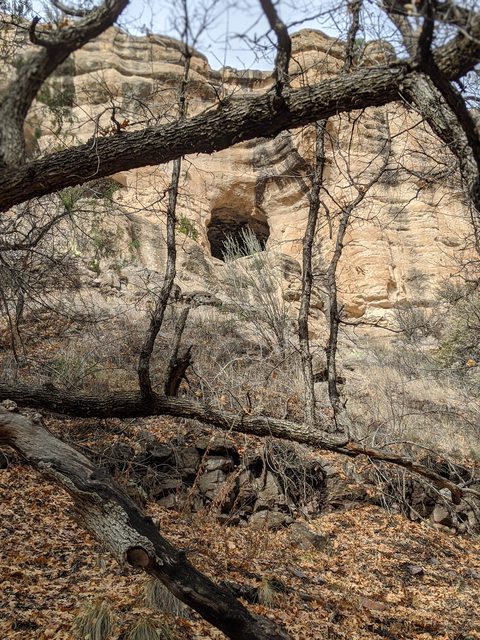
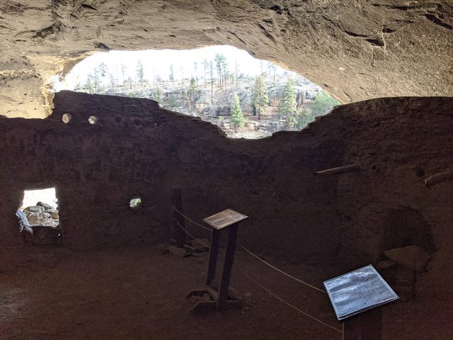
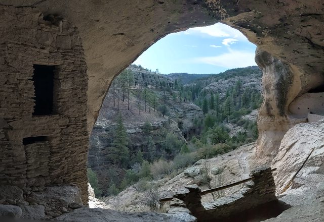
This area is ripe with the remnants of volcanic activity and is home to several ancient calderas. Like the more famous Yellowstone, these large magma chambers dominated the landscape for tens of millions of years and created the basis for the formations we see today. The results of those ancient lava eruptions are clearly visible in the bare cliffs and strata of the mountains with layers on layers, revealing millions and millions of years of history. *SQUEE*


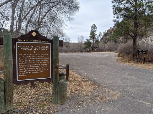
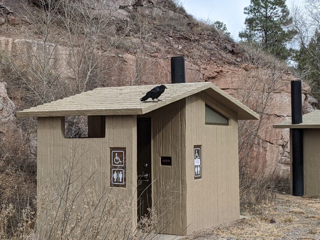
Just before you get to the monument entrance there is a complex of hot springs down on the Gila River. There are some to be found, naturally, by hiking up and down the river and it's forks on trails accessed by a number of parking areas and trail heads. There are also privately owned ones that you can visit for a very small fee and camp at for a nominal rent. I always love to hop from cold Gila river to warm hot springs and in the winter, when access to this area isn't closed, there is no better place to spend a day. I won't mention names, as one of these is owned by a family friend. To be sure, there is no services out here and even the close ones are remote. This here is what we call frontier land. I include a landmark for reference if you ever end up in this area and are interested in spending a day in some amazing hot pools.

Pulling into my favorite (paid) hot spring spot, the wife and I noticed this beauty in her natural habitat. She read 'REX overland' on her quarter panel, if memory serves. They were gone before I could go interrupt their serenity.

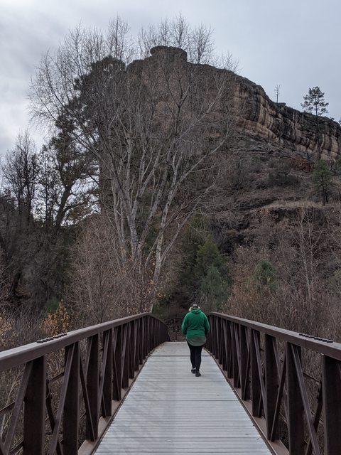
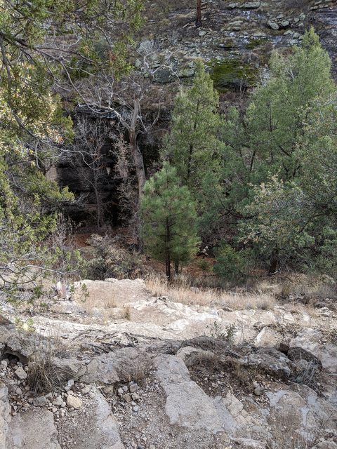
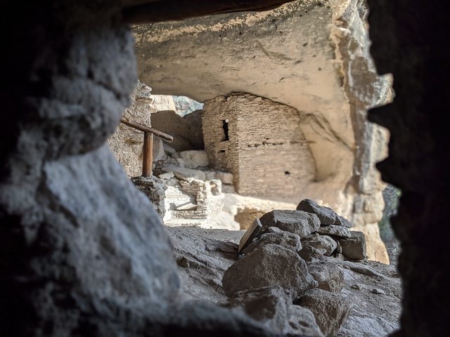
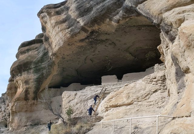
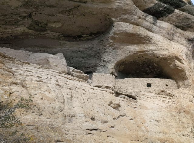
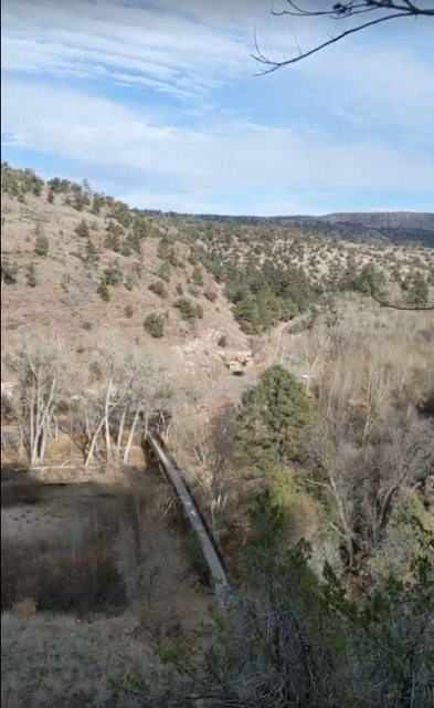
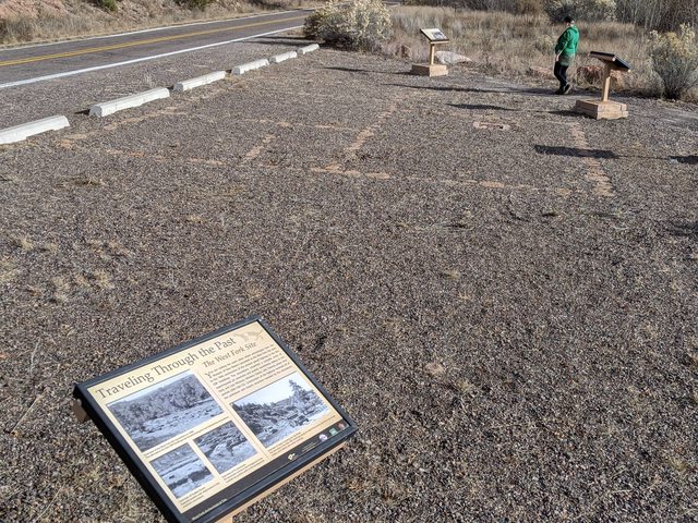
We left my mother and my first born at the well maintained and very comfortable hot springs in the capable hands of a dear friend while the wife and I continued on to the monument. As you can see on the second picture, the two places are within hiking distance, if one was so inclined.


More to follow!!
The trip down to New Mexico is a familiar one to us. We travel the same basic path through Nevada and Arizona, mostly because it's largely empty and relatively speedy limits of travel means we make good time. The trip down there is a story in it's own right, owing to our over zealous adventure sense and hyper confidence in an under equipped vehicle. There is a multitude of cool things to see and do in the Nevada desert-scape off Hwy 95. You don't even need 4 wheel drive, but it helps. Our capable rover, dubbed ∩OV Firefly (that reads ∩northodox Overland Vehicle Firefly) is deceptively apt for adventure travel and we have done a few things in it. I'll leave those stories for another rainy day... or pandemic lockdown.
After we had suitable time to relax and enjoy a bit of family time with me mum the night before, we awoke on a chilly morning to gather the troops and visit one of the nations lesser visited monuments. I was comfortable and didn't really want to get out of bed. Neither did my stud, Artemis.
As a quick side note: One could make an adventure of the lesser visited national sites. There are some interesting prospects in some back water places.
Taking Pinos Altos Rd out of Silver City, we drive through the familiar upper pine, fir and juniper dominated forests in these parts. We have some deciduous trees - cottonwoods, aspens and such, but this is evergreen country and we have a lot of them. The road passes through a very old and very small town of the same name and that, again, is a story for another day. This corner of the US is little traveled in comparison to the rest of the continent and a lot of history remains just below the surface. Every so often you can stumble across (or find easily if you know where to look) a well preserved piece of history. I invite you to find your own adventure.
The road continues on through the Gila National Forest and makes a turn towards Mimbres at Lake Roberts. From Mimbres, you can head east out the Black Range (oooh, more adventures) and hit I-25, or you can head back towards HWY 180 and into Silver City. As a kid, we used to make the loop in our cars. Sometimes as fast as possible, sometimes with less haste. There were bragging rights and times kept. A good deal of betting of all sorts of goods was done. Women were swooned, others scorned. Good times.
The views along this stretch of the highway are mostly canyon walls and pine forests, but at some points you get great glimpses of the watershed divide. You can stand at points and look left as one watershed drains to the Colorado River in Arizona and the other watershed drains into the Rio Grande, down Mexico way. A quick view back down towards the west and the Gila watershed (which is where I have a residence).
This area is ripe with the remnants of volcanic activity and is home to several ancient calderas. Like the more famous Yellowstone, these large magma chambers dominated the landscape for tens of millions of years and created the basis for the formations we see today. The results of those ancient lava eruptions are clearly visible in the bare cliffs and strata of the mountains with layers on layers, revealing millions and millions of years of history. *SQUEE*
Just before you get to the monument entrance there is a complex of hot springs down on the Gila River. There are some to be found, naturally, by hiking up and down the river and it's forks on trails accessed by a number of parking areas and trail heads. There are also privately owned ones that you can visit for a very small fee and camp at for a nominal rent. I always love to hop from cold Gila river to warm hot springs and in the winter, when access to this area isn't closed, there is no better place to spend a day. I won't mention names, as one of these is owned by a family friend. To be sure, there is no services out here and even the close ones are remote. This here is what we call frontier land. I include a landmark for reference if you ever end up in this area and are interested in spending a day in some amazing hot pools.
Pulling into my favorite (paid) hot spring spot, the wife and I noticed this beauty in her natural habitat. She read 'REX overland' on her quarter panel, if memory serves. They were gone before I could go interrupt their serenity.
We left my mother and my first born at the well maintained and very comfortable hot springs in the capable hands of a dear friend while the wife and I continued on to the monument. As you can see on the second picture, the two places are within hiking distance, if one was so inclined.
More to follow!!
Last edited: