• Guest, UPDATE We went through the site migration runbook and completed all steps. We will need to complete the migration next week, but will leave the forums up for the weekend. A few days after maintenance, a major upgrade revision to the forum site will occur.
  • HTML tutorial

US West Mendocino BDT planning

GSInTheSun

Rank 0

Contributor I

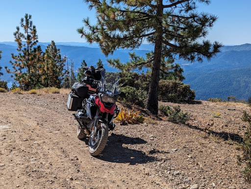
I have some extremely rare free time with my teenage son and we're considering doing the Mendocino BDT. I have a BMW GS and we've done this kind of riding together ever since he was little. I have a few questions I'd love help with:

1) We'll be starting in San Jose, CA on Thursday morning and would take Thursday to make our way up to the start of the trail. Any recommendations on places to stay close to the start of the BDT? Looks like about a 3 hour ride from San Jose.

2) Should we budget for 2 days ( 1 night ) to make it to the end?

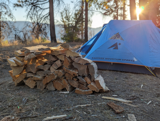
3) Any recommendations for camping spots on the trail?

4) Best places for gas along the way? Or plan to bring enough for the whole trail?

5) Is there any cell service along the way? Or is a spot type device recommended?

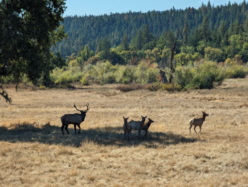
6) Any concerns with animals when camping on the trail?

Thanks so much for any advice, I really appreciate it. I'm really excited about this and want to make it a good experience for my son.
 
Last edited:

Wildcat-01

Rank II

Enthusiast III

I've backpacked and off-roaded in the areas around Snow Mountain quite a bit. While I haven't done anywhere near the full distance of the BDT, I can at least help a little.
Most of the trails up there are pretty manageable- fire roads, and the like. I poked around there in a barely-lifted RWD T100 and there were a few times where clearance was a concern, but only in the really technical areas. I can't say as much for the dirt bike trails around Letts Lake.

1. My personal favorite plan of attack is to get off work on a Thursday or Friday, and bomb out to the trailhead and camp out in Dixie Glade before hitting the trail. I think that your plan of SJ to the trailhead is reasonable. You could probably stay at Anderson Marsh up by Clear Lake for that night, if that's where you're starting.

2. Are you planning on doing the whole trail in two days? I'd budget more time if so. You'll be moving slowly, there's some technical bits, and also it's just gorgeous up there and you should take your time to enjoy it. That's my two cents, anyway. You do do.

3. Dixie Glade is a great place to stop by. Also, Letts Lake, Bear Wallow. If you'll be weaving in and out of civilization, then the Loose Caboose in Wilitts is a good place to grab a bite. I don't know if it's still open, I haven't been up there in a long time.

4. You can gas up in Clear Lake and Stonyford on the south end, but there isn't a whole lot of gas up there. Bringing some for emergencies is a good idea.

5. There's almost no cell service up there. I bring my InReach along, and even that can get spotty.

6. Yes. Bears. Captured habituated black bears are released up there. I haven't had any issues, but always exercise caution. Do a proper bear hang for your food, avoid wearing things that smell, make sure to disperse your waste to avoid attracting animals.

It's gorgeous up there, I hope that you enjoy yourself.
 

GSInTheSun

Rank 0

Contributor I

Thanks so much for all the info, Sam. I really appreciate it! We had an amazing time, no issues whatsoever, and rode about 200 miles on the trails up there. We camped at Atchison campground, and bears are absolutely a thing, other campers had also dealt with wolves in the camp the night before.

Thanks again for your help, and if anyone else has questions I'd be happy to answer based on my experience.

1696795912162.png
1696795960820.png
1696795979502.png
 

Attachments

Wildcat-01

Rank II

Enthusiast III

Thanks so much for all the info, Sam. I really appreciate it! We had an amazing time, no issues whatsoever, and rode about 200 miles on the trails up there. We camped at Atchison campground, and bears are absolutely a thing, other campers had also dealt with wolves in the camp the night before.

Thanks again for your help, and if anyone else has questions I'd be happy to answer based on my experience.

View attachment 267486
View attachment 267488
View attachment 267489
And thank you for bringing it up, I'm looking into doing that one next summer.
 

Speric

Rank VI
Launch Member

Advocate III

Were you able to make the whole loop? Last summer a group of us did that route but there was a slide just north of Eel River Campground on the M1. It was totally impassable. Has that been cleared? We had to backtrack on Espee Ridge Rd.
 
Top