

Member III
- 2,827
- First Name
- Joshua
- Last Name
- Downs
- Member #
-
20468
- Ham/GMRS Callsign
- KK6RBI / WQYH678
- Service Branch
- USMC 03-16, FIRE/EMS
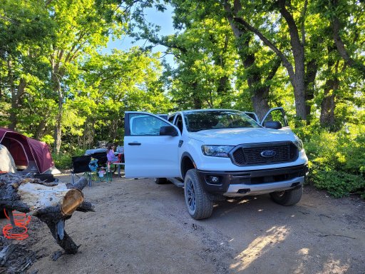
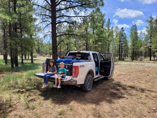
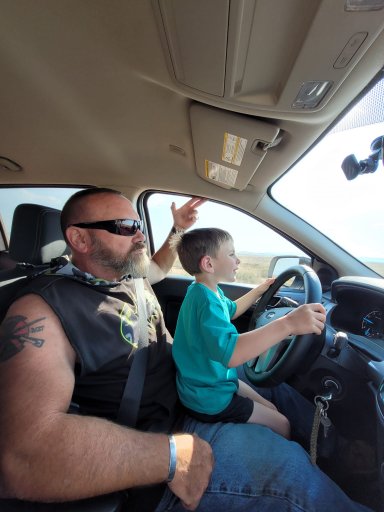
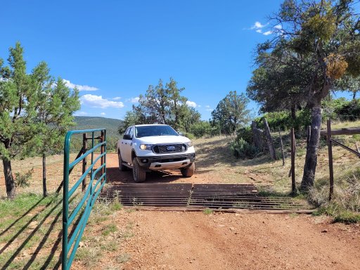
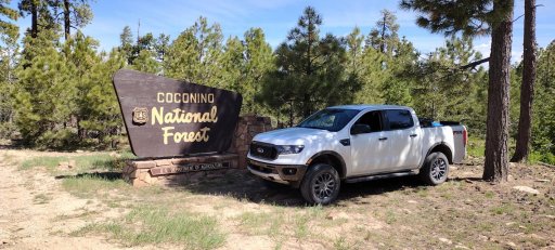
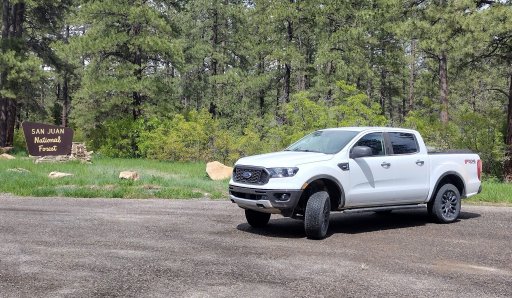
My dad and I usually try to take a trip once a year that's about a week long or so and explores whatever we can access in that time. This year we decided to do the NMBDR but due to the weather forecast and my experience on the southern portion of the NMBDR trying to make progress we decided to push a state over and do the AZBDR which was forecast to be clear and sunny for the most part. We used to do these trips on motorcycles, then the last few years have moved to cage travel. Usually with my Jeep, but he recently bought a 2023 Ford Ranger Crew Cab with the FX4 package. I was a little bummed by not taking one of the Jeeps, but I gotta say I was impressed with this little mid-sized truck and really wouldn't mind having one. It should be noted that you can get a rear locker as an option on even the 4x2 models for the measly sum of 400 dollars and the FX4 package gets it as well and if you ever buy a truck or SUV that you ever plan on off-roading and it has a locker option......get it.
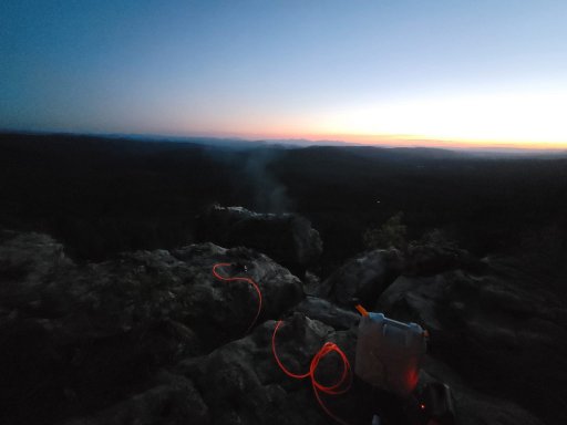
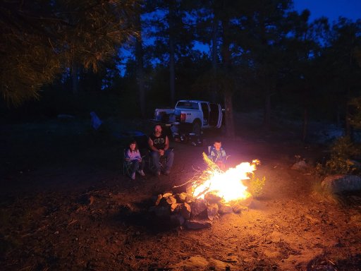
We decided to skip Section1 and most of section 2 to bypass some of the lower altitude areas to the south and start off at higher altitude. We powered though on the first day, leaving very early in the morning. No long road trip is complete without a stop at a (W)affle House. Yes, the sign on this one had the W burnt out, lol. The first day was going to be a 16-hour slog from Greenville to the Pinal Mountain summit, where there are some NFS campsites. Didn't really have a view from the first site, but did have a higher altitude spot with cool temps, a fire ring, a table and a vault toilet. We got there just as the sun was creeping across the horizon and completed camp setup before it got dark. The kids got to burn up some marshmallows on the camp fire and we got to relax after the drive.
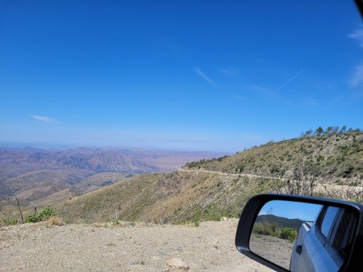
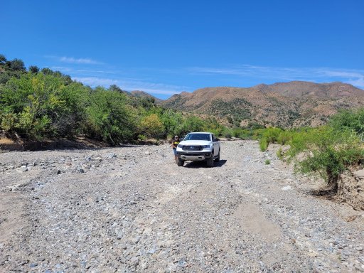
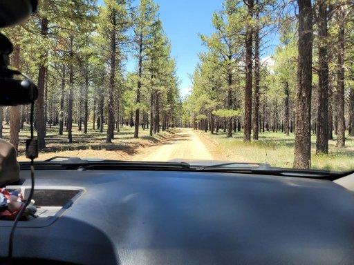
The next day our goal was to get across the low area of the route back up to 7–8000 feet to the Mongollon Rim. Neither myself or my dad care to sleep in higher temps if we can help it. Arizona doesn't participate in Daylight Savings time, so we were also enjoying the 2-hour reduction in our normal time, meaning waking up "late" was waking up at 5 or 6am local time to the sunrise. We made breakfast, packed up and headed down the mountain to link into the actual BDR just east of Pinal Peak. I would later find out we were on the "difficult" section as this BDR was updated earlier in the year and the map I had was still based on the old data, showing what was now the "difficult" section as just the regular BDR route. But to even get to that point we needed to get down off the mountain, and the easiest way I could see on our topo maps on GAIA was gated off and closed. One more road down would get us going in that direction but would require us to do a lot of backtracking and route exploring before finally winding up in a dry creek/river bed before going through a stretch gate and linking into a well maintained dirt road that would eventually link into the BDR, that allowed us to pick up the pace.
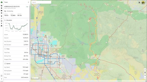
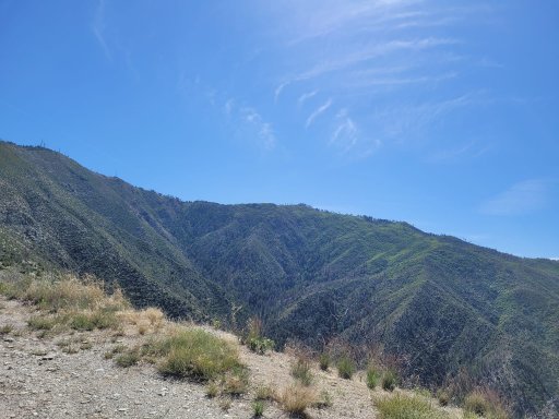
We made our way up Pioneer Pass, which in many sections was washed out and rutted. This would wind up being a fun section, making 4 low a good idea in some sections along with the rear locker due to the flex caused by the washed out rutted road. We even got to play in a little bit of sand in a nearly dry river section. We eventually made it to the Pioneer pass campground area which is a series of campsites dispersed along the road, they looked nice enough. It looked like there was some drainage maintenance going on up there, with new culverts going in and a lot of ripped up dirt.
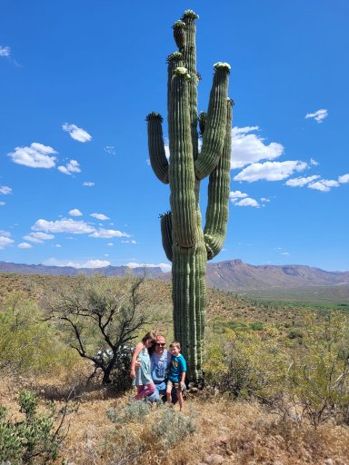
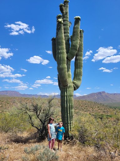
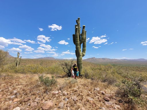
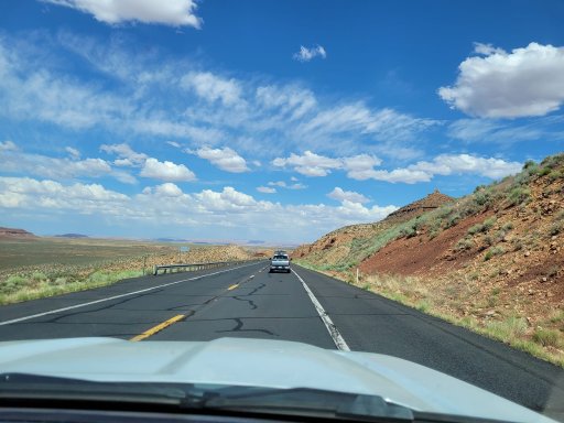
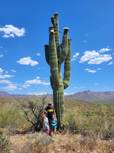
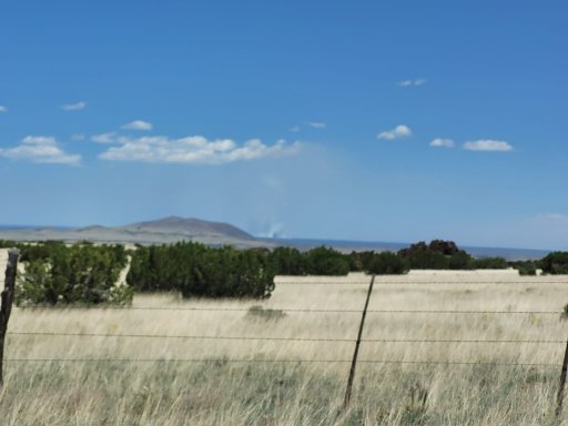
The rest of pioneer pass was uneventful other than descending into the Globe, AZ where we restocked the fridge for lunch and dinner. We would leave out of Globe and move north, stopping along the way to get a photo with some of the giant cactus in the area.
We crossed a lot of good ground, but did bypass one "expert" section that went into Young, AZ, so we could push for the rim campsites before dark, which kind of bummed us out because we were enjoying what technical sections we could. We would wind up getting there around 630ish local time. This would set the tone for our continual underestimation of how much time it would take for us to complete sections, with us getting into camp prior to planned time only on the last night.
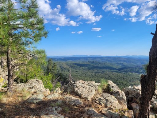
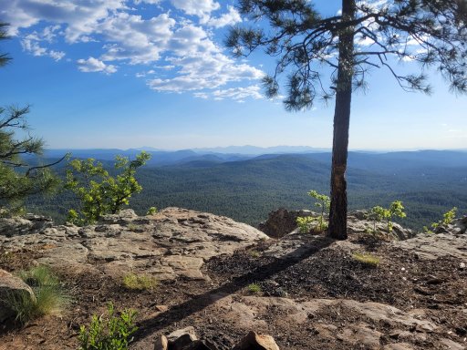
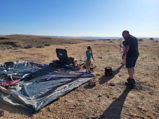
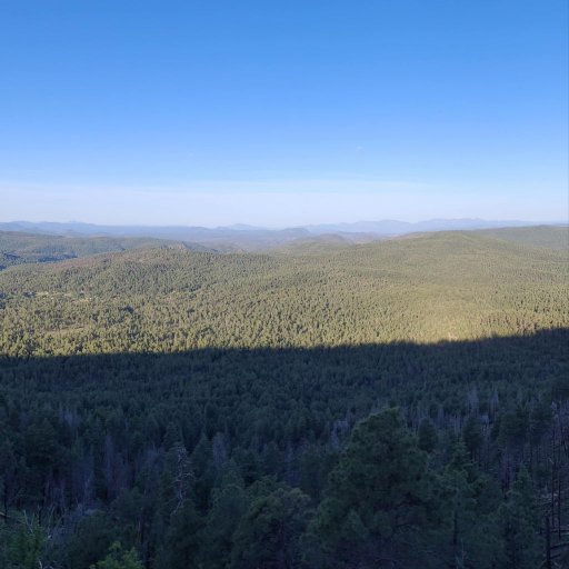
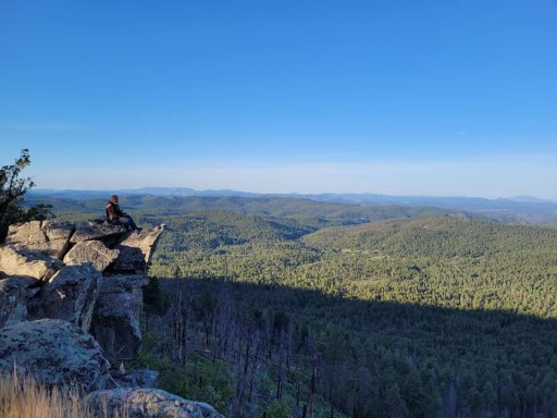
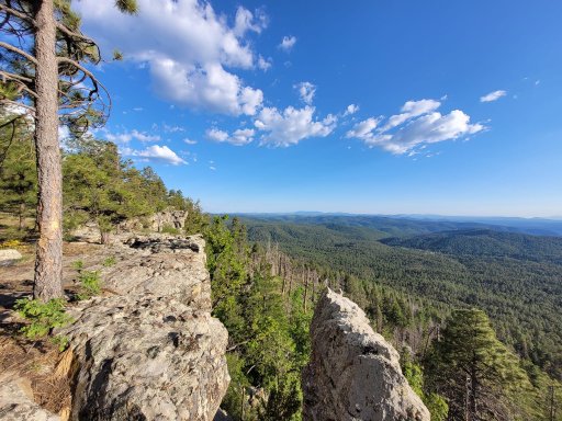
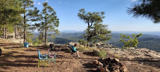
The Mongollon Rim has some amazing views to the south, standing about 1400 feet over the area below in some spots. We set up camp and started a small fire that the kids would again melt some marshmallows over. We would also take a "sprayer" shower here using a small RV water pump a 5 gallon jug and a sprayer nozzle. It was pretty cold but good to take a shower. Unlike my XJ that has onboard water, we had to improvise with this setup when using the truck.
The next morning we would repeat the process, at this point I realize how much I hate cooking breakfast anytime I go on a trip, even by myself. Just something about how much time it takes in the morning to cook, eat, clean, let the griddle cool off, pack it up and then FINALLY get back on the road. If I'm staying in one spot for more than a day, so be it, but if I'm traveling from spot to spot it just takes up too much time.
We get packed up and take some FS roads back to the main route from the camp site. On the map, it's not very far at all, but we wind up on a rocky power line road where we come across a 5 foot nearly vertical climb that will require some rock stacking. We were so busy trying to solve the problem that we wound up getting no video or pictures of the even, and the dash camera never saved the video. Once we got back to the main road/trail, we made great time and saw some great sights as we made our way along the Mongollon Rim. Our destination today would be the Cinder Hills, OHV area, just north of Flagstaff. Once again, it would take longer than expected to reach the area, so we would omit a portion of the BDR to make camp in time.
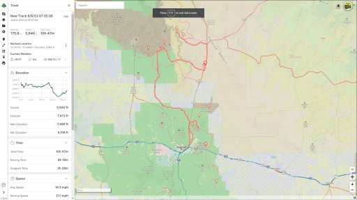
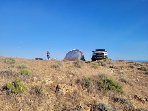
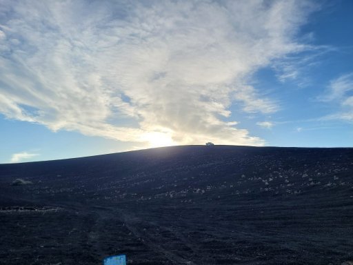
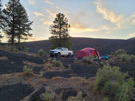
If we read the info boards right, this area was active around 1000 AD, we were finding the first spats of Volcanic looking rock about 50–70 miles south of this area. I'd guess the activity in this area threw stuff at least that far. We camped between two cinder hills. The surface was dry and looked like tiny balls of pumice stone, once you compressed the surface a few inches it would become firm. We did a little digging with the shovel and found moisture just a few inches down.
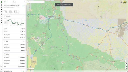
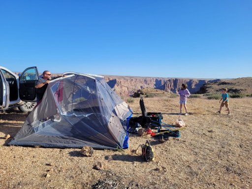
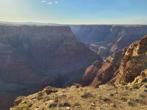
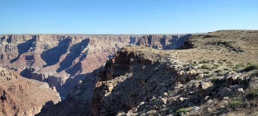
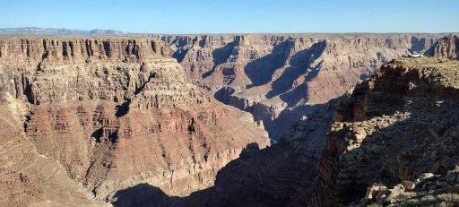
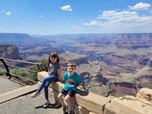
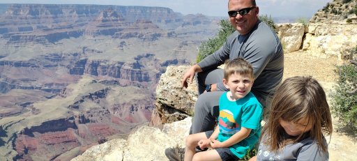
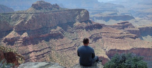
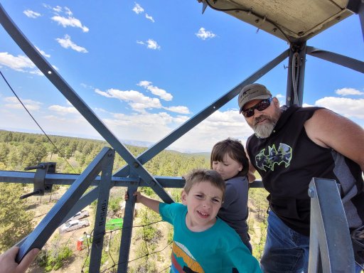
The next day, we woke up with the goal of reaching the Little Colorado Canyon, which is located on Navajo land adjacent to the Grand Canyon. This would be one of the cooler camp sites from a visual perspective. It was windy as all get out, but there's something cool about camping 2000+ feet over a river with sheer cliffs. Along the way, we would hit more awesome areas, including a section that cuts though a cattle ranch that looks like people haven't been though there in a long time. In the previous section, we had run across some guys riding the BDR on ADV bikes. It was becoming a habit of running across them a few times during the day. Today we would run across them again a few times until we split from the main trail to get into the Navajo area to the final campsite we would stay at in Arizona. The kids got to climb a fire tower and see the Grand Canyon up close and personal. My only gripe was the Navajo land's charges, the last camp site would wind up costing us 120 dollars :(. 15 dollars per person per day and if you are camping overnight that's considered 2 days of fees. That hurt, but the view was amazing.
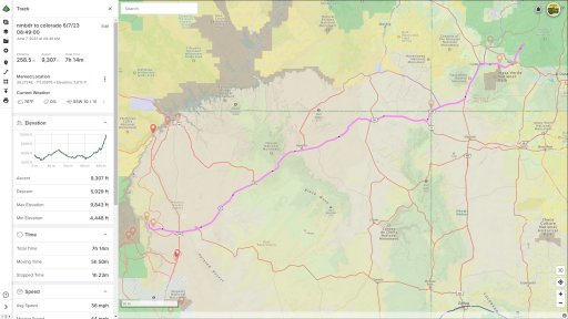
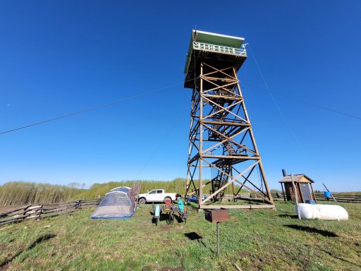
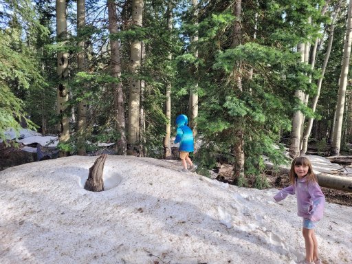
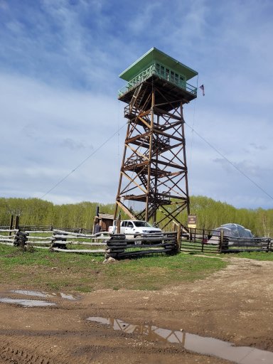
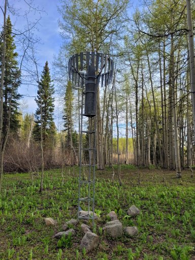
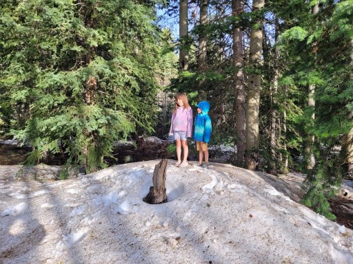
The next day, we would turn east and start heading home. We would set our sights on the San Juan National Forest, just north-east of Cortez, Colorado. We would wind up coming across a very well-preserved fire tower that turns out to be one of only 2 fire towers in Colorado you can rent like an Airbnb. We were unable to find a way to reserve from the site, and no one else was in the area, so we set up camp at the base of the tower with the idea we would move our campsite if someone came along to stay there. This would be the only time we got to a campsite earlier than we expected, ha. After setting up camp and cooking dinner, we took a walk into the nearby woods and found a large area of snow around a group of pine trees. The kids loved that. We stumbled across a strange item which I would later find out is a precipitation gauge and the "toggles" around it are part of a windshield. This would also be the only portion of the trip we saw any wildlife outside of birds and cows. We watched a few Elk cows cross the field to the north of the fire tower. The next day we would wake up pack camp and decide that instead of making our way to NM and camping the Carson we would power though to home. We set the cruise on 80 and flew back home as quick as we could without going to jail.
We go home around 2am this morning and woke up around 8 to clean and reset the equipment including doing a quick wipe down and cleaning of the inside and outside of the truck. My dad left a few hours later for my brother's house and they will be doing a similar trip to either Colorado or Arizona again in a few days.
These pictures are in no particular order.
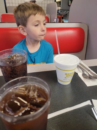
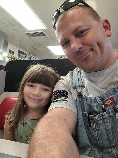


We decided to skip Section1 and most of section 2 to bypass some of the lower altitude areas to the south and start off at higher altitude. We powered though on the first day, leaving very early in the morning. No long road trip is complete without a stop at a (W)affle House. Yes, the sign on this one had the W burnt out, lol. The first day was going to be a 16-hour slog from Greenville to the Pinal Mountain summit, where there are some NFS campsites. Didn't really have a view from the first site, but did have a higher altitude spot with cool temps, a fire ring, a table and a vault toilet. We got there just as the sun was creeping across the horizon and completed camp setup before it got dark. The kids got to burn up some marshmallows on the camp fire and we got to relax after the drive.
The next day our goal was to get across the low area of the route back up to 7–8000 feet to the Mongollon Rim. Neither myself or my dad care to sleep in higher temps if we can help it. Arizona doesn't participate in Daylight Savings time, so we were also enjoying the 2-hour reduction in our normal time, meaning waking up "late" was waking up at 5 or 6am local time to the sunrise. We made breakfast, packed up and headed down the mountain to link into the actual BDR just east of Pinal Peak. I would later find out we were on the "difficult" section as this BDR was updated earlier in the year and the map I had was still based on the old data, showing what was now the "difficult" section as just the regular BDR route. But to even get to that point we needed to get down off the mountain, and the easiest way I could see on our topo maps on GAIA was gated off and closed. One more road down would get us going in that direction but would require us to do a lot of backtracking and route exploring before finally winding up in a dry creek/river bed before going through a stretch gate and linking into a well maintained dirt road that would eventually link into the BDR, that allowed us to pick up the pace.
We made our way up Pioneer Pass, which in many sections was washed out and rutted. This would wind up being a fun section, making 4 low a good idea in some sections along with the rear locker due to the flex caused by the washed out rutted road. We even got to play in a little bit of sand in a nearly dry river section. We eventually made it to the Pioneer pass campground area which is a series of campsites dispersed along the road, they looked nice enough. It looked like there was some drainage maintenance going on up there, with new culverts going in and a lot of ripped up dirt.
The rest of pioneer pass was uneventful other than descending into the Globe, AZ where we restocked the fridge for lunch and dinner. We would leave out of Globe and move north, stopping along the way to get a photo with some of the giant cactus in the area.
We crossed a lot of good ground, but did bypass one "expert" section that went into Young, AZ, so we could push for the rim campsites before dark, which kind of bummed us out because we were enjoying what technical sections we could. We would wind up getting there around 630ish local time. This would set the tone for our continual underestimation of how much time it would take for us to complete sections, with us getting into camp prior to planned time only on the last night.
The Mongollon Rim has some amazing views to the south, standing about 1400 feet over the area below in some spots. We set up camp and started a small fire that the kids would again melt some marshmallows over. We would also take a "sprayer" shower here using a small RV water pump a 5 gallon jug and a sprayer nozzle. It was pretty cold but good to take a shower. Unlike my XJ that has onboard water, we had to improvise with this setup when using the truck.
The next morning we would repeat the process, at this point I realize how much I hate cooking breakfast anytime I go on a trip, even by myself. Just something about how much time it takes in the morning to cook, eat, clean, let the griddle cool off, pack it up and then FINALLY get back on the road. If I'm staying in one spot for more than a day, so be it, but if I'm traveling from spot to spot it just takes up too much time.
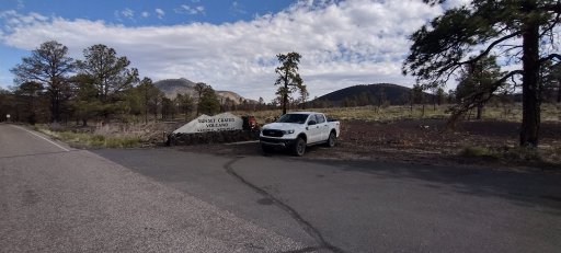
We get packed up and take some FS roads back to the main route from the camp site. On the map, it's not very far at all, but we wind up on a rocky power line road where we come across a 5 foot nearly vertical climb that will require some rock stacking. We were so busy trying to solve the problem that we wound up getting no video or pictures of the even, and the dash camera never saved the video. Once we got back to the main road/trail, we made great time and saw some great sights as we made our way along the Mongollon Rim. Our destination today would be the Cinder Hills, OHV area, just north of Flagstaff. Once again, it would take longer than expected to reach the area, so we would omit a portion of the BDR to make camp in time.
If we read the info boards right, this area was active around 1000 AD, we were finding the first spats of Volcanic looking rock about 50–70 miles south of this area. I'd guess the activity in this area threw stuff at least that far. We camped between two cinder hills. The surface was dry and looked like tiny balls of pumice stone, once you compressed the surface a few inches it would become firm. We did a little digging with the shovel and found moisture just a few inches down.
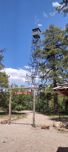
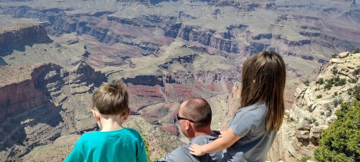
The next day, we woke up with the goal of reaching the Little Colorado Canyon, which is located on Navajo land adjacent to the Grand Canyon. This would be one of the cooler camp sites from a visual perspective. It was windy as all get out, but there's something cool about camping 2000+ feet over a river with sheer cliffs. Along the way, we would hit more awesome areas, including a section that cuts though a cattle ranch that looks like people haven't been though there in a long time. In the previous section, we had run across some guys riding the BDR on ADV bikes. It was becoming a habit of running across them a few times during the day. Today we would run across them again a few times until we split from the main trail to get into the Navajo area to the final campsite we would stay at in Arizona. The kids got to climb a fire tower and see the Grand Canyon up close and personal. My only gripe was the Navajo land's charges, the last camp site would wind up costing us 120 dollars :(. 15 dollars per person per day and if you are camping overnight that's considered 2 days of fees. That hurt, but the view was amazing.
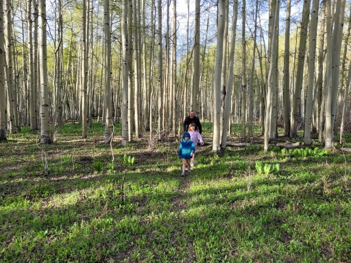
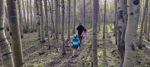
The next day, we would turn east and start heading home. We would set our sights on the San Juan National Forest, just north-east of Cortez, Colorado. We would wind up coming across a very well-preserved fire tower that turns out to be one of only 2 fire towers in Colorado you can rent like an Airbnb. We were unable to find a way to reserve from the site, and no one else was in the area, so we set up camp at the base of the tower with the idea we would move our campsite if someone came along to stay there. This would be the only time we got to a campsite earlier than we expected, ha. After setting up camp and cooking dinner, we took a walk into the nearby woods and found a large area of snow around a group of pine trees. The kids loved that. We stumbled across a strange item which I would later find out is a precipitation gauge and the "toggles" around it are part of a windshield. This would also be the only portion of the trip we saw any wildlife outside of birds and cows. We watched a few Elk cows cross the field to the north of the fire tower. The next day we would wake up pack camp and decide that instead of making our way to NM and camping the Carson we would power though to home. We set the cruise on 80 and flew back home as quick as we could without going to jail.
We go home around 2am this morning and woke up around 8 to clean and reset the equipment including doing a quick wipe down and cleaning of the inside and outside of the truck. My dad left a few hours later for my brother's house and they will be doing a similar trip to either Colorado or Arizona again in a few days.
These pictures are in no particular order.
Attachments
-
 405 KB Views: 1
