Appalachian Trail Area

  • HTML tutorial

DCR465

Rank III
Launch Member

Enthusiast III

646
Evansville, IN
First Name
Don
Last Name
Rumble
Member #

21636

Does anyone have any excess maps detailing the AT route area. I'm pondering an trek along the trail route if I can find a Cat 1/2/3 path.

Thanks
 

DCR465

Rank III
Launch Member

Enthusiast III

646
Evansville, IN
First Name
Don
Last Name
Rumble
Member #

21636

Driving maps. I thought Category 1 was a paved road (cat 1) Cat 2 gravel Cat 3 dirt minor obstacles Cat 4 major obstacles.
 
  • Like
Reactions: Tatankaroo

justjames

Rank V
Launch Member

Member III

2,306
Chapel Hill, North Carolina
Member #

9429

OK, I was not familiar with that description. I guess you want maps for a series of back roads which roughly follow the AT. There are routes which have been planned to follow the Continental Divide in the Rockies and I'm guessing you are looking for something similar for the AT.

I'm not aware of anyone having put together such a collection. The Georgia Traverse crosses the AT in a place or two as well as the Mid-Atlantic Backroad Discovery Route (MABDR). I don't know of anything further north.

Let us know if you find anything.
 
  • Like
Reactions: DCR465

Overland Omnivore

US MidWest Region Local Expert
Member
Member
Investor

Explorer I

4,440
New Albany, IN
First Name
Jason
Last Name
Price
Member #

6480

OK, I was not familiar with that description. I guess you want maps for a series of back roads which roughly follow the AT. There are routes which have been planned to follow the Continental Divide in the Rockies and I'm guessing you are looking for something similar for the AT.

I'm not aware of anyone having put together such a collection. The Georgia Traverse crosses the AT in a place or two as well as the Mid-Atlantic Backroad Discovery Route (MABDR). I don't know of anything further north.

Let us know if you find anything.
I have traveled part of the MABDR and its very nice....there are several places where it parallels the AT or has trails heads to the AT. I was there in October and posted a route on Gaia GPS...we stayed at the White Rocks Camp Ground but there is a lodge Mountain Lake (This is where Dirty Dancing was filmed) as well as a very cool hippy hostel B&B called Woods Hole (3696 Sugar Run Road) ...There is also a lot of nice roads outside of Edgemont that we had to bypass to get to our destination....

Link
 
Last edited:
  • Like
Reactions: coffenut

DCR465

Rank III
Launch Member

Enthusiast III

646
Evansville, IN
First Name
Don
Last Name
Rumble
Member #

21636

Assume.. Thanks everyone!!! I've been holding off on getting GAIA membership until I am "allowed" to get an ipad but I think I will start using it with my laptop
 
  • Like
Reactions: Overland Omnivore

Overland Omnivore

US MidWest Region Local Expert
Member
Member
Investor

Explorer I

4,440
New Albany, IN
First Name
Jason
Last Name
Price
Member #

6480

Assume.. Thanks everyone!!! I've been holding off on getting GAIA membership until I am "allowed" to get an ipad but I think I will start using it with my laptop
$30 a year is well worth it...it also works on your phone
 

JersT4R

Rank V
Member
Investor

Traveler III

2,352
Norfolk, VA
First Name
Jeremy
Last Name
Bailey
Member #

8880

Here's the link to the USDA Forest Service, with the printable maps for the forests.

USDA Forest Service

As mentioned though, the MABDR will take you from Damascus, VA to the PA/NY border. Once you get the GAIA app, check out the GPX files posted in the OVERLAND BOUND ROUTES / DOWNLOADABLE threads.
 

Attachments

egilbe

Rank IV
Launch Member

Enthusiast III

1,146
Biddeford, Maine, USA
First Name
Earl
Last Name
Gilbert
Member #

22993

Ham/GMRS Callsign
GMRS: WRFT263, HAM:
Here's the interactive map from the ATC


scroll, or zoom in, and you can find the forest service roads. The AT crosses many roads, but doesn't parallel many. I've been section hiking the AT for the last 5 years. Completed hiking Maine and NH and started on VT last year. I'm sure once I get into more heavily populated states, there will be more roads. That can be a blessing and a curse. A blessing because food and showers, a curse because the reason I hike is to get away from reminders of civilization.

The funniest thing I've seen was an ADA accessible privy with a wheelchair ramp in the Mahoosucs. The Maine Appalachian Trail Club is slowly replacing all the old Pit toilets with new composting outhouses that easily sleep 6. It was cheaper to build them ADA compliant than to battle for an exception for each one. They are pretty nice, but I can't help be feel that anyone who can hike to some of these privy's aren't going to be deterred by a lack of a ramp or handrails.
 
  • Like
Reactions: Wallygator

DCR465

Rank III
Launch Member

Enthusiast III

646
Evansville, IN
First Name
Don
Last Name
Rumble
Member #

21636

Here's the interactive map from the ATC


scroll, or zoom in, and you can find the forest service roads. The AT crosses many roads, but doesn't parallel many. I've been section hiking the AT for the last 5 years. Completed hiking Maine and NH and started on VT last year. I'm sure once I get into more heavily populated states, there will be more roads. That can be a blessing and a curse. A blessing because food and showers, a curse because the reason I hike is to get away from reminders of civilization.

The funniest thing I've seen was an ADA accessible privy with a wheelchair ramp in the Mahoosucs. The Maine Appalachian Trail Club is slowly replacing all the old Pit toilets with new composting outhouses that easily sleep 6. It was cheaper to build them ADA compliant than to battle for an exception for each one. They are pretty nice, but I can't help be feel that anyone who can hike to some of these privy's aren't going to be deterred by a lack of a ramp or handrails.
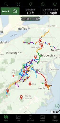
Thank You very much. I have been using the GAIA AT Layer and just received the National Geo AT Map Set. I've attempted to plot out a driving path North Bound. So far I've only got what I figure is the Day 1 a/o 2 getting me to Cherokee, NC. Route doesn't parallel the AT much but should be beautiful. My biggest concern is the pass-ability of my route. I figure tons of more research is in my future. Right now I'm still hoping for 2021 though.
 
  • Like
Reactions: Wallygator

Overland Omnivore

US MidWest Region Local Expert
Member
Member
Investor

Explorer I

4,440
New Albany, IN
First Name
Jason
Last Name
Price
Member #

6480

Here's the link to the USDA Forest Service, with the printable maps for the forests.

USDA Forest Service

As mentioned though, the MABDR will take you from Damascus, VA to the PA/NY border. Once you get the GAIA app, check out the GPX files posted in the OVERLAND BOUND ROUTES / DOWNLOADABLE threads.
WOW!! This is a ready great site.