Looking for information regarding backcountry travel and camping in Death Valley.

  • HTML tutorial

stevenboise

Rank IV
Launch Member

Enthusiast III

1,221
Boise, ID, USA
Member #

4146

I’ve read everything on the NPS sight and I’ve followed TAP for some years and have all their stuff. We plan on spending 5 – 7 nights in Death Valley and we want to spend as many of them off grid as possible. I understand that backcountry camping is allowed with a permit but the locations are restricted but I have the Park Service map.

So I was hoping there might be people on here that had GPS or descriptions of exact spots they had camped outside of designated camp grounds in the past. I would like to collect some information that I could then plot out to my map. I could then better plan the trip as I would have confirmed places to stay. I don’t mind “winging it” on BLM, but in a NP where the restrictions are so much greater, I’d rather have a very good idea where I’m staying each night.

Also, I can’t find any information on potable water or dump stations outside of the designated camp grounds. Are there any spots where we can fill up our water tank where we don’t have to stay the night in a camp ground? How about dumping our porta-potty? Do any of the visitor centers have these facilities?

If we have to camp in a camp ground once or twice on the trip, then I guess that’s what I’ll need to do. But if there is potable water available somewhere, then I’d just as soon pull up to it and fill up.
 
  • Like
Reactions: Rubiconcruiser

Rubiconcruiser

Rank V
Launch Member

Influencer II

2,335
So Georgia
Member #

4884

I’ve read everything on the NPS sight and I’ve followed TAP for some years and have all their stuff. We plan on spending 5 – 7 nights in Death Valley and we want to spend as many of them off grid as possible. I understand that backcountry camping is allowed with a permit but the locations are restricted but I have the Park Service map.

So I was hoping there might be people on here that had GPS or descriptions of exact spots they had camped outside of designated camp grounds in the past. I would like to collect some information that I could then plot out to my map. I could then better plan the trip as I would have confirmed places to stay. I don’t mind “winging it” on BLM, but in a NP where the restrictions are so much greater, I’d rather have a very good idea where I’m staying each night.

Also, I can’t find any information on potable water or dump stations outside of the designated camp grounds. Are there any spots where we can fill up our water tank where we don’t have to stay the night in a camp ground? How about dumping our porta-potty? Do any of the visitor centers have these facilities?

If we have to camp in a camp ground once or twice on the trip, then I guess that’s what I’ll need to do. But if there is potable water available somewhere, then I’d just as soon pull up to it and fill up.
The Mojave Road is your premier run, in this area, right now is beautiful, it's 4wheel drive for about 12 miles, but can be done safely, and hopefully won't be alone. There is no permits required for the trail, it's all National Monument, lots of history, good start point is Off I40 at Kelbaker Road, you can add an extra 10 miles by going to ludlow going in from there, RR museum at Kelbaker, lots of old wells, ore digs, great camping, may be a bit windy, I've seen gusts to 80 knots. Dump station not necessary unless you've got porta potty then just bury the waste. Water sometimes, carry at least 5 per person for the 3 day. Text if you need more love to help out and may even join y'all


Sent from my iPad using OB Talk
 

armymgdude

Rank IV

Advocate II

1,008
Olympia, WA
There are tons of great threads on routes on Google. Camping was easy to get a permit for and the true backcountry routes where normal tourists never go have tons of places to camp. Plus all of the BLM land around the park has great camping. We used a National geographic map and it was great. The rangers have no clue about conditions of trails for 4x4s so go prepared. Mengel Pass, Geologists cabin, Barker Ranch, Steele Pass, Lippincott Pass, Racetrack, etc are all accessible and there are camping areas around those places. Water is at the big campgrounds which are near gas stations. We have done the Mojave Road and Death Valley, and we prefer Death Valley. Both are a must do. Also, schedule time to see the tourist stuff that the rental cars can go to, all of it is amazing.


Sent from my SM-G900V using Tapatalk
 
  • Like
Reactions: TOMB

Eric Neal

Rank V
Launch Member

Pathfinder I

1,798
Atlanta, GA
Member #

8704

Steven: thanks for asking the questions about DV. I'm also planning a trip there with my wife for 2-4 nights in early January 2018. But before that I just have to make a run across the Mojave Rd. from West to East in the days before heading to DV. Hoping that late December early January is a good time for both.
 

armymgdude

Rank IV

Advocate II

1,008
Olympia, WA
Just be prepared for any kind of weather in DV in January. The pic I previously posted was last January. There was many roads closed due to flooding and lots of snow in higher elevations. We had to turn around on one route because of 3 feet of heavy snow, and had to cross a river that normally runs underground. Lots of trails washed out, so go prepared.


Sent from my SM-G900V using Tapatalk
 

Eric Neal

Rank V
Launch Member

Pathfinder I

1,798
Atlanta, GA
Member #

8704

Thanks armymgdude: I would never have expected that amount of snow... a dusting, sure but a 3 foot pack, well, I'd be trying to turn around and get back to some place more predictable.

I have a follow up question, if you folks will indulge me, is our plan of going into the valley following fairly low risk/rating roads & trails by ourselves a "fools errand"??

I drive a 2002 Ford Ranger 4x4 with 33" tires (285/75 R16) with 10" clearance for the lowest point on the differential (stock no lift suspension). I've replaced all cooling system hoses, belts, rebuilt brakes and steering systems as well as replace all fluids... and more, in other words gave it all the love and attention it needed in order to be mechanically reliable within the last 6 months. We've gone out on some really demanding (at least for me) trails in N. GA and NC and have had not had any problems other than minor scrapes and inner tie-rod boots needing replaced.

We run with a Yakima RTT on a Yakima bed frame, carry 7-14 gallons of water with the ability to also bring along a 20L jerrycan of fuel. We pack enough food (pantry bin and kitchen bin) to keep us in good standing (if stranded while working on the truck) for 4-5 days or more when we travel... just in case.

Not planning to "crawl" but just to visit and see the sights of some of the SW US. I guess the same question applies to our goal of running the Mojave Rd West to East... is that also a fools errand during that time of year?
 

armymgdude

Rank IV

Advocate II

1,008
Olympia, WA
Based on my experience with that truck and those trails you should have no worries. Get some traction devices like Maxtracks and a satellite communicator like the Inreach and have fun. I did all of what you want to do in a much bigger truck and solo. One note though, choose washboard speed wisely. It depends on your driving skill, and sometimes faster is better. But trust me, faster is not better on Racetrack road in DV if you like your truck. This guy passed me at least 45mph. He destroyed his truck in less than 40 miles...


Sent from my SM-G900V using Tapatalk
 

Eric Neal

Rank V
Launch Member

Pathfinder I

1,798
Atlanta, GA
Member #

8704

What is that saying? "Speed kills"?? I guess in the Chevy driver's life it was a KIA for the truck, so sad

Thanks for the input on the rig and risks we're going to undertake. Can't wait!
 

Andrew A.

Rank II
Launch Member

Off-Road Ranger I

357
Fullerton, CA
Member #

5119

Ham/GMRS Callsign
KM6KRF
Based on my experience with that truck and those trails you should have no worries. Get some traction devices like Maxtracks and a satellite communicator like the Inreach and have fun. I did all of what you want to do in a much bigger truck and solo. One note though, choose washboard speed wisely. It depends on your driving skill, and sometimes faster is better. But trust me, faster is not better on Racetrack road in DV if you like your truck. This guy passed me at least 45mph. He destroyed his truck in less than 40 miles...
Wow... how did this happen? Did he bounce off the road from high speed driving on the wash board? Or did the truck just literally vibrate to pieces??
 

BigDogKona

Rank III
Launch Member

Enthusiast III

684
Albuquerque, Bernalillo County, New Mexico, United States
First Name
Blaine
Last Name
Wiles
Member #

6061

Thanks armymgdude: I would never have expected that amount of snow... a dusting, sure but a 3 foot pack, well, I'd be trying to turn around and get back to some place more predictable.

I have a follow up question, if you folks will indulge me, is our plan of going into the valley following fairly low risk/rating roads & trails by ourselves a "fools errand"??

I drive a 2002 Ford Ranger 4x4 with 33" tires (285/75 R16) with 10" clearance for the lowest point on the differential (stock no lift suspension). I've replaced all cooling system hoses, belts, rebuilt brakes and steering systems as well as replace all fluids... and more, in other words gave it all the love and attention it needed in order to be mechanically reliable within the last 6 months. We've gone out on some really demanding (at least for me) trails in N. GA and NC and have had not had any problems other than minor scrapes and inner tie-rod boots needing replaced.

We run with a Yakima RTT on a Yakima bed frame, carry 7-14 gallons of water with the ability to also bring along a 20L jerrycan of fuel. We pack enough food (pantry bin and kitchen bin) to keep us in good standing (if stranded while working on the truck) for 4-5 days or more when we travel... just in case.

Not planning to "crawl" but just to visit and see the sights of some of the SW US. I guess the same question applies to our goal of running the Mojave Rd West to East... is that also a fools errand during that time of year?
Get an InReach and go have fun! Satellite communicators are a game changer, making it much safer to travel alone. That said, it's always better to have 2 vehicles travel together... but at least you will be found before you're dead if something does happen that strands you in BFE.
 

BigDogKona

Rank III
Launch Member

Enthusiast III

684
Albuquerque, Bernalillo County, New Mexico, United States
First Name
Blaine
Last Name
Wiles
Member #

6061

Based on my experience with that truck and those trails you should have no worries. Get some traction devices like Maxtracks and a satellite communicator like the Inreach and have fun. I did all of what you want to do in a much bigger truck and solo. One note though, choose washboard speed wisely. It depends on your driving skill, and sometimes faster is better. But trust me, faster is not better on Racetrack road in DV if you like your truck. This guy passed me at least 45mph. He destroyed his truck in less than 40 miles...


Sent from my SM-G900V using Tapatalk
New Years 1998... I was driving on Saline Valley Road (west edge of Death Valley NP) and the airbags went off on my 1997 Dodge Dakota. This was on a graded dirt road, that had some recent rains wash across certain sections. We hit a washed out section going 50ish and BANG. No damage to the truck, but my ears were ringing for a few weeks.
 
  • Like
Reactions: stevenboise

armymgdude

Rank IV

Advocate II

1,008
Olympia, WA
Wow... how did this happen? Did he bounce off the road from high speed driving on the wash board? Or did the truck just literally vibrate to pieces??
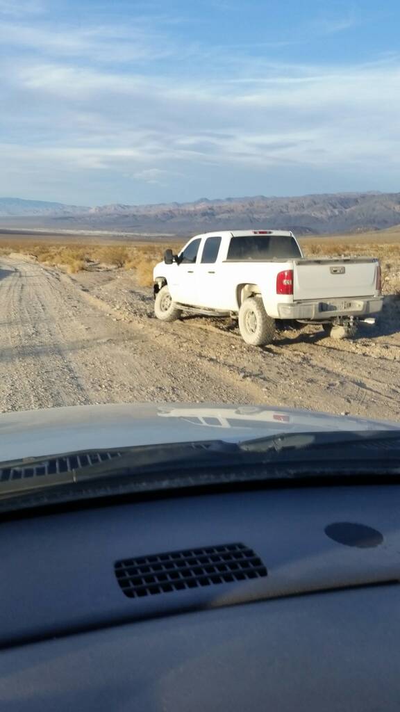
We passed Chevy parts for 15 miles after he passed us. Both front bumper ends and a complete headlight assembly were the big parts we saw. He literally just vibrated the truck to pieces. There was no pothole or rock where the balljoint broke.


Sent from my SM-G900V using Tapatalk
 

Andrew A.

Rank II
Launch Member

Off-Road Ranger I

357
Fullerton, CA
Member #

5119

Ham/GMRS Callsign
KM6KRF
We passed Chevy parts for 15 miles after he passed us. Both front bumper ends and a complete headlight assembly were the big parts we saw. He literally just vibrated the truck to pieces. There was no pothole or rock where the balljoint broke.

Sent from my SM-G900V using Tapatalk

Holy cow! I thought that kind of stuff only happened in cartoons.
I did have a rear view mirror pop off from the windshield once while on a washboard road, to which my passenger laughed hysterically for about half an hour. Never saw headlights falling off and ball joints breaking though!
 
  • Like
Reactions: BigDogKona

Knitron

US Rocky Mountain Region Local Expert Utah
Launch Member

Off-Road Ranger I

2,459
Clearfield, UT
First Name
Jason
Last Name
T
Member #

3805

Ham/GMRS Callsign
KJ7EBG
Hey, does anyone know what if any type of cell service exists in Death Valley?

OB# 3805
 

Andy G

Rank V
Launch Member

Enthusiast II

1,918
Cannonsburg, MI
First Name
Andy
Last Name
Grow
Member #

8505

Hey, does anyone know what if any type of cell service exists in Death Valley?

OB# 3805
I was just out there a few weeks ago, and was shocked to see that around Furnace Creek I had service (have AT&T and it said Off Network) with 3-4 bars of service. That's really limited though and not many miles out of there service disappeared. DV is HUGE so it's hard to say what's available in all the different areas.

Plan on NO cell service, though.
 

Boort

Rank V
Launch Member

Member III

2,779
Colorado
Member #

9314

Hey, does anyone know what if any type of cell service exists in Death Valley?
OB# 3805
Very limited, On my last visit (spring 2016) AT&T was limited to Furnace Creek, Stovepipe Wells and a few high altitude areas with line of sight to those areas. Verizon was slightly better but still mostly offline. No one in my group was running Sprint or T-mobile so can't say what their coverage was.

Wifi was available in some of the commercial campsites and a few of the bars/restaurants. some times free other times at cost.

Boort
 

Knitron

US Rocky Mountain Region Local Expert Utah
Launch Member

Off-Road Ranger I

2,459
Clearfield, UT
First Name
Jason
Last Name
T
Member #

3805

Ham/GMRS Callsign
KJ7EBG
Thanks everyone for the info. Definitely didn't get much service, but we did get it in some of the weirdest places....

OB# 3805
 

armymgdude

Rank IV

Advocate II

1,008
Olympia, WA
Thanks everyone for the info. Definitely didn't get much service, but we did get it in some of the weirdest places....

OB# 3805
That's the same experience we had. My Verizon phone was spotty, but my dad's Consumer cellular phone worked in the middle of nowhere.

Sent from my SM-G900V using Tapatalk
 

4xFar Adventures

Rank VI
Founder 500
Launch Member

Benefactor

4,826
San Francisco,CA
First Name
Brenton
Last Name
Corns
Member #

0070

Check out the Tom Harrison DV map. He has many others, including one for the Mojave Road.

I did a 10 day trip to DV in 2013. Started in Gold Point (outside the park) and ended up in the Dumont Dunes. We were able to stay at a lot of cabins, but they are first come, first serve. The general rule is if you see a flag flying, someone has already taken that cabin.