

Member III
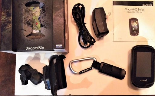
Garmin Oregon 650T GPS- excellent shape, used very little. I got a tablet for Christmas and already have a Rino handheld. Complete with box, cord, Garmin charger, carabiner and RAM mount. $175 shipped in CONUS. I can do Paypal. PM interested. Thanks
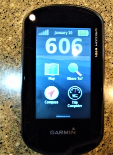
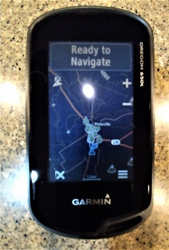
The bright spots on the screen in the pictures is just a light reflection. Here's the description from Garmin.
Built-in 100K topographic mapping data covers the entire United States, including Alaska, Hawaii and Puerto Rico
The bright spots on the screen in the pictures is just a light reflection. Here's the description from Garmin.
Built-in 100K topographic mapping data covers the entire United States, including Alaska, Hawaii and Puerto Rico
- Map detail includes national, state and local parks and forests, terrain contours, elevation information, trails, rivers, lakes and points of interest
- Built-in digital camera features an 8-megapixel sensor, autofocus and digital zoom for capturing quality photos; automatic geotagging lets you navigate back to the exact spot
- Compatibility with Russian GLONASS system allows up to 20% faster and more reliable satellite acquisition, helpful in challenging spots such as deep canyons or heavy cover
- GLONASS lets the Oregon 650t lock on to 24 more satellites than using GPS alone; WAAS (Wide Area Augmentation System) receiver is accurate to within 10 ft. in North America
- Brilliant, sunlight-readable touchscreen is reinforced for impact resistance; dual-orientation display lets you view maps and data in portrait or landscape mode
- Reflective display technology uses external light, such as sunlight, along with an LED backlight to increase brightness
- Multi-touch design accommodates easy operation while wearing gloves; customizable buttons allow 1-touch waypoint marking
- Included worldwide basemap features shaded relief; easily add more maps such as TOPO U.S. 24K and City Navigator® (sold separately) with the microSD™ card slot
- Basemap stores up to 4,000 waypoints, 200 routes and 200 tracks with up to 10,000 points
- 3-axis electronic compass with accelerometer tilt compensation shows where you're heading even when you're standing still, without the need to hold the unit level
- Barometric altimeter tracks changes in pressure to help pinpoint your altitude; it also plots barometric pressure over time to track changing weather conditions
- Full Track view shows your entire elevation profile; Future Plot uses your mapping data to predict the elevation profile of your route ahead
- Enjoy up to 16 hrs. of battery life with 2 AA batteries (sold separately) or a rechargeable NiMH pack (included)
- Wirelessly share your waypoints, tracks, routes, geocaches and maps with other Oregon 600-series devices; just touch “Send” to instantly transfer your information
- Enjoy ANT+ wireless compatibility with the Chirp geocache transmitter, Tempe temperature sensor, heart rate monitors and cadence sensors (sold separately)
- Download up to 4 million geocache files from OpenCaching.com or GSAK.net and view full descriptions, logs, hints and photos
- BaseCamp™ trip-planning software lets you view and organize maps, waypoints and routes, and track and share your adventures with your friends
- With Garmin Connect™ compatibility, Oregon 650t lets you enjoy an online community where you analyze, categorize and share data
- When paired with a BirdsEye Satellite Imagery subscription (not included), BaseCamp™ allows you to download an unlimited amount of satellite imagery
- Flashlight mode features high and low brightness levels and a battery-saving strobe option
- Rugged, waterproof construction helps protect the unit from bumps, dust and moisture; meets IEC 60529 lPX7 standards (can be submerged to 1m for up to 30 min.)
- Other features include a hunting/fishing calendar, sun and moon info, custom points of interest, and a picture viewer
Attachments
-
 411.8 KB Views: 33
 -
 312.2 KB Views: 16
 -
 279.3 KB Views: 15
 -
 641.4 KB Views: 13
Last edited:
