Chloride Canyon, NM

  • HTML tutorial

BamaJim

Rank IV
Launch Member

Enthusiast II

1,084
Athens Al
Member #

4717

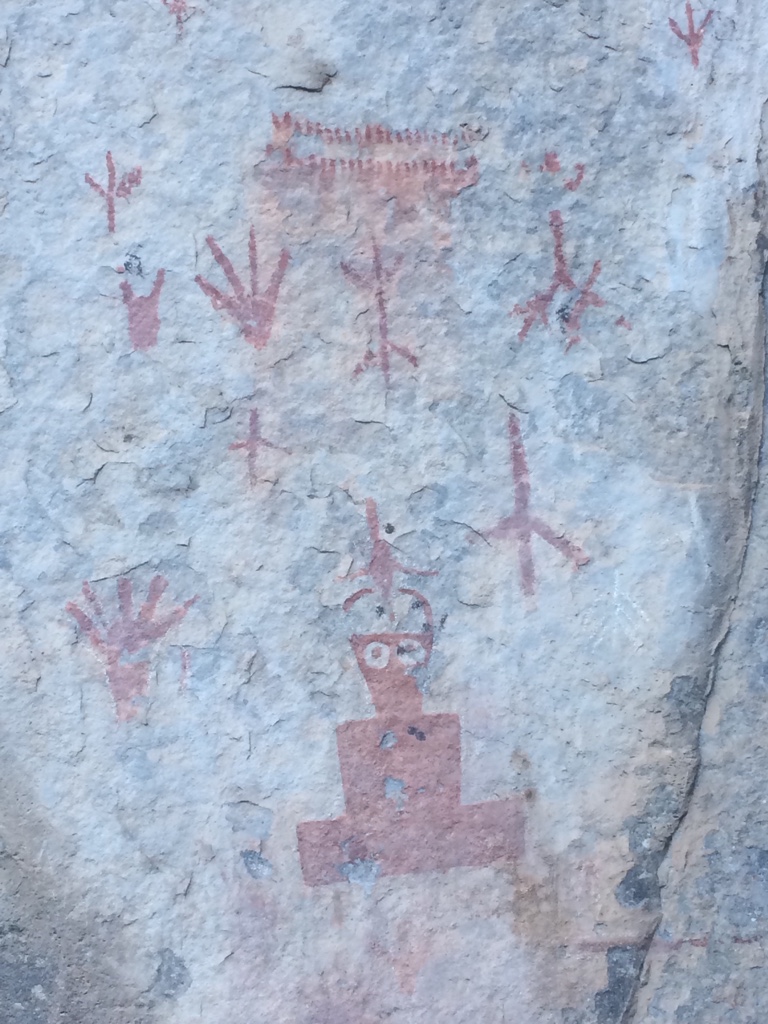
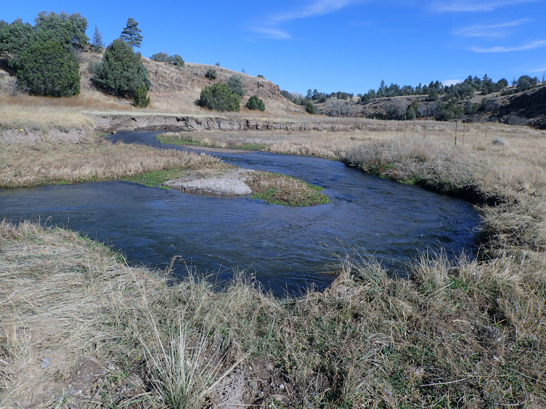
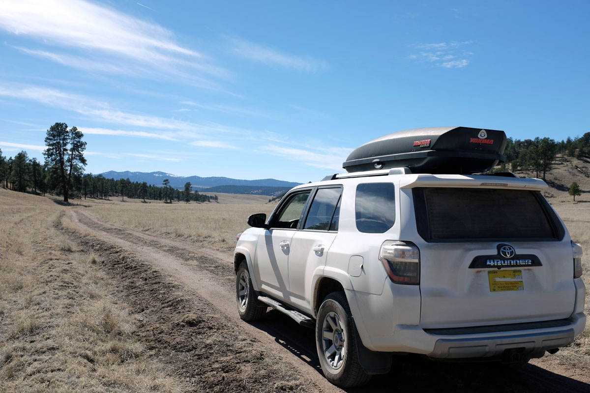
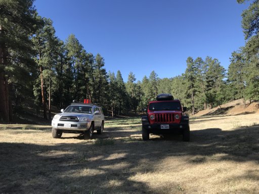
Nice day long trip from Chloride, NM to Reserve, NM. Great trail with water crossings, awesome views and tons of wildlife. The trail starts in Chloride, NM and meanders through the Canyon with a lot of water crossings through Chloride creek and beautiful views of the Canyon walls. Some of the highlights are the wildlife, open range cattle and Indian petroglyphs. Once out of the Canyon the trail takes you down some service roads and then through some slow, rocky logging roads that gives some of the best views at 10,000ft that I️ was able to enjoy while in New Mexico.


DocTorres112

Rank IV
Launch Member

Enthusiast III

1,041
San Antonio, TX, USA
First Name
Chris
Last Name
Torres
Member #

6529

What was the total distance/time of the trip?

Do you happen to have on a shareable file?

Did you camp out or did you see any stellar camping spots?

I've got a 3 day trip in 5 days and at present time I've got nothing concrete locked in. Was planning on going to the Jemez mountains but this might be an option as part of the trip. We are coming from El Paso.

Thanks,
-Chris
 
  • Like
Reactions: mep1811

BamaJim

Rank IV
Launch Member

Enthusiast II

1,084
Athens Al
Member #

4717

The track as pictured is 115 miles long. I️ can certainly send you the .gpx file if you’d like. Not entirely sure how to post it here but I️ can email it. If you have a RRT, there are tons of places to camp here. The ground is pretty rocky for a ground tent, but not impossible- Just fewer options.
 
  • Like
Reactions: darjo242

Toyfool

Rank I

Traveler I

Sorry to hijack your thread but ... I love the Gila! Great place to just cruise and enjoy. Mostly raw landscape but I find it peacefully awesome. This time of year expect lots of hunter camps setup making the options for the lone traveler somewhat more limited.

You can likely find decent primitive camping around the valley where Diamond Creek is. Also, if you are resourceful enough, there is a cool place to camp overlooking the East Fork of the Gila River near Diamond Creek. N33.29265° W108.12880°. We were there over Thanksgiving weekend last year. It was cold enough the little throw-away propane tanks wouldn't generate enough pressure to cook from. Good thing we were in our truck camper.

The view from camp:


And if you bother to venture down to the river:
 

Toyfool

Rank I

Traveler I

Well then.... here's a few more tasty nuggets for ya:
The camp ground shown on most maps at Wall Lake is a no-go. It's on private property now. Too bad, it's a really cool spot.
Northeast of the Beaverhead worksite is a cool section of hills that can be accessed from a few spots. We found a way in from FS163 which runs through Railroad Canyon, closer to its southern end and south of where the CDT crosses RR Canyon. Here's a screenshot from BaseCamp. The heavier track running due south is the line you are looking for. A faint two track rounds a meadow then becomes more prominent as it climbs up the face of a steep hill. Once up, smooth sailing in a backcountry sort of way.:smirk:


If you are into wide open spaces that make you wish you could of crossed the area on horse back 100 years ago then this is for you:


A tasty section that lead us up onto a spectacular ridge for a mile or so:


I'm intentionally not providing a lot of detail here. Go poke around and see what you find. It's better that way. :sunglasses:
 

darjo242

Rank VI
Launch Member

Influencer I

3,364
Show Low, AZ
First Name
Darryl
Last Name
Johnson
Member #

11962

Ham/GMRS Callsign
KJ7HLL
The track as pictured is 115 miles long. I️ can certainly send you the .gpx file if you’d like. Not entirely sure how to post it here but I️ can email it. If you have a RRT, there are tons of places to camp here. The ground is pretty rocky for a ground tent, but not impossible- Just fewer options.
Can you shoot me a copy of the .gpx file too? looking to do some exploring in NM this coming summer/fall

darjo242@gmail.com
 

mep1811

Rank IV

Pathfinder I

1,212
El Paso, Texas
First Name
Michael
Last Name
Perez
I've been in El Paso for 20 years and never have been. Time to make the trip. How is the road? Suitable for a Porsche Cayenne?
 

FireMedicPQ1

Rank V
Launch Member

Off-Road Ranger I

2,135
Rio Rancho, New Mexico
Member #

9354

Ham/GMRS Callsign
K5PCB
Glad to find this thread. We are heading down to the Gila next weekend. Planning on south-to-north route along the North Star Mesa Road. It looks like beautiful country. I'll keep the Chloride route in mind for future weekend treks. I will post up on how our trip goes (note - I am taking an off-road teardrop trailer). I think the roads should be suitable, but apparently the area is susceptible to washouts. Weather should be fine though.
 

BamaJim

Rank IV
Launch Member

Enthusiast II

1,084
Athens Al
Member #

4717

I've been in El Paso for 20 years and never have been. Time to make the trip. How is the road? Suitable for a Porsche Cayenne?
The section in the Canyon itself is the roughest. There are several rocky creek crossings. Water levels are dependent on time of year. But it is quite doable in a Cayenne, just take your time. There are more difficult sections after the Canyon, but there are alternate routes available if needed.
 
  • Like
Reactions: mep1811