Last August some friends and I explored the Blue Lakes and Indian Valley area and I finally got around to uploading the photos. This was a quick weekend trip, we left the Bay Area Saturday morning and got home Sunday night.
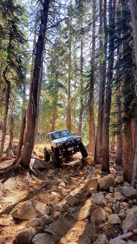
We drove east up highway 88 and then turned south onto Forestdale Road which is just after Red Lake. This road drives up and over the Forestdale Divide and offers some beautiful scenery. It is a fairly easy road, but there is one off camber area on a ledge and there can be snow late into the summer.

We parked at the Lost Lakes and hiked cross country with the goal of summiting the Nipple. Please note, the PCT actually goes right past the west side of the lakes and is a much easier route than we took.

There were some large snowfields even in August during a dry year.

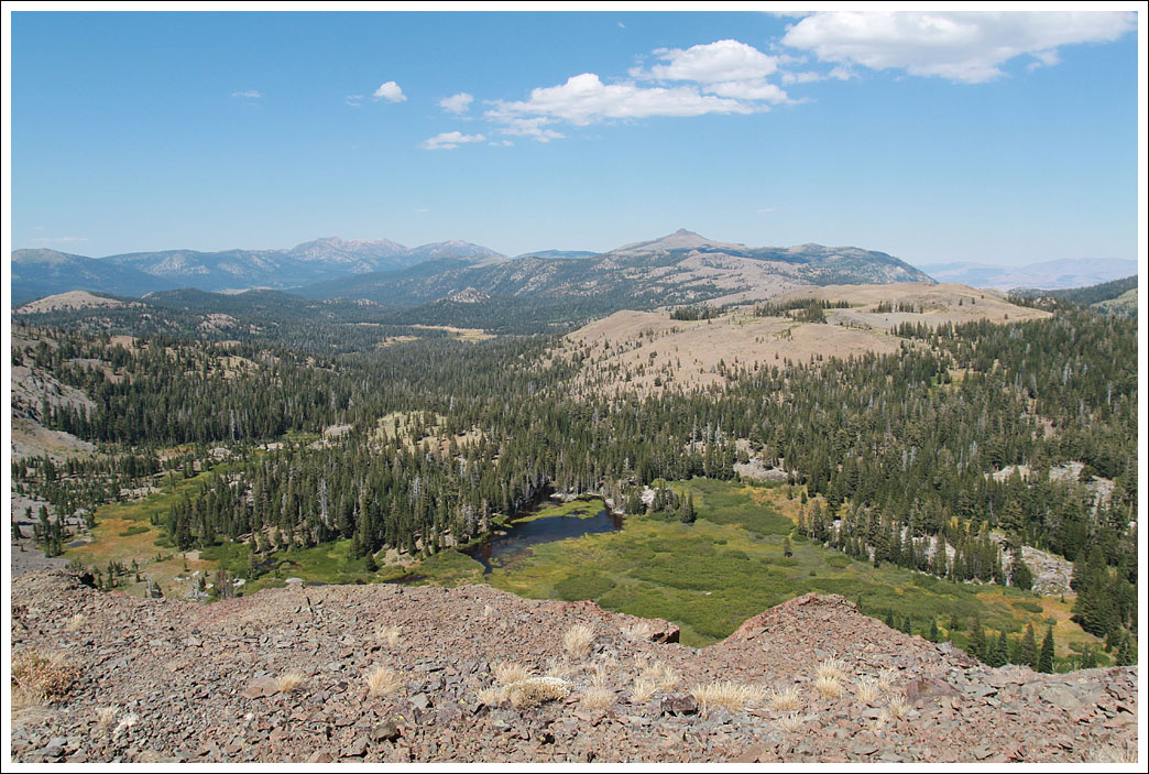
The ridge drops off steeply to the north...

And slopes down to the south towards the Blue Lakes area. The Deer Valley trail (re-opening this summer after many years of being closed!) starts at the end of the Blue Lakes and heads south to Highway 4.


Here is the Nipple up close. There are several similar outcroppings, and we had to use the GPS and a map to determine which is the actual peak. There is a geocache on the top.

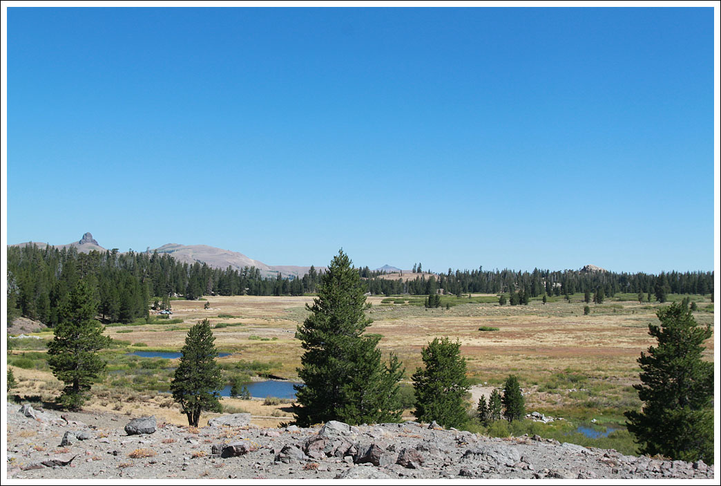
The view back towards the Lost Lakes where our trucks are parked.

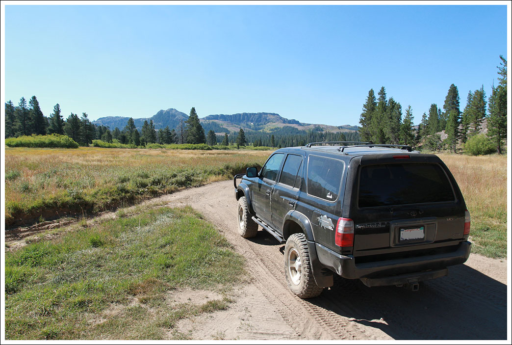
After descending we headed down into the Blue Lakes area and then headed west on Blue Lakes Road which is paved and heads back north to highway 88. We had been over Forestdale Road many times before, the real goal of this trip was to explore the Indian Valley Area. Off of Blue Lakes Road we turned east onto Sunset Lakes Road. This easy dirt road passes multiple small lakes all with camping opportunities. We checked out Tamarack Lake, Upper and Lower Sunset Lakes, Summit Lake, and Wet Meadows Reservoir and ended up camping at Lower Sunset Lake about 100' from the PCT.
West side of Upper Sunset Lake

Dinner

Our campsite

Sunset Lakes Road continues north past the east side of Wet Meadows Reservoir for a mile or two and dead ends where it meets the PCT.
We backtracked to the junction and headed south on the dirt road into Indian Valley. I had been scoping out this area in Google maps and wanted to see what it is like in person. It is fairly dry, and offers nice views and a few good remote camping opportunities.

The road forks at the end of the valley and unfortunately both ways are dead ends. There is a nice camping spot in a meadow at the end of the western fork. I had hope to find a way to route out to highway 4 which is about 2.5mi south, but there is no way to get there.
We backtracked and headed out Blue Lakes Road through Hope Valley to highway 88. There are a ton of other roads to explore in this area. In the future I want to explore Burnside Lake and I'll be running Deer Valley in September.

Here's a map.
https://drive.google.com/open?id=1aljUac7eGyXS7Iz-F5e50Vw5QPI&usp=sharing
- Matt
We drove east up highway 88 and then turned south onto Forestdale Road which is just after Red Lake. This road drives up and over the Forestdale Divide and offers some beautiful scenery. It is a fairly easy road, but there is one off camber area on a ledge and there can be snow late into the summer.
We parked at the Lost Lakes and hiked cross country with the goal of summiting the Nipple. Please note, the PCT actually goes right past the west side of the lakes and is a much easier route than we took.
There were some large snowfields even in August during a dry year.
The ridge drops off steeply to the north...
And slopes down to the south towards the Blue Lakes area. The Deer Valley trail (re-opening this summer after many years of being closed!) starts at the end of the Blue Lakes and heads south to Highway 4.
Here is the Nipple up close. There are several similar outcroppings, and we had to use the GPS and a map to determine which is the actual peak. There is a geocache on the top.
The view back towards the Lost Lakes where our trucks are parked.
After descending we headed down into the Blue Lakes area and then headed west on Blue Lakes Road which is paved and heads back north to highway 88. We had been over Forestdale Road many times before, the real goal of this trip was to explore the Indian Valley Area. Off of Blue Lakes Road we turned east onto Sunset Lakes Road. This easy dirt road passes multiple small lakes all with camping opportunities. We checked out Tamarack Lake, Upper and Lower Sunset Lakes, Summit Lake, and Wet Meadows Reservoir and ended up camping at Lower Sunset Lake about 100' from the PCT.
West side of Upper Sunset Lake
Dinner
Our campsite
Sunset Lakes Road continues north past the east side of Wet Meadows Reservoir for a mile or two and dead ends where it meets the PCT.
We backtracked to the junction and headed south on the dirt road into Indian Valley. I had been scoping out this area in Google maps and wanted to see what it is like in person. It is fairly dry, and offers nice views and a few good remote camping opportunities.
The road forks at the end of the valley and unfortunately both ways are dead ends. There is a nice camping spot in a meadow at the end of the western fork. I had hope to find a way to route out to highway 4 which is about 2.5mi south, but there is no way to get there.
We backtracked and headed out Blue Lakes Road through Hope Valley to highway 88. There are a ton of other roads to explore in this area. In the future I want to explore Burnside Lake and I'll be running Deer Valley in September.
Here's a map.
https://drive.google.com/open?id=1aljUac7eGyXS7Iz-F5e50Vw5QPI&usp=sharing
- Matt