

I shared this in the Southeast Section so there will be a little more detailed info there but in order to get my "badge" I also need to share it here for all the Overland World to see. LOL
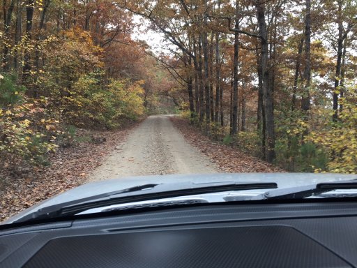
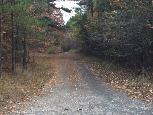
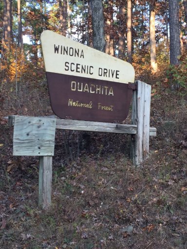
If you are ever coming through Central AR, just a few miles northwest of Little Rock will be the Winona Auto Tour just between Hwy's 9 and 7. It is a 27 mile tour that goes along Forest Road FR 132. It takes about an hour if you don't stop but it took us 3-1/2 hours and we didn't see nearly all of it. The gravel road is stated to be maintained for "two-way travel" but most of it is single track and if you meet someone coming from the other direction you will need to pull off (or they will) to allow travel to pass.
I will include the brochure as an attachment so that you can print it out for more information. You can also visit the following website which gives tons of information on this route along with tons of info on different routes around the area. I am guessing to see everything you will need 2-3 days at least.
http://www.exploretheozarksonline.com/activities/parksnature/nationalforests/ouachita/jessieville/winonatour.html
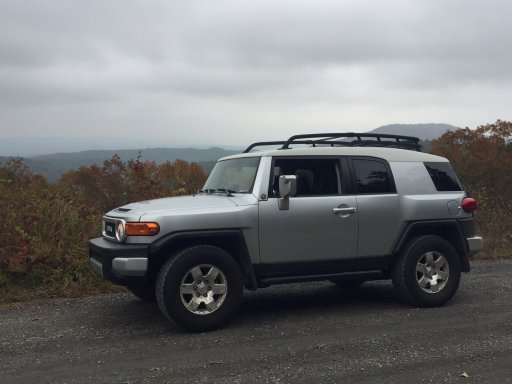
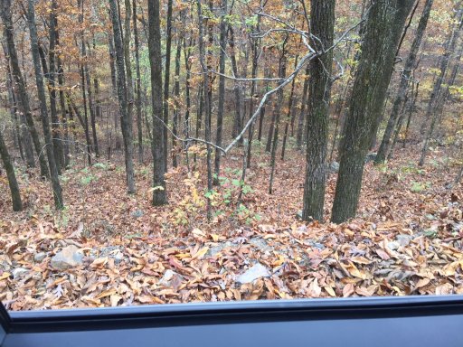
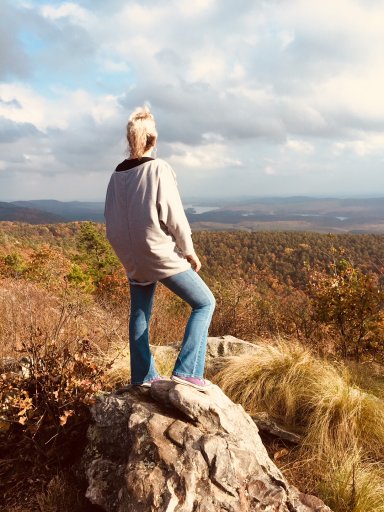
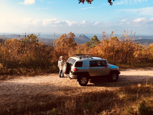
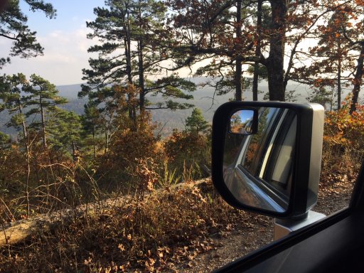
We began our ascent up the mountain on the drive from Hwy 9 approximately 10 miles south of Perryville. It was about 32 miles from my house in Conway. Right off the bat there was a beautiful overlook. I had never been this way so I stopped and took a photo.
Like I stated the road was pretty narrow and rocky. But any of our vehicles would have made it. Unless you overland in a Honda Civic. Wouldn't recommend that at all.
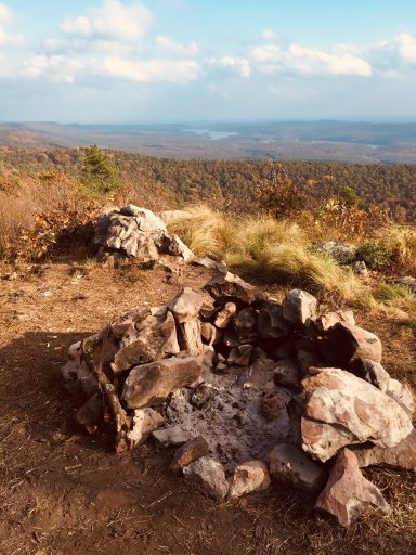
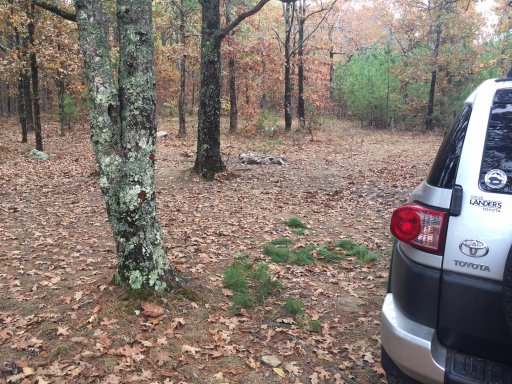 Along the route are many different primitive roadside camping spots.
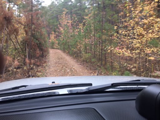
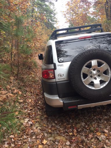
We found a side road which had a gate but the gate was open. It stated it was for Forest Vehicles only. But that is only when the gate is closed. This was a pretty tight trail. It would be pretty tough if you met someone on this. It went for a few miles and came out on the main road so there is a chance you could meet someone. Very few opportunities to turn around or even get over to let someone pass. I received a few "badges of honor" on this trail. My wife called them scratches and doesn't like them at all. LOL
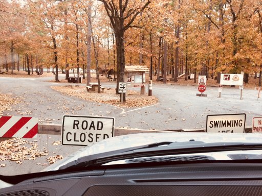
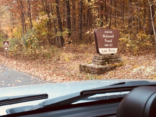
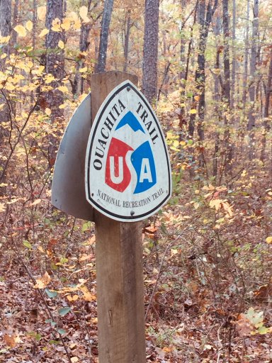
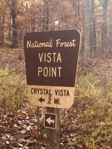
Right across from this trail was a sign that stated Lake Sylvia was 2 miles. We ventured down the mountain and found the lake to be closed. Not sure why. The Ozark Trail also crossed down this road and found several hikers parked in a parking spot.
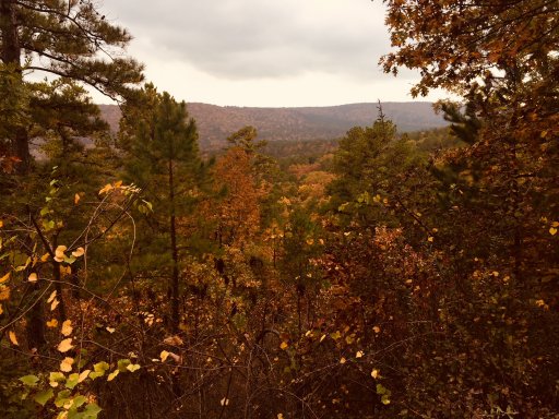
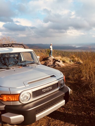
Back on the main road we continued to ascend up the pretty well maintained road. Again there were several campsites along the main road. Then we encountered several overlooks that were pretty amazing.
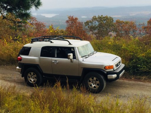
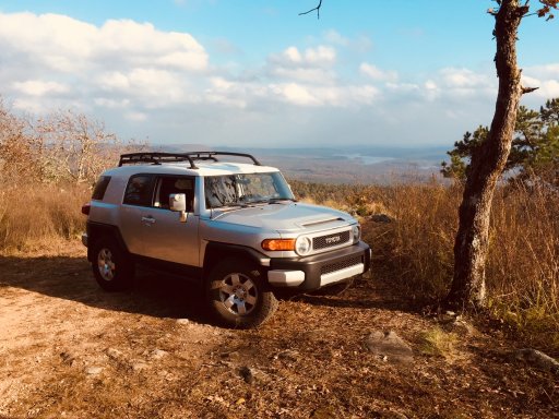
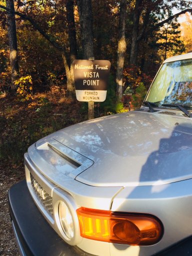
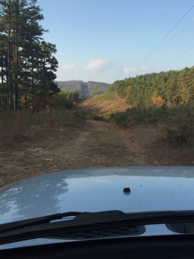
Happening up on Winona Lake Vista Point entrance we took off up the mountain. This road was not maintained at all. Very rough and narrow with large rocks. But the view at the top and the campground up there were amazing and we will definitely be coming back when we have more time.
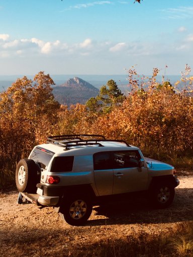
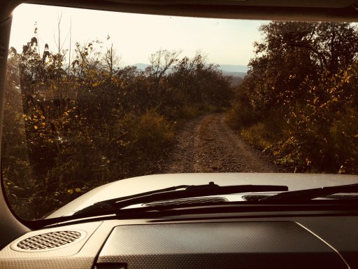
Down the road were several more overlooks and the scenery was so beautiful with the fall colors. Forked Mountain was beautiful and we will definitely be visiting there. The history and info on it are very intriguing but you must take a completely different route to get to it.
http://www.exploretheozarksonline.com/activities/parksnature/nationalforests/ouachita/jessieville/flatside/forkedmountain.html
About 1/2 in the 27 miles you encounter the Flatside Pinnacle area which we did not have time to go down. The description of it in the brochure states it has arguably the most beautiful sunset viewing in all of Arkansas. So we will surely be going back there.
The rest of the trip was so beautiful as well. The roads were pretty good and nothing that most vehicles couldn't do. Most of the time you had steep going down on one side and steep going up on the other.
At the end of the Auto Tour (which was well marked as well), there was another FR that went for 20+ miles even further west that we will put on the future list of travels. Plus when we headed north on Hwy 7 there were several other marked trails where you have an endless amount of sightseeing in the Ouachitas.
So if you are ever around Central AR especially in the fall, check this route out. You will not be disappointed. Look me up. I will definitely be glad to come along. Places like this never get old to me.
If you are ever coming through Central AR, just a few miles northwest of Little Rock will be the Winona Auto Tour just between Hwy's 9 and 7. It is a 27 mile tour that goes along Forest Road FR 132. It takes about an hour if you don't stop but it took us 3-1/2 hours and we didn't see nearly all of it. The gravel road is stated to be maintained for "two-way travel" but most of it is single track and if you meet someone coming from the other direction you will need to pull off (or they will) to allow travel to pass.
I will include the brochure as an attachment so that you can print it out for more information. You can also visit the following website which gives tons of information on this route along with tons of info on different routes around the area. I am guessing to see everything you will need 2-3 days at least.
http://www.exploretheozarksonline.com/activities/parksnature/nationalforests/ouachita/jessieville/winonatour.html
We began our ascent up the mountain on the drive from Hwy 9 approximately 10 miles south of Perryville. It was about 32 miles from my house in Conway. Right off the bat there was a beautiful overlook. I had never been this way so I stopped and took a photo.
Like I stated the road was pretty narrow and rocky. But any of our vehicles would have made it. Unless you overland in a Honda Civic. Wouldn't recommend that at all.
Along the route are many different primitive roadside camping spots.We found a side road which had a gate but the gate was open. It stated it was for Forest Vehicles only. But that is only when the gate is closed. This was a pretty tight trail. It would be pretty tough if you met someone on this. It went for a few miles and came out on the main road so there is a chance you could meet someone. Very few opportunities to turn around or even get over to let someone pass. I received a few "badges of honor" on this trail. My wife called them scratches and doesn't like them at all. LOL
Right across from this trail was a sign that stated Lake Sylvia was 2 miles. We ventured down the mountain and found the lake to be closed. Not sure why. The Ozark Trail also crossed down this road and found several hikers parked in a parking spot.
Back on the main road we continued to ascend up the pretty well maintained road. Again there were several campsites along the main road. Then we encountered several overlooks that were pretty amazing.
Happening up on Winona Lake Vista Point entrance we took off up the mountain. This road was not maintained at all. Very rough and narrow with large rocks. But the view at the top and the campground up there were amazing and we will definitely be coming back when we have more time.
Down the road were several more overlooks and the scenery was so beautiful with the fall colors. Forked Mountain was beautiful and we will definitely be visiting there. The history and info on it are very intriguing but you must take a completely different route to get to it.
http://www.exploretheozarksonline.com/activities/parksnature/nationalforests/ouachita/jessieville/flatside/forkedmountain.html
About 1/2 in the 27 miles you encounter the Flatside Pinnacle area which we did not have time to go down. The description of it in the brochure states it has arguably the most beautiful sunset viewing in all of Arkansas. So we will surely be going back there.
The rest of the trip was so beautiful as well. The roads were pretty good and nothing that most vehicles couldn't do. Most of the time you had steep going down on one side and steep going up on the other.
At the end of the Auto Tour (which was well marked as well), there was another FR that went for 20+ miles even further west that we will put on the future list of travels. Plus when we headed north on Hwy 7 there were several other marked trails where you have an endless amount of sightseeing in the Ouachitas.
So if you are ever around Central AR especially in the fall, check this route out. You will not be disappointed. Look me up. I will definitely be glad to come along. Places like this never get old to me.
Attachments
-
1.4 MB Views: 21

