First off, big thanks to @Xplorer313 for sending over the track. Couldn't have done this without his version of the route.
Anyways, this past Sunday, a friend of mine and I met up and tackled a section of the TNJT.
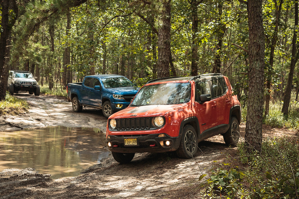
The TNJT is a route that was originally mapped out by two-wheeled adventure riders, and it's since been amended over time to be both more legal (no private property) and also accessible to four-wheel vehicles. It stretches over 400 miles from end to end, from High Point State Park in the north, to Cape May in the south, twisting and winding it's way through all kinds of terrain. Paved, unpaved, dirt, sand, mud, and... even some water. The section that we chose to tackle ran from Jackson NJ to Barnegat, NJ, through Colliers Mills Wildlife Management area, Whitesbog Historic Village, and Brendan T. Byrne State Forest. Most of this part of the TNJT is unpaved; we hit fireroads and doubletrack, with the occasional stretch of asphalt in between. We saw areas of the state that most don't even know exist: 100+ year old cranberry bogs, decommissioned nuclear bunkers, and miles and miles of sandy fireroad that take you deep into the most isolated areas of New Jersey.
Overall, we had a fantastic ride - the trail was in good shape with only the occasional downed log that was cleared with a quick tug, and although it's been a very wet summer, the water crossings and wet sections we did encounter weren't impossible to navigate. I would not suggest doing this in a car, as ground clearance and elevation are... somewhat necessary.
Anyways, onto the photos!
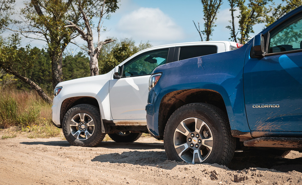
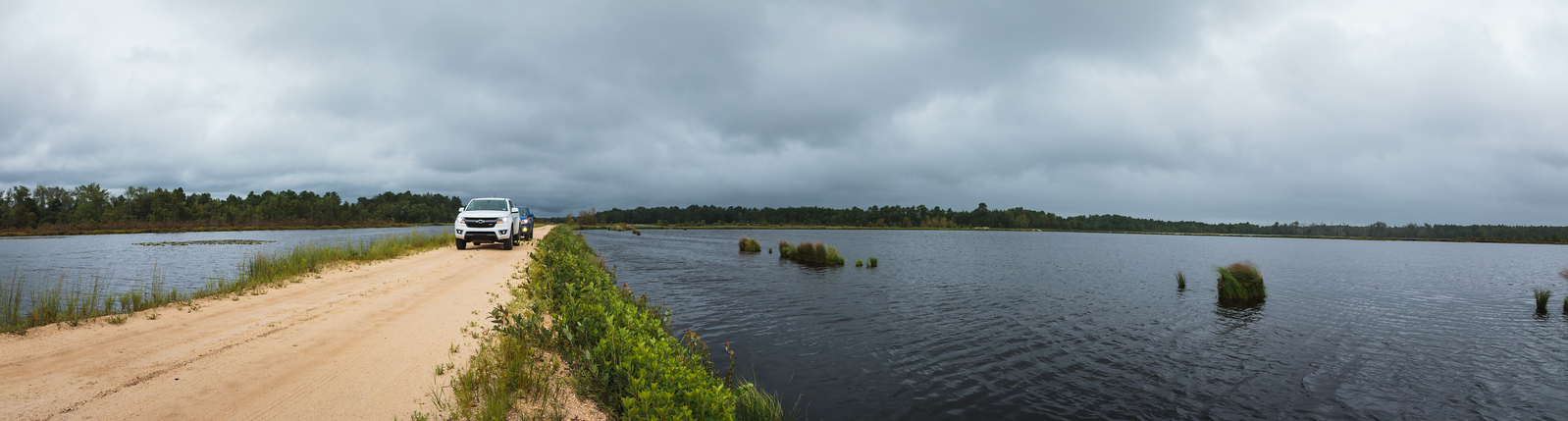
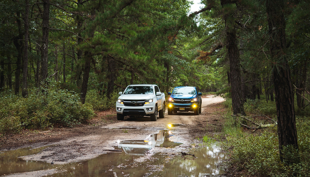
Obligatory clean-truck photo, taken at the start of the first dirt section.

Yours truly behind the wheel.

Rearview full of Kinetic Blue.

It rained on and off all day, which made having an enclosed and air-conditioned vehicle quite nice.

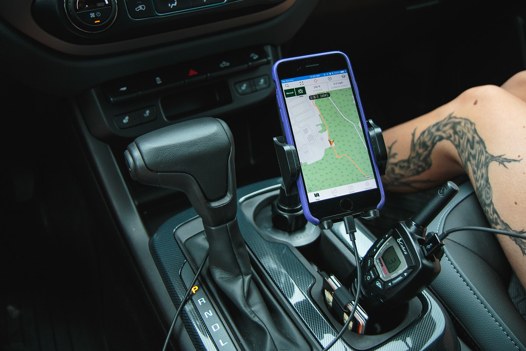
I dusted off an old Macally phone holder and found it fit perfectly in the cupholder of the Colorado; it placed my phone into the perfect position for navigating the route with the Gaia GPS app. Walkie talkies were used for trail communication.
The trail runs right past BOMARC Base No. 1 - site of a nuclear mishap in 1960. It's been long-since decommissioned: https://en.wikipedia.org/wiki/BOMARC_Missile_Accident_Site


Apex's BajaDesign Squadron-Rs provided plenty of lumens all day, not that we needed them. But they were great for being seen.

Log down? No problem!
With the rain we've received this summer, there was no shortage of green flora.

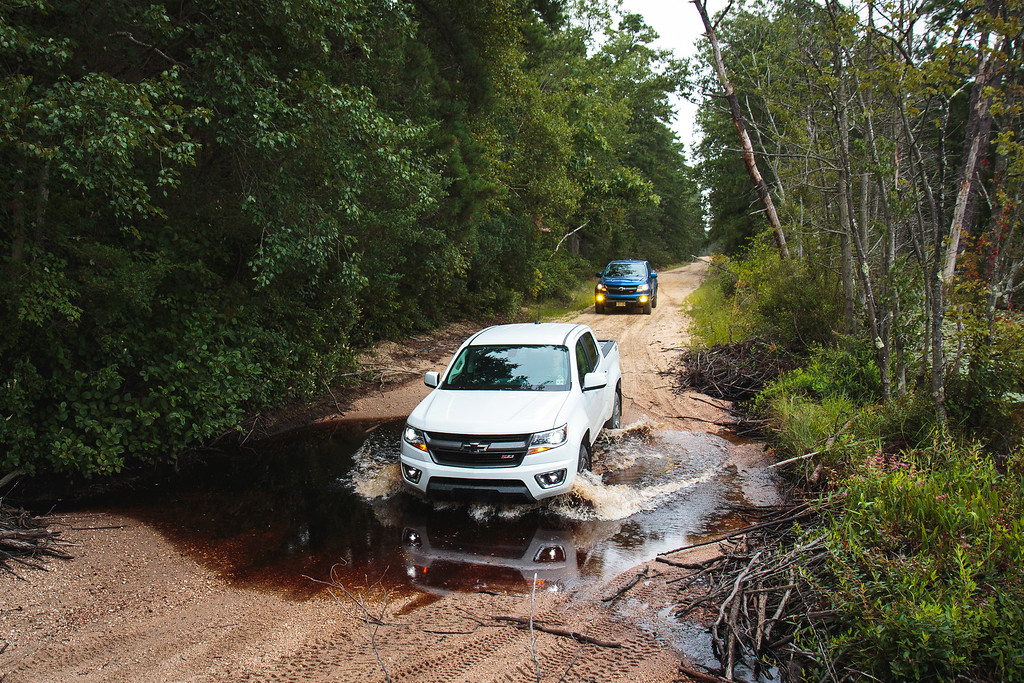
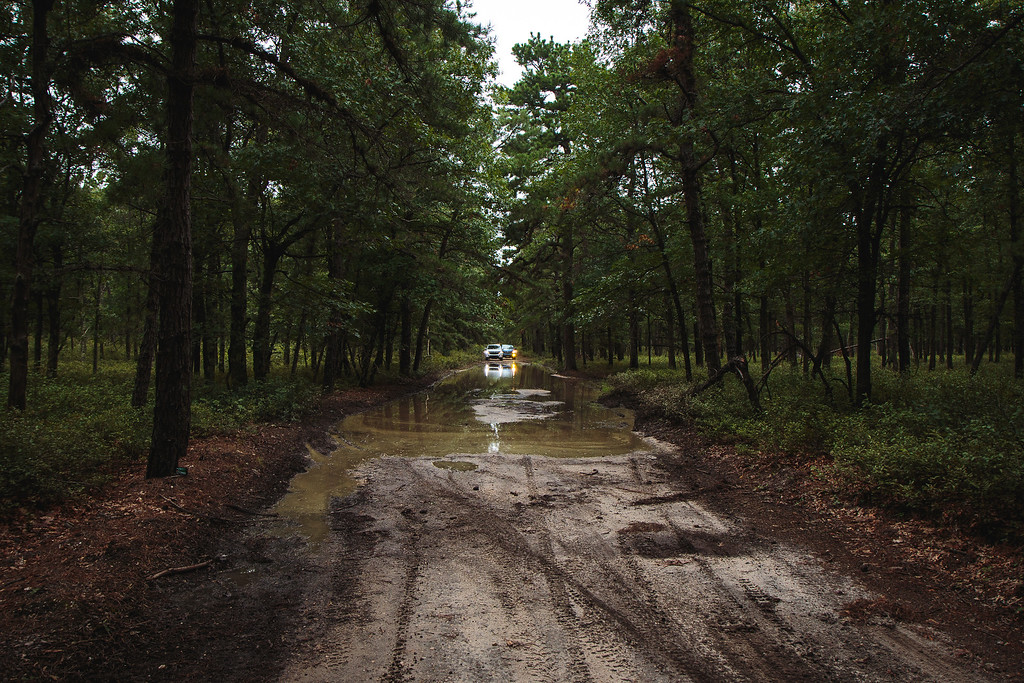
And with all the rain, we encountered several wet spots on the trail.

Smaller puddles like these were easily navigated...


...the deeper ones, however, required some scouting.

And a little can-do attitude.

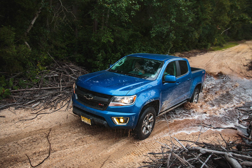
More water, of course.

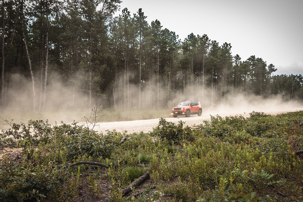
Officially off the road.

So far, so good. This was taken shortly after we stopped for a quick lunch break. Also, a good moment of comparison: Stock halogens headlights and BajaDesigns Squadron Rs on the left. Diode Dynamics SL1s and Morimoto XBs on the right.

The trail soon opened up to the wide-open bogs of Whitesbog, where the oldest Cranberry bogs in the United States can be found, and it's also the birthplace of the modern blueberry.

Blueberries were found and consumed.

And a few more water crossings remained.
This one took me by surprise, and I entered a little quicker than I should have.
Seems innocent enough, right?
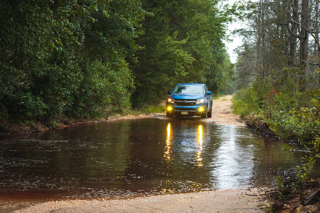
Think again.

The Colorado handled it like a champ, though.


Our last big puddle for the day.

Long, but not deep.


And that's the end... for now.

Anyways, this past Sunday, a friend of mine and I met up and tackled a section of the TNJT.
The TNJT is a route that was originally mapped out by two-wheeled adventure riders, and it's since been amended over time to be both more legal (no private property) and also accessible to four-wheel vehicles. It stretches over 400 miles from end to end, from High Point State Park in the north, to Cape May in the south, twisting and winding it's way through all kinds of terrain. Paved, unpaved, dirt, sand, mud, and... even some water. The section that we chose to tackle ran from Jackson NJ to Barnegat, NJ, through Colliers Mills Wildlife Management area, Whitesbog Historic Village, and Brendan T. Byrne State Forest. Most of this part of the TNJT is unpaved; we hit fireroads and doubletrack, with the occasional stretch of asphalt in between. We saw areas of the state that most don't even know exist: 100+ year old cranberry bogs, decommissioned nuclear bunkers, and miles and miles of sandy fireroad that take you deep into the most isolated areas of New Jersey.
Overall, we had a fantastic ride - the trail was in good shape with only the occasional downed log that was cleared with a quick tug, and although it's been a very wet summer, the water crossings and wet sections we did encounter weren't impossible to navigate. I would not suggest doing this in a car, as ground clearance and elevation are... somewhat necessary.
Anyways, onto the photos!
Obligatory clean-truck photo, taken at the start of the first dirt section.
Yours truly behind the wheel.
Rearview full of Kinetic Blue.
It rained on and off all day, which made having an enclosed and air-conditioned vehicle quite nice.
I dusted off an old Macally phone holder and found it fit perfectly in the cupholder of the Colorado; it placed my phone into the perfect position for navigating the route with the Gaia GPS app. Walkie talkies were used for trail communication.
The trail runs right past BOMARC Base No. 1 - site of a nuclear mishap in 1960. It's been long-since decommissioned: https://en.wikipedia.org/wiki/BOMARC_Missile_Accident_Site
Apex's BajaDesign Squadron-Rs provided plenty of lumens all day, not that we needed them. But they were great for being seen.
Log down? No problem!
With the rain we've received this summer, there was no shortage of green flora.
And with all the rain, we encountered several wet spots on the trail.
Smaller puddles like these were easily navigated...
...the deeper ones, however, required some scouting.
And a little can-do attitude.
More water, of course.
Officially off the road.
So far, so good. This was taken shortly after we stopped for a quick lunch break. Also, a good moment of comparison: Stock halogens headlights and BajaDesigns Squadron Rs on the left. Diode Dynamics SL1s and Morimoto XBs on the right.
The trail soon opened up to the wide-open bogs of Whitesbog, where the oldest Cranberry bogs in the United States can be found, and it's also the birthplace of the modern blueberry.
Blueberries were found and consumed.
And a few more water crossings remained.
This one took me by surprise, and I entered a little quicker than I should have.
Seems innocent enough, right?
Think again.
The Colorado handled it like a champ, though.
Our last big puddle for the day.
Long, but not deep.
And that's the end... for now.